Seymour is a city in and the county seat of Baylor County, Texas, United States. Its population was 2,575 as of the 2020 Census.
| Name: | Seymour city |
|---|---|
| LSAD Code: | 25 |
| LSAD Description: | city (suffix) |
| State: | Texas |
| County: | Baylor County |
| Elevation: | 1,289 ft (393 m) |
| Total Area: | 2.93 sq mi (7.59 km²) |
| Land Area: | 2.92 sq mi (7.57 km²) |
| Water Area: | 0.01 sq mi (0.01 km²) |
| Total Population: | 2,575 |
| Population Density: | 880/sq mi (340/km²) |
| ZIP code: | 76380 |
| Area code: | 940 |
| FIPS code: | 4866968 |
| Website: | www.cityofseymour.org |
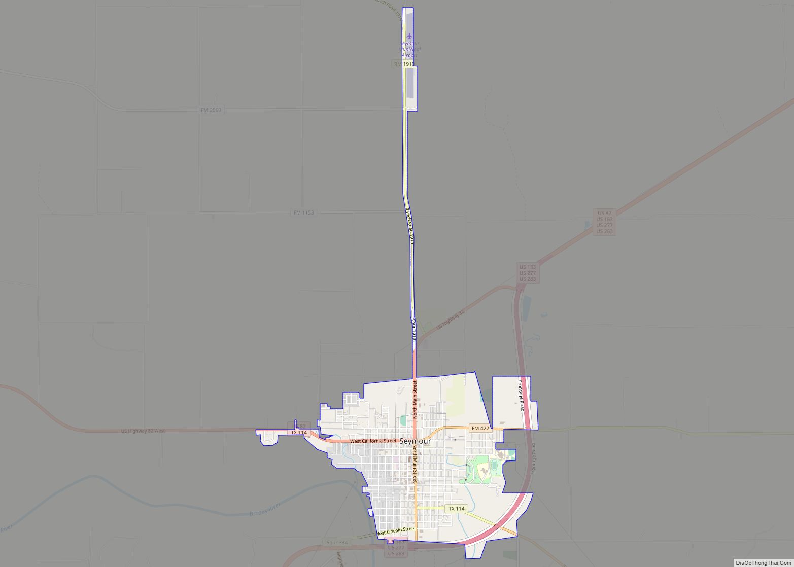
Online Interactive Map
Click on ![]() to view map in "full screen" mode.
to view map in "full screen" mode.
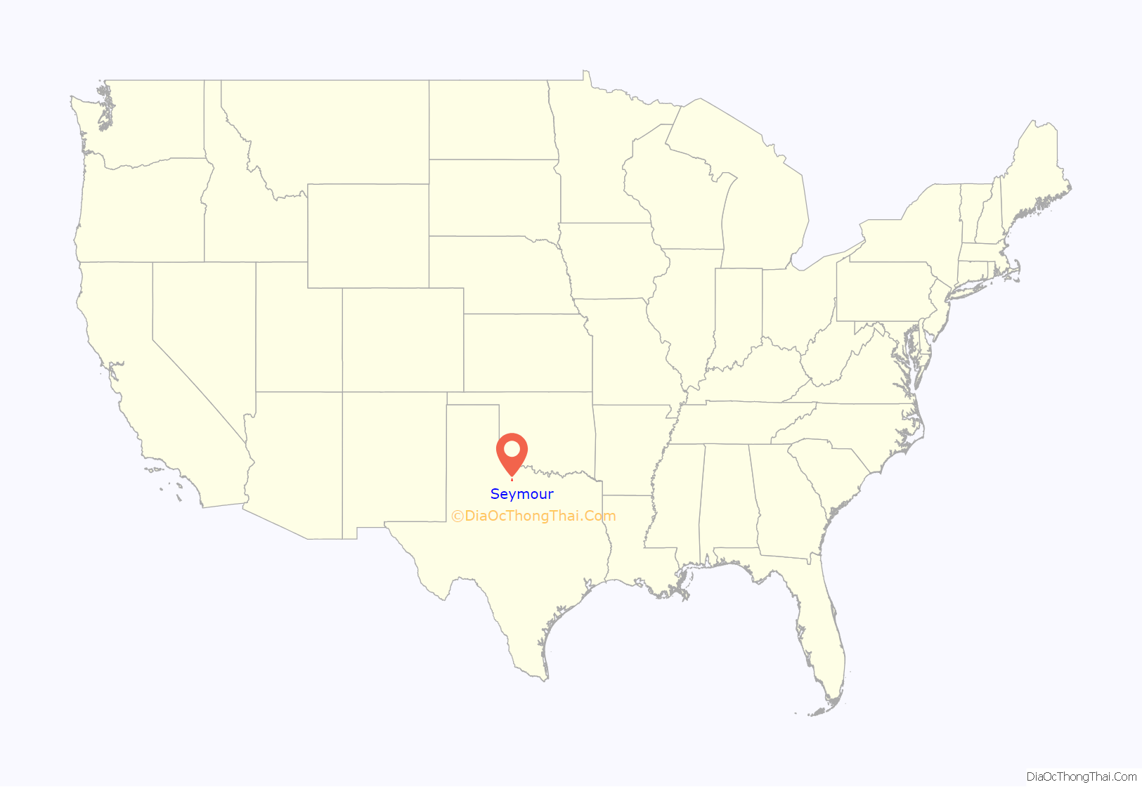
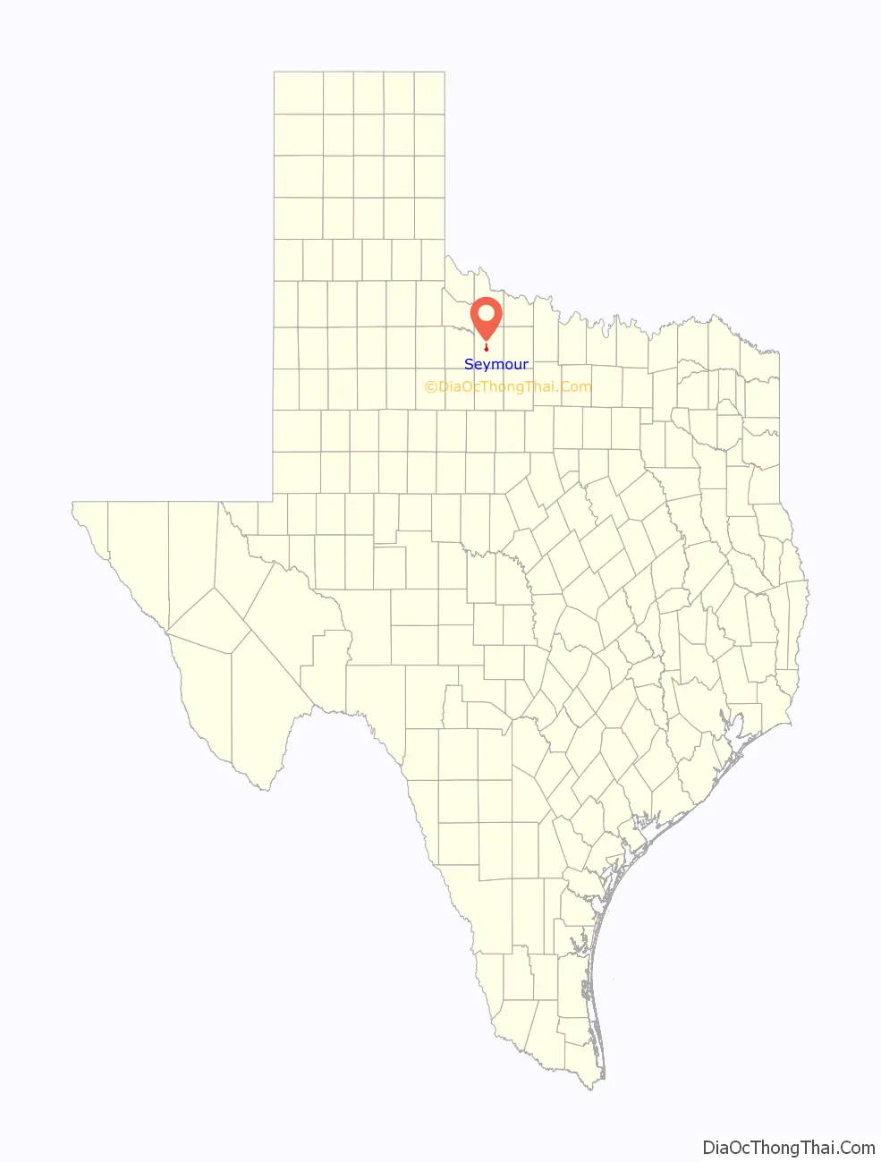
Seymour location map. Where is Seymour city?
History
Seymour was founded by settlers from Oregon, who called the town Oregon City; it was originally located where the Western Trail crossed the Brazos River, which flows just south of the townsite. A post office was established in 1879, when the town’s name was changed to honor local cowboy Seymour Munday, after whom nearby Munday was also named. The census of 1880 shows 78 people living in the 901-square-mile county. The first settlers were ranchers. During those years, the Miller brothers established a large ranch with the headquarters some 10 miles south of Seymour on Miller Creek. About 50 men were in the Miller outfit, and some of these were reportedly outlaws. Not unusually, some of the cowboys rode into town and proceeded to “shoot it up”. The Millers realized that law had come to Baylor County in 1884, and sold the ranch. It was the largest transaction ever made in northwest Texas at that time. The purchasers used the Hashknife Ranch brand, which is still in use in the county.
Commerce, a newspaper, a hotel, and the county courthouse all followed soon after, as did violence between cowboys and settlers. The town experienced two distinct economic booms; the first, short-lived, was with the construction of the Wichita Valley rail line in 1880, and the second was due to the discovery of oil in 1906. The population grew from 500 in 1884 to almost 3800 in 1950; it remained around that level for more than 30 years, but has declined since to 2,575 in the 2020 census. Agribusiness, as well as some tourism from nearby Lake Kemp, has overtaken oil as the driving factor of the local economy. The Old Settlers Reunion and Rodeo has been held each July since 1896.
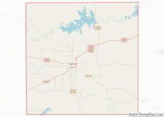
The town calls itself “the crossroads of North Texas” because it is located at the junction of five highways: U.S. highways 82, 277, 183, and 283, and State Highway 114.
On August 12, 1936, the temperature at Seymour reached 120 °F (49 °C), the highest temperature ever recorded in Texas.
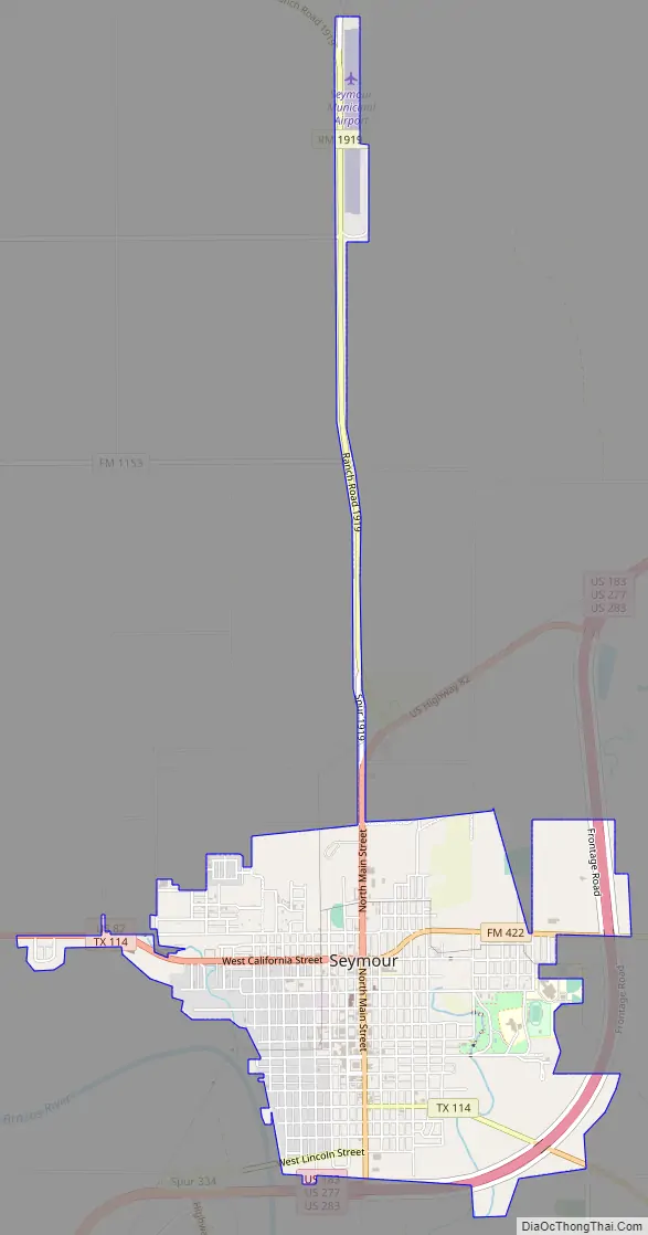
Seymour Road Map
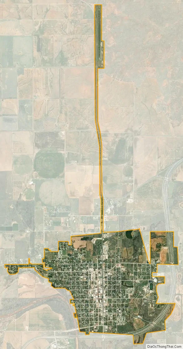
Seymour city Satellite Map
Geography
Seymour is located on the Brazos River. It is 52 miles (84 km) southwest of Wichita Falls and 102 miles (164 km) north-northeast of Abilene.
According to the United States Census Bureau, the city has a total area of 2.9 square miles (7.6 km), of which 0.004 square miles (0.01 km), or 0.20%, is covered by water.
Climate
The climate is humid subtropical (Köppen: Cfa) with an extreme temperature deviation, but much of the time, the variation is always more and the warm weather prevails over the cold as the averages and the records show. Its subtropical location and south of the center of a large land mass bring occasional outbreaks even to a latitude and not very high altitude. The climate in this area is characterized by hot, humid summers and generally mild to cool winters, sometimes cold. On August 12, 1936, Seymour witnessed the record highest temperature in Texas (120 °F) (49 °C), a record that was tied by the city of Monahans on June 28, 1994.
Geology
Seymour is within the area underlain by Texas Red Beds, which are strata of red-colored sedimentary rock from the Early Permian. The fossils of Permian-period vertebrates in the Texas Red Beds were first discovered by Edward Drinker Cope in 1877. Subsequent research has revealed rare fossils of Permian amphibians such as Trimerorhachis, as well as rich deposits of other Permian tetrapods such as Dimetrodon and Diadectes. The order Seymouriamorpha and genus Seymouria, which were first discovered in the Seymour area, are named after the city.
See also
Map of Texas State and its subdivision:- Anderson
- Andrews
- Angelina
- Aransas
- Archer
- Armstrong
- Atascosa
- Austin
- Bailey
- Bandera
- Bastrop
- Baylor
- Bee
- Bell
- Bexar
- Blanco
- Borden
- Bosque
- Bowie
- Brazoria
- Brazos
- Brewster
- Briscoe
- Brooks
- Brown
- Burleson
- Burnet
- Caldwell
- Calhoun
- Callahan
- Cameron
- Camp
- Carson
- Cass
- Castro
- Chambers
- Cherokee
- Childress
- Clay
- Cochran
- Coke
- Coleman
- Collin
- Collingsworth
- Colorado
- Comal
- Comanche
- Concho
- Cooke
- Coryell
- Cottle
- Crane
- Crockett
- Crosby
- Culberson
- Dallam
- Dallas
- Dawson
- Deaf Smith
- Delta
- Denton
- Dewitt
- Dickens
- Dimmit
- Donley
- Duval
- Eastland
- Ector
- Edwards
- El Paso
- Ellis
- Erath
- Falls
- Fannin
- Fayette
- Fisher
- Floyd
- Foard
- Fort Bend
- Franklin
- Freestone
- Frio
- Gaines
- Galveston
- Garza
- Gillespie
- Glasscock
- Goliad
- Gonzales
- Gray
- Grayson
- Gregg
- Grimes
- Guadalupe
- Hale
- Hall
- Hamilton
- Hansford
- Hardeman
- Hardin
- Harris
- Harrison
- Hartley
- Haskell
- Hays
- Hemphill
- Henderson
- Hidalgo
- Hill
- Hockley
- Hood
- Hopkins
- Houston
- Howard
- Hudspeth
- Hunt
- Hutchinson
- Irion
- Jack
- Jackson
- Jasper
- Jeff Davis
- Jefferson
- Jim Hogg
- Jim Wells
- Johnson
- Jones
- Karnes
- Kaufman
- Kendall
- Kenedy
- Kent
- Kerr
- Kimble
- King
- Kinney
- Kleberg
- Knox
- La Salle
- Lamar
- Lamb
- Lampasas
- Lavaca
- Lee
- Leon
- Liberty
- Limestone
- Lipscomb
- Live Oak
- Llano
- Loving
- Lubbock
- Lynn
- Madison
- Marion
- Martin
- Mason
- Matagorda
- Maverick
- McCulloch
- McLennan
- McMullen
- Medina
- Menard
- Midland
- Milam
- Mills
- Mitchell
- Montague
- Montgomery
- Moore
- Morris
- Motley
- Nacogdoches
- Navarro
- Newton
- Nolan
- Nueces
- Ochiltree
- Oldham
- Orange
- Palo Pinto
- Panola
- Parker
- Parmer
- Pecos
- Polk
- Potter
- Presidio
- Rains
- Randall
- Reagan
- Real
- Red River
- Reeves
- Refugio
- Roberts
- Robertson
- Rockwall
- Runnels
- Rusk
- Sabine
- San Augustine
- San Jacinto
- San Patricio
- San Saba
- Schleicher
- Scurry
- Shackelford
- Shelby
- Sherman
- Smith
- Somervell
- Starr
- Stephens
- Sterling
- Stonewall
- Sutton
- Swisher
- Tarrant
- Taylor
- Terrell
- Terry
- Throckmorton
- Titus
- Tom Green
- Travis
- Trinity
- Tyler
- Upshur
- Upton
- Uvalde
- Val Verde
- Van Zandt
- Victoria
- Walker
- Waller
- Ward
- Washington
- Webb
- Wharton
- Wheeler
- Wichita
- Wilbarger
- Willacy
- Williamson
- Wilson
- Winkler
- Wise
- Wood
- Yoakum
- Young
- Zapata
- Zavala
- Alabama
- Alaska
- Arizona
- Arkansas
- California
- Colorado
- Connecticut
- Delaware
- District of Columbia
- Florida
- Georgia
- Hawaii
- Idaho
- Illinois
- Indiana
- Iowa
- Kansas
- Kentucky
- Louisiana
- Maine
- Maryland
- Massachusetts
- Michigan
- Minnesota
- Mississippi
- Missouri
- Montana
- Nebraska
- Nevada
- New Hampshire
- New Jersey
- New Mexico
- New York
- North Carolina
- North Dakota
- Ohio
- Oklahoma
- Oregon
- Pennsylvania
- Rhode Island
- South Carolina
- South Dakota
- Tennessee
- Texas
- Utah
- Vermont
- Virginia
- Washington
- West Virginia
- Wisconsin
- Wyoming