Seabrook is a city in Harris County in the U.S. state of Texas, with some water surface area located within Chambers County. The population was 11,952 at the 2010 U.S. census, and 14,149 in 2019. Several fish markets line the city’s waterfront, while antique shops and bed and breakfast establishments are found in the city’s downtown area. The city is home to several miles of trails, which connect multiple city parks to each other.
| Name: | Seabrook city |
|---|---|
| LSAD Code: | 25 |
| LSAD Description: | city (suffix) |
| State: | Texas |
| County: | Chambers County, Galveston County, Harris County |
| Incorporated: | 1961 |
| Elevation: | 14 ft (4.3 m) |
| Total Area: | 21.26 sq mi (55.06 km²) |
| Land Area: | 5.32 sq mi (13.77 km²) |
| Water Area: | 15.94 sq mi (41.29 km²) |
| Total Population: | 11,952 |
| Population Density: | 2,661.59/sq mi (1,027.57/km²) |
| ZIP code: | 77586 |
| Area code: | 281 |
| FIPS code: | 4866392 |
| GNISfeature ID: | 1346840 |
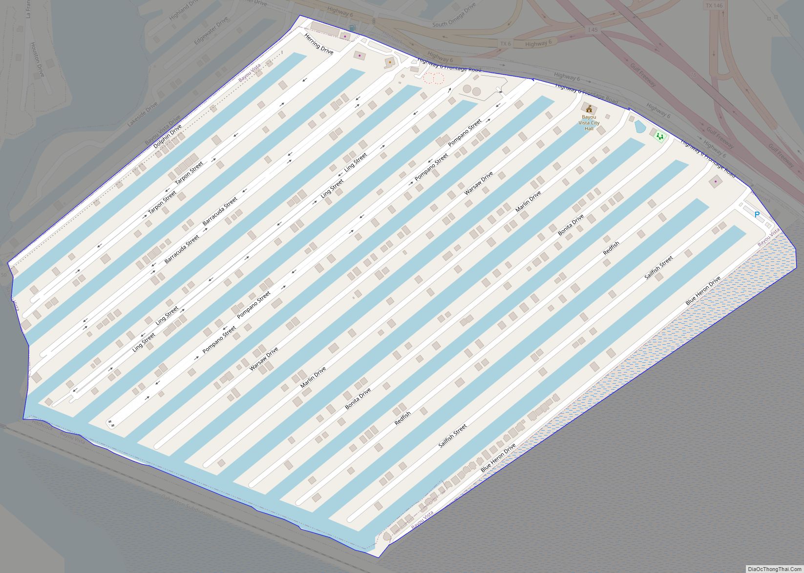
Online Interactive Map
Click on ![]() to view map in "full screen" mode.
to view map in "full screen" mode.
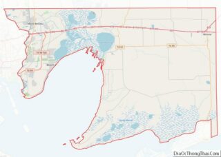
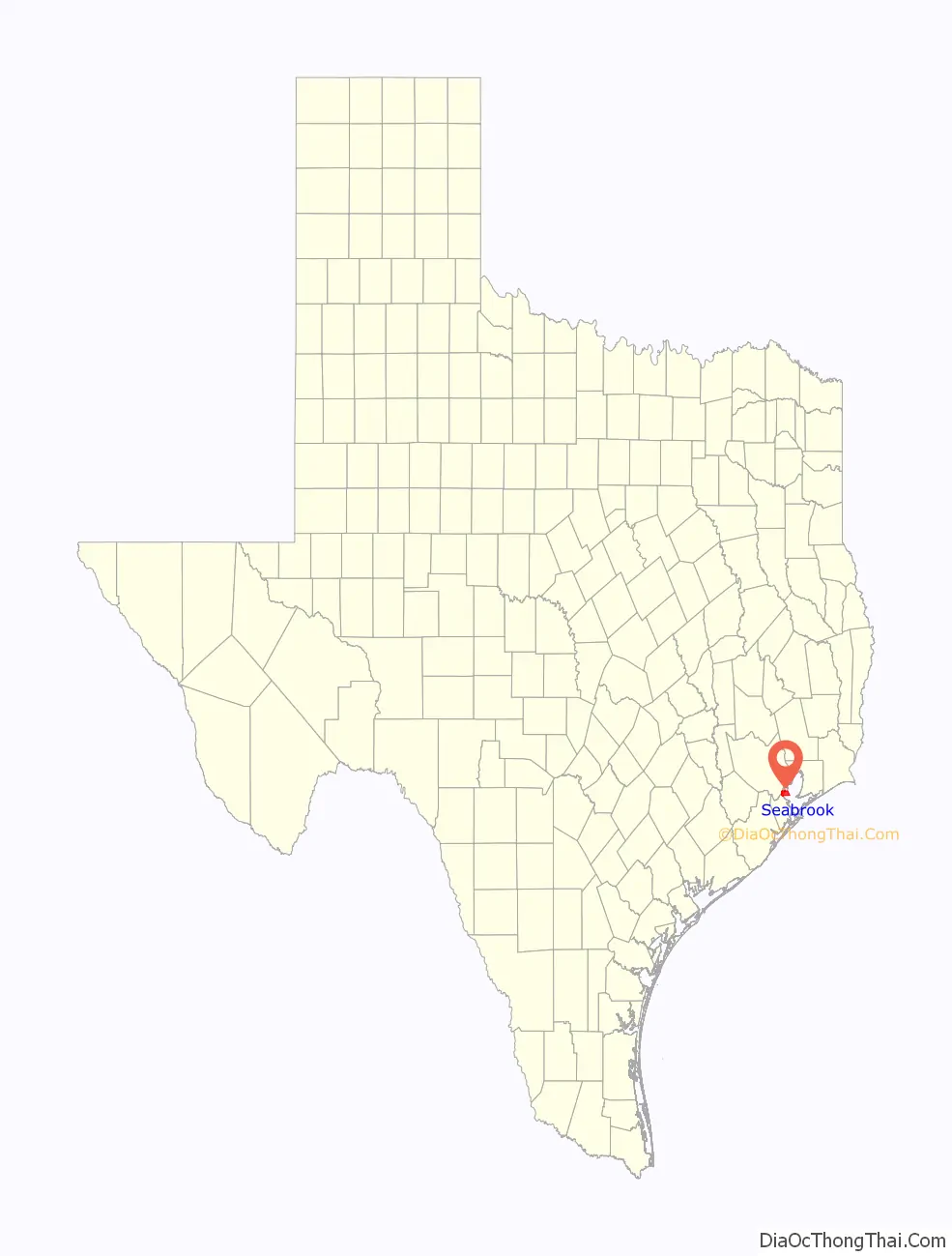
Seabrook location map. Where is Seabrook city?

History
Seabrook is known for its fish markets on Waterfront Drive where resident shrimpers and fishermen bring in their catches daily. Besides bordering the bay, the city encompasses marshes through which runoff from inland fields drain to the bay. The piece of land was purchased by Seabrook W. Sydnor, who was the son of a Galveston slave trader, John Seabrook Sydnor in 1895. In March 1903, the Seabrook Company of Houston created a layout of the proposed Seabrook Town site. The new town attracted fishermen, merchants and even a few residents.
The Galveston Hurricane of 1900 demolished the local school, but by 1905 it was restored and was run by three teachers who taught 100 students. The local schools became part of the Clear Creek Independent School District in 1947. The population of Seabrook rose from 200 to 560 before the Great Depression, but fell to 200 in 1936, and remained at 400 from 1940 until 1947, when the Albert and Ernest Fay shipyard opened. It could handle 150 boats, and opened up jobs and is the main cause of the population increase. Despite damage from Hurricane Carla, a bridge linking Seabrook and Kemah was completed in 1961. With the opening of the bridge and the Johnson Space Center (JSC) in Houston, Seabrook’s population rose to approximately 6,000.
In 1986, the decision was made to start the construction of a fixed-span bridge that was tall enough for sailboats to pass under. After this bridge was finished, Highway 146 was linked all the way from Galveston to Texas State Highway 225. This spurred a further increase in the population of Seabrook to its present level of nearly 12,000 people. Seabrook’s residents are quite diversified and are employed in a variety of professional positions. Quite a few residents have ties to the chemical and oil industry as well as the NASA space program.
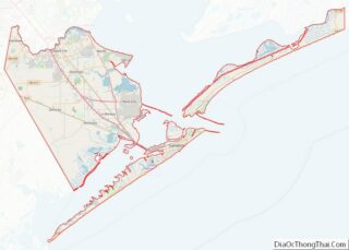
Seabrook Road Map

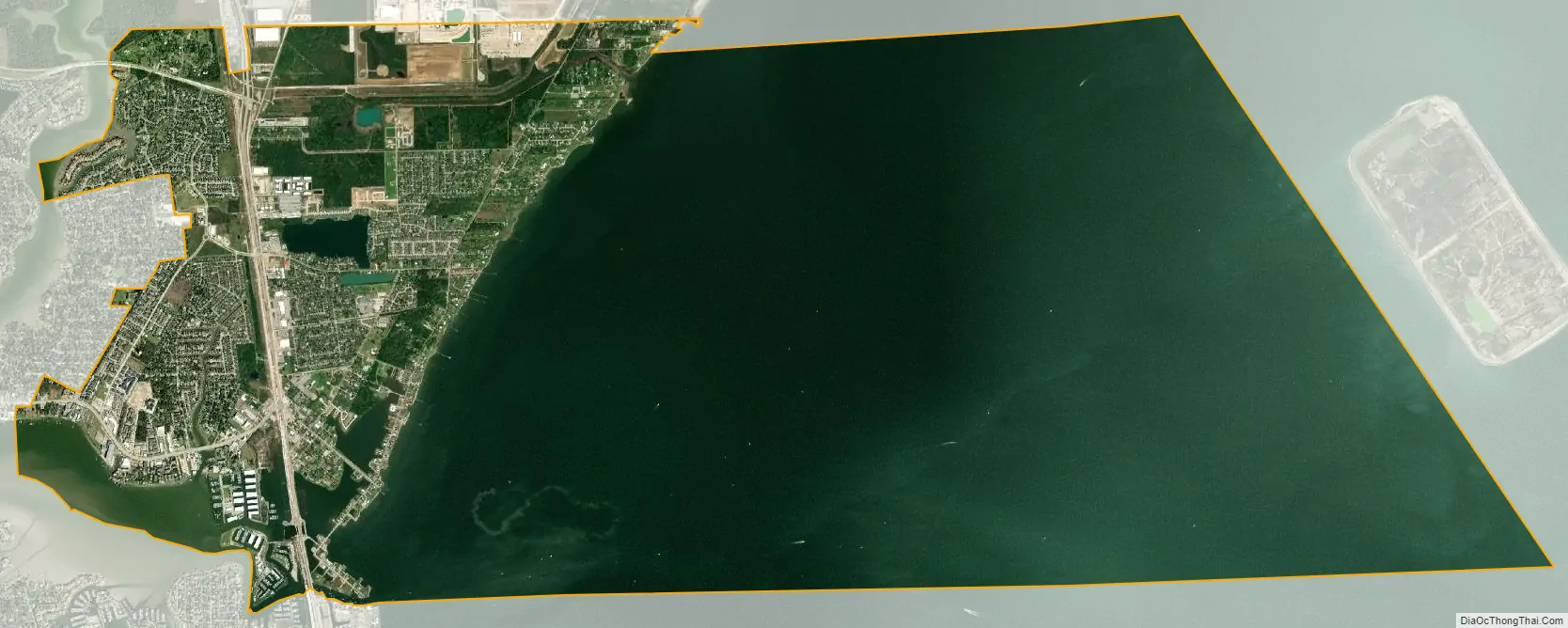
Seabrook city Satellite Map
Geography
Seabrook is located on Galveston Bay at Clear Lake, southeast of Houston near Pasadena and La Porte. According to the United States Census Bureau, the city has a total area of 21.3 square miles (55.1 km), of which 5.3 square miles (13.8 km) is land and 15.9 square miles (41.3 km), or 74.97%, is water.
Climate
Seabrook has an oceanic humid subtropical climate, with consistent rainfall throughout the year, but usually with heavier amounts during the hot and humid summer months.
See also
Map of Texas State and its subdivision:- Anderson
- Andrews
- Angelina
- Aransas
- Archer
- Armstrong
- Atascosa
- Austin
- Bailey
- Bandera
- Bastrop
- Baylor
- Bee
- Bell
- Bexar
- Blanco
- Borden
- Bosque
- Bowie
- Brazoria
- Brazos
- Brewster
- Briscoe
- Brooks
- Brown
- Burleson
- Burnet
- Caldwell
- Calhoun
- Callahan
- Cameron
- Camp
- Carson
- Cass
- Castro
- Chambers
- Cherokee
- Childress
- Clay
- Cochran
- Coke
- Coleman
- Collin
- Collingsworth
- Colorado
- Comal
- Comanche
- Concho
- Cooke
- Coryell
- Cottle
- Crane
- Crockett
- Crosby
- Culberson
- Dallam
- Dallas
- Dawson
- Deaf Smith
- Delta
- Denton
- Dewitt
- Dickens
- Dimmit
- Donley
- Duval
- Eastland
- Ector
- Edwards
- El Paso
- Ellis
- Erath
- Falls
- Fannin
- Fayette
- Fisher
- Floyd
- Foard
- Fort Bend
- Franklin
- Freestone
- Frio
- Gaines
- Galveston
- Garza
- Gillespie
- Glasscock
- Goliad
- Gonzales
- Gray
- Grayson
- Gregg
- Grimes
- Guadalupe
- Hale
- Hall
- Hamilton
- Hansford
- Hardeman
- Hardin
- Harris
- Harrison
- Hartley
- Haskell
- Hays
- Hemphill
- Henderson
- Hidalgo
- Hill
- Hockley
- Hood
- Hopkins
- Houston
- Howard
- Hudspeth
- Hunt
- Hutchinson
- Irion
- Jack
- Jackson
- Jasper
- Jeff Davis
- Jefferson
- Jim Hogg
- Jim Wells
- Johnson
- Jones
- Karnes
- Kaufman
- Kendall
- Kenedy
- Kent
- Kerr
- Kimble
- King
- Kinney
- Kleberg
- Knox
- La Salle
- Lamar
- Lamb
- Lampasas
- Lavaca
- Lee
- Leon
- Liberty
- Limestone
- Lipscomb
- Live Oak
- Llano
- Loving
- Lubbock
- Lynn
- Madison
- Marion
- Martin
- Mason
- Matagorda
- Maverick
- McCulloch
- McLennan
- McMullen
- Medina
- Menard
- Midland
- Milam
- Mills
- Mitchell
- Montague
- Montgomery
- Moore
- Morris
- Motley
- Nacogdoches
- Navarro
- Newton
- Nolan
- Nueces
- Ochiltree
- Oldham
- Orange
- Palo Pinto
- Panola
- Parker
- Parmer
- Pecos
- Polk
- Potter
- Presidio
- Rains
- Randall
- Reagan
- Real
- Red River
- Reeves
- Refugio
- Roberts
- Robertson
- Rockwall
- Runnels
- Rusk
- Sabine
- San Augustine
- San Jacinto
- San Patricio
- San Saba
- Schleicher
- Scurry
- Shackelford
- Shelby
- Sherman
- Smith
- Somervell
- Starr
- Stephens
- Sterling
- Stonewall
- Sutton
- Swisher
- Tarrant
- Taylor
- Terrell
- Terry
- Throckmorton
- Titus
- Tom Green
- Travis
- Trinity
- Tyler
- Upshur
- Upton
- Uvalde
- Val Verde
- Van Zandt
- Victoria
- Walker
- Waller
- Ward
- Washington
- Webb
- Wharton
- Wheeler
- Wichita
- Wilbarger
- Willacy
- Williamson
- Wilson
- Winkler
- Wise
- Wood
- Yoakum
- Young
- Zapata
- Zavala
- Alabama
- Alaska
- Arizona
- Arkansas
- California
- Colorado
- Connecticut
- Delaware
- District of Columbia
- Florida
- Georgia
- Hawaii
- Idaho
- Illinois
- Indiana
- Iowa
- Kansas
- Kentucky
- Louisiana
- Maine
- Maryland
- Massachusetts
- Michigan
- Minnesota
- Mississippi
- Missouri
- Montana
- Nebraska
- Nevada
- New Hampshire
- New Jersey
- New Mexico
- New York
- North Carolina
- North Dakota
- Ohio
- Oklahoma
- Oregon
- Pennsylvania
- Rhode Island
- South Carolina
- South Dakota
- Tennessee
- Texas
- Utah
- Vermont
- Virginia
- Washington
- West Virginia
- Wisconsin
- Wyoming