Map of Seven Points city
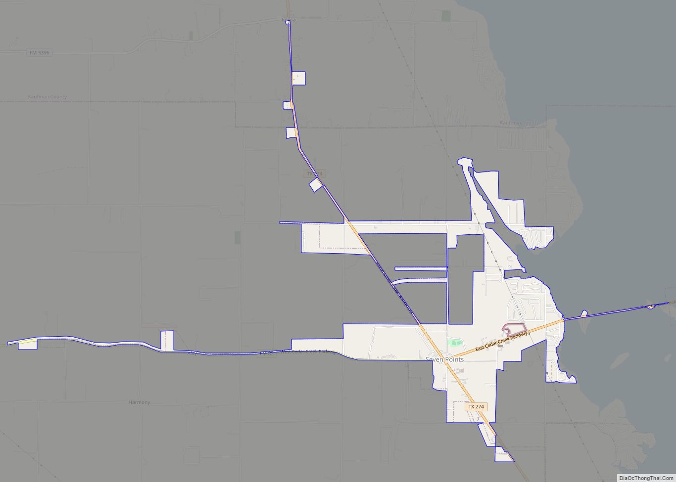
Seven Points is a city in Henderson and Kaufman counties in the U.S. state of Texas. The population was 1,455 at the 2010 census, up from 1,145 at the 2000 census. The city is named for an intersection where seven roads converge. These are not Old West wagon trails, however; the town did not exist ... Read more
Map of Seven Points city
Map of Seven Oaks city, Texas
Seven Oaks is a city in Polk County, Texas, United States. The population was 111 at the 2010 census. Seven Oaks city overview: Name: Seven Oaks city LSAD Code: 25 LSAD Description: city (suffix) State: Texas County: Polk County Elevation: 220 ft (67 m) Total Area: 1.40 sq mi (3.62 km²) Land Area: 1.40 sq mi (3.62 km²) Water Area: 0.00 sq mi (0.00 km²) Total ... Read more
Map of Seven Oaks city, Texas
Map of Seth Ward CDP
Seth Ward is an unincorporated community and census-designated place (CDP) in Hale County, Texas, United States. The population was 2,025 at the 2010 census. Seth Ward CDP overview: Name: Seth Ward CDP LSAD Code: 57 LSAD Description: CDP (suffix) State: Texas County: Hale County Elevation: 3,373 ft (1,028 m) Total Area: 2.2 sq mi (5.8 km²) Land Area: 2.2 sq mi (5.8 km²) ... Read more
Map of Seth Ward CDP
Map of Serenada CDP
Serenada is a census-designated place (CDP) in Williamson County, Texas, United States. The population was 1,641 at the 2010 census. Those living in Serenada have Georgetown addresses. Serenada CDP overview: Name: Serenada CDP LSAD Code: 57 LSAD Description: CDP (suffix) State: Texas County: Williamson County Elevation: 820 ft (250 m) Total Area: 2.6 sq mi (7 km²) Land Area: 2.6 sq mi ... Read more
Map of Serenada CDP
Map of Seminole city, Texas
Seminole is a city in and the county seat of Gaines County, Texas, United States. Its population was 6,430 at the 2010 census. Seminole and Gaines County are home to a large German Mennonite population that came to West Texas in the 1980s. It is the birthplace of country music singers Larry Gatlin and Tanya ... Read more
Map of Seminole city, Texas
Map of Selma city, Texas
Selma is a city in Bexar, Comal, and Guadalupe Counties in the U.S. state of Texas. It is part of the San Antonio metropolitan statistical area. Its population was 10,952 at the 2020 census, up from 5,540 at the 2010 census. Selma was settled by German and Polish immigrants in the mid 1800s. The Retama ... Read more
Map of Selma city, Texas
Map of Shavano Park city
Shavano Park is a city located in Bexar County, Texas, United States. As of the 2020 census, the population was 3,524, up from 3,035 at the 2010 census. It is an enclave of San Antonio and is part of the San Antonio Metropolitan Statistical Area. Shavano Park city overview: Name: Shavano Park city LSAD Code: ... Read more
Map of Shavano Park city
Map of Shamrock city, Texas
Shamrock is a city in Wheeler County, Texas, United States. As of the 2010 census, the city had a total population of 1,910. The city is located in the eastern portion of the Texas Panhandle centered along the crossroads of Interstate 40 (formerly U.S. Route 66) and U.S. Route 83. It is 110 miles (180 km) ... Read more
Map of Shamrock city, Texas
Map of Shallowater city
Shallowater is a city in Lubbock County, Texas, United States. Shallowater is on U.S. Route 84 and the Burlington Northern Santa Fe line, 12 miles (19 km) northwest of Lubbock. Its population was 2,484 at the 2010 census. It is part of the Lubbock metropolitan statistical area. Shallowater city overview: Name: Shallowater city LSAD Code: 25 ... Read more
Map of Shallowater city
Map of Shoreacres city
Shoreacres is a city located in Harris County in the U.S. state of Texas alongside State Highway 146. Established with a mayor-alderman form of city government, it was incorporated in 1949. The population was 1,566 at the 2020 census. Shoreacres city overview: Name: Shoreacres city LSAD Code: 25 LSAD Description: city (suffix) State: Texas County: ... Read more
Map of Shoreacres city
Map of Shiner city
Shiner is a city in Lavaca County, Texas, United States. The town was named after Henry B. Shiner, who donated 250 acres (1.0 km) for a railroad right-of-way. As of the 2020 census, the city had a population of 2,127. Shiner was founded by German and Czech emigrants. Shiner city overview: Name: Shiner city LSAD Code: ... Read more
Map of Shiner city
Map of Sherwood Shores CDP
Sherwood Shores is an unincorporated community and census-designated place in Grayson County, Texas, United States. Its population was 1,190 as of the 2010 census. The community is located on the Red River, which forms the state line with Oklahoma. Sherwood Shores CDP overview: Name: Sherwood Shores CDP LSAD Code: 57 LSAD Description: CDP (suffix) State: ... Read more
Map of Sherwood Shores CDP