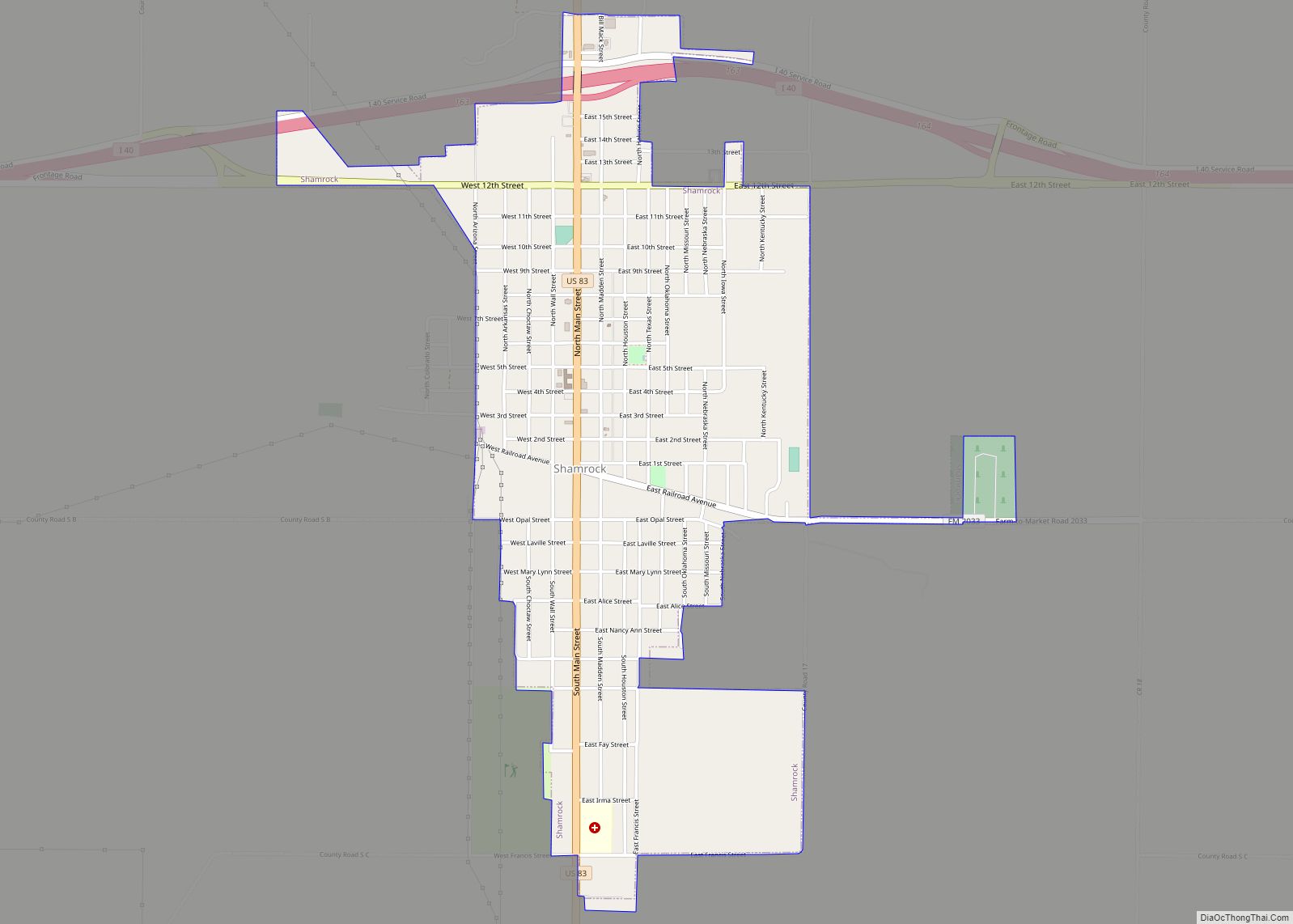
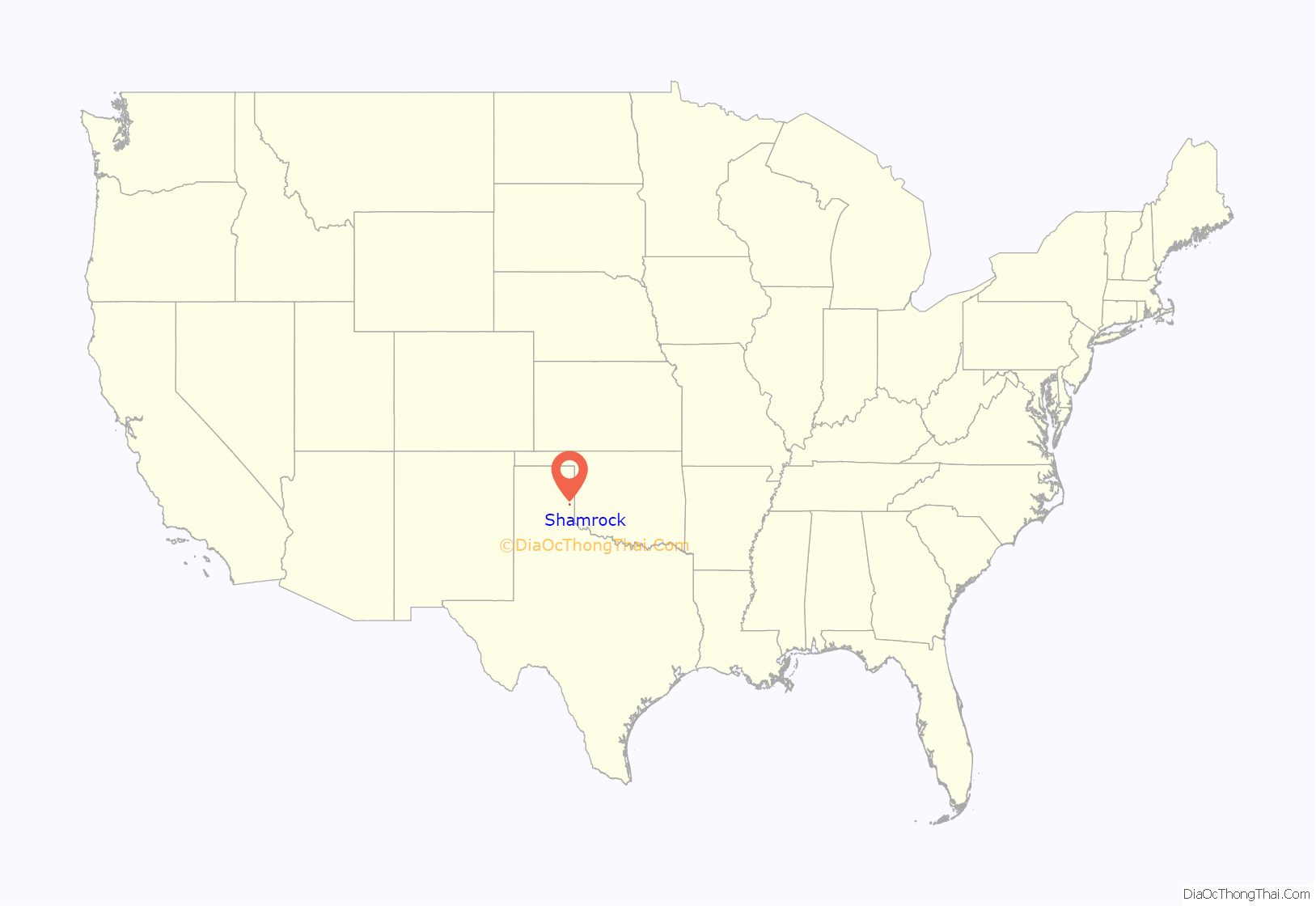
Shamrock is a city in Wheeler County, Texas, United States. As of the 2010 census, the city had a total population of 1,910. The city is located in the eastern portion of the Texas Panhandle centered along the crossroads of Interstate 40 (formerly U.S. Route 66) and U.S. Route 83. It is 110 miles (180 km) east of Amarillo, 188 miles (303 km) west of Oklahoma City, and 291 miles (468 km) northwest of Dallas.
| Name: | Shamrock city |
|---|---|
| LSAD Code: | 25 |
| LSAD Description: | city (suffix) |
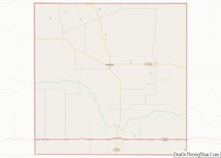
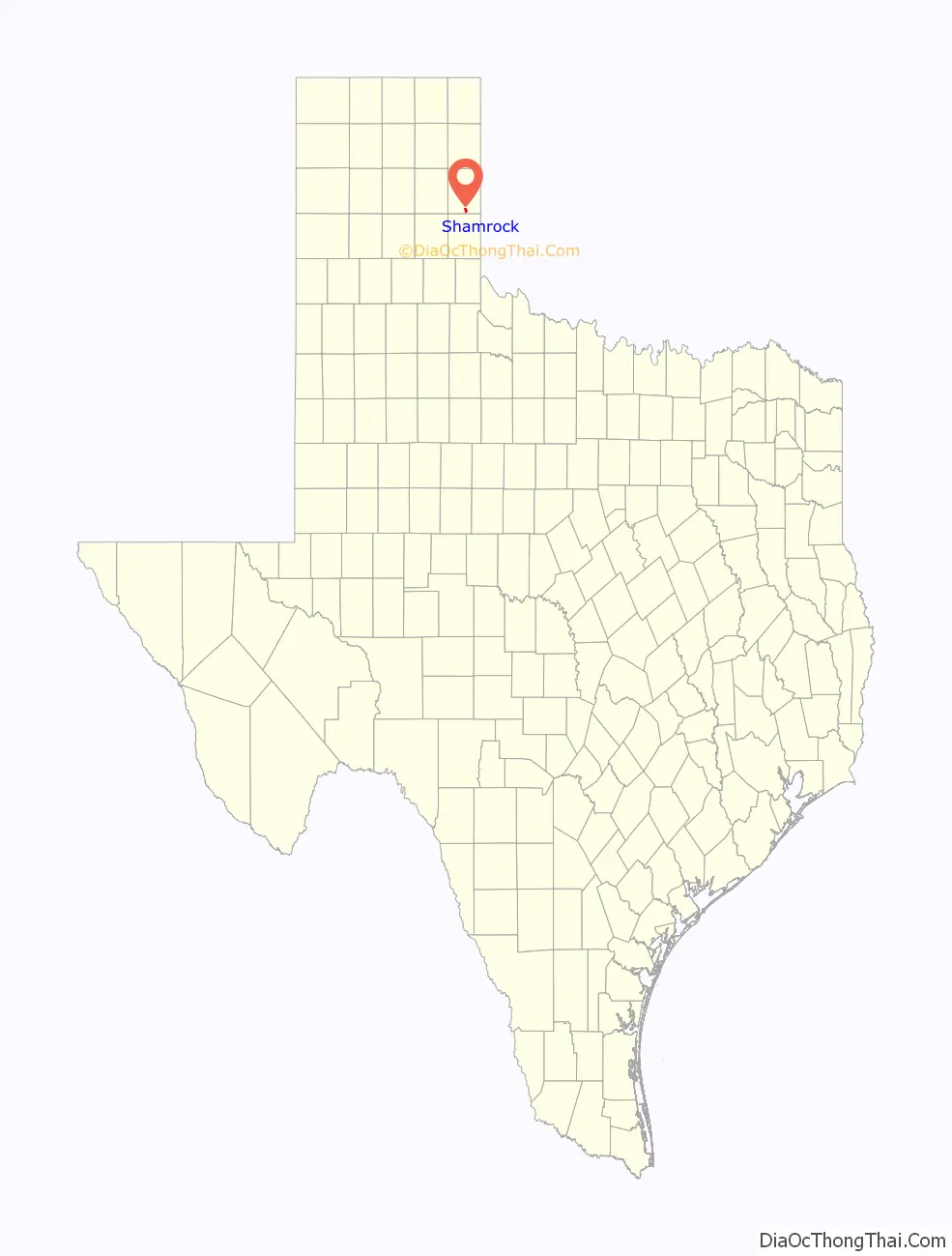
| State: | Texas |
| County: | Wheeler County |
| Incorporated: | 1911 |
| Elevation: | 2,343 ft (714 m) |
| Total Area: | 2.05 sq mi (5.30 km²) |
| Land Area: | 2.05 sq mi (5.30 km²) |
| Water Area: | 0.00 sq mi (0.00 km²) |
| Total Population: | 1,910 |
| Population Density: | 861.75/sq mi (332.80/km²) |
| ZIP code: | 79079 |
| Area code: | 806 |
| FIPS code: | 4867160 |
| GNISfeature ID: | 1368050 |
| Website: | www.shamrocktexas.net |
Online Interactive Map
Click on ![]() to view map in "full screen" mode.
to view map in "full screen" mode.
Shamrock location map. Where is Shamrock city?
History
Located in south-central Wheeler County, Shamrock was the largest town in the county in the late 19th century. George and Dora Nickel consented to keep the first post office in their dugout there in 1890. The mail was to be carried once a week from Mobeetie, Texas. The neighbors decided to let George name the office. His Irish-American mother had told him always to depend on a shamrock to bring him good luck, so holding true to his Irish descent, he suggested “Shamrock” for the name of the office. When a mysterious fire destroyed his dugout, however, George Nickel’s post office never opened. Mary Ruth Jones became Shamrock’s first postmistress, running the Shamrock post office out of the Jones family home.
In 1902, the Chicago, Rock Island and Gulf Railway set up a station in the town, calling it “Wheeler” like the county, but later changing it back to the original name of Shamrock in 1903, which prompted the reopening of the Shamrock post office. By 1907, the town was competing with the towns of Story and Benonine as trade centers.
The town continued its growth as other businesses moved into the city, including the county newspaper, which moved from Story and renamed itself from the Wheeler County Texan to the Shamrock Texan, several banks, and Shamrock Cotton Oil Mill. In 1911, E. L. Woodley became the mayor of the newly incorporated city. In 1926, the discovery of oil and the operation of natural gas wells by Shamrock Gas Company helped spur the city’s continuing growth. A decline in the oil industry caused the population to drop in the 1940s, but it rebounded in the next decade with the improvement of Route 66. By the 1980s, the town was home to an established modern school system, a chemical plant, oil and gas processing plants, and a hospital.
At its peak in 1930, Shamrock had a population of 3,778. Despite some rebounds, the city population continues to fluctuate. According to the 2020 census, the city population has dropped to its lowest recorded point with 1,986 residents. Despite this, Shamrock is the second-largest Texas city on Route 66, after Amarillo.
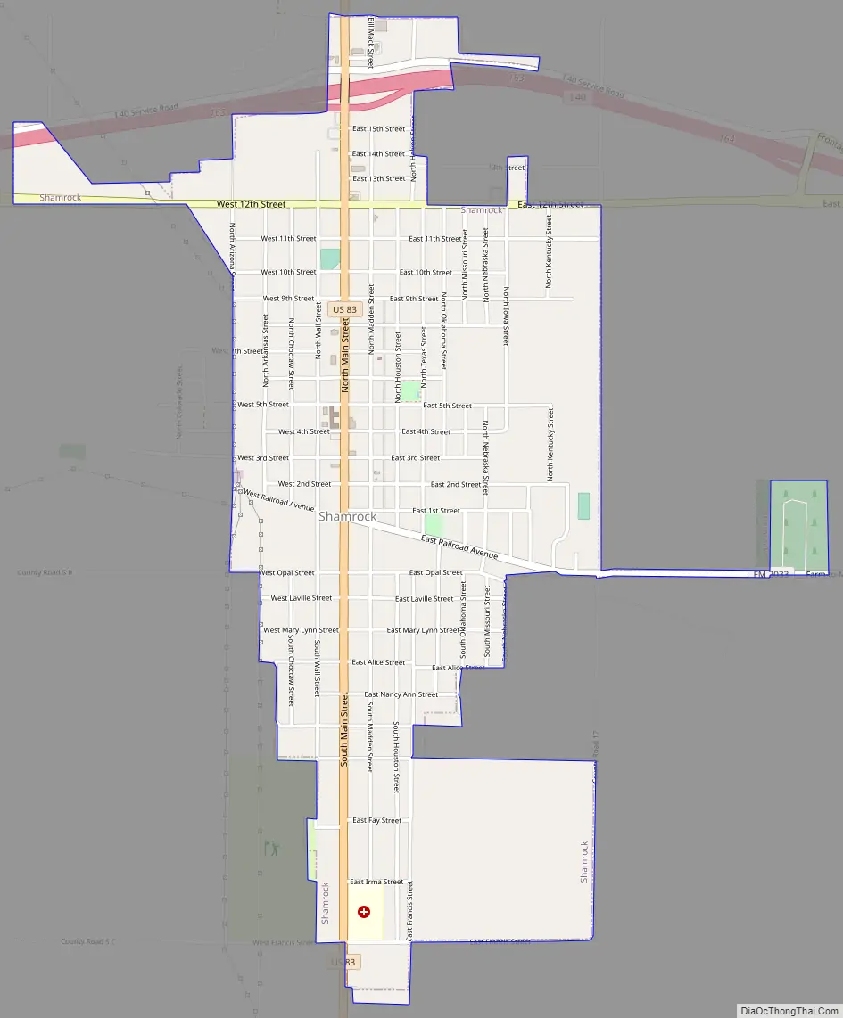
Shamrock Road Map
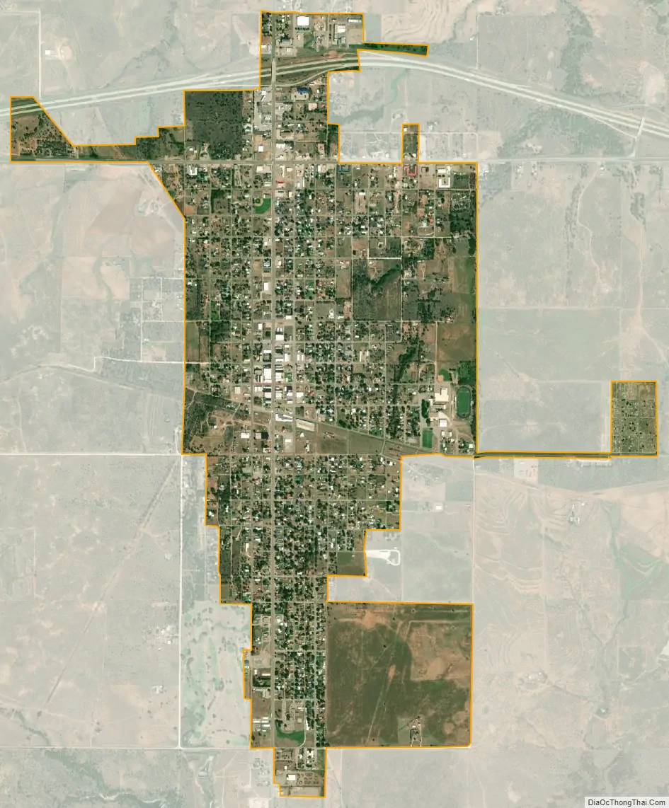
Shamrock city Satellite Map
Geography
Shamrock is located at 35°13′2″N 100°14′50″W / 35.21722°N 100.24722°W / 35.21722; -100.24722 (35.217116, –100.247171).
According to the United States Census Bureau, the city has a total area of 2.1 square miles (5.4 km), all of it land.
See also
Map of Texas State and its subdivision:- Anderson
- Andrews
- Angelina
- Aransas
- Archer
- Armstrong
- Atascosa
- Austin
- Bailey
- Bandera
- Bastrop
- Baylor
- Bee
- Bell
- Bexar
- Blanco
- Borden
- Bosque
- Bowie
- Brazoria
- Brazos
- Brewster
- Briscoe
- Brooks
- Brown
- Burleson
- Burnet
- Caldwell
- Calhoun
- Callahan
- Cameron
- Camp
- Carson
- Cass
- Castro
- Chambers
- Cherokee
- Childress
- Clay
- Cochran
- Coke
- Coleman
- Collin
- Collingsworth
- Colorado
- Comal
- Comanche
- Concho
- Cooke
- Coryell
- Cottle
- Crane
- Crockett
- Crosby
- Culberson
- Dallam
- Dallas
- Dawson
- Deaf Smith
- Delta
- Denton
- Dewitt
- Dickens
- Dimmit
- Donley
- Duval
- Eastland
- Ector
- Edwards
- El Paso
- Ellis
- Erath
- Falls
- Fannin
- Fayette
- Fisher
- Floyd
- Foard
- Fort Bend
- Franklin
- Freestone
- Frio
- Gaines
- Galveston
- Garza
- Gillespie
- Glasscock
- Goliad
- Gonzales
- Gray
- Grayson
- Gregg
- Grimes
- Guadalupe
- Hale
- Hall
- Hamilton
- Hansford
- Hardeman
- Hardin
- Harris
- Harrison
- Hartley
- Haskell
- Hays
- Hemphill
- Henderson
- Hidalgo
- Hill
- Hockley
- Hood
- Hopkins
- Houston
- Howard
- Hudspeth
- Hunt
- Hutchinson
- Irion
- Jack
- Jackson
- Jasper
- Jeff Davis
- Jefferson
- Jim Hogg
- Jim Wells
- Johnson
- Jones
- Karnes
- Kaufman
- Kendall
- Kenedy
- Kent
- Kerr
- Kimble
- King
- Kinney
- Kleberg
- Knox
- La Salle
- Lamar
- Lamb
- Lampasas
- Lavaca
- Lee
- Leon
- Liberty
- Limestone
- Lipscomb
- Live Oak
- Llano
- Loving
- Lubbock
- Lynn
- Madison
- Marion
- Martin
- Mason
- Matagorda
- Maverick
- McCulloch
- McLennan
- McMullen
- Medina
- Menard
- Midland
- Milam
- Mills
- Mitchell
- Montague
- Montgomery
- Moore
- Morris
- Motley
- Nacogdoches
- Navarro
- Newton
- Nolan
- Nueces
- Ochiltree
- Oldham
- Orange
- Palo Pinto
- Panola
- Parker
- Parmer
- Pecos
- Polk
- Potter
- Presidio
- Rains
- Randall
- Reagan
- Real
- Red River
- Reeves
- Refugio
- Roberts
- Robertson
- Rockwall
- Runnels
- Rusk
- Sabine
- San Augustine
- San Jacinto
- San Patricio
- San Saba
- Schleicher
- Scurry
- Shackelford
- Shelby
- Sherman
- Smith
- Somervell
- Starr
- Stephens
- Sterling
- Stonewall
- Sutton
- Swisher
- Tarrant
- Taylor
- Terrell
- Terry
- Throckmorton
- Titus
- Tom Green
- Travis
- Trinity
- Tyler
- Upshur
- Upton
- Uvalde
- Val Verde
- Van Zandt
- Victoria
- Walker
- Waller
- Ward
- Washington
- Webb
- Wharton
- Wheeler
- Wichita
- Wilbarger
- Willacy
- Williamson
- Wilson
- Winkler
- Wise
- Wood
- Yoakum
- Young
- Zapata
- Zavala
- Alabama
- Alaska
- Arizona
- Arkansas
- California
- Colorado
- Connecticut
- Delaware
- District of Columbia
- Florida
- Georgia
- Hawaii
- Idaho
- Illinois
- Indiana
- Iowa
- Kansas
- Kentucky
- Louisiana
- Maine
- Maryland
- Massachusetts
- Michigan
- Minnesota
- Mississippi
- Missouri
- Montana
- Nebraska
- Nevada
- New Hampshire
- New Jersey
- New Mexico
- New York
- North Carolina
- North Dakota
- Ohio
- Oklahoma
- Oregon
- Pennsylvania
- Rhode Island
- South Carolina
- South Dakota
- Tennessee
- Texas
- Utah
- Vermont
- Virginia
- Washington
- West Virginia
- Wisconsin
- Wyoming