Seminole is a city in and the county seat of Gaines County, Texas, United States. Its population was 6,430 at the 2010 census. Seminole and Gaines County are home to a large German Mennonite population that came to West Texas in the 1980s.
It is the birthplace of country music singers Larry Gatlin and Tanya Tucker.
| Name: | Seminole city |
|---|---|
| LSAD Code: | 25 |
| LSAD Description: | city (suffix) |
| State: | Texas |
| County: | Gaines County |
| Elevation: | 3,297 ft (1,005 m) |
| Total Area: | 3.80 sq mi (9.83 km²) |
| Land Area: | 3.80 sq mi (9.83 km²) |
| Water Area: | 0.00 sq mi (0.00 km²) |
| Total Population: | 6,988 |
| Population Density: | 2,058.20/sq mi (794.74/km²) |
| ZIP code: | 79360 |
| Area code: | 432 |
| FIPS code: | 4866764 |
| GNISfeature ID: | 2411866 |
Online Interactive Map
Click on ![]() to view map in "full screen" mode.
to view map in "full screen" mode.
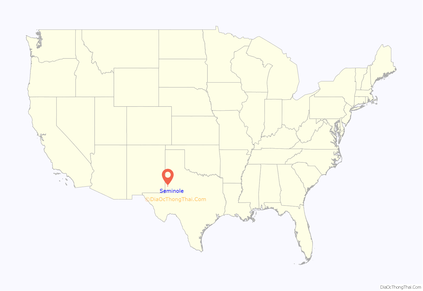
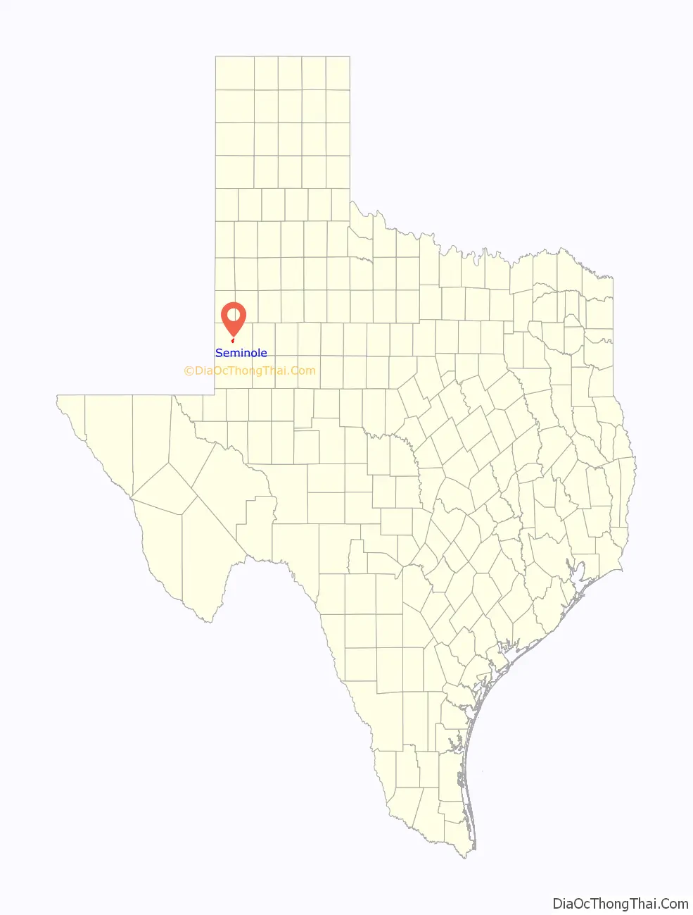
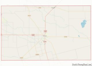
Seminole location map. Where is Seminole city?
History
The land for Seminole was donated by nonresident landowners to become the county seat for Gaines County. In 1906, the first move to Seminole was made by W. B. Austin and his wife Emma, who moved their general store there, which was located in Caput, Texas. During this time, several post offices found a new home in Seminole. Seminole National Bank opened its doors in 1906, followed by First State Bank in 1907. In 1912, Seminole National Bank lost over $3,000 when it was robbed. In 1914, the two banks merged to form First State Bank. In 1950, Seminole’s population surpassed Seagraves, Texas, for the first time.
In 1977, some 100 families of Plautdietsch-speaking “Russian” Mennonites from Mexico bought land southwest of Seminole to settle there, but faced difficulties with immigration. In 1980, President Jimmy Carter signed legislation allowing the original 100 families to gain full citizenship. In 2016, about 6,000 Plautdietsch speakers lived around Seminole.
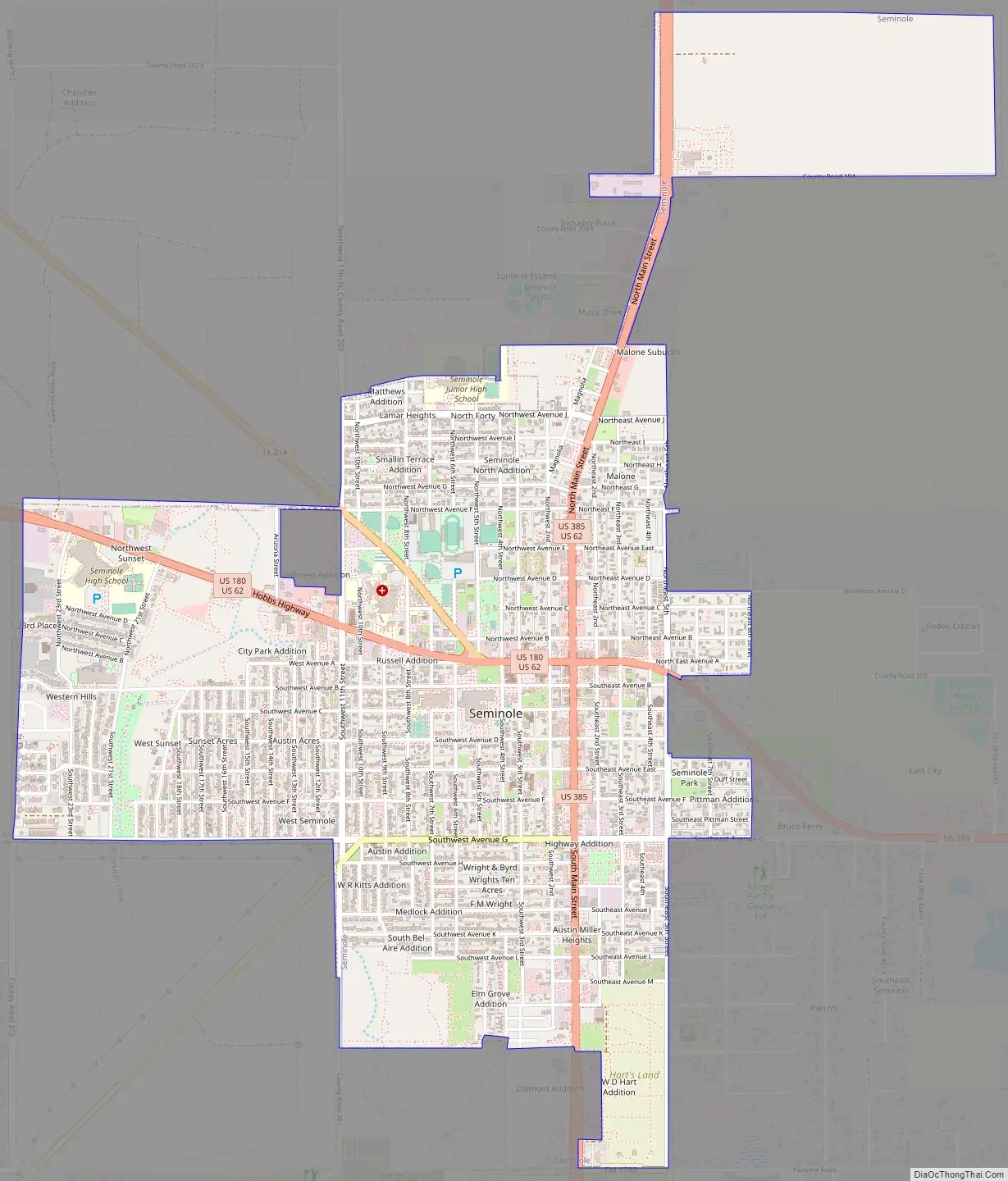
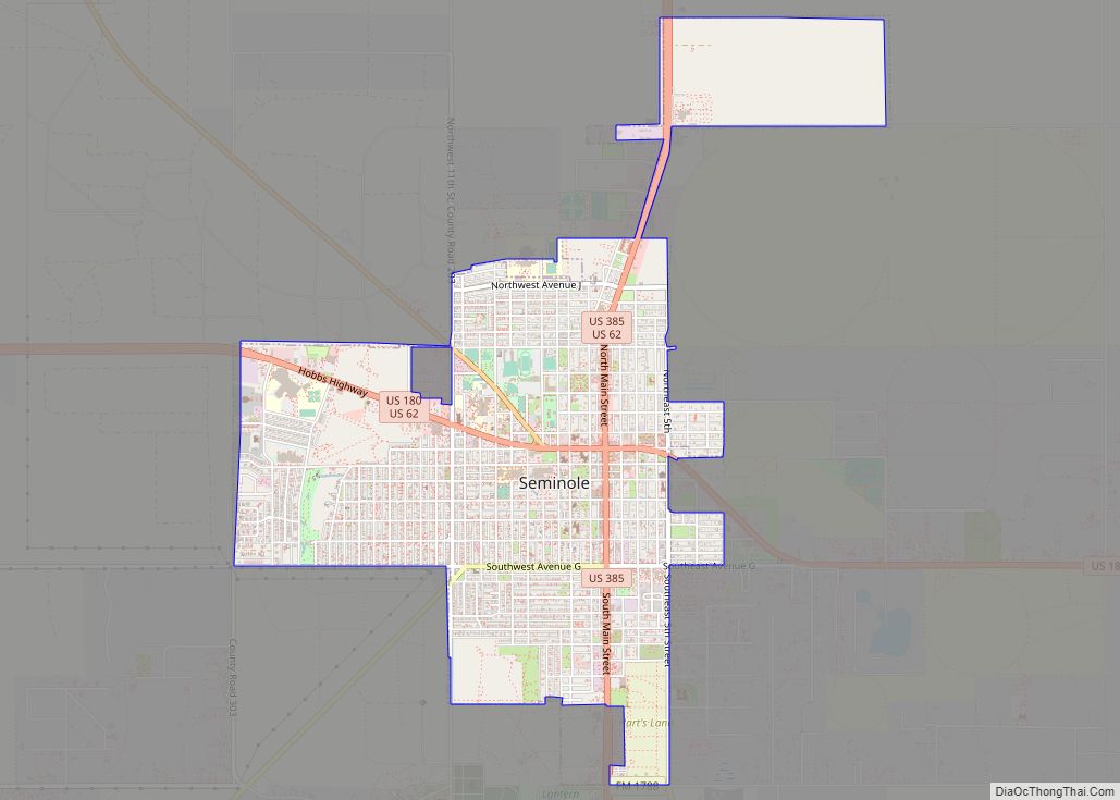
Seminole Road Map
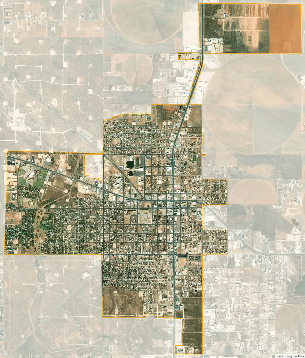
Seminole city Satellite Map
Geography
Seminole is located at 32°43′7″N 102°39′00″W / 32.71861°N 102.65000°W / 32.71861; -102.65000.
According to the United States Census Bureau, the city has a total area of 3.3 square miles (8.5 km), all land.
Climate
The climate is cold semiarid (Köppen: BSk) affected by elevation with well defined seasons, more extreme and drier than most of the great cities of Texas. The lowest temperature measured in the state was in the city with −23 °F (−31 °C), recorded on February 8, 1933.
See also
Map of Texas State and its subdivision:- Anderson
- Andrews
- Angelina
- Aransas
- Archer
- Armstrong
- Atascosa
- Austin
- Bailey
- Bandera
- Bastrop
- Baylor
- Bee
- Bell
- Bexar
- Blanco
- Borden
- Bosque
- Bowie
- Brazoria
- Brazos
- Brewster
- Briscoe
- Brooks
- Brown
- Burleson
- Burnet
- Caldwell
- Calhoun
- Callahan
- Cameron
- Camp
- Carson
- Cass
- Castro
- Chambers
- Cherokee
- Childress
- Clay
- Cochran
- Coke
- Coleman
- Collin
- Collingsworth
- Colorado
- Comal
- Comanche
- Concho
- Cooke
- Coryell
- Cottle
- Crane
- Crockett
- Crosby
- Culberson
- Dallam
- Dallas
- Dawson
- Deaf Smith
- Delta
- Denton
- Dewitt
- Dickens
- Dimmit
- Donley
- Duval
- Eastland
- Ector
- Edwards
- El Paso
- Ellis
- Erath
- Falls
- Fannin
- Fayette
- Fisher
- Floyd
- Foard
- Fort Bend
- Franklin
- Freestone
- Frio
- Gaines
- Galveston
- Garza
- Gillespie
- Glasscock
- Goliad
- Gonzales
- Gray
- Grayson
- Gregg
- Grimes
- Guadalupe
- Hale
- Hall
- Hamilton
- Hansford
- Hardeman
- Hardin
- Harris
- Harrison
- Hartley
- Haskell
- Hays
- Hemphill
- Henderson
- Hidalgo
- Hill
- Hockley
- Hood
- Hopkins
- Houston
- Howard
- Hudspeth
- Hunt
- Hutchinson
- Irion
- Jack
- Jackson
- Jasper
- Jeff Davis
- Jefferson
- Jim Hogg
- Jim Wells
- Johnson
- Jones
- Karnes
- Kaufman
- Kendall
- Kenedy
- Kent
- Kerr
- Kimble
- King
- Kinney
- Kleberg
- Knox
- La Salle
- Lamar
- Lamb
- Lampasas
- Lavaca
- Lee
- Leon
- Liberty
- Limestone
- Lipscomb
- Live Oak
- Llano
- Loving
- Lubbock
- Lynn
- Madison
- Marion
- Martin
- Mason
- Matagorda
- Maverick
- McCulloch
- McLennan
- McMullen
- Medina
- Menard
- Midland
- Milam
- Mills
- Mitchell
- Montague
- Montgomery
- Moore
- Morris
- Motley
- Nacogdoches
- Navarro
- Newton
- Nolan
- Nueces
- Ochiltree
- Oldham
- Orange
- Palo Pinto
- Panola
- Parker
- Parmer
- Pecos
- Polk
- Potter
- Presidio
- Rains
- Randall
- Reagan
- Real
- Red River
- Reeves
- Refugio
- Roberts
- Robertson
- Rockwall
- Runnels
- Rusk
- Sabine
- San Augustine
- San Jacinto
- San Patricio
- San Saba
- Schleicher
- Scurry
- Shackelford
- Shelby
- Sherman
- Smith
- Somervell
- Starr
- Stephens
- Sterling
- Stonewall
- Sutton
- Swisher
- Tarrant
- Taylor
- Terrell
- Terry
- Throckmorton
- Titus
- Tom Green
- Travis
- Trinity
- Tyler
- Upshur
- Upton
- Uvalde
- Val Verde
- Van Zandt
- Victoria
- Walker
- Waller
- Ward
- Washington
- Webb
- Wharton
- Wheeler
- Wichita
- Wilbarger
- Willacy
- Williamson
- Wilson
- Winkler
- Wise
- Wood
- Yoakum
- Young
- Zapata
- Zavala
- Alabama
- Alaska
- Arizona
- Arkansas
- California
- Colorado
- Connecticut
- Delaware
- District of Columbia
- Florida
- Georgia
- Hawaii
- Idaho
- Illinois
- Indiana
- Iowa
- Kansas
- Kentucky
- Louisiana
- Maine
- Maryland
- Massachusetts
- Michigan
- Minnesota
- Mississippi
- Missouri
- Montana
- Nebraska
- Nevada
- New Hampshire
- New Jersey
- New Mexico
- New York
- North Carolina
- North Dakota
- Ohio
- Oklahoma
- Oregon
- Pennsylvania
- Rhode Island
- South Carolina
- South Dakota
- Tennessee
- Texas
- Utah
- Vermont
- Virginia
- Washington
- West Virginia
- Wisconsin
- Wyoming
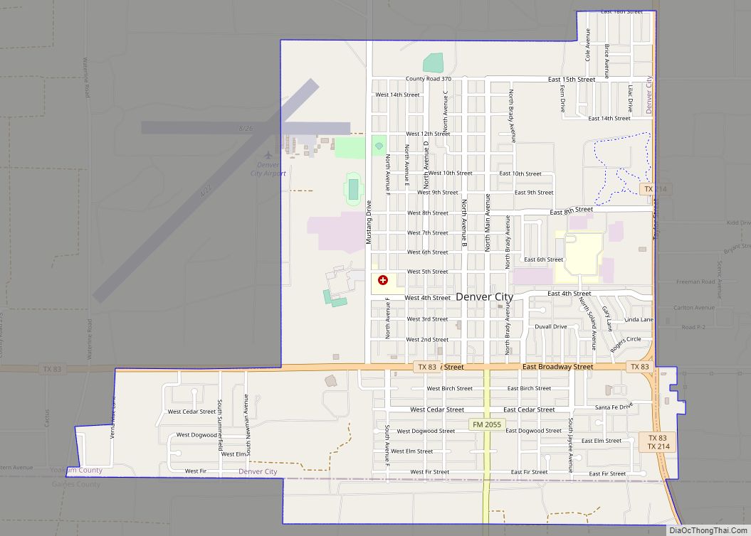
The name of the town is Seminole, not Seminole city. Also, whenever “city” is actually part of a city or town’s official name, it gets capitalized. Just to the northwest of Seminole is a town called Denver City. Seminole is never called Seminole city and Denver City is never called Denver because those are not the names of them. The town’s government and official buildings would be listed under “City of Seminole”, both words definitely capitalized.