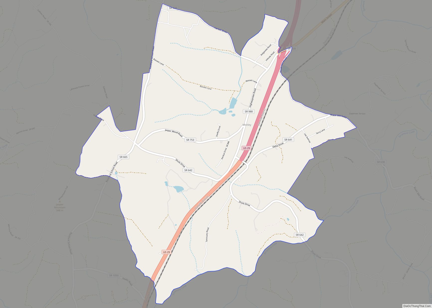
Motley is a census-designated place (CDP) in Pittsylvania County, Virginia, United States. It was named for a notable Virginia family in colonial times, the Motleys. Two of them, Joseph and his son David James Motley, fought in the American Revolution. The population as of the 2010 Census was 1,015. Motley CDP overview: Name: Motley CDP ... Read more
Map of US Cities and Places
New Church is a census-designated place (CDP) in Accomack County, Virginia, United States. Per the 2020 census, the population was 256. Pitts Neck Farm was added to the National Register of Historic Places in 1976. New Church CDP overview: Name: New Church CDP LSAD Code: 57 LSAD Description: CDP (suffix) State: Virginia County: Accomack County ... Read more
New Castle (historically spelled as one word; “Newcastle”) is the only town in Craig County, Virginia, United States. The population was 125 at the 2020 census. It is the county seat of Craig County. The junctions of State Route 311 and State Route 42 and State Route 311 and State Route 615 are in New ... Read more
Nelsonia is a census-designated place (CDP) in Accomack County, Virginia, United States. Per the 2020 census, the population was 451. Nelsonia CDP overview: Name: Nelsonia CDP LSAD Code: 57 LSAD Description: CDP (suffix) State: Virginia County: Accomack County Elevation: 46 ft (14 m) Total Area: 451 FIPS code: 5155448 GNISfeature ID: 2584889 Online Interactive Map Nelsonia online ... Read more
Nellysford CDP overview: Name: Nellysford CDP LSAD Code: 57 LSAD Description: CDP (suffix) State: Virginia County: Nelson County FIPS code: 5155400 Online Interactive Map Nellysford online map. Source: Basemap layers from Google Map, Open Street Map (OSM), Arcgisonline, Wmflabs. Boundary Data from Database of Global Administrative Areas. Nellysford location map. Where is Nellysford CDP? Nellysford ... Read more
Neabsco CDP overview: Name: Neabsco CDP LSAD Code: 57 LSAD Description: CDP (suffix) State: Virginia County: Prince William County FIPS code: 5155272 Online Interactive Map Neabsco online map. Source: Basemap layers from Google Map, Open Street Map (OSM), Arcgisonline, Wmflabs. Boundary Data from Database of Global Administrative Areas. Neabsco location map. Where is Neabsco CDP? ... Read more
Nathalie is an unincorporated community and census-designated place (CDP) in Halifax County, Virginia, United States, in the south-central region of the state. The population as of the 2010 census was 183. Nathalie CDP overview: Name: Nathalie CDP LSAD Code: 57 LSAD Description: CDP (suffix) State: Virginia County: Halifax County Elevation: 169 ft (554 m) Total Area: 3.00 sq mi ... Read more
Nassawadox is a town in Northampton County, Virginia, United States. Per the 2020 census, the population was 533. The town, with an area of 0.4 square miles (1.0 km), is located on U.S. Route 13 on Virginia’s Eastern Shore, approximately five miles south of Exmore and 25 miles (40 km) north of the Chesapeake Bay Bridge-Tunnel. Nassawadox ... Read more
Narrows, named for the narrowing of the New River that flows through the town, is a town in Giles County, Virginia, United States. The population was 2,029 at the 2010 census, a decline of 3.9% from the 2000 count of 2,111. It is part of the Blacksburg–Christiansburg Metropolitan Statistical Area. Narrows town overview: Name: Narrows ... Read more
Mountain Road is a census-designated place (CDP) in Halifax County, Virginia, United States. The population as of the 2010 census was 1,100. Mountain Road CDP overview: Name: Mountain Road CDP LSAD Code: 57 LSAD Description: CDP (suffix) State: Virginia County: Halifax County Elevation: 533 ft (162 m) Total Area: 8.6 sq mi (22.3 km²) Land Area: 8.6 sq mi (22.2 km²) Water Area: ... Read more
North Shore CDP overview: Name: North Shore CDP LSAD Code: 57 LSAD Description: CDP (suffix) State: Virginia County: Franklin County FIPS code: 5157531 Online Interactive Map North Shore online map. Source: Basemap layers from Google Map, Open Street Map (OSM), Arcgisonline, Wmflabs. Boundary Data from Database of Global Administrative Areas. North Shore location map. Where ... Read more
Nokesville is a census-designated place (CDP) in Prince William County, Virginia, United States and Fauquier County, Virginia, United States. The population was 1,354 at the 2010 census. Nokesville CDP overview: Name: Nokesville CDP LSAD Code: 57 LSAD Description: CDP (suffix) State: Virginia County: Prince William County Elevation: 266 ft (81 m) Total Area: 9.5 sq mi (24.5 km²) Land Area: ... Read more