New Castle (historically spelled as one word; “Newcastle”) is the only town in Craig County, Virginia, United States. The population was 125 at the 2020 census. It is the county seat of Craig County.
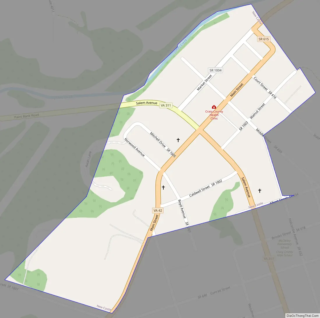
The junctions of State Route 311 and State Route 42 and State Route 311 and State Route 615 are in New Castle.
New Castle is part of the Roanoke Metropolitan Statistical Area.
| Name: | New Castle town |
|---|---|
| LSAD Code: | 43 |
| LSAD Description: | town (suffix) |
| State: | Virginia |
| County: | Craig County |
| Elevation: | 1,352 ft (412 m) |
| Total Area: | 0.17 sq mi (0.43 km²) |
| Land Area: | 0.17 sq mi (0.43 km²) |
| Water Area: | 0.00 sq mi (0.00 km²) |
| Population Density: | 927.27/sq mi (358.14/km²) |
| ZIP code: | 24127 |
| Area code: | 540 |
| FIPS code: | 5155592 |
| GNISfeature ID: | 1498522 |
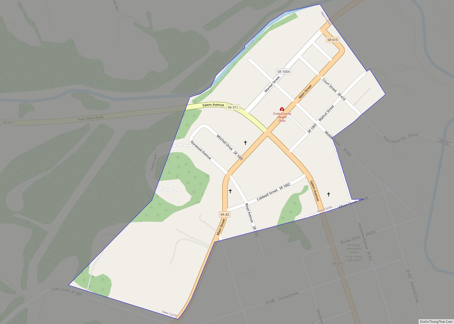
Online Interactive Map
Click on ![]() to view map in "full screen" mode.
to view map in "full screen" mode.
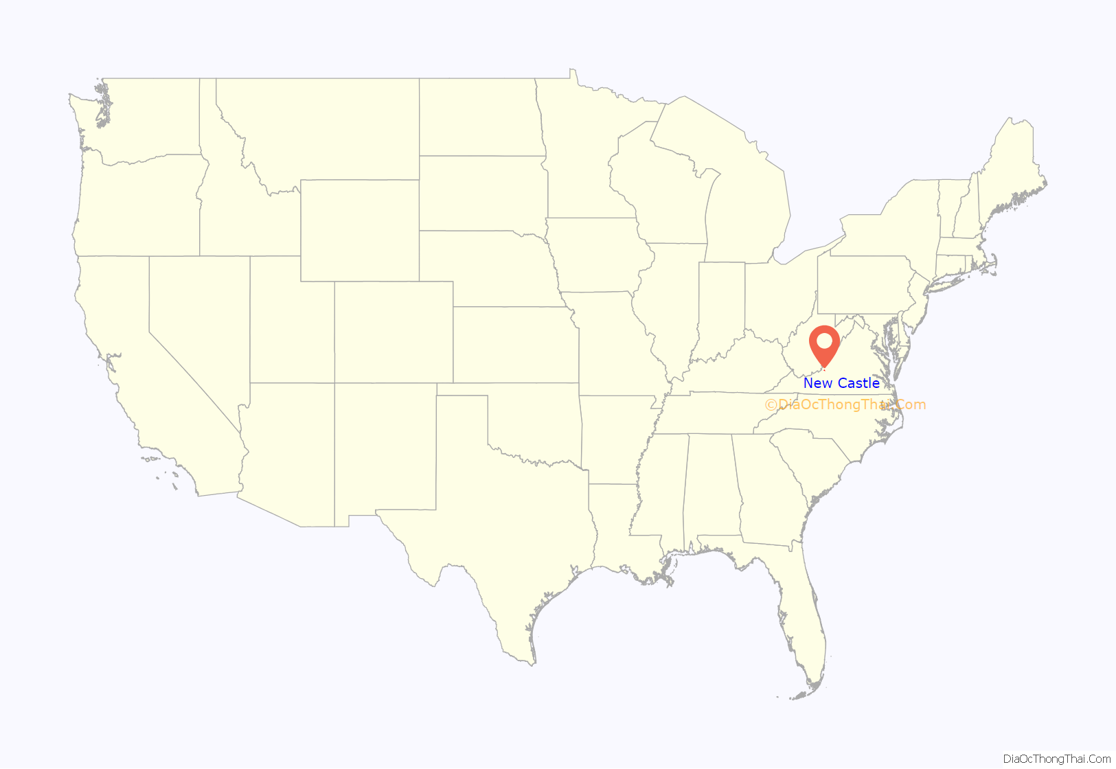
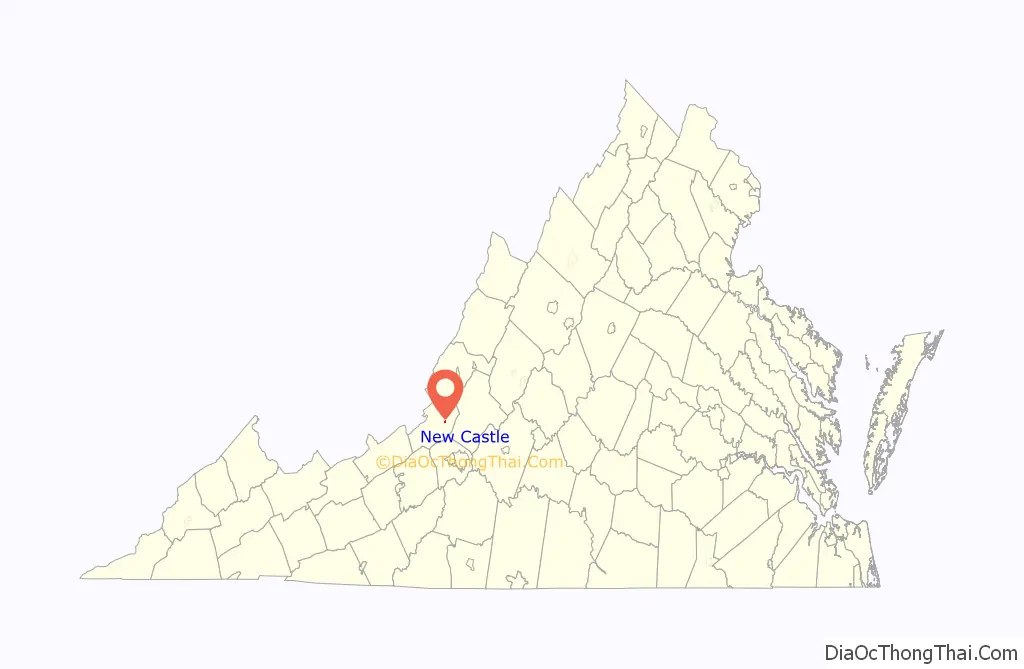
New Castle location map. Where is New Castle town?
New Castle Road Map
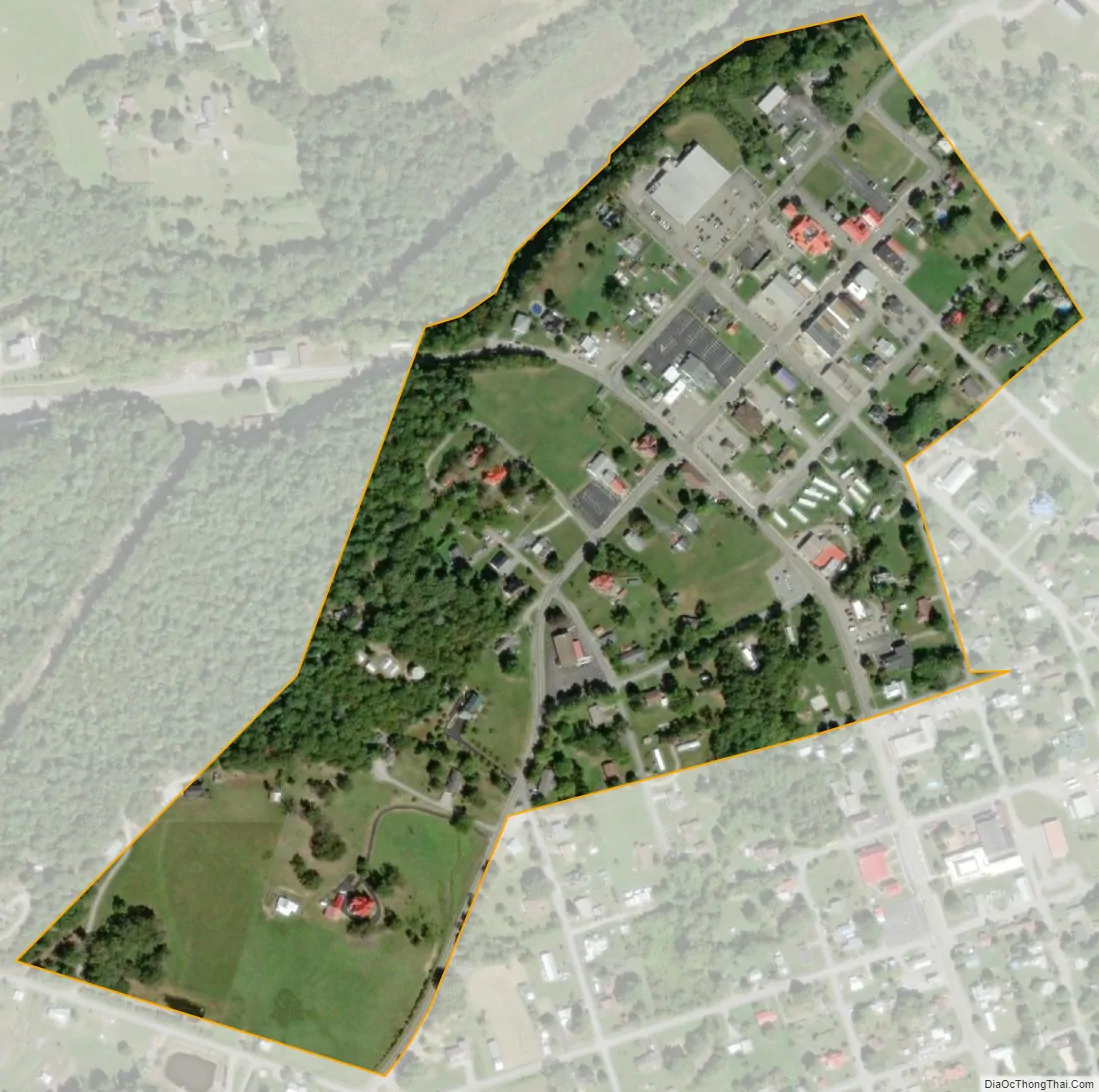
New Castle city Satellite Map
Geography
New Castle is located at 37°30′3″N 80°6′39″W / 37.50083°N 80.11083°W / 37.50083; -80.11083 (37.500746, -80.110798).
According to the United States Census Bureau, the town has a total area of 0.2 square miles (0.4 km), all of it land.
Two notable geophysical features of the town are the high cliffs just west of the city (which keeps the New River watershed flowing north away from New Castle) and Johns Creek gorge featuring some challenging whitewater (James River watershed). Due to an old land charter however, paddling Johns Creek was disputed as trespassing by the landowner, recent court rulings have opened the run up once again.
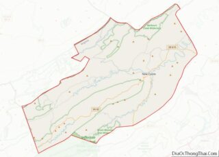
The town is just north of the Sinking Creek Valley Cluster, west of the Craig Creek Cluster, and south of the Barbours Creek-Shawvers Run Cluster; areas in the Jefferson National Forest designated by the Wilderness Society as containing “Mountain Treasures”.
See also
Map of Virginia State and its subdivision:- Accomack
- Albemarle
- Alexandria
- Alleghany
- Amelia
- Amherst
- Appomattox
- Arlington
- Augusta
- Bath
- Bedford
- Bedford City
- Bland
- Botetourt
- Bristol
- Brunswick
- Buchanan
- Buckingham
- Buena Vista
- Campbell
- Caroline
- Carroll
- Charles City
- Charlotte
- Charlottesville
- Chesapeake
- Chesterfield
- Clarke
- Clifton Forge City
- Colonial Heights
- Covington
- Craig
- Culpeper
- Cumberland
- Danville
- Dickenson
- Dinwiddie
- Emporia
- Essex
- Fairfax
- Fairfax City
- Falls Church
- Fauquier
- Floyd
- Fluvanna
- Franklin
- Frederick
- Fredericksburg
- Galax
- Giles
- Gloucester
- Goochland
- Grayson
- Greene
- Greensville
- Halifax
- Hampton
- Hanover
- Harrisonburg
- Henrico
- Henry
- Highland
- Hopewell
- Isle of Wight
- James City
- King and Queen
- King George
- King William
- Lancaster
- Lee
- Lexington
- Loudoun
- Louisa
- Lunenburg
- Lynchburg
- Madison
- Manassas
- Manassas Park
- Martinsville
- Mathews
- Mecklenburg
- Middlesex
- Montgomery
- Nelson
- New Kent
- Newport News
- Norfolk
- Northampton
- Northumberland
- Norton
- Nottoway
- Orange
- Page
- Patrick
- Petersburg
- Pittsylvania
- Poquoson
- Portsmouth
- Powhatan
- Prince Edward
- Prince George
- Prince William
- Pulaski
- Radford
- Rappahannock
- Richmond
- Roanoke
- Roanoke City
- Rockbridge
- Rockingham
- Russell
- Salem
- Scott
- Shenandoah
- Smyth
- Southampton
- Spotsylvania
- Stafford
- Staunton
- Suffolk
- Surry
- Sussex
- Tazewell
- Virginia Beach
- Warren
- Washington
- Waynesboro
- Westmoreland
- Williamsburg
- Winchester
- Wise
- Wythe
- York
- Alabama
- Alaska
- Arizona
- Arkansas
- California
- Colorado
- Connecticut
- Delaware
- District of Columbia
- Florida
- Georgia
- Hawaii
- Idaho
- Illinois
- Indiana
- Iowa
- Kansas
- Kentucky
- Louisiana
- Maine
- Maryland
- Massachusetts
- Michigan
- Minnesota
- Mississippi
- Missouri
- Montana
- Nebraska
- Nevada
- New Hampshire
- New Jersey
- New Mexico
- New York
- North Carolina
- North Dakota
- Ohio
- Oklahoma
- Oregon
- Pennsylvania
- Rhode Island
- South Carolina
- South Dakota
- Tennessee
- Texas
- Utah
- Vermont
- Virginia
- Washington
- West Virginia
- Wisconsin
- Wyoming