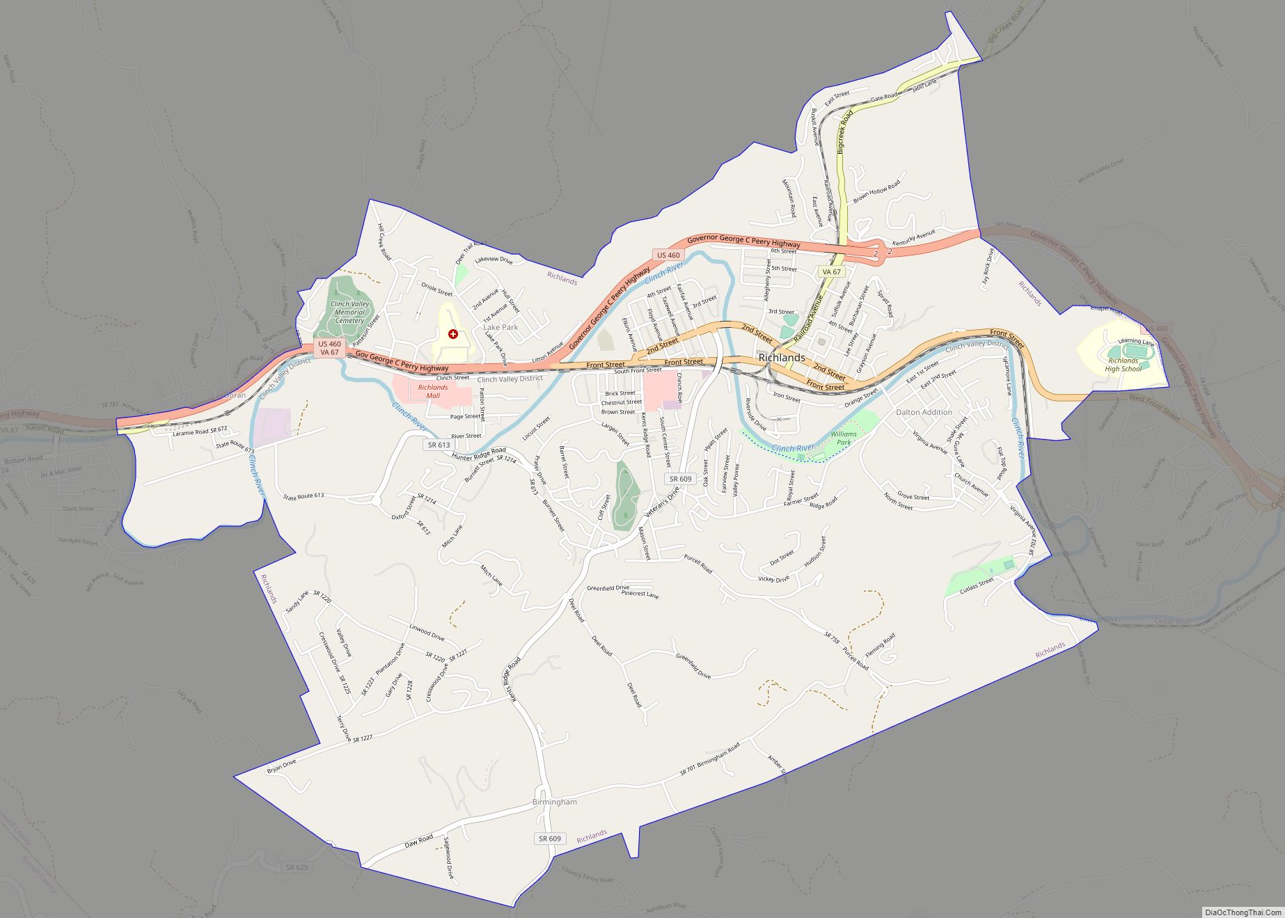
Richlands is a town in Tazewell County, Virginia, United States. The population was 5,261 at the 2020 census. It is part of the Bluefield, WV-VA micropolitan area which has a population of 107,578. Richlands town overview: Name: Richlands town LSAD Code: 43 LSAD Description: town (suffix) State: Virginia County: Tazewell County Incorporated: 1892 Elevation: 1,933 ft ... Read more
Map of US Cities and Places
Rich Creek is a town in Giles County, Virginia, United States. The population was 774 as per the 2010 census, up from 665 as per the 2000 census. It is part of the Blacksburg–Christiansburg Metropolitan Statistical Area. Rich Creek town overview: Name: Rich Creek town LSAD Code: 43 LSAD Description: town (suffix) State: Virginia County: ... Read more
Reston is a census-designated place in Fairfax County, Virginia, and a principal city of the Washington metropolitan area. As of the 2020 U.S. Census, Reston’s population was 63,226. Founded in 1964, Reston was influenced by the Garden City movement that emphasized planned, self-contained communities that intermingled green space, residential neighborhoods, and commercial development. The intent ... Read more
Ravensworth is a census-designated place in Fairfax County, Virginia, United States. Its name reflects Ravensworth plantation, farmed since the 18th century and manor house which burned under mysterious circumstances on August 1, 1926. The Ravensworth Farm subdivision was developed in the early 1960s. The 2010 census lists the area’s population as 2,466. It is part ... Read more
Quinby is a census-designated place (CDP) in Accomack County, Virginia, United States. It was first listed as a CDP in 2010. Per the 2020 census, the population was 285. Quinby CDP overview: Name: Quinby CDP LSAD Code: 57 LSAD Description: CDP (suffix) State: Virginia County: Accomack County Elevation: 7 ft (2 m) Total Area: 285 FIPS code: ... Read more
Rockwood is a census-designated place in Chesterfield County, Virginia. The population as of the 2010 Census was 8,431. Rockwood CDP overview: Name: Rockwood CDP LSAD Code: 57 LSAD Description: CDP (suffix) State: Virginia County: Chesterfield County Total Area: 8,431 ZIP code: 23236 Area code: 804 FIPS code: 5168470 GNISfeature ID: 2584911 Online Interactive Map Rockwood ... Read more
Riverview is a census-designated place in Wise County, Virginia, southwest of Coeburn. The population as of the 2010 Census was 782. Riverview CDP overview: Name: Riverview CDP LSAD Code: 57 LSAD Description: CDP (suffix) State: Virginia County: Wise County Total Area: 782 ZIP code: 24230 FIPS code: 5167704 GNISfeature ID: 2629844 Online Interactive Map Riverview ... Read more
Rustburg CDP overview: Name: Rustburg CDP LSAD Code: 57 LSAD Description: CDP (suffix) State: Virginia County: Campbell County FIPS code: 5169536 Online Interactive Map Rustburg online map. Source: Basemap layers from Google Map, Open Street Map (OSM), Arcgisonline, Wmflabs. Boundary Data from Database of Global Administrative Areas. Rustburg location map. Where is Rustburg CDP? Rustburg ... Read more
Rushmere is a census-designated place (CDP) in Isle of Wight County, Virginia, United States. The population was 1,018 at the 2010 census. Rushmere CDP overview: Name: Rushmere CDP LSAD Code: 57 LSAD Description: CDP (suffix) State: Virginia County: Isle of Wight County Elevation: 72 ft (22 m) Total Area: 8.4 sq mi (21.8 km²) Land Area: 8.3 sq mi (21.4 km²) Water Area: ... Read more
Rural Retreat is a town in Wythe County, Virginia, United States. The population was 1,483 at the 2010 census. Rural Retreat town overview: Name: Rural Retreat town LSAD Code: 43 LSAD Description: town (suffix) State: Virginia County: Wythe County Elevation: 2,513 ft (766 m) Total Area: 2.28 sq mi (5.90 km²) Land Area: 2.28 sq mi (5.89 km²) Water Area: 0.00 sq mi (0.00 km²) Total ... Read more
Ruckersville CDP overview: Name: Ruckersville CDP LSAD Code: 57 LSAD Description: CDP (suffix) State: Virginia County: Greene County FIPS code: 5169360 Online Interactive Map Ruckersville online map. Source: Basemap layers from Google Map, Open Street Map (OSM), Arcgisonline, Wmflabs. Boundary Data from Database of Global Administrative Areas. Ruckersville location map. Where is Ruckersville CDP? Ruckersville ... Read more
Round Hill is a town in Loudoun County, Virginia, United States. Its population was 539 at the 2010 census and an estimated 656 in 2019. The town is located at the crossroads of Virginia Routes 7 and 719 (Woodgrove Road), approximately 50 miles (80 km) northwest of Washington, D.C. The town’s name refers a hill two ... Read more