Richlands is a town in Tazewell County, Virginia, United States. The population was 5,261 at the 2020 census. It is part of the Bluefield, WV-VA micropolitan area which has a population of 107,578.
| Name: | Richlands town |
|---|---|
| LSAD Code: | 43 |
| LSAD Description: | town (suffix) |
| State: | Virginia |
| County: | Tazewell County |
| Incorporated: | 1892 |
| Elevation: | 1,933 ft (589 m) |
| Total Area: | 5.71 sq mi (14.77 km²) |
| Land Area: | 5.65 sq mi (14.63 km²) |
| Water Area: | 0.06 sq mi (0.14 km²) |
| Total Population: | 5,261 |
| Population Density: | 926.37/sq mi (357.70/km²) |
| ZIP code: | 24641 |
| Area code: | 276 |
| FIPS code: | 5166928 |
| GNISfeature ID: | 1473194 |
| Website: | http://town.richlands.va.us/ |
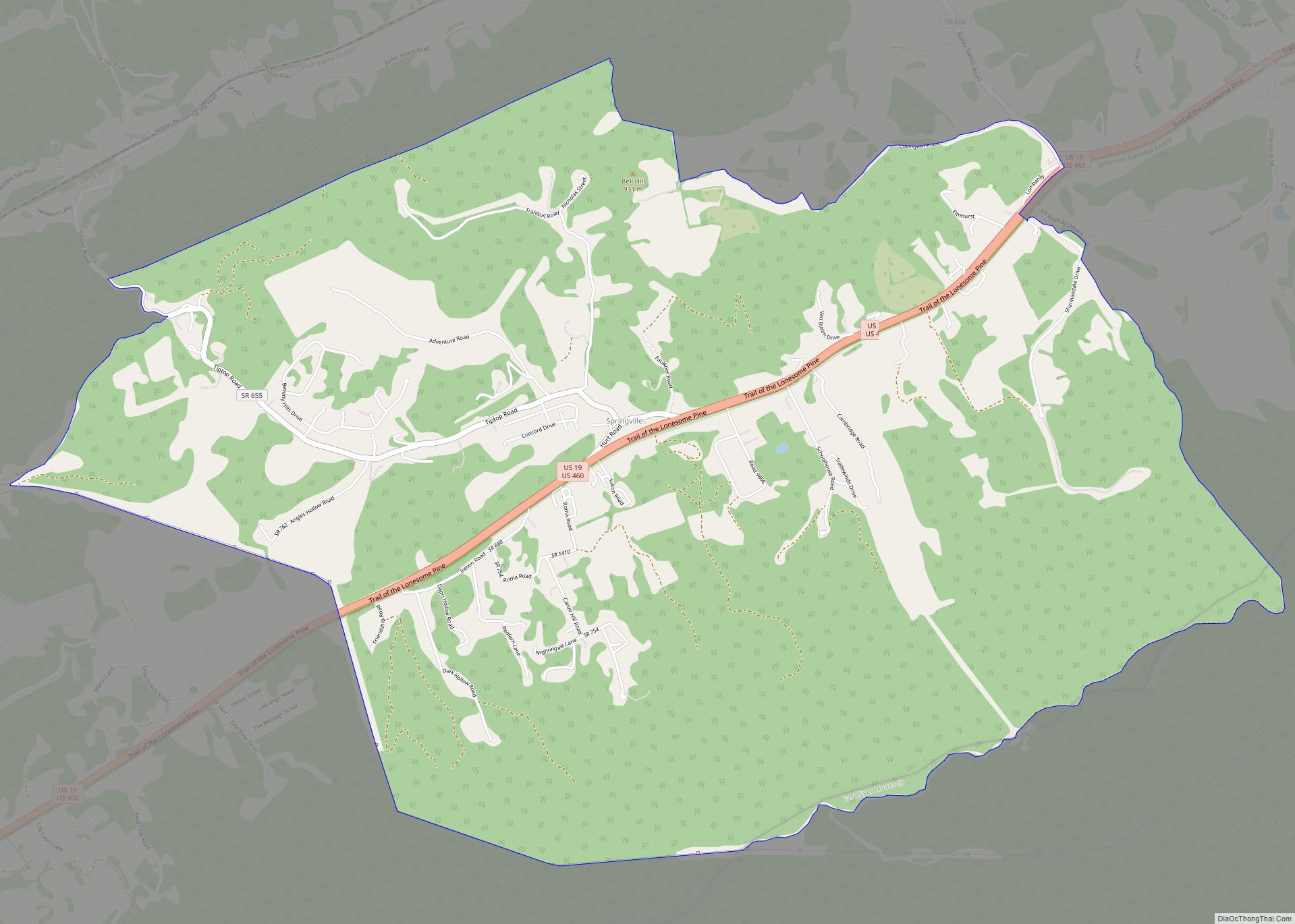
Online Interactive Map
Click on ![]() to view map in "full screen" mode.
to view map in "full screen" mode.
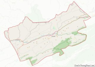
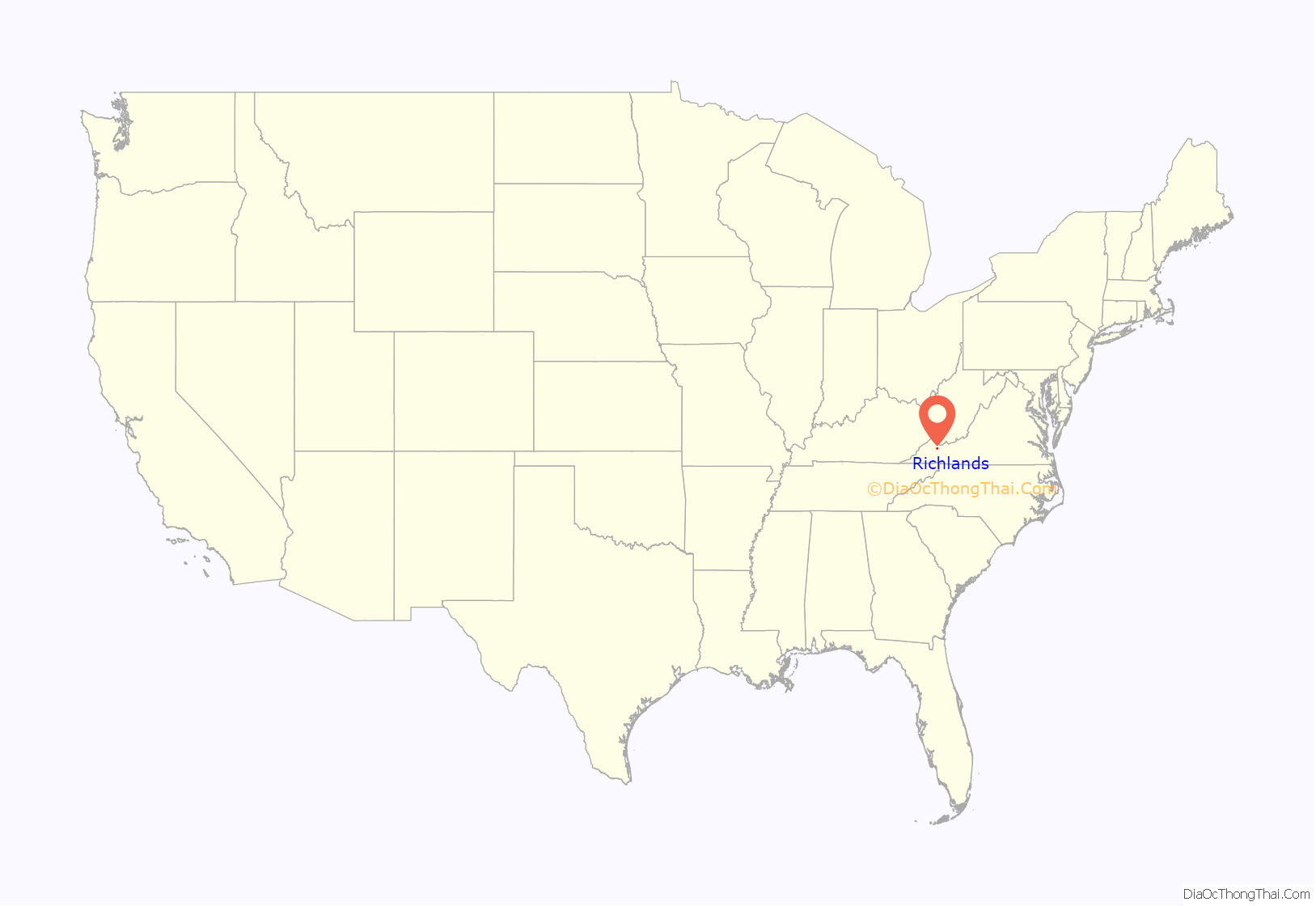
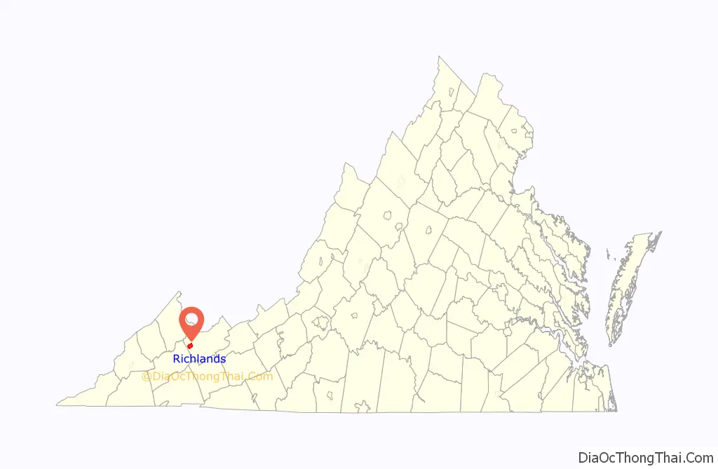
Richlands location map. Where is Richlands town?
History
Located along the banks of the Clinch River, Richlands began as a farming community and was named for its fertile “rich lands.”
The Clinch Valley Coal & Iron Company began to develop Richlands in 1890, and company officials hoped Richlands’ readily available coal, iron, and timber might make it the “Pittsburgh of the South.” The company abandoned its plans following the stock market crash of 1893.
In February 1893, Richlands was the site of a mass lynching of five black railroad workers after it was alleged some of the men had robbed and beaten a white man. Four of the railroad workers were arrested and held in the Richlands jail, but the jailor was overpowered by a mob of white townspeople, including James Hurt, a magistrate and member of the Richlands town council, and James Crabtree, a prominent businessman, who removed the four men and hanged them from the same tree. A fifth black railroad worker was later found and lynched.
The Richlands Historic District encompasses much of downtown Richlands, and the Tazewell Avenue Historic District, and Williams House, are both listed on the National Register of Historic Places.
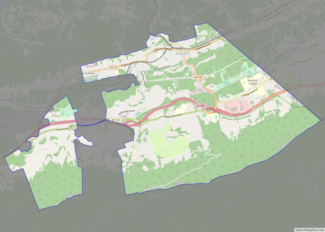
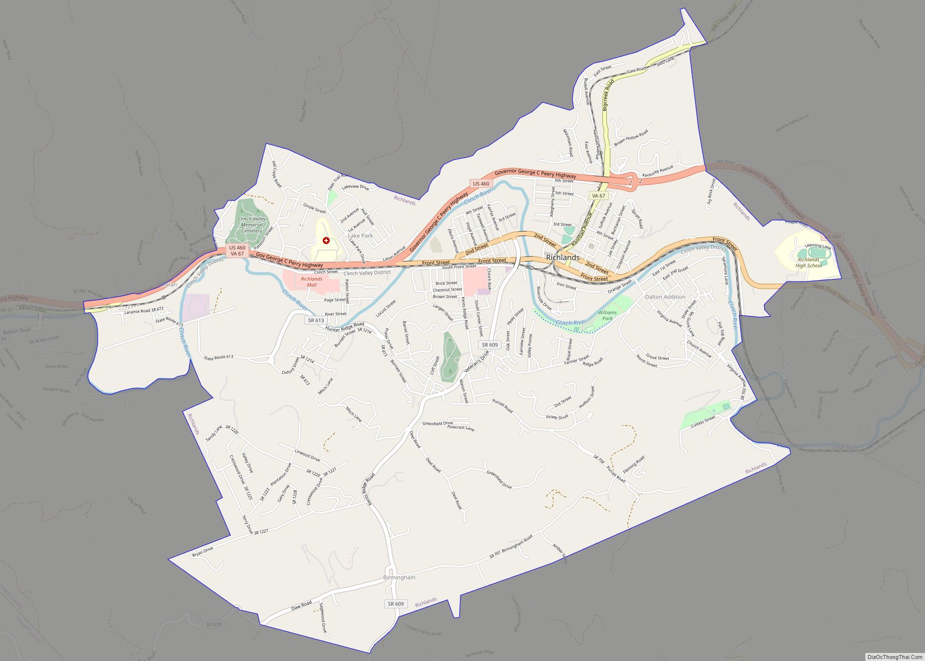
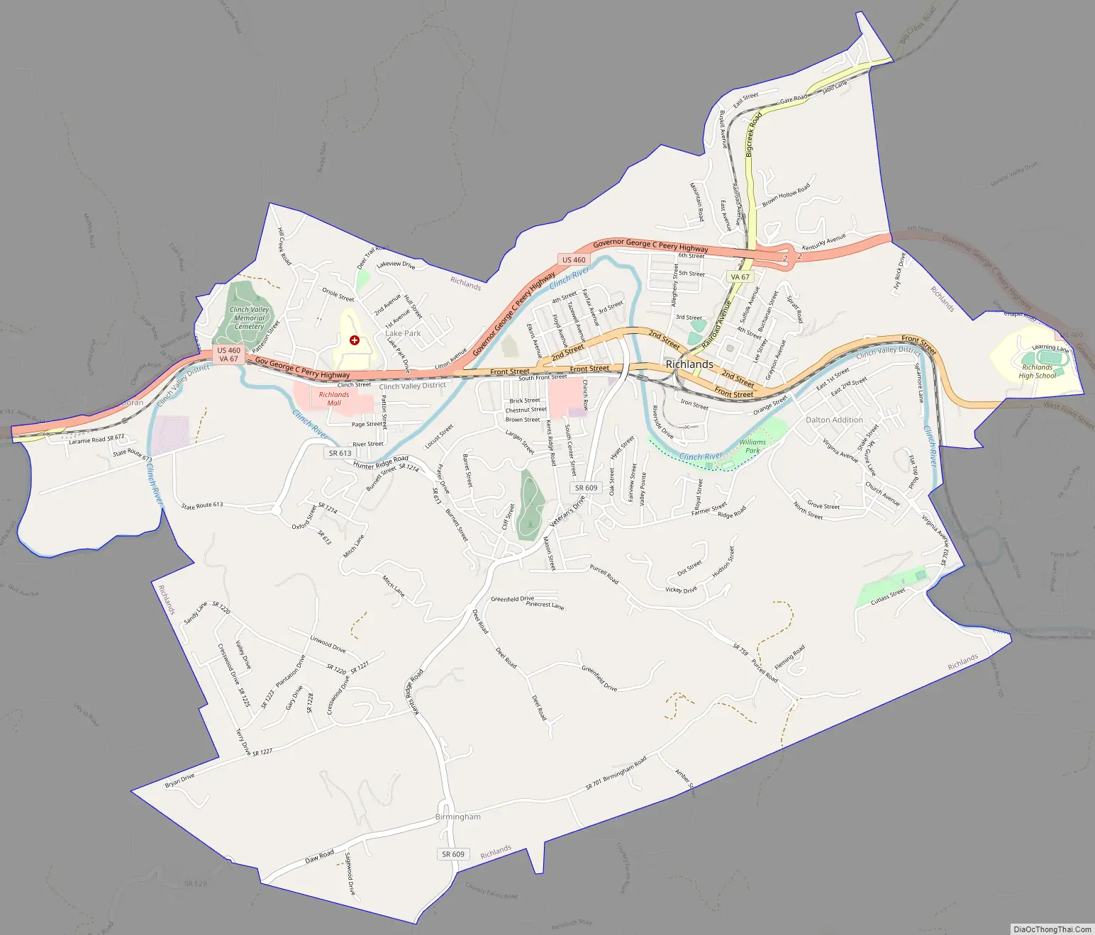
Richlands Road Map
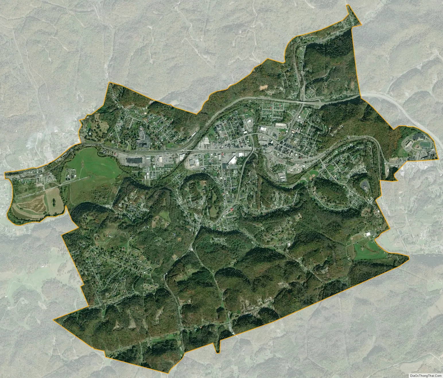
Richlands city Satellite Map
Geography
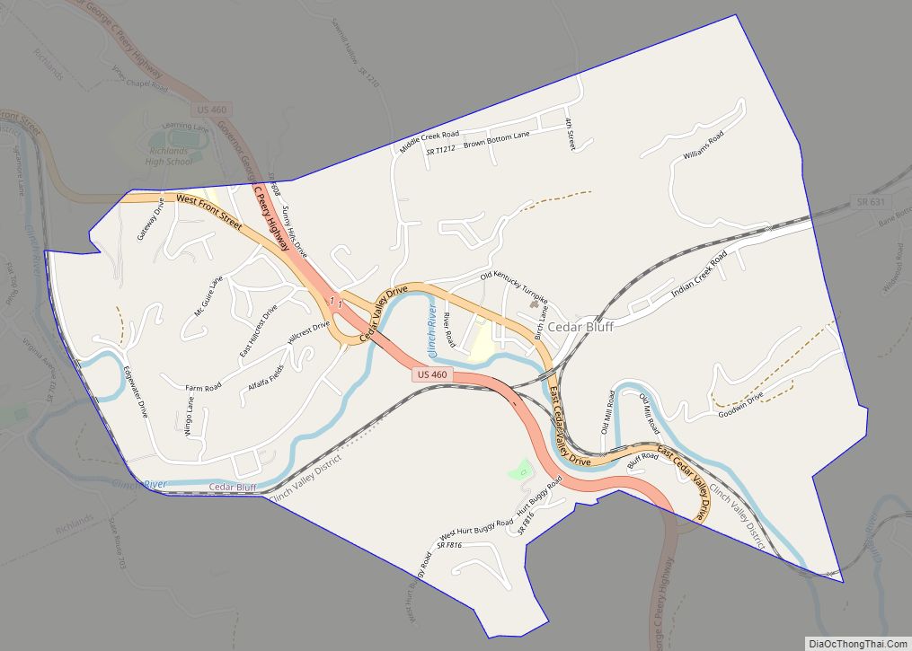
Richlands is situated along the Clinch River just east of the Tazewell-Russell county line. Cedar Bluff borders Richlands to the east, and the community of Raven lies just to the west. U.S. Route 460 and Virginia State Route 67 both traverse Richlands.
According to the United States Census Bureau, the town has a total area of 2.7 square miles (6.9 km²), all land.
Climate
The Trewartha climate classification for Richlands is temperate oceanic due to five months of winter chill (monthly means below 10 °C (50 °F)), abbreviated “Do” on climate maps.
See also
Map of Virginia State and its subdivision:- Accomack
- Albemarle
- Alexandria
- Alleghany
- Amelia
- Amherst
- Appomattox
- Arlington
- Augusta
- Bath
- Bedford
- Bedford City
- Bland
- Botetourt
- Bristol
- Brunswick
- Buchanan
- Buckingham
- Buena Vista
- Campbell
- Caroline
- Carroll
- Charles City
- Charlotte
- Charlottesville
- Chesapeake
- Chesterfield
- Clarke
- Clifton Forge City
- Colonial Heights
- Covington
- Craig
- Culpeper
- Cumberland
- Danville
- Dickenson
- Dinwiddie
- Emporia
- Essex
- Fairfax
- Fairfax City
- Falls Church
- Fauquier
- Floyd
- Fluvanna
- Franklin
- Frederick
- Fredericksburg
- Galax
- Giles
- Gloucester
- Goochland
- Grayson
- Greene
- Greensville
- Halifax
- Hampton
- Hanover
- Harrisonburg
- Henrico
- Henry
- Highland
- Hopewell
- Isle of Wight
- James City
- King and Queen
- King George
- King William
- Lancaster
- Lee
- Lexington
- Loudoun
- Louisa
- Lunenburg
- Lynchburg
- Madison
- Manassas
- Manassas Park
- Martinsville
- Mathews
- Mecklenburg
- Middlesex
- Montgomery
- Nelson
- New Kent
- Newport News
- Norfolk
- Northampton
- Northumberland
- Norton
- Nottoway
- Orange
- Page
- Patrick
- Petersburg
- Pittsylvania
- Poquoson
- Portsmouth
- Powhatan
- Prince Edward
- Prince George
- Prince William
- Pulaski
- Radford
- Rappahannock
- Richmond
- Roanoke
- Roanoke City
- Rockbridge
- Rockingham
- Russell
- Salem
- Scott
- Shenandoah
- Smyth
- Southampton
- Spotsylvania
- Stafford
- Staunton
- Suffolk
- Surry
- Sussex
- Tazewell
- Virginia Beach
- Warren
- Washington
- Waynesboro
- Westmoreland
- Williamsburg
- Winchester
- Wise
- Wythe
- York
- Alabama
- Alaska
- Arizona
- Arkansas
- California
- Colorado
- Connecticut
- Delaware
- District of Columbia
- Florida
- Georgia
- Hawaii
- Idaho
- Illinois
- Indiana
- Iowa
- Kansas
- Kentucky
- Louisiana
- Maine
- Maryland
- Massachusetts
- Michigan
- Minnesota
- Mississippi
- Missouri
- Montana
- Nebraska
- Nevada
- New Hampshire
- New Jersey
- New Mexico
- New York
- North Carolina
- North Dakota
- Ohio
- Oklahoma
- Oregon
- Pennsylvania
- Rhode Island
- South Carolina
- South Dakota
- Tennessee
- Texas
- Utah
- Vermont
- Virginia
- Washington
- West Virginia
- Wisconsin
- Wyoming