Map of Carnation city
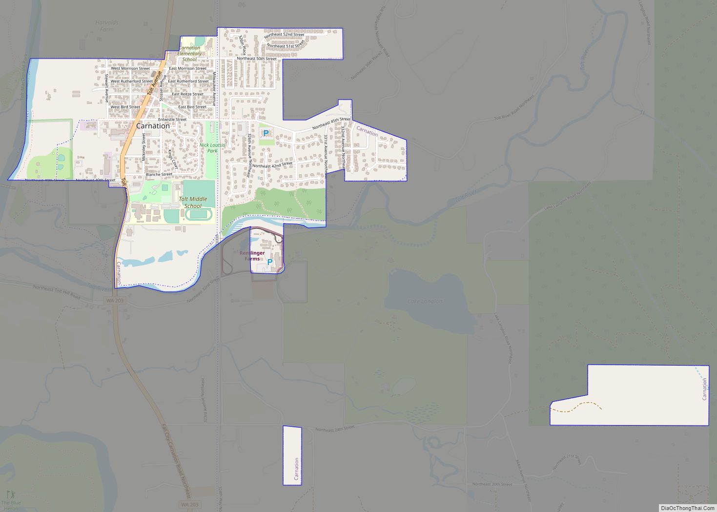
Carnation is a city in King County, Washington, United States. The population was 2,158 at the 2020 census. It was historically known as Tolt (Lushootseed: tultxʷ) and lies at the confluence of the Snoqualmie and Tolt rivers. The city is located east of Redmond and south of Duvall on State Route 203. Carnation city overview: ... Read more
Map of Carnation city
Map of Carbonado town
Carbonado town overview: Name: Carbonado town LSAD Code: 43 LSAD Description: town (suffix) State: Washington County: Pierce County FIPS code: 5309970 Online Interactive Map Carbonado online map. Source: Basemap layers from Google Map, Open Street Map (OSM), Arcgisonline, Wmflabs. Boundary Data from Database of Global Administrative Areas. Carbonado location map. Where is Carbonado town? Carbonado ... Read more
Map of Carbonado town
Map of Canyon Creek CDP, Washington
Canyon Creek is a census-designated place (CDP) in Snohomish County, Washington, United States. The population was 3,200 at the 2010 census. Prior to the 2010 census, the CDP was known as Jordan Road-Canyon Creek. Canyon Creek CDP overview: Name: Canyon Creek CDP LSAD Code: 57 LSAD Description: CDP (suffix) State: Washington County: Snohomish County Total ... Read more
Map of Canyon Creek CDP, Washington
Map of Canterwood CDP
Canterwood is a census-designated place (CDP) located in Pierce County, Washington. Canterwood CDP overview: Name: Canterwood CDP LSAD Code: 57 LSAD Description: CDP (suffix) State: Washington County: Pierce County Elevation: 335 ft (102 m) Total Area: 2.17 sq mi (5.6 km²) Total Population: 3,076 Population Density: 1,400/sq mi (550/km²) Area code: 253 FIPS code: 5309810 Online Interactive Map Canterwood online map. ... Read more
Map of Canterwood CDP
Map of Chelan Falls CDP
Chelan Falls is a census-designated place and unincorporated community in Chelan County, Washington, United States. The population was 340 at the 2020 census. Chelan Falls is located on the Columbia River at the mouth of the Chelan River, 5 miles (8 km) south-southeast of Chelan. Chelan Falls has a post office with ZIP code 98817. Chelan ... Read more
Map of Chelan Falls CDP
Map of Chehalis city
Chehalis (/ʃəˈheɪlɪs/ (listen) shə-HAY-lis) is a city in and the county seat of Lewis County, Washington. The population was 7,439 at the time of the 2020 census. Incorporated in 1883, Chehalis was primarily a logging and railroad town, with a shift towards farming in the mid-20th century. The city has bolstered its economy in the ... Read more
Map of Chehalis city
Map of Chain Lake CDP
Chain Lake is a census-designated place (CDP) in Snohomish County, Washington, United States. The population was 3,741 at the 2010 census. Chain Lake CDP overview: Name: Chain Lake CDP LSAD Code: 57 LSAD Description: CDP (suffix) State: Washington County: Snohomish County Total Area: 10.60 sq mi (27.46 km²) Land Area: 10.55 sq mi (27.33 km²) Water Area: 0.05 sq mi (0.13 km²) Total Population: ... Read more
Map of Chain Lake CDP
Map of Centralia city, Washington
Centralia (/sɛnˈtreɪliə/) is a city in Lewis County, Washington, United States. It is located along Interstate 5 near the midpoint between Seattle and Portland, Oregon. The city had a population of 18,183 at the 2020 census. Centralia is twinned with Chehalis, located to the south near the confluence of the Chehalis and Newaukum rivers. Centralia ... Read more
Map of Centralia city, Washington
Map of Cavalero CDP
Cavalero (also named Cavelero) is a census-designated place (CDP) in Snohomish County, Washington, United States. The population was 4,660 at the 2010 census. Cavalero was created out of the former West Lake Stevens CDP in 2010. Cavalero CDP overview: Name: Cavalero CDP LSAD Code: 57 LSAD Description: CDP (suffix) State: Washington County: Snohomish County Total ... Read more
Map of Cavalero CDP
Map of Cathcart CDP
Cathcart is a census-designated place (CDP) in Snohomish County, Washington, United States. The population was 2,458 at the 2010 census. Based on per capita income, one of the more reliable measures of affluence, Cathcart ranks 45th of 522 areas in the state of Washington to be ranked. Cathcart was named for Isaac Cathcart, a lumberman, ... Read more
Map of Cathcart CDP
Map of Castle Rock city, Washington
Castle Rock is a city in Cowlitz County, Washington, United States. Located between the Willapa Hills and the western base of Mount St. Helens, Castle Rock is at the heart of Washington timber country in the Pacific temperate rain forest. Castle Rock is part of the Longview, Washington Metropolitan Statistical Area; the population was 2,446 ... Read more
Map of Castle Rock city, Washington
Map of Chewelah city
Chewelah (/tʃəˈwiːlə/ chə-WEE-lə) is a city in Stevens County, Washington, United States. It is located approximately 45 mi (72 km) northwest of Spokane. The population was 2,607 at the 2010 census, a 19.3% increase from 2000. Chewelah city overview: Name: Chewelah city LSAD Code: 25 LSAD Description: city (suffix) State: Washington County: Stevens County Elevation: 1,667 ft (508 m) ... Read more
Map of Chewelah city