Map of Kaycee town
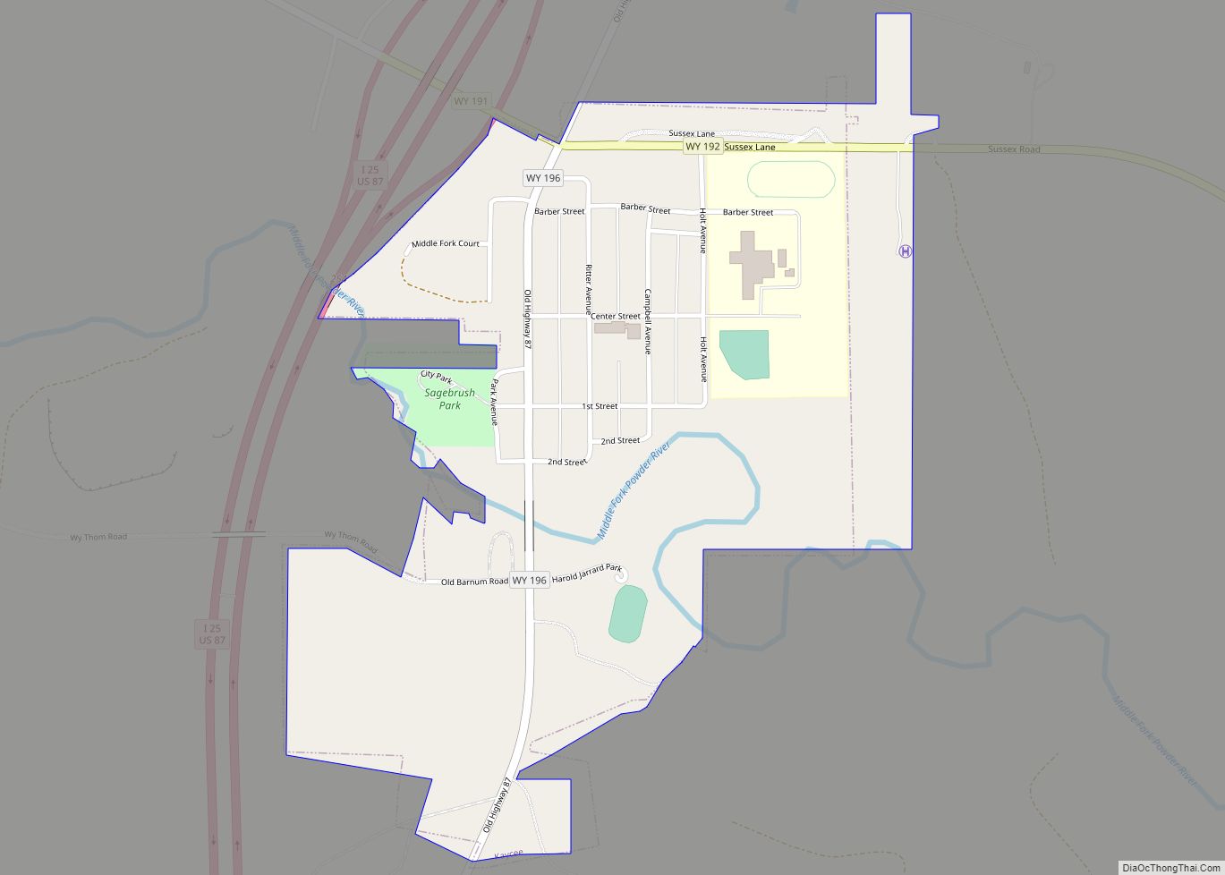
Kaycee is a town in Johnson County, Wyoming, United States. The population was 247 at the 2020 census. It is home to a museum that preserves the cattle ranching heritage of the area, especially the history of the Johnson County War. Kaycee was incorporated in 1906 after the establishment of a small post office and ... Read more
Map of Kaycee town
Map of Lusk town
Lusk is a high-plains town in the eastern part of the U.S. state of Wyoming. The town is the seat of Niobrara County. The town was founded in July 1886, by Frank S. Lusk, a renowned Wyoming rancher, partner in the Western Live Stock Company, and stockholder in the Wyoming Central Railway. Cattle ranching remains ... Read more
Map of Lusk town
Map of Johnstown CDP, Wyoming
Johnstown is a census-designated place (CDP) in Fremont County, Wyoming, United States. The population was 242 at the 2010 census. Johnstown CDP overview: Name: Johnstown CDP LSAD Code: 57 LSAD Description: CDP (suffix) State: Wyoming County: Fremont County Elevation: 5,259 ft (1,603 m) Total Area: 32.1 sq mi (83.2 km²) Land Area: 31.5 sq mi (81.5 km²) Water Area: 0.7 sq mi (1.8 km²) Total Population: ... Read more
Map of Johnstown CDP, Wyoming
Map of Lucerne CDP, Wyoming
Lucerne is a census-designated place (CDP) in Hot Springs County, Wyoming, United States. The population was 535 at the 2010 census. Lucerne CDP overview: Name: Lucerne CDP LSAD Code: 57 LSAD Description: CDP (suffix) State: Wyoming County: Hot Springs County Elevation: 4,315 ft (1,315 m) Total Area: 20.6 sq mi (53 km²) Land Area: 19.9 sq mi (52 km²) Water Area: 0.7 sq mi (2 km²) ... Read more
Map of Lucerne CDP, Wyoming
Map of Mountain View CDP, Wyoming
Mountain View is a census-designated place in Natrona County, Wyoming, United States. It is part of the Casper, Wyoming Metropolitan Statistical Area. The population was 96 at the 2010 census. Mountain View CDP overview: Name: Mountain View CDP LSAD Code: 57 LSAD Description: CDP (suffix) State: Wyoming County: Natrona County Elevation: 5,200 ft (1,600 m) Total Area: ... Read more
Map of Mountain View CDP, Wyoming
Map of Moose Wilson Road CDP
Moose Wilson Road is a census-designated place (CDP) in Teton County, Wyoming, United States. The population was 1,821 at the 2010 census. It is part of the Jackson, WY–ID Micropolitan Statistical Area. Moose Wilson Road CDP overview: Name: Moose Wilson Road CDP LSAD Code: 57 LSAD Description: CDP (suffix) State: Wyoming County: Teton County Elevation: ... Read more
Map of Moose Wilson Road CDP
Map of Moorcroft town
Moorcroft is a town in Crook County, Wyoming, United States. The population was 946 at the 2020 census. Moorcroft town overview: Name: Moorcroft town LSAD Code: 43 LSAD Description: town (suffix) State: Wyoming County: Crook County Elevation: 4,226 ft (1,288 m) Total Area: 1.26 sq mi (3.27 km²) Land Area: 1.26 sq mi (3.27 km²) Water Area: 0.00 sq mi (0.00 km²) Total Population: 946 Population ... Read more
Map of Moorcroft town
Map of Midwest town
Midwest is a town in Natrona County, Wyoming, United States. It is part of the Casper, Wyoming Metropolitan Statistical Area. The population was 404 at the 2010 census. Midwest town overview: Name: Midwest town LSAD Code: 43 LSAD Description: town (suffix) State: Wyoming County: Natrona County Elevation: 4,849 ft (1,478 m) Total Area: 0.49 sq mi (1.27 km²) Land Area: ... Read more
Map of Midwest town
Map of Meeteetse town
Meeteetse is a town in Park County, Wyoming, United States. The population was 327 at the 2010 census. Meeteetse town overview: Name: Meeteetse town LSAD Code: 43 LSAD Description: town (suffix) State: Wyoming County: Park County Elevation: 5,751 ft (1,753 m) Total Area: 0.87 sq mi (2.26 km²) Land Area: 0.87 sq mi (2.26 km²) Water Area: 0.00 sq mi (0.00 km²) Total Population: 327 Population ... Read more
Map of Meeteetse town
Map of Medicine Bow town
Medicine Bow is a town in Carbon County, Wyoming, United States. Its population was 284 at the 2010 census. Medicine Bow town overview: Name: Medicine Bow town LSAD Code: 43 LSAD Description: town (suffix) State: Wyoming County: Carbon County Elevation: 6,565 ft (2,001 m) Total Area: 3.46 sq mi (8.96 km²) Land Area: 3.46 sq mi (8.96 km²) Water Area: 0.00 sq mi (0.00 km²) Total ... Read more
Map of Medicine Bow town
Map of Meadow Acres CDP
Meadow Acres is a census-designated place (CDP) in Natrona County, Wyoming, United States. It is part of the Casper, Wyoming Metropolitan Statistical Area. The population was 198 at the 2010 census. Meadow Acres CDP overview: Name: Meadow Acres CDP LSAD Code: 57 LSAD Description: CDP (suffix) State: Wyoming County: Natrona County Elevation: 5,046 ft (1,538 m) Total ... Read more
Map of Meadow Acres CDP
Map of Osmond CDP, Wyoming
Osmond is a census-designated place (CDP) in Lincoln County, Wyoming, United States. The population was 397 at the 2010 census. Osmond CDP overview: Name: Osmond CDP LSAD Code: 57 LSAD Description: CDP (suffix) State: Wyoming County: Lincoln County Elevation: 6,329 ft (1,929 m) Total Area: 3.2 sq mi (8.4 km²) Land Area: 3.2 sq mi (8.4 km²) Water Area: 0.0 sq mi (0.0 km²) Total Population: ... Read more
Map of Osmond CDP, Wyoming