Lusk is a high-plains town in the eastern part of the U.S. state of Wyoming. The town is the seat of Niobrara County. The town was founded in July 1886, by Frank S. Lusk, a renowned Wyoming rancher, partner in the Western Live Stock Company, and stockholder in the Wyoming Central Railway. Cattle ranching remains the primary industry in the town of Lusk.
The population was 1,567 at the 2010 census. The town of Lusk is known for being the county seat of the least populated county in the least populated state in the US.
| Name: | Lusk town |
|---|---|
| LSAD Code: | 43 |
| LSAD Description: | town (suffix) |
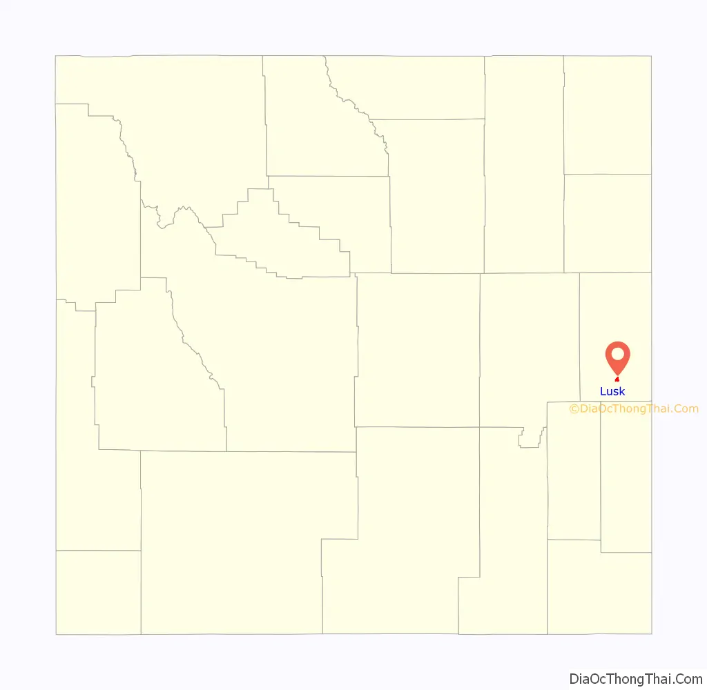
| State: | Wyoming |
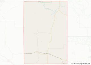
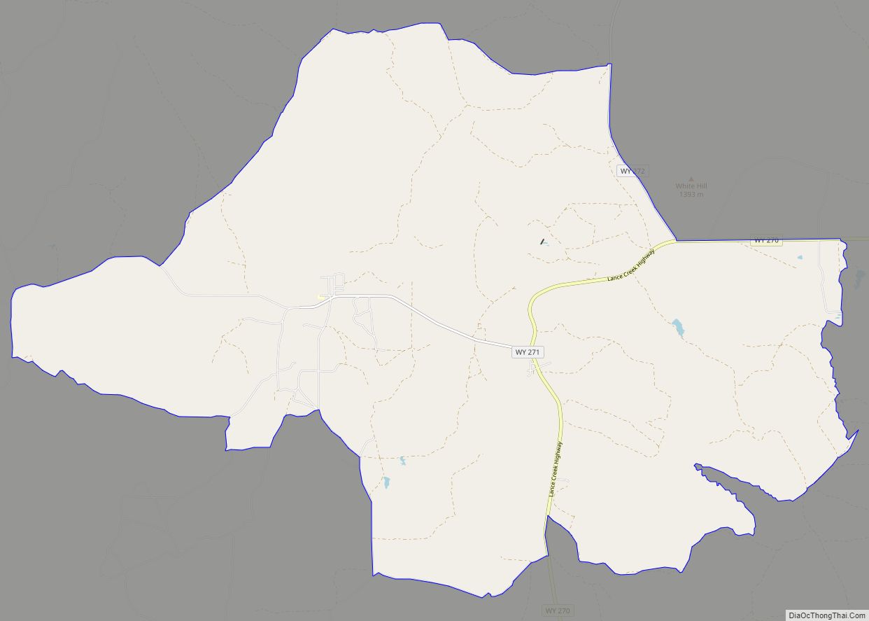
| County: | Niobrara County |
| Incorporated: | 1886 |
| Elevation: | 5,020 ft (1,530 m) |
| Total Area: | 2.07 sq mi (5.36 km²) |
| Land Area: | 2.07 sq mi (5.36 km²) |
| Water Area: | 0.00 sq mi (0.00 km²) |
| Total Population: | 1,541 |
| Population Density: | 737.91/sq mi (284.88/km²) |
| ZIP code: | 82225 |
| Area code: | 307 |
| FIPS code: | 5648530 |
| GNISfeature ID: | 1591129 |
Online Interactive Map
Click on ![]() to view map in "full screen" mode.
to view map in "full screen" mode.
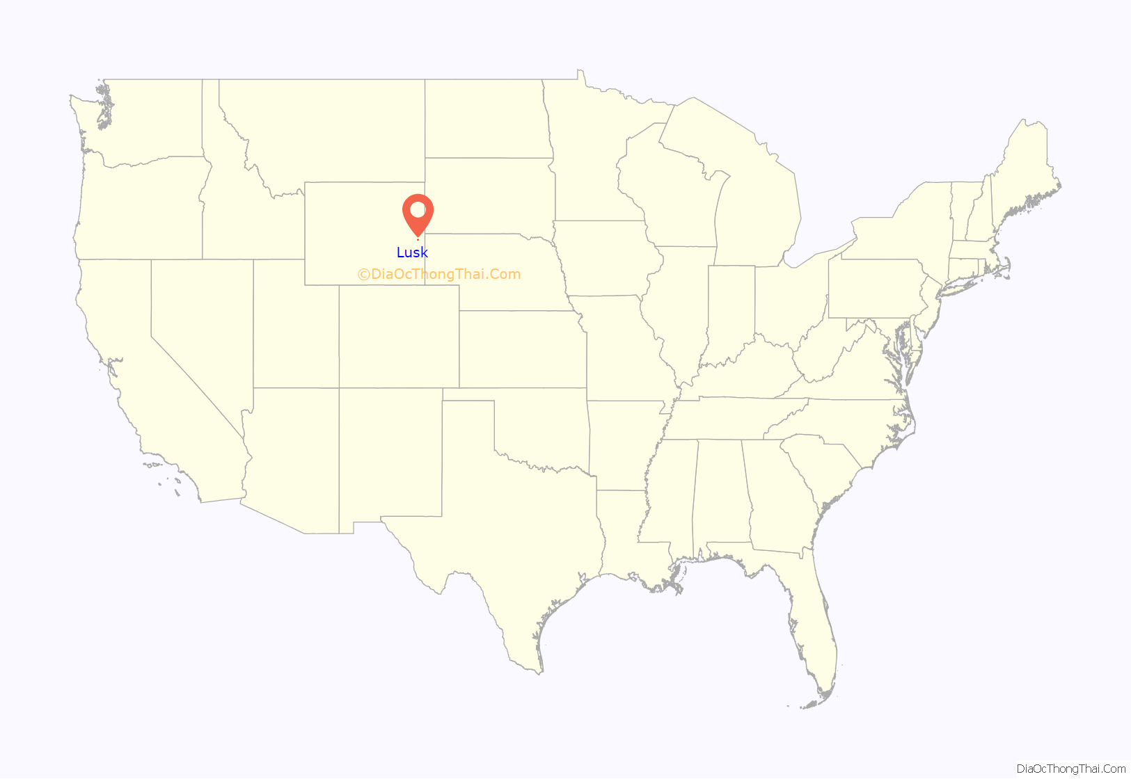
Lusk location map. Where is Lusk town?
History
The Black Hills Gold Rush brought fortune seekers to the Wyoming Territory. Within two years, the stage coach route between Cheyenne, Wyoming and Deadwood, South Dakota delivered freight, including salt pork and whiskey. The boom also brought armored stage coaches and gold bricks, along with Indians and thieves. The Cheyenne–Deadwood route operated from 1876 to 1887, when it was replaced by the Wyoming Central Railway.
Frank S. Lusk
Frank S. Lusk (1857–1930) was a Wyoming rancher and stockholder in the Wyoming Central Railway. Initially residing in Cleveland, Ohio, he moved to Denver, Colorado in 1876 and built the Western Live Stock Company under a partnership agreement and established a ranch east of Greeley. In 1877, Lusk traveled to the Wyoming Territory for the first time on personal business and left highly impressed with the people and the area. In 1879, eastern Colorado had grown to the point that Lusk, along with his partners began exploring options outside of the area. His thoughts were recorded in the 1923 Annals of Wyoming: Quarterly Bulletin:
Lusk and the Western Live Stock Company arrived in the Wyoming Territory in 1880 via Denver, establishing the Node Ranch, about 15 miles (24 km) east of present-day Lusk. A year later, he bought some land about 3 miles (5 km) outside of Lusk, which included the Running Water Stage Station. Buildings on the land included a stone barn and shelters that had been used by the Cheyenne–Deadwood stage route. Lusk established a hay ranch on the property. He organized his horse ranch at the site of what would later become the town of Lusk.
Lusk Post Office
After establishing his three ranch properties, it became clear that the nearest post office was located in Rawhide Buttes, 15 miles (24 km) southeast of the hay ranch, actually Route 20. Collecting the mail required a ride of 40 miles (64 km) round trip. In response, one of the partners in the Gilmer and Salisbury Express Stage told Lusk that he should set up a post office at the ranch, which would provide for delivery of the mail, rather than requiring him to make the ride to Rawhide Buttes. When Lusk sent in the application to the Post Office Department, everything was complete, but he didn’t indicate a name for the post office. When asked about it later, Lusk told the star route representative that he was “busy and told him to do whatever he thought would, without a doubt, establish a post office for us. He told me he had suggested that it be called ‘Lusk’ and in due course of time it was so established”.
Wyoming Central Railway
In 1886, the Fremont, Elkhorn and Missouri Valley Railroad wanted to extend their line west from Nebraska toward Casper, Wyoming, in order to transport coal. The territorial laws at that time required railroad companies to incorporate within the territory, before they were allowed to build or operate lines in the area. In order to meet the requirements allow construction and ownership, the Wyoming Central Railway was established as a dummy corporation. While Frank Lusk had been a successful cattleman, he was named as a director and only resident stockholder of the company. Letters of incorporation listed the base of operations as Lusk, Wyoming.
While Lusk was the only post office in Wyoming on the entire (proposed) line and was named as the place of business of the company in its incorporation papers, it wasn’t officially established until July of that year, when railroad engineers laid the first plat for the town. That same year, the towns of Douglas, and Casper were officially established in the same manner by Lusk, on behalf of the Wyoming Central Railway.
After the turn of the century, there was another mining boom. Silver was discovered in the hills surrounding Lusk, which brought a steady stream of miners to the area. By the 1950s, growth in the area stabilized when cattle ranching usurped mining as the primary industry of the town.
In 1952, the Lusk Baptist Church sent letters to Representative William Henry Harrison III and Senators Joseph C. O’Mahoney and Lester C. Hunt protesting the creation of diplomatic relations with Vatican City through the appointment of Mark W. Clark.
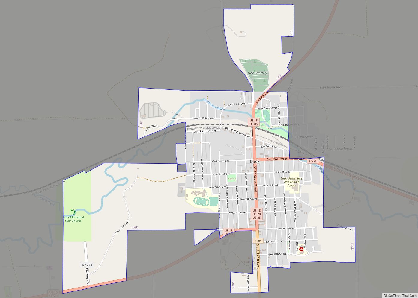
Lusk Road Map
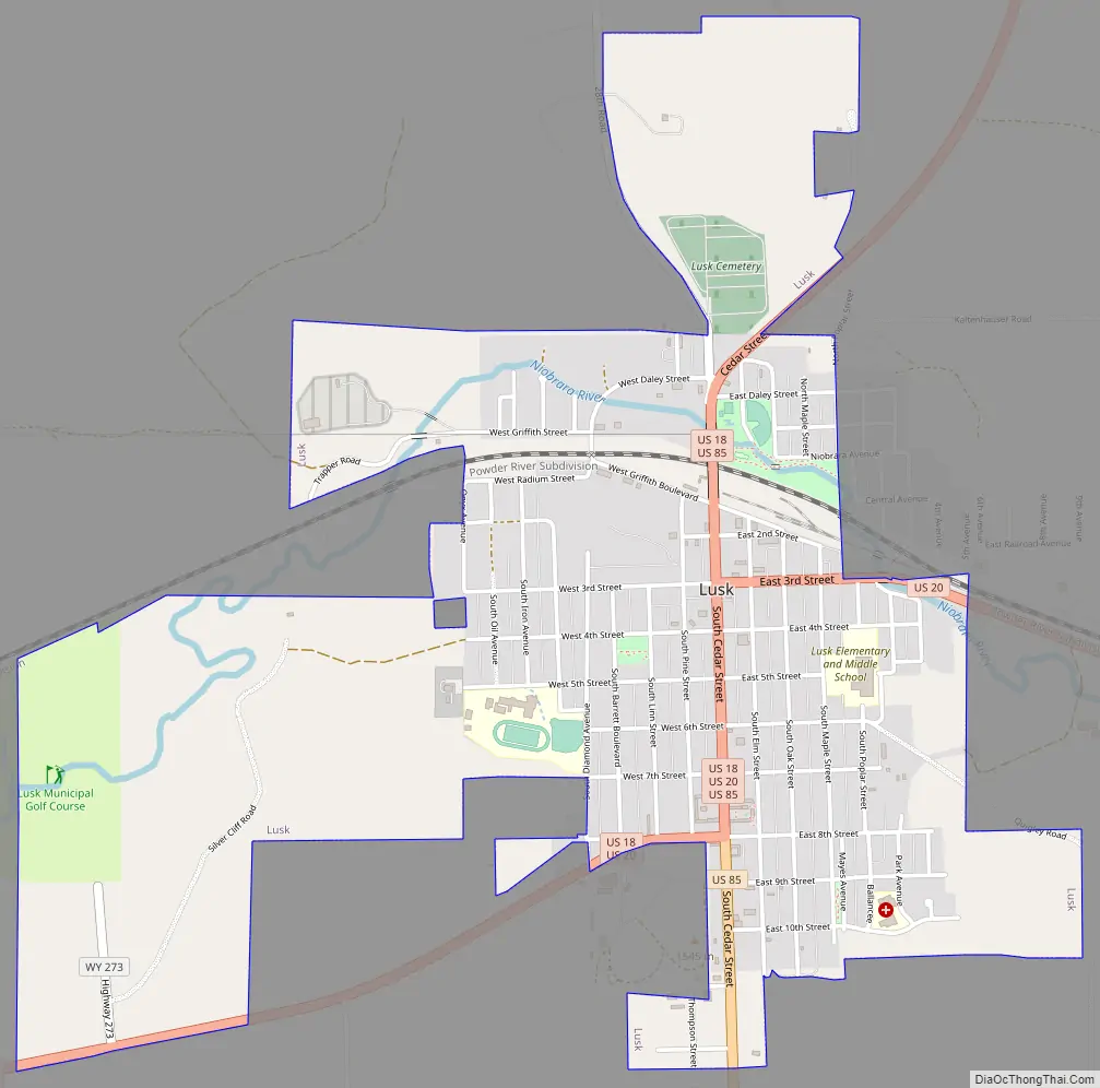
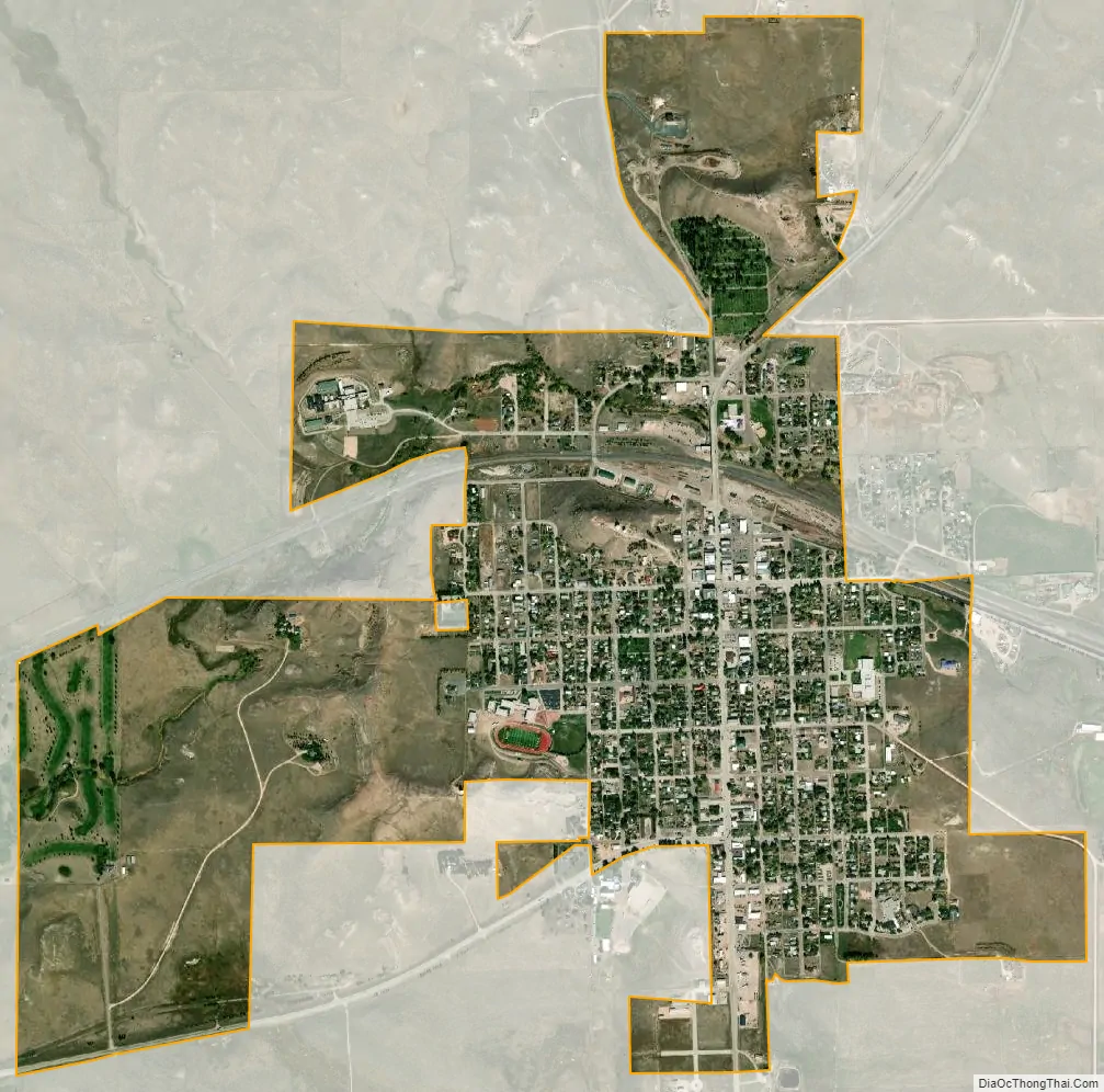
Lusk city Satellite Map
Geography
Lusk is located at 42°45′38″N 104°27′10″W / 42.76056°N 104.45278°W / 42.76056; -104.45278 (42.760674, -104.452729). According to the United States Census Bureau, the town has a total area of 2.07 square miles (5.36 km), all land. The town is 20 miles (32 km) west of the Nebraska border and sits at 5,000 feet (1,500 m) above sea level, surrounded by the southeastern extension of the Black Hills National Forest.
Climate
Lusk experiences a dry humid continental climate (Köppen climate classification Dfb) with cold, dry winters and hot, humid summers.
See also
Map of Wyoming State and its subdivision: Map of other states:- Alabama
- Alaska
- Arizona
- Arkansas
- California
- Colorado
- Connecticut
- Delaware
- District of Columbia
- Florida
- Georgia
- Hawaii
- Idaho
- Illinois
- Indiana
- Iowa
- Kansas
- Kentucky
- Louisiana
- Maine
- Maryland
- Massachusetts
- Michigan
- Minnesota
- Mississippi
- Missouri
- Montana
- Nebraska
- Nevada
- New Hampshire
- New Jersey
- New Mexico
- New York
- North Carolina
- North Dakota
- Ohio
- Oklahoma
- Oregon
- Pennsylvania
- Rhode Island
- South Carolina
- South Dakota
- Tennessee
- Texas
- Utah
- Vermont
- Virginia
- Washington
- West Virginia
- Wisconsin
- Wyoming