Kaycee is a town in Johnson County, Wyoming, United States. The population was 247 at the 2020 census. It is home to a museum that preserves the cattle ranching heritage of the area, especially the history of the Johnson County War.
Kaycee was incorporated in 1906 after the establishment of a small post office and general store. The town was named after the brand “KC” used by its earliest homesteader, John Nolan. The government required the name to be spelled out resulting in “Kaycee”. The town is now home to three churches, two bars, two restaurants, one store, one museum, one K-12 school, and zero stoplights.
Western music star and rodeo champion Chris LeDoux resided on a ranch near Kaycee, although he was born in Biloxi, Mississippi.
Kaycee is home to former NCAA Division II track and field athlete Dakotah Winsor.
Former NCAA Division III track and field athlete Noah Elm was born and raised in Kaycee.
Wyoming Governor Mark Gordon grew up on the Gordon Ranch near Kaycee. Gordon is owner of the Merlin Ranch east of Buffalo and is affiliated with the 48 Ranch Partnership in Kaycee.
| Name: | Kaycee town |
|---|---|
| LSAD Code: | 43 |
| LSAD Description: | town (suffix) |
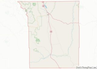
| State: | Wyoming |
| County: | Johnson County |
| Elevation: | 4,646 ft (1,416 m) |
| Total Area: | 0.45 sq mi (1.16 km²) |
| Land Area: | 0.44 sq mi (1.14 km²) |
| Water Area: | 0.01 sq mi (0.03 km²) |
| Total Population: | 247 |
| Population Density: | 550/sq mi (210/km²) |
| ZIP code: | 82639 |
| Area code: | 307 |
| FIPS code: | 5641353 |
| GNISfeature ID: | 1590292 |
| Website: | http://www.kayceewyoming.org/ |
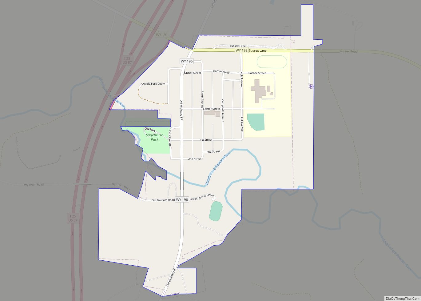
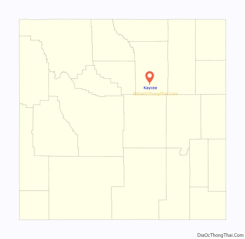
Online Interactive Map
Click on ![]() to view map in "full screen" mode.
to view map in "full screen" mode.
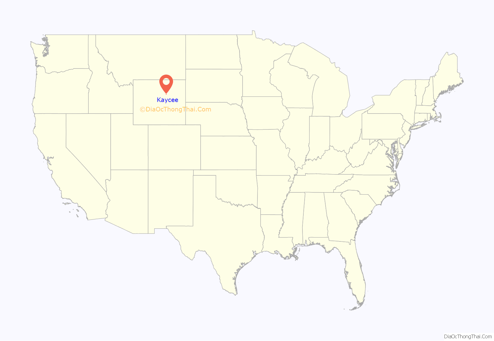
Kaycee location map. Where is Kaycee town?
History
The Portuguese Fort
In 1834 a band of trappers and traders led by Antonio Montero from Portugal built a trading post east of Kaycee. It became known as the “Portuguese Fort.” A unique site, what little remains from the area have been donated to the Hoofprints of the Past Museum and includes artefacts including a sword, beads, and clay pipes.
The Bozeman Trail
The 1860s brought new attention from both whites and Native Americans to the northeast corner of what soon would become Wyoming Territory. First, a gold frenzy in Montana Territory drew miners north from the emigrant road that followed the North Platte River. Mountain man Jim Bridger warned against establishing a trail through the Arapaho and Lakota hunting grounds, urging that another path west of the Bighorns be used instead. But the Powder River Basin route was the most direct and, in 1863, John Bozeman following ancient routes long used by Indians, blazed the Bozeman Trail through the middle of the basin.
The Bozeman Trail ran within four miles of Kaycee, overlaying previous Indian, trader and exploration routes and connecting the Oregon Trail to the gold rush territory in Montana. Its most important period was 1863-1868, and its most significant consequence was the Indian Wars of the Northern Plains. The Hoofprints of the Past Museum displays items relating to this period.
Fort Reno and Cantonment Reno
During the Indian Wars of the late 1800s, two military posts were built miles apart near the Bozeman Trail crossing of the Powder River: Fort Reno in the 1860s and Cantonment Reno in the 1870s. Historical markers presently mark the spots.
Items donated from the Fort Reno site are on display at the Hoofprints of the Past Museum, as well as a diorama of the fort created by Robert Wilson, an expert in local military forts.
Moreton Frewen
The Frewen Ranch was located east of present-day Kaycee at the confluence of the North Fork and the Middle Fork of the Powder River. Moreton Frewen was the fifth son of Thomas Frewen, MP for South Leicestershire, and was educated at Trinity College, Cambridge, where he gained his BA in 1877. He emigrated to Wyoming during the cattle boom in the 1870s and 1880s. A charming if financially incompetent adventurer from an English landed gentry family known for reckless financial and political schemes, he managed to marry Clarita “Clara” Jerome (1851–1935) in 1881, daughter of the New York City financier Leonard Jerome, and sister to Lord Randolph Churchill’s wife Jennie. They settled together on a huge Wyoming ranch, The Prince of Wales Ranch, where Frewen built an enormous log lodge/castle later destroyed by fire and ran up ever increasing debt, earning the sobriquets “Mortal Ruin” and “the splendid pauper”. His laterally descended family, the Martins formerly of Charley Hall, Leicestershire, refer to him to this day however not as “Mortal Ruin” but as “Immortal Ruin”, as he ran through two family fortunes before being granted a remittance and “encouraged” by family to emigrate to America.
Hole In the Wall
Hole-in-the-Wall is located in the foothills of the Big Horn Mountains of Johnson County, Wyoming. The site was used in the late 19th century by the Hole in the Wall Gang, a group of cattle rustlers and other outlaws which included Kid Curry, Black Jack Ketchum, and Butch Cassidy’s Wild Bunch gang. Cassidy, the Sundance Kid, and other desperados met at a log cabin in the Hole-in-the-Wall country which has been preserved at the Old Trail Town museum in Cody, Wyoming. The cabin was built in 1883 by Alexander Ghent.
The Johnson County Cattle War
In the early days in Wyoming, most of the land was in the public domain, open both to stockraising as open range and to homesteading. Large numbers of cattle were turned loose on the open range by large ranches, sometimes financed by other investors. In the spring a roundup was held and the cows and the calves belonging to each ranch were separated and the calves branded. Before the roundup, sometimes calves, especially orphan or stray calves, were surreptitiously branded, and thus taken. The large ranches, concerned about this practice, forbade their employees from owning cattle and aggressively defended against rustling.
The situation became steadily worse after the poor winter of 1886. The large companies began to aggressively appropriate land and control the flow and supply of water in this area; they justified these excesses on what was public land by using the catch-all allegation of rustling, and vigorously sought to exclude the smaller ranchers from participation in the annual roundup; apparently agents of the larger ranches killed several alleged rustlers. A number of lynchings of alleged rustlers took place in 1889, including the double lynching of innocent homesteaders and ranchers Ella Watson and Jim Averell.
The large ranches were organized as the Wyoming Stock Growers Association (the WSGA) and gathered socially as the Cheyenne Club in Cheyenne, Wyoming. In April 1892 the WSGA hired killers from Texas; an expedition of 50 men was organized, which proceeded by train from Cheyenne to Casper, Wyoming, then toward Johnson County, intending to eliminate alleged rustlers and also, apparently, to replace the government in Johnson County. Major Frank Wolcott led the Regulators into Johnson County. To prevent an alarm, the telegraph lines out of Buffalo were cut. The expedition was accompanied by two newspaper reporters whose lurid accounts later appeared in the eastern newspapers.
The first target of the WSGA was Nate Champion at the “KC Ranch”. Champion was a small rancher who was active in the efforts of small ranchers to organize a competing roundup. Three men besides Champion were at the KC. Two men, evidently trappers, who had taken shelter for the night, were captured as they emerged from the cabin early that morning to collect water at the nearby Powder River, while the third, Nick Ray, was shot while standing inside the doorway of the cabin and died a few hours later. The fourth, Nate Champion, was besieged. Two passers-by noticed the ruckus and rode to Buffalo, where Johnson County Sheriff William “Red” Angus raised a posse of 200 men and set out for the “KC Ranch”.
Champion held out for several hours, killing at least four of the vigilantes, and wounding several others. During the siege, Champion kept a poignant journal which contained a number of notes he wrote to friends while taking cover inside the cabin. “Boys, I feel pretty lonesome just now. I wish there was someone here with me so we could watch all sides at once.” he wrote. The last journal entry read: Well, they have just got through shelling the house like hail. I heard them splitting wood. I guess they are going to fire the house tonight. I think I will make a break when night comes, if alive. Shooting again. It’s not night yet. The house is all fired. Goodbye, boys, if I never see you again.
With the house on fire, Nate Champion signed his journal entry and put the journal in his pocket before he emerged, running from the back door with a Colt Revolver in the left hand and a Winchester rifle in the right. He was gunned down by four men firing simultaneously, hit by 28 bullets. The invaders later pinned a note on Champion’s bullet-riddled chest that read “Cattle Thieves Beware”. They also carefully removed entries from the diary which named some of the attackers.
‘The Invaders then loaded up the wood on a wagon that was left by Jack Flagg and pushed it towards the cabin. With the house on fire, Nate Champion signed his journal entry and put it in his pocket before running from the back door with a six shooter in one hand and either a knife and a rifle in the other. As he emerged, the Invaders shot him dead. The killers pinned a note on Champion’s bullet-riddled chest that read, “Cattle Thieves Beware.” Jack Flagg, who after escaping his pursuers, rode to Buffalo where he reported Champion’s dilemma to the townsfolk. Sheriff Angus then raised a posse of 200 men over the next 24 hours and set out for the KC on Sunday night, April 10.
Artifacts from the Johnson County War, including the local KC Fight and Nate Champion related items are on display at the Hoofprints of the Past Museum.
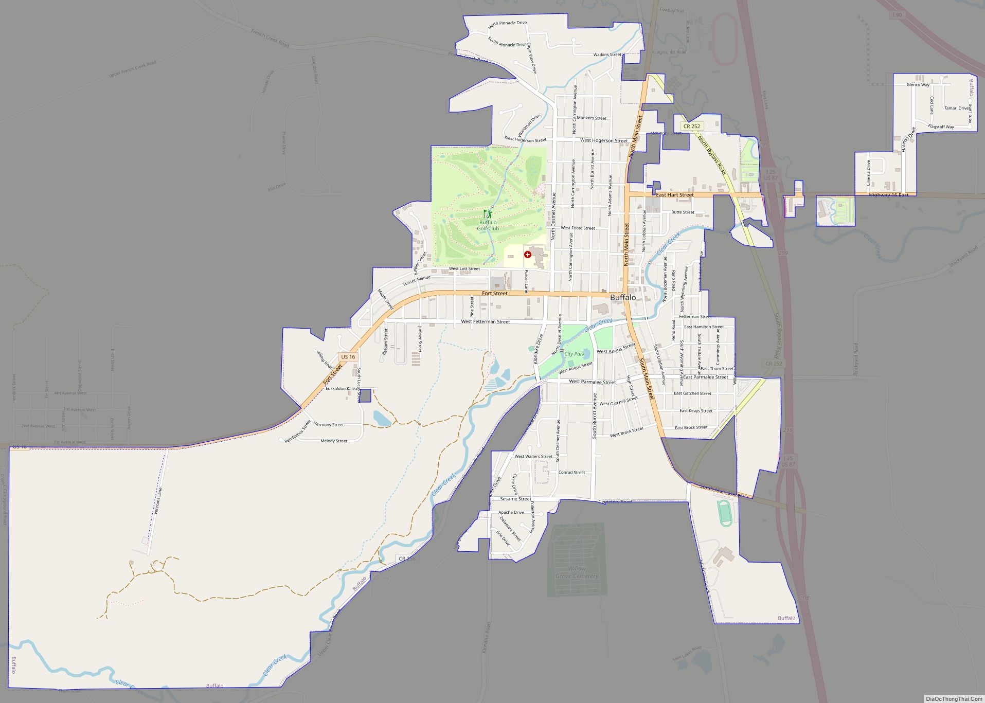
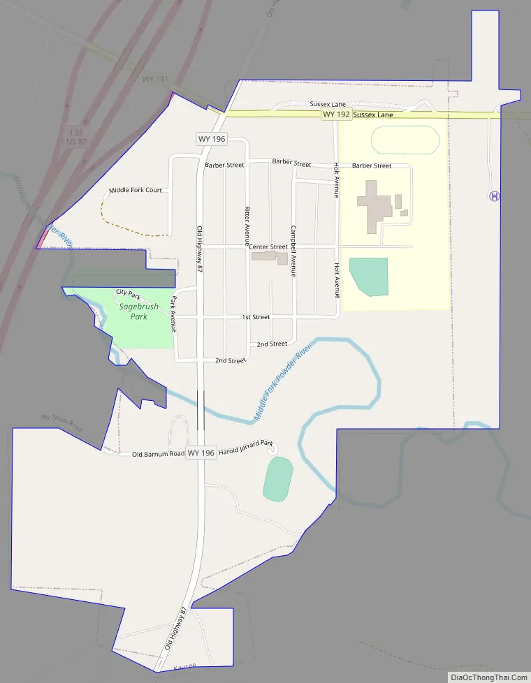
Kaycee Road Map
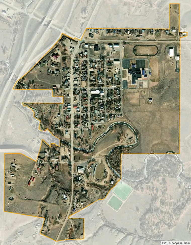
Kaycee city Satellite Map
Geography
According to the United States Census Bureau, the town has a total area of 0.41 square miles (1.06 km), of which 0.40 square miles (1.04 km) is land and 0.01 square miles (0.03 km) is water.
See also
Map of Wyoming State and its subdivision: Map of other states:- Alabama
- Alaska
- Arizona
- Arkansas
- California
- Colorado
- Connecticut
- Delaware
- District of Columbia
- Florida
- Georgia
- Hawaii
- Idaho
- Illinois
- Indiana
- Iowa
- Kansas
- Kentucky
- Louisiana
- Maine
- Maryland
- Massachusetts
- Michigan
- Minnesota
- Mississippi
- Missouri
- Montana
- Nebraska
- Nevada
- New Hampshire
- New Jersey
- New Mexico
- New York
- North Carolina
- North Dakota
- Ohio
- Oklahoma
- Oregon
- Pennsylvania
- Rhode Island
- South Carolina
- South Dakota
- Tennessee
- Texas
- Utah
- Vermont
- Virginia
- Washington
- West Virginia
- Wisconsin
- Wyoming