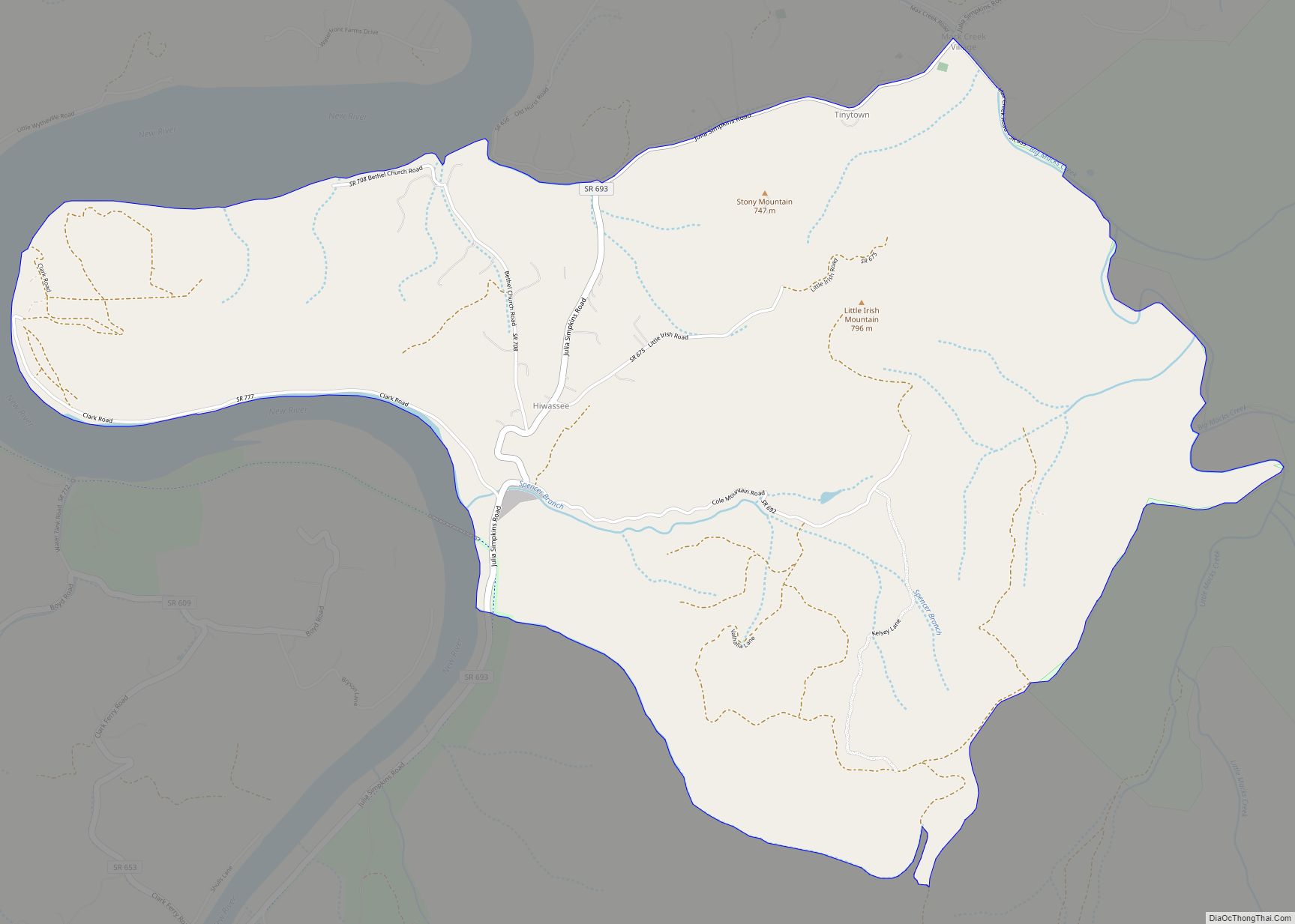
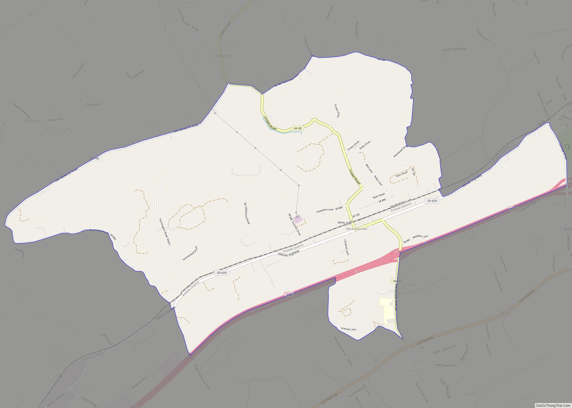
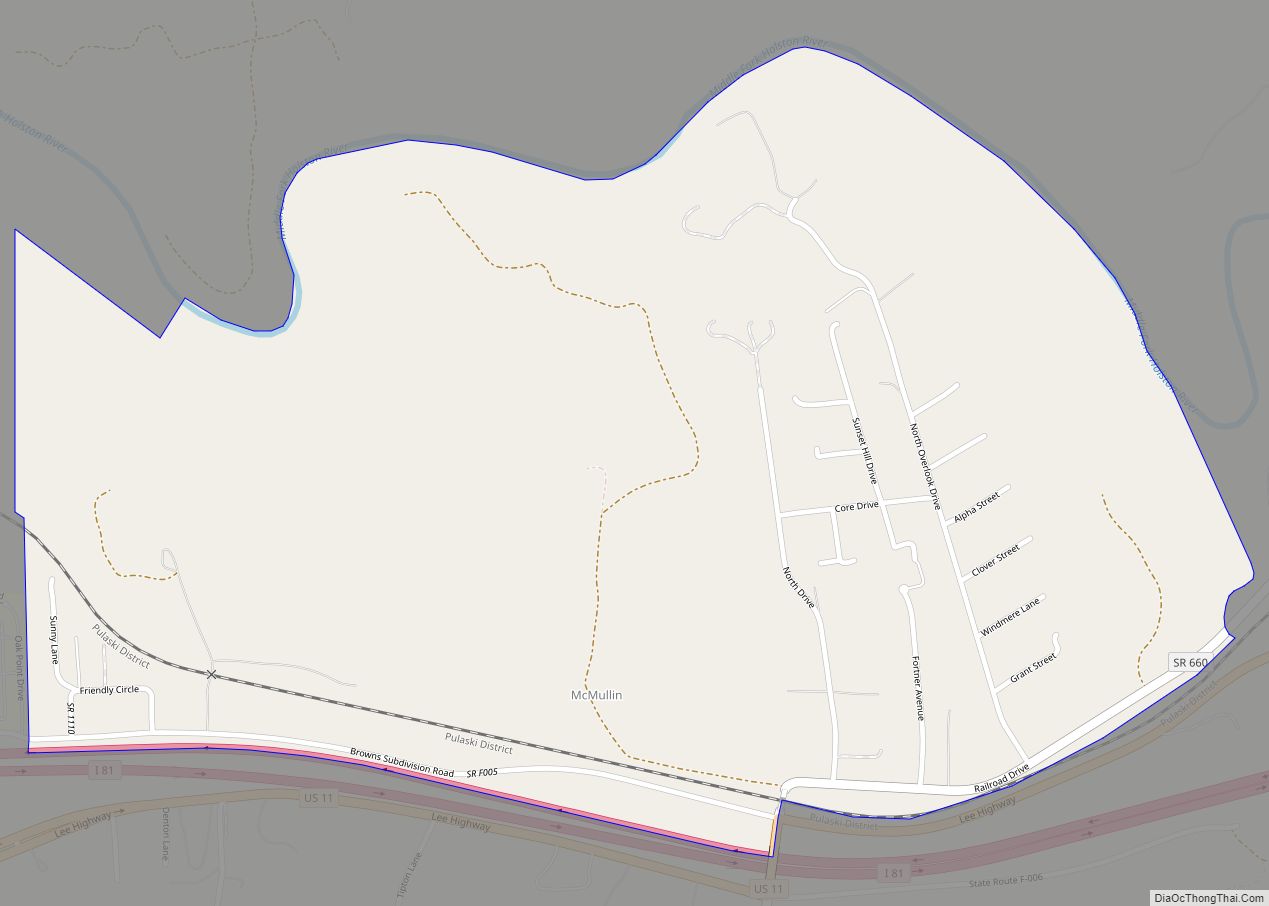
Innsbrook is a census-designated place in Henrico County, Virginia, United States. The population as of the 2010 Census was 7,753. Innsbrook is a mixed-use corporate center in Central Virginia that was founded in 1979 by local developer Sidney Gunst on property owned by David Arenstein and Henry Stern. Located approximately 13 miles northwest of Richmond’s ... Read more
Map of US Cities and Places
Kings Park West is a census-designated place in the eastern USA, in Fairfax County, Virginia, southwest of Washington, D.C. The population as of the 2010 census was 13,390. Kings Park West CDP overview: Name: Kings Park West CDP LSAD Code: 57 LSAD Description: CDP (suffix) State: Virginia County: Fairfax County Elevation: 400 ft (100 m) Total Area: ... Read more
Laurel is a census-designated place (CDP) in western Henrico County, Virginia. The population was 16,713 at the 2010 United States Census. It is the county seat of Henrico County. It is the location of the Laurel Skate Park. The bowl was recently filled in with smooth concrete and the vertical ramp removed to make way ... Read more
Marshall is a census-designated place (CDP) and unincorporated town in northwestern Fauquier County, Virginia, in the United States. The population as of the 2010 census was 1,480. Marshall CDP overview: Name: Marshall CDP LSAD Code: 57 LSAD Description: CDP (suffix) State: Virginia County: Fauquier County Elevation: 685 ft (209 m) Total Area: 2.89 sq mi (7.49 km²) Land Area: 2.88 sq mi ... Read more
Massanutten CDP overview: Name: Massanutten CDP LSAD Code: 57 LSAD Description: CDP (suffix) State: Virginia County: Rockingham County FIPS code: 5150030 Online Interactive Map Massanutten online map. Source: Basemap layers from Google Map, Open Street Map (OSM), Arcgisonline, Wmflabs. Boundary Data from Database of Global Administrative Areas. Massanutten location map. Where is Massanutten CDP? Massanutten ... Read more
Meadowbrook is a census-designated place in Chesterfield County, Virginia. The population as of the 2010 Census was 18,312. It is named after the old Meadowbrook Farm owned by the Jeffress family, which later turned into the Meadowbrook Country Club (Chesterfield County, Virginia). Meadowbrook CDP overview: Name: Meadowbrook CDP LSAD Code: 57 LSAD Description: CDP (suffix) ... Read more
Meadow View CDP overview: Name: Meadow View CDP LSAD Code: 57 LSAD Description: CDP (suffix) State: Virginia County: Washington County FIPS code: 5150776 Online Interactive Map Meadow View online map. Source: Basemap layers from Google Map, Open Street Map (OSM), Arcgisonline, Wmflabs. Boundary Data from Database of Global Administrative Areas. Meadow View location map. Where ... Read more
McMullin is a census-designated place in Smyth County, Virginia. The population as of the 2010 Census was 464. Fox Farm site was listed on the National Register of Historic Places in 1978. McMullin CDP overview: Name: McMullin CDP LSAD Code: 57 LSAD Description: CDP (suffix) State: Virginia County: Smyth County Total Area: 464 ZIP code: ... Read more
Mineral is a town in Louisa County, Virginia, United States. The population was 467 at the 2010 census. Mineral town overview: Name: Mineral town LSAD Code: 43 LSAD Description: town (suffix) State: Virginia County: Louisa County Founded: 1890 Elevation: 459 ft (140 m) Total Area: 0.89 sq mi (2.31 km²) Land Area: 0.89 sq mi (2.30 km²) Water Area: 0.01 sq mi (0.01 km²) Total Population: ... Read more
Midland CDP overview: Name: Midland CDP LSAD Code: 57 LSAD Description: CDP (suffix) State: Virginia County: Fauquier County FIPS code: 5151544 Online Interactive Map Midland online map. Source: Basemap layers from Google Map, Open Street Map (OSM), Arcgisonline, Wmflabs. Boundary Data from Database of Global Administrative Areas. Midland location map. Where is Midland CDP? Midland ... Read more
Mount Hermon is a census-designated place (CDP) in Pittsylvania County, Virginia, United States. The population as of the 2010 Census was 3,966. Mount Hermon is located approximately 3 miles northwest of the city limits of Danville, Virginia. Mount Hermon CDP overview: Name: Mount Hermon CDP LSAD Code: 57 LSAD Description: CDP (suffix) State: Virginia County: ... Read more
Mount Crawford is a town in Rockingham County, Virginia, United States. It is included in the Harrisonburg Metropolitan Statistical Area, and the town’s population was 433 at the 2010 census. Mount Crawford town overview: Name: Mount Crawford town LSAD Code: 43 LSAD Description: town (suffix) State: Virginia County: Rockingham County Elevation: 1,204 ft (367 m) Total Area: ... Read more