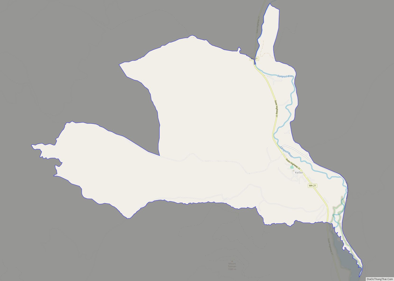
Keller is an unincorporated community and census-designated place (CDP) in southwestern Ferry County in the northeastern part of the U.S. state of Washington. As of the 2010 census, the population was 234. Keller CDP overview: Name: Keller CDP LSAD Code: 57 LSAD Description: CDP (suffix) State: Washington County: Ferry County Elevation: 1,499 ft (457 m) Total Area: ... Read more
Map of US Cities and Places
Kittitas (/ˈkɪtɪtæs/) is a city in Kittitas County, Washington, United States. The population was 1,381 at the 2010 census and an estimated 1,493 in 2018. There are numerous interpretations of the name, which is from the language of the Kittitas American Indian Sahaptin language. According to toponymist William Bright, the name “Kittitas” comes from the ... Read more
Klickitat is an unincorporated community and census-designated place (CDP) in Klickitat County, Washington, United States. The population was 362 at the 2010 census. Once the site of a lumber mill, it is now primarily a bedroom community. Klickitat CDP overview: Name: Klickitat CDP LSAD Code: 57 LSAD Description: CDP (suffix) State: Washington County: Klickitat County ... Read more
Lacey is a city in Thurston County, Washington, United States. It is a suburb of Olympia with a population of 53,526 at the 2020 census. Lacey is located along Interstate 5 between Olympia and the Nisqually River, which marks the border with Pierce County and Joint Base Lewis–McChord. Lacey city overview: Name: Lacey city LSAD ... Read more
Lebam is a census-designated place (CDP) in Pacific County, Washington, United States. The population was 160 at the 2010 census. Lebam CDP overview: Name: Lebam CDP LSAD Code: 57 LSAD Description: CDP (suffix) State: Washington County: Pacific County Elevation: 184 ft (56 m) Total Area: 1.5 sq mi (3.8 km²) Land Area: 1.5 sq mi (3.8 km²) Water Area: 0.0 sq mi (0.0 km²) Total Population: ... Read more
Long Beach is a city in Pacific County, Washington, United States. The population was 1,392 at the 2010 census. Long Beach city overview: Name: Long Beach city LSAD Code: 25 LSAD Description: city (suffix) State: Washington County: Pacific County Incorporated: January 18, 1922 Elevation: 10 ft (3 m) Total Area: 1.89 sq mi (4.90 km²) Land Area: 1.38 sq mi (3.57 km²) Water ... Read more
Lyle is an unincorporated community and census-designated place (CDP) in Klickitat County, Washington, United States. The population was 499 at the 2010 census. Lyle CDP overview: Name: Lyle CDP LSAD Code: 57 LSAD Description: CDP (suffix) State: Washington County: Klickitat County Elevation: 203 ft (62 m) Total Area: 0.71 sq mi (1.83 km²) Land Area: 0.71 sq mi (1.83 km²) Water Area: 0.0 sq mi ... Read more
Marcus town overview: Name: Marcus town LSAD Code: 43 LSAD Description: town (suffix) State: Washington County: Stevens County FIPS code: 5343395 Online Interactive Map Marcus online map. Source: Basemap layers from Google Map, Open Street Map (OSM), Arcgisonline, Wmflabs. Boundary Data from Database of Global Administrative Areas. Marcus location map. Where is Marcus town? Marcus ... Read more
Maryhill is an unincorporated community and census-designated place (CDP) in Klickitat County, Washington, United States. The population was 58 at the 2010 census, down from 98 at the 2000 census. Maryhill CDP overview: Name: Maryhill CDP LSAD Code: 57 LSAD Description: CDP (suffix) State: Washington County: Klickitat County Elevation: 187 ft (57 m) Total Area: 2.8 sq mi (7.3 km²) ... Read more
Metaline Falls town overview: Name: Metaline Falls town LSAD Code: 43 LSAD Description: town (suffix) State: Washington County: Pend Oreille County FIPS code: 5345320 Online Interactive Map Metaline Falls online map. Source: Basemap layers from Google Map, Open Street Map (OSM), Arcgisonline, Wmflabs. Boundary Data from Database of Global Administrative Areas. Metaline Falls location map. ... Read more
Morton is a city in Lewis County, Washington, United States. The population was 1,036 at the 2020 census. Morton city overview: Name: Morton city LSAD Code: 25 LSAD Description: city (suffix) State: Washington County: Lewis County Elevation: 948 ft (289 m) Total Area: 0.83 sq mi (2.16 km²) Land Area: 0.82 sq mi (2.13 km²) Water Area: 0.01 sq mi (0.03 km²) Total Population: 1,036 Population ... Read more
Mossyrock is a city in Lewis County, Washington, United States. The population was 768 at the 2020 census. Mossyrock city overview: Name: Mossyrock city LSAD Code: 25 LSAD Description: city (suffix) State: Washington County: Lewis County Elevation: 656 ft (200 m) Total Area: 0.69 sq mi (1.78 km²) Land Area: 0.69 sq mi (1.78 km²) Water Area: 0.00 sq mi (0.00 km²) Total Population: 768 Population ... Read more