Lacey is a city in Thurston County, Washington, United States. It is a suburb of Olympia with a population of 53,526 at the 2020 census. Lacey is located along Interstate 5 between Olympia and the Nisqually River, which marks the border with Pierce County and Joint Base Lewis–McChord.
| Name: | Lacey city |
|---|---|
| LSAD Code: | 25 |
| LSAD Description: | city (suffix) |
| State: | Washington |
| County: | Thurston County |
| Incorporated: | December 5, 1966 |
| Elevation: | 203 ft (62 m) |
| Land Area: | 17.20 sq mi (44.55 km²) |
| Water Area: | 0.47 sq mi (1.20 km²) |
| Population Density: | 3,057.67/sq mi (1,180.57/km²) |
| Area code: | 360 |
| FIPS code: | 5336745 |
| GNISfeature ID: | 1512362 |
| Website: | cityoflacey.org |
Online Interactive Map
Click on ![]() to view map in "full screen" mode.
to view map in "full screen" mode.
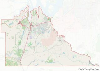
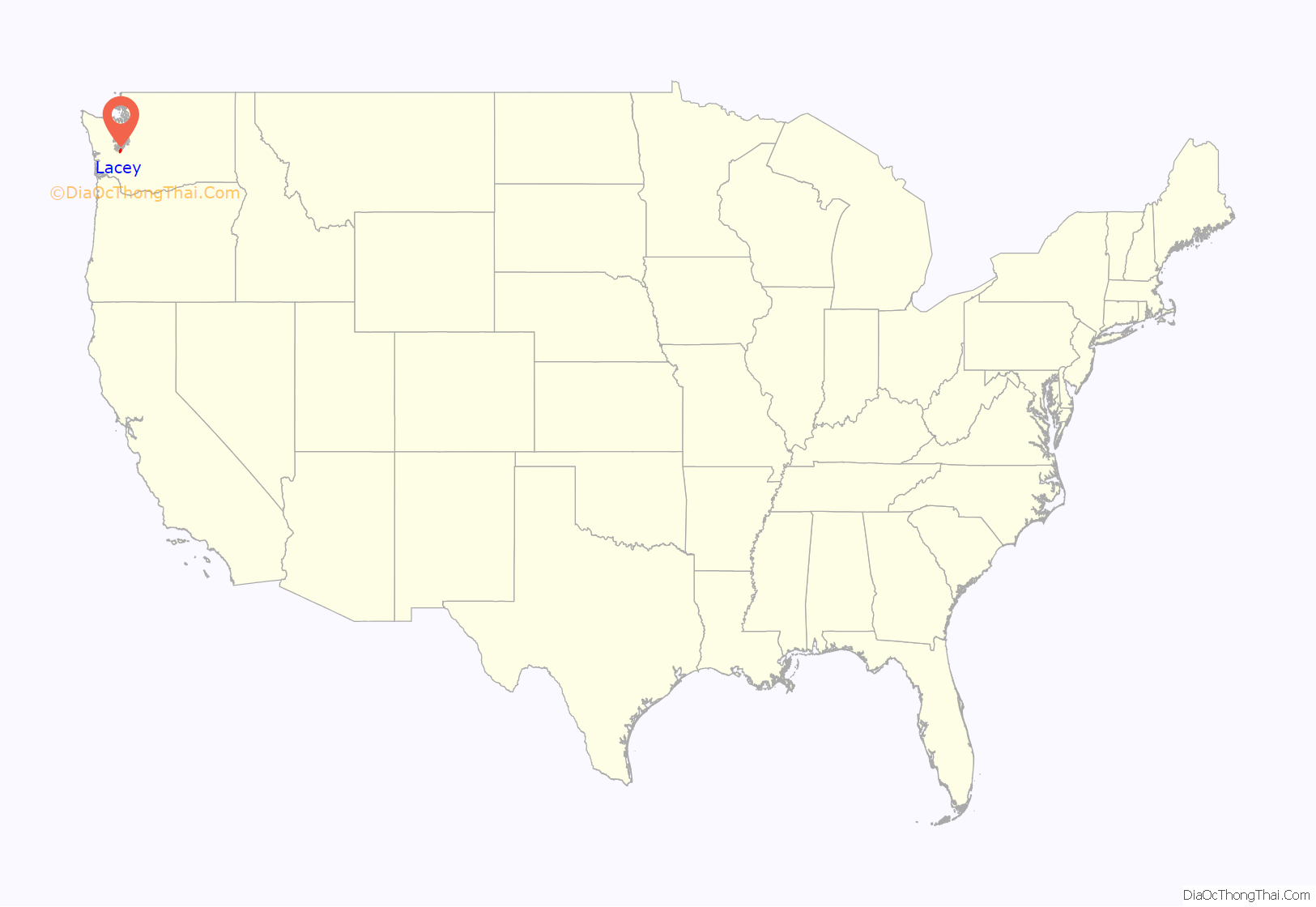
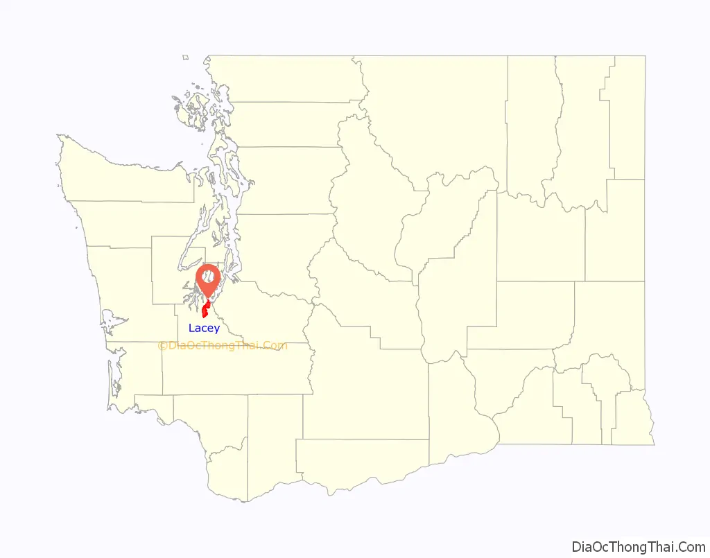
Lacey location map. Where is Lacey city?
History
Lacey was originally called Woodland after settlers Isaac and Catherine Wood, who claimed land there in 1853. By 1891, the railroad had come to the community of Woodland and the residents decided it was time to apply for a post office. The request was denied because there was already a town called Woodland on the Columbia River. The name Lacey was chosen for the new post office application, presumably after O. C. Lacey, a Justice of the Peace in Olympia. The small settlements of Woodland and Chambers Prairie consolidated into Lacey in the 1950s. The city of Lacey was not officially incorporated until 1966. At the time, the main industries were cattle, milk, forest products, and retail. Lacey became a commuter town for Olympia, Fort Lewis and to some extent, Tacoma; in recent years, however, business developments, community groups, and population growth have led Lacey to develop into a city in its own right.
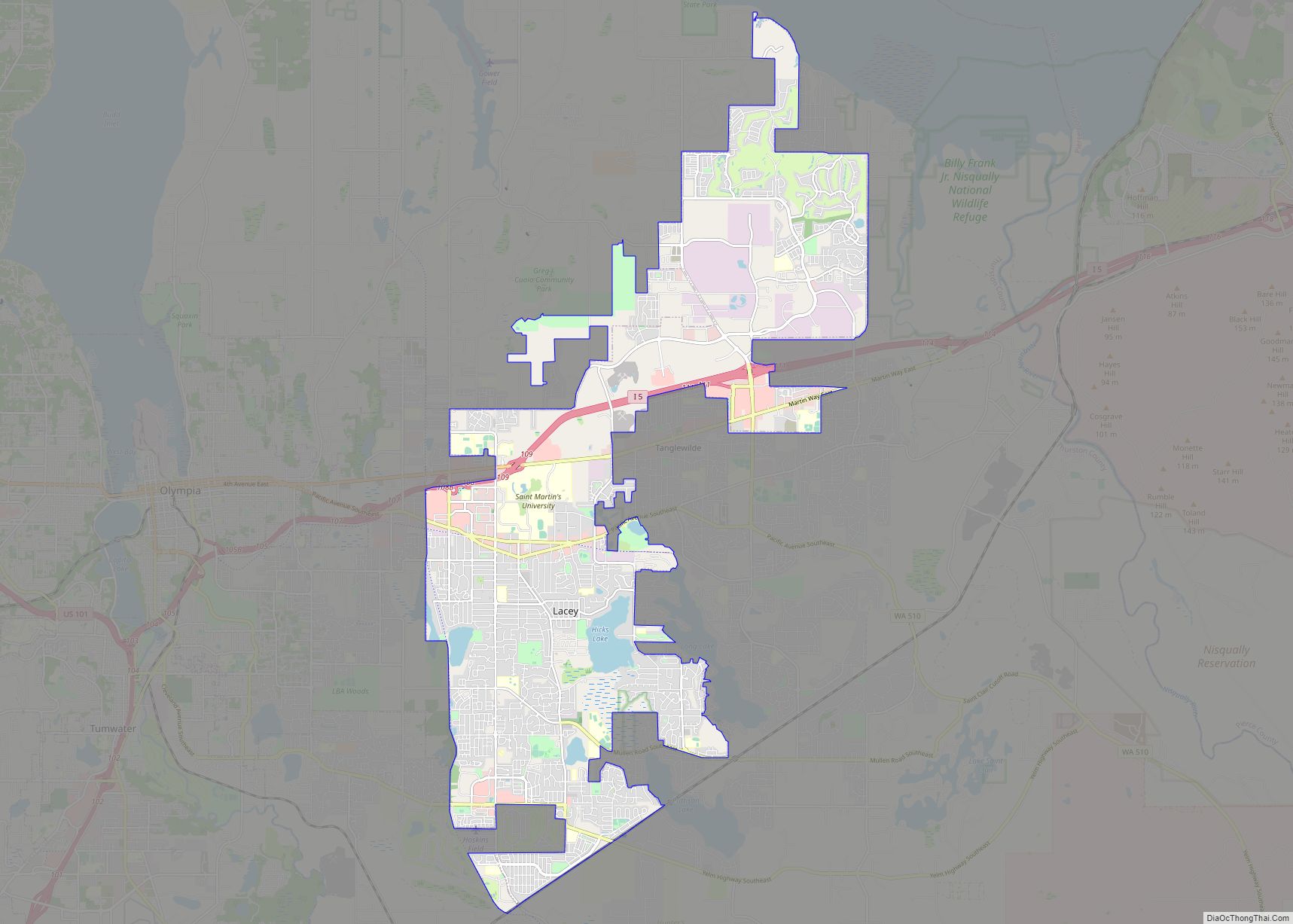
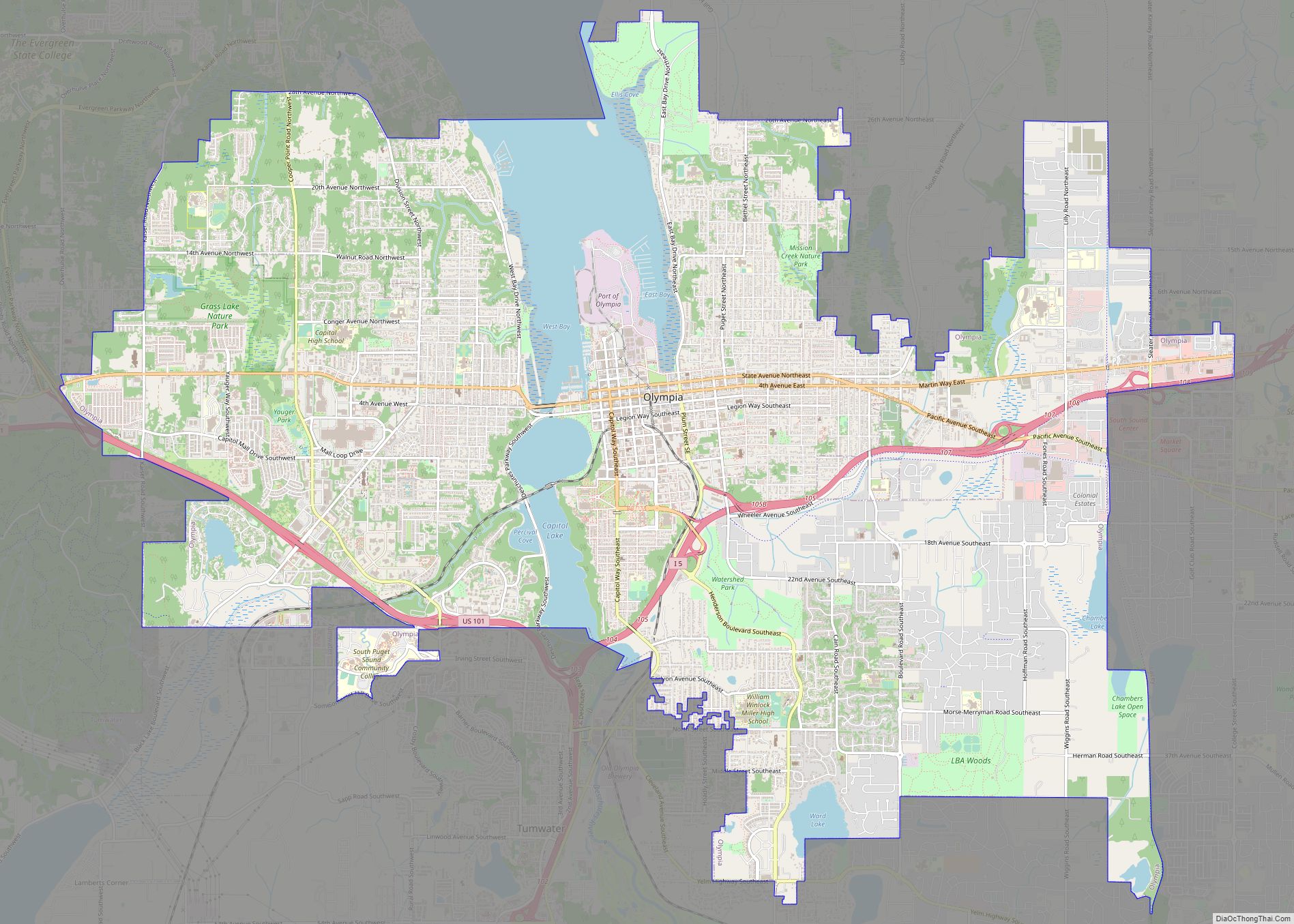
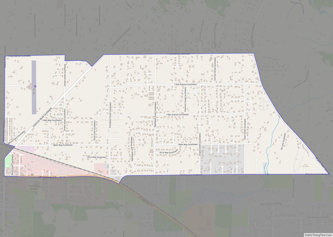
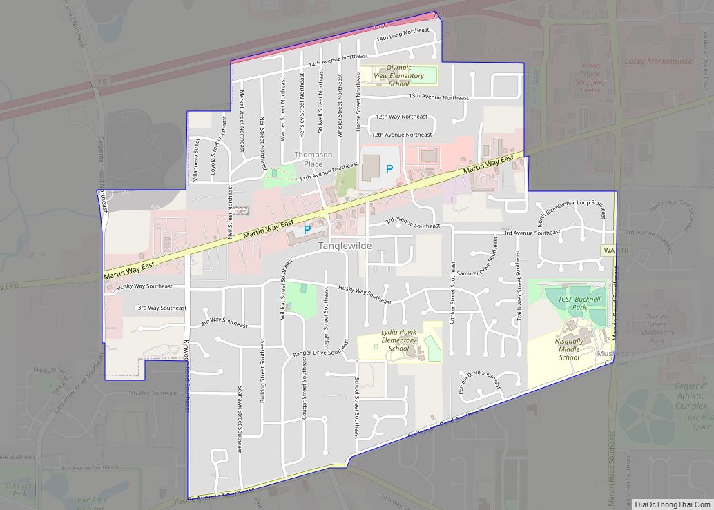
Lacey Road Map

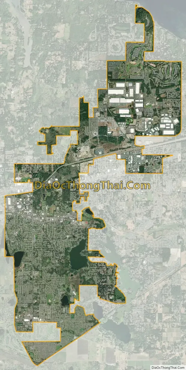
Lacey city Satellite Map
Geography
According to the United States Census Bureau, the city has a total area of 16.51 square miles (42.76 km), of which, 16.06 square miles (41.60 km) is land and 0.45 square miles (1.17 km) is water.
See also
Map of Washington State and its subdivision:- Adams
- Asotin
- Benton
- Chelan
- Clallam
- Clark
- Columbia
- Cowlitz
- Douglas
- Ferry
- Franklin
- Garfield
- Grant
- Grays Harbor
- Island
- Jefferson
- King
- Kitsap
- Kittitas
- Klickitat
- Lewis
- Lincoln
- Mason
- Okanogan
- Pacific
- Pend Oreille
- Pierce
- San Juan
- Skagit
- Skamania
- Snohomish
- Spokane
- Stevens
- Thurston
- Wahkiakum
- Walla Walla
- Whatcom
- Whitman
- Yakima
- Alabama
- Alaska
- Arizona
- Arkansas
- California
- Colorado
- Connecticut
- Delaware
- District of Columbia
- Florida
- Georgia
- Hawaii
- Idaho
- Illinois
- Indiana
- Iowa
- Kansas
- Kentucky
- Louisiana
- Maine
- Maryland
- Massachusetts
- Michigan
- Minnesota
- Mississippi
- Missouri
- Montana
- Nebraska
- Nevada
- New Hampshire
- New Jersey
- New Mexico
- New York
- North Carolina
- North Dakota
- Ohio
- Oklahoma
- Oregon
- Pennsylvania
- Rhode Island
- South Carolina
- South Dakota
- Tennessee
- Texas
- Utah
- Vermont
- Virginia
- Washington
- West Virginia
- Wisconsin
- Wyoming