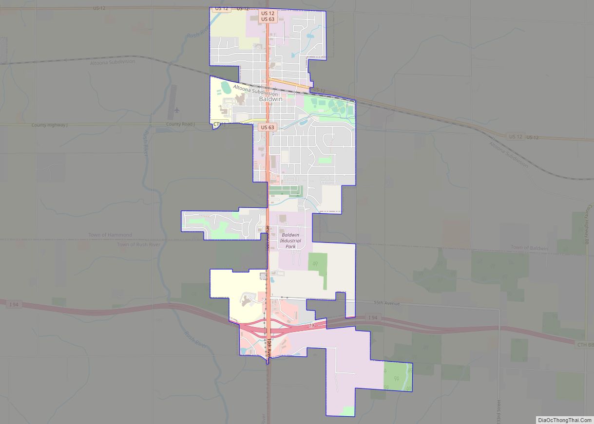
Map of Baraboo city
Baraboo is a city in the Midwest and the county seat of Sauk County, Wisconsin, United States. The largest city in the county, Baraboo is the principal city of the Baraboo Micropolitan Statistical Area which comprises a portion of the Madison Combined Statistical area. Its 2020 population was 12,556. It is situated on the Baraboo ... Read more
Map of Baraboo city
Map of Bangor village, Wisconsin
Bangor is a town in La Crosse County, Wisconsin, United States. It is part of the La Crosse, Wisconsin Metropolitan Statistical Area. The population was 570 at the 2010 census. The Village of Bangor is located partially within the town. Bangor village overview: Name: Bangor village LSAD Code: 47 LSAD Description: village (suffix) State: Wisconsin ... Read more
Map of Bangor village, Wisconsin
Map of Beloit city, Wisconsin
Beloit is a city in Rock County, Wisconsin, United States. As of the 2020 census, the city had a population of 36,657 people. Beloit is a principal city of the Janesville-Beloit Metropolitan Statistical Area and is included in the Madison Combined Statistical Area. Beloit city overview: Name: Beloit city LSAD Code: 25 LSAD Description: city ... Read more
Map of Beloit city, Wisconsin
Map of Belmont village, Wisconsin
Belmont is a town in Lafayette County, Wisconsin, United States. The population was 767 at the 2010 census, up from 676 at the 2000 census. The village of Belmont is located in the southeastern part of the town. The unincorporated community of Leslie close to the center of the town. Belmont village overview: Name: Belmont ... Read more
Map of Belmont village, Wisconsin
Map of Bellevue village, Wisconsin
Bellevue is a village in Brown County, Wisconsin. It was a town until incorporating as a village on February 14, 2003. The population was 14,570 at the time of the 2010 census. Bellevue is part of the Green Bay metropolitan area. Bellevue sits around 4.34 miles (6.99km) east from central Green Bay. Bellevue village overview: ... Read more
Map of Bellevue village, Wisconsin
Map of Belleville village, Wisconsin
Belleville is a village in Dane and Green counties in the U.S. state of Wisconsin. The population was 2,491 at the 2020 census. Of this, 1,909 were in Dane County, and 582 were in Green County. The Dane County portion of Belleville is part of the Madison Metropolitan Statistical Area, while the Green County portion ... Read more
Map of Belleville village, Wisconsin
Map of Bell Center village
Bell Center is a village in Crawford County, Wisconsin, United States. The population was 117 at the 2010 census. Bell Center village overview: Name: Bell Center village LSAD Code: 47 LSAD Description: village (suffix) State: Wisconsin County: Crawford County Elevation: 719 ft (219 m) Total Area: 5.59 sq mi (14.47 km²) Land Area: 5.55 sq mi (14.37 km²) Water Area: 0.04 sq mi (0.10 km²) Total ... Read more
Map of Bell Center village
Map of Bear Creek village, Wisconsin
Bear Creek is a village in Outagamie County, Wisconsin, United States. The population was 448 at the 2010 census. Bear Creek village overview: Name: Bear Creek village LSAD Code: 47 LSAD Description: village (suffix) State: Wisconsin County: Outagamie County Total Area: 0.92 sq mi (2.39 km²) Land Area: 0.92 sq mi (2.39 km²) Water Area: 0.00 sq mi (0.00 km²) Total Population: 448 Population ... Read more
Map of Bear Creek village, Wisconsin
Map of Bayside village, Wisconsin
Bayside is a village in Milwaukee and Ozaukee counties in the U.S. state of Wisconsin. The population was 4,482 at the 2020 census. Of this, 4,378 were in Milwaukee County, and only 104 were in Ozaukee County. Bayside village overview: Name: Bayside village LSAD Code: 47 LSAD Description: village (suffix) State: Wisconsin County: Milwaukee County, ... Read more
Map of Bayside village, Wisconsin
Map of Bayfield city, Wisconsin
Bayfield is a city in Bayfield County, Wisconsin, United States. The population was 584 at the 2020 census. This makes it the city with the smallest population in Wisconsin. In fact, for a new city to be incorporated today, state regulations require a population of at least 1,000 residents, so it would have to be ... Read more
Map of Bayfield city, Wisconsin
Map of Bay City village, Wisconsin
Bay City is a village on the Mississippi River in Pierce County, Wisconsin, United States. The population was 500 at the 2010 census. Bay City village overview: Name: Bay City village LSAD Code: 47 LSAD Description: village (suffix) State: Wisconsin County: Pierce County Elevation: 692 ft (211 m) Total Area: 0.61 sq mi (1.57 km²) Land Area: 0.59 sq mi (1.53 km²) Water ... Read more
Map of Bay City village, Wisconsin
Map of Barronett CDP
Barronett is an unincorporated census-designated place located in the town of Lakeland, Barron County, Wisconsin, United States. Barronett is located on U.S. Route 63 7.5 miles (12.1 km) north-northeast of Cumberland. Barronett has a post office with ZIP code 54813. As of the 2010 census, its population is 111. Barronett CDP overview: Name: Barronett CDP LSAD ... Read more
Map of Barronett CDP