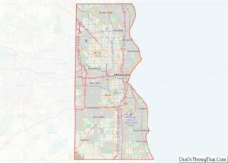
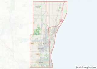
Bayside is a village in Milwaukee and Ozaukee counties in the U.S. state of Wisconsin. The population was 4,482 at the 2020 census. Of this, 4,378 were in Milwaukee County, and only 104 were in Ozaukee County.
| Name: | Bayside village |
|---|---|
| LSAD Code: | 47 |
| LSAD Description: | village (suffix) |
| State: | Wisconsin |
| County: | Milwaukee County, Ozaukee County |
| Incorporated: | February 13, 1953; 70 years ago (February 13, 1953) |
| Elevation: | 673 ft (205 m) |
| Total Area: | 2.39 sq mi (6.19 km²) |
| Land Area: | 2.39 sq mi (6.19 km²) |
| Water Area: | 0.00 sq mi (0.00 km²) |
| Total Population: | 4,482 |
| Population Density: | 1,814.91/sq mi (700.66/km²) |
| ZIP code: | 53217 |
| Area code: | 414 |
| FIPS code: | 5505450 |
| GNISfeature ID: | 1561327 |
| Website: | baysidewi.gov |
Online Interactive Map
Click on ![]() to view map in "full screen" mode.
to view map in "full screen" mode.
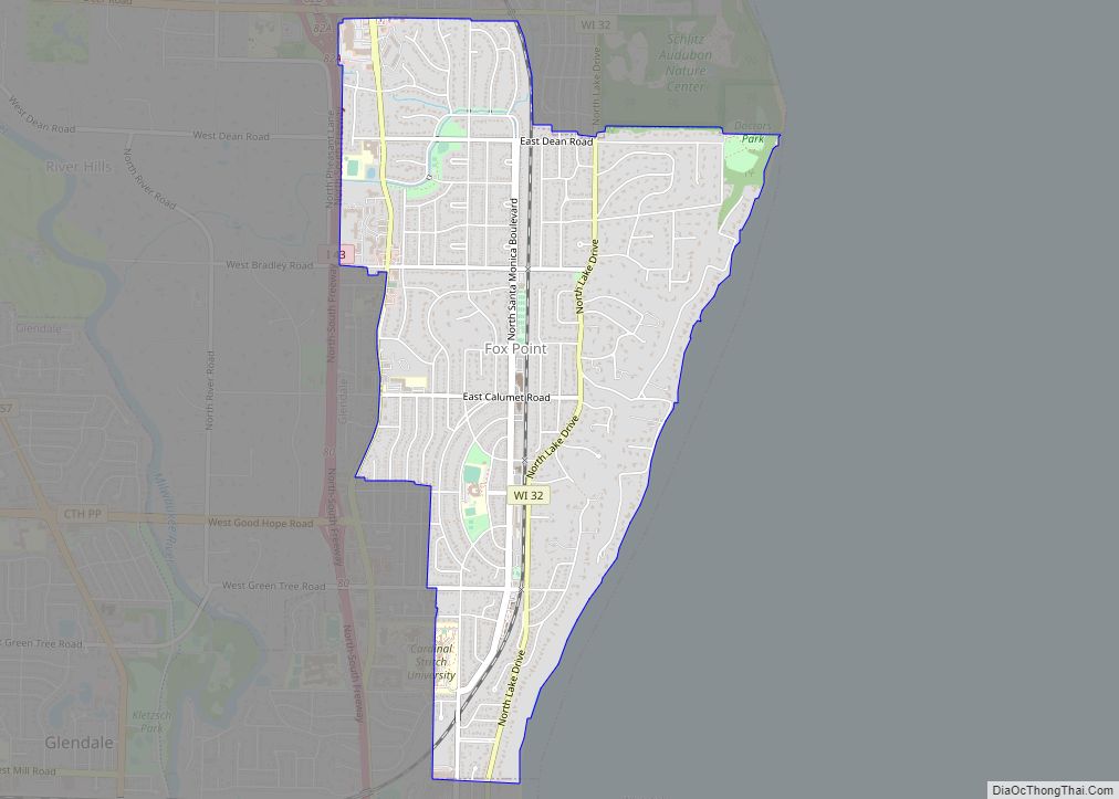
Bayside location map. Where is Bayside village?


History
The land that became Bayside was originally inhabited by Native Americans, who surrendered their land to the United States Federal Government in the 1830s. However, it is possible that the Potawatomi Chief Waubeka maintained a summer camp in Bayside and a winter camp in the Ozaukee County community that bears his name as late as 1845.
In the 19th century, the community was part of the Town of Milwaukee, and most of the land was used for logging and then farming by the early Dutch-American settlers.
In 1885, the Uihlein family, which owned the Joseph Schlitz Brewing Company, began purchasing land in Bayside, which became Nine Mile Farm, where the company bred draft horses for the brewery. The Uihlein family also kept chickens and cows on the property, and began reforesting the area around 1910. In 1969, the Schlitz Foundation considered getting rid of the land, which caused a debate in Bayside over whether it should become a public space or private developments. In 1971, the foundation donated the land to the National Audubon Society to create a nature center, which today is the 185-acre Schlitz Audubon Nature Center.
In the 1890s and early 20th century, prominent Milwaukeeans, including Jacob Donges and Frederick Usinger, began to construct summer homes in the “Fairy Chasm” community near Lake Michigan. The Fish Creek Park Company, organized in 1892, was one group that built vacation homes in Ozaukee County portion of what would become Bayside.
Bayside grew rapidly during the post-war suburbanization and economic prosperity. Many of the homes in the village were constructed between 1950 and 1980. The village incorporated on February 13, 1953, to prevent annexation by the City of Milwaukee, as happened to other communities in the county, including the Town of Milwaukee and the Town of Granville. In 1955, some of the residents of the Fairy Chasm community in Ozaukee County petitioned to join Bayside. The southern part joined the village, while the northern portion became part of the City of Mequon.
Bayside Road Map

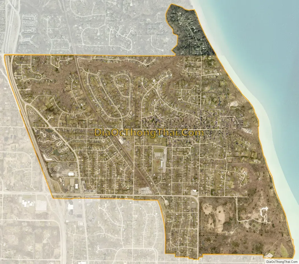
Bayside city Satellite Map
Geography
Bayside is located at 43°10′49″N 87°54′17″W / 43.18028°N 87.90472°W / 43.18028; -87.90472 (43.180275, -87.904735).
According to the United States Census Bureau, the village has a total area of 2.39 square miles (6.19 km), all of it land. Lake Michigan borders the eastern edge of Bayside. Most of the village is in Milwaukee County, but a small portion at the end of Lake Drive bordering Fish Creek is in Ozaukee County.
See also
Map of Wisconsin State and its subdivision:- Adams
- Ashland
- Barron
- Bayfield
- Brown
- Buffalo
- Burnett
- Calumet
- Chippewa
- Clark
- Columbia
- Crawford
- Dane
- Dodge
- Door
- Douglas
- Dunn
- Eau Claire
- Florence
- Fond du Lac
- Forest
- Grant
- Green
- Green Lake
- Iowa
- Iron
- Jackson
- Jefferson
- Juneau
- Kenosha
- Kewaunee
- La Crosse
- Lafayette
- Lake Michigan
- Lake Superior
- Langlade
- Lincoln
- Manitowoc
- Marathon
- Marinette
- Marquette
- Menominee
- Milwaukee
- Monroe
- Oconto
- Oneida
- Outagamie
- Ozaukee
- Pepin
- Pierce
- Polk
- Portage
- Price
- Racine
- Richland
- Rock
- Rusk
- Saint Croix
- Sauk
- Sawyer
- Shawano
- Sheboygan
- Taylor
- Trempealeau
- Vernon
- Vilas
- Walworth
- Washburn
- Washington
- Waukesha
- Waupaca
- Waushara
- Winnebago
- Wood
- Alabama
- Alaska
- Arizona
- Arkansas
- California
- Colorado
- Connecticut
- Delaware
- District of Columbia
- Florida
- Georgia
- Hawaii
- Idaho
- Illinois
- Indiana
- Iowa
- Kansas
- Kentucky
- Louisiana
- Maine
- Maryland
- Massachusetts
- Michigan
- Minnesota
- Mississippi
- Missouri
- Montana
- Nebraska
- Nevada
- New Hampshire
- New Jersey
- New Mexico
- New York
- North Carolina
- North Dakota
- Ohio
- Oklahoma
- Oregon
- Pennsylvania
- Rhode Island
- South Carolina
- South Dakota
- Tennessee
- Texas
- Utah
- Vermont
- Virginia
- Washington
- West Virginia
- Wisconsin
- Wyoming