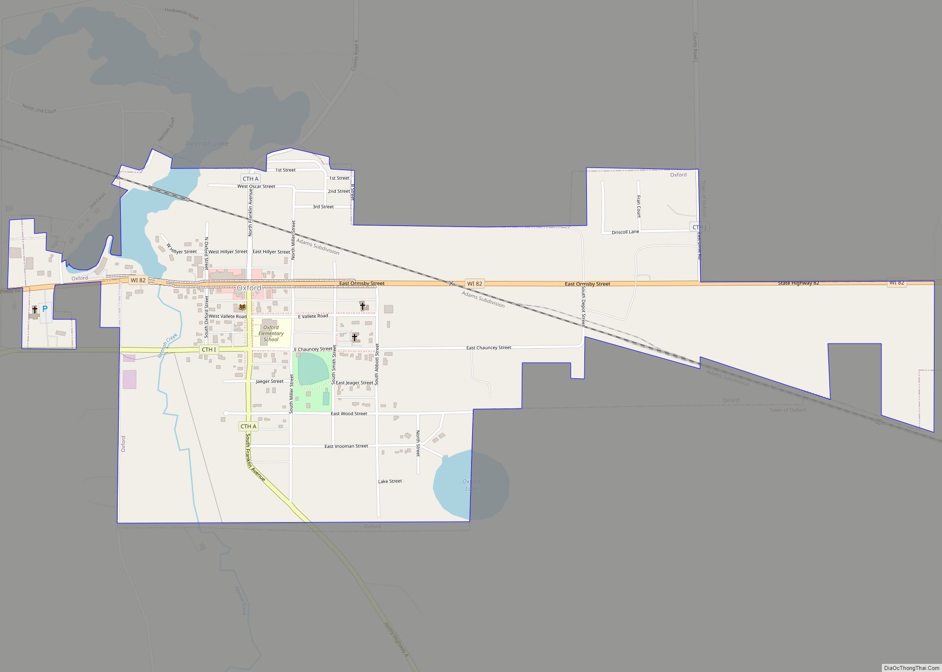
Map of West Logan town

Map of West Logan town

West Logan is a town along the Guyandotte River in Logan County, West Virginia, United States. The population was 400 at the 2020 census. For unknown reasons, some sources report West Logan to lay west of the county seat at Logan, attributing to this fact the name. West Logan town overview: Name: West Logan town … Read more

Map of West Liberty town, West Virginia

Map of West Liberty town, West Virginia

West Liberty is a town in Ohio County, West Virginia, United States. The population was 1,557 at the 2020 census. It is part of the Wheeling metropolitan area. West Liberty town overview: Name: West Liberty town LSAD Code: 43 LSAD Description: town (suffix) State: West Virginia County: Ohio County Elevation: 1,224 ft (373 m) Total Area: 1.09 sq mi … Read more

Map of West Hamlin town

Map of West Hamlin town

West Hamlin is a town in Lincoln County, West Virginia, United States, along the Guyandotte River. The population was 519 at the 2020 census, and is now down to 509, according to the 2021 census. West Hamlin is a part of the Huntington-Ashland, WV-KY-OH, Metropolitan Statistical Area (MSA). West Hamlin is west of the county … Read more

Map of Wellsburg city, West Virginia

Map of Wellsburg city, West Virginia

Wellsburg is a city in and the county seat of Brooke County, West Virginia, United States. The 2020 census recorded a population of 2,455. It is a part of the Weirton–Steubenville metropolitan area. The city’s economy includes several telemarketing facilities, and a factory that does metal fabrication and plastics molding. Wellsburg city overview: Name: Wellsburg … Read more

Map of Windsor Heights village, West Virginia

Map of Windsor Heights village, West Virginia

Windsor Heights is a village in Brooke County, West Virginia, United States. It is part of the Wheeling, West Virginia Metropolitan Statistical Area. The population was 423 at the 2010 census. Grace Davis was the mayor as of June, 2017. Windsor Heights village overview: Name: Windsor Heights village LSAD Code: 47 LSAD Description: village (suffix) … Read more

Map of Welch city, West Virginia

Map of Welch city, West Virginia

Welch is a city in and the county seat of McDowell County, West Virginia, United States. The population was 3,590 at the 2020 census, however the 2021 census estimate put the population at 1,914, due to the Federal Correctional Institution, McDowell leaving city limits. Welch was incorporated as a city in 1893. Welch city overview: … Read more

Map of Alpine Northeast CDP

Map of Alpine Northeast CDP

Alpine Northeast is a census-designated place in Lincoln County, Wyoming, United States. The population was 196 at the 2010 census. Alpine Northeast CDP overview: Name: Alpine Northeast CDP LSAD Code: 57 LSAD Description: CDP (suffix) State: Wyoming County: Lincoln County Total Area: 5.0 sq mi (13.1 km²) Land Area: 5.0 sq mi (13.1 km²) Water Area: 0.0 sq mi (0.0 km²) Total Population: 196 … Read more

Map of Alcova CDP

Map of Alcova CDP

Alcova is a census-designated place (CDP) in Natrona County, Wyoming, United States. It is part of the Casper, Wyoming Metropolitan Statistical Area. The population was 34 at the 2020 census. Wyoming’s center of population is located in the small Town of Alcova. Alcova and the nearby reservoir, Alcova Lake, are popular vacation spots with many … Read more

Map of Albin town

Map of Albin town

Albin is a town in Laramie County, Wyoming, United States. It is part of the Cheyenne Metropolitan Statistical Area. The population was 181 at the 2010 census. Albin town overview: Name: Albin town LSAD Code: 43 LSAD Description: town (suffix) State: Wyoming County: Laramie County Elevation: 5,338 ft (1,627 m) Total Area: 0.15 sq mi (0.38 km²) Land Area: 0.15 sq mi … Read more

Map of Albany CDP, Wyoming

Map of Albany CDP, Wyoming

Albany is a census-designated place (CDP) in Albany County, Wyoming, United States. The population was 55 at the 2010 census. Albany CDP overview: Name: Albany CDP LSAD Code: 57 LSAD Description: CDP (suffix) State: Wyoming County: Albany County Elevation: 8,327 ft (2,538 m) Total Area: 11.0 sq mi (28 km²) Land Area: 11.0 sq mi (28 km²) Water Area: 0 sq mi (0 km²) Total Population: … Read more

Map of Afton town, Wyoming

Map of Afton town, Wyoming

Afton is a town in Lincoln County, Wyoming, United States. The population was 1,911 at the 2010 census. Afton is home to the world’s largest arch made of elk antlers. Spanning 75 feet (23 m) across the four lanes of U.S. Highway 89, the arch consists of 3,011 elk antlers and weighs 15 tons. Afton town … Read more

Map of Auburn CDP, Wyoming

Map of Auburn CDP, Wyoming

Auburn is a census-designated place (CDP) in Lincoln County, Wyoming, United States. As of the 2010 census, the CDP population was 328. The first settlement at Auburn was made in 1879. Auburn CDP overview: Name: Auburn CDP LSAD Code: 57 LSAD Description: CDP (suffix) State: Wyoming County: Lincoln County Elevation: 6,053 ft (1,845 m) Total Area: 2.1 sq mi … Read more