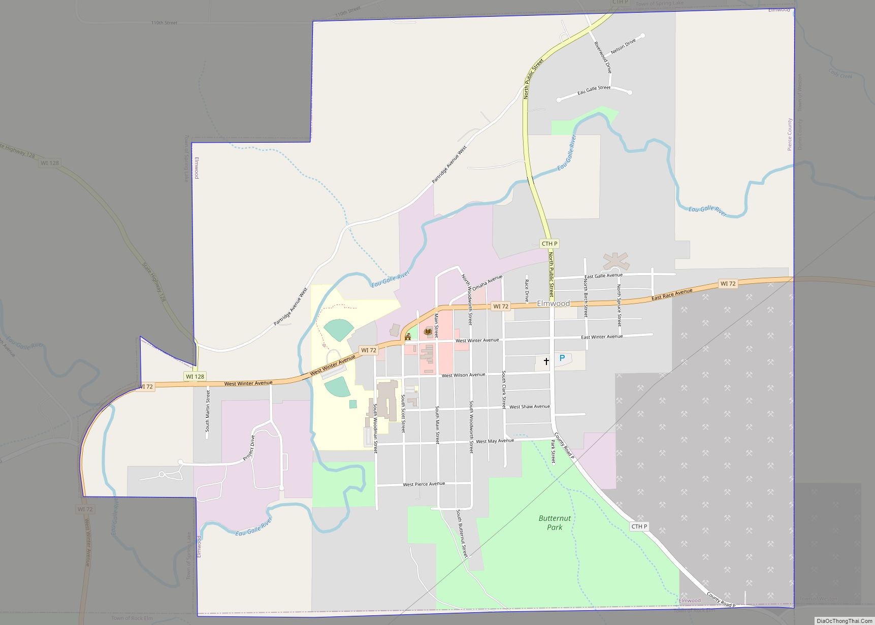
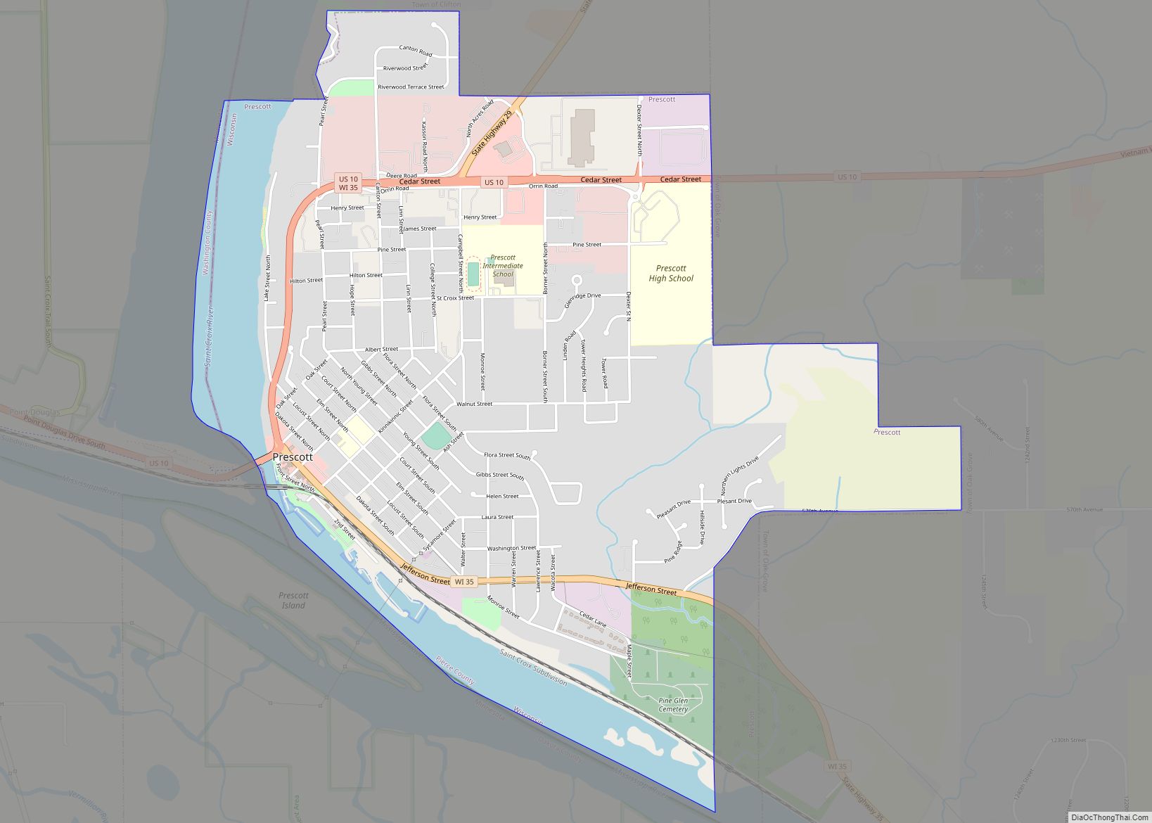
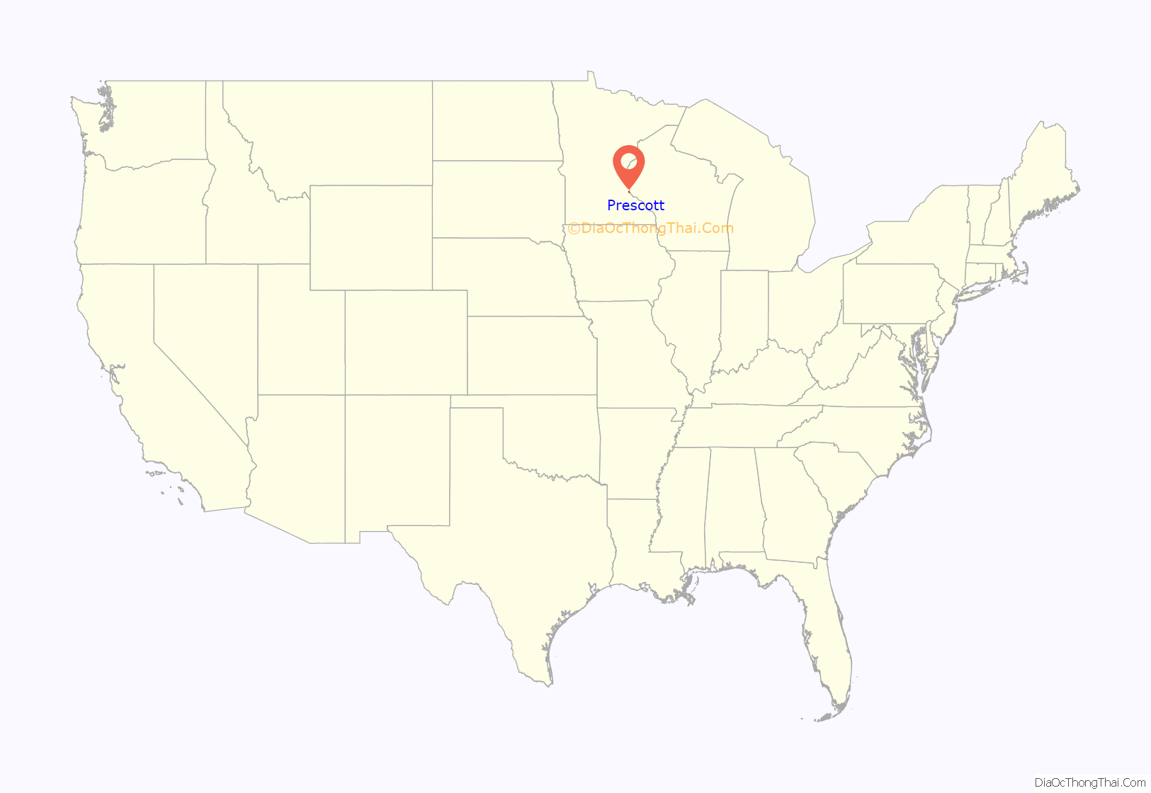
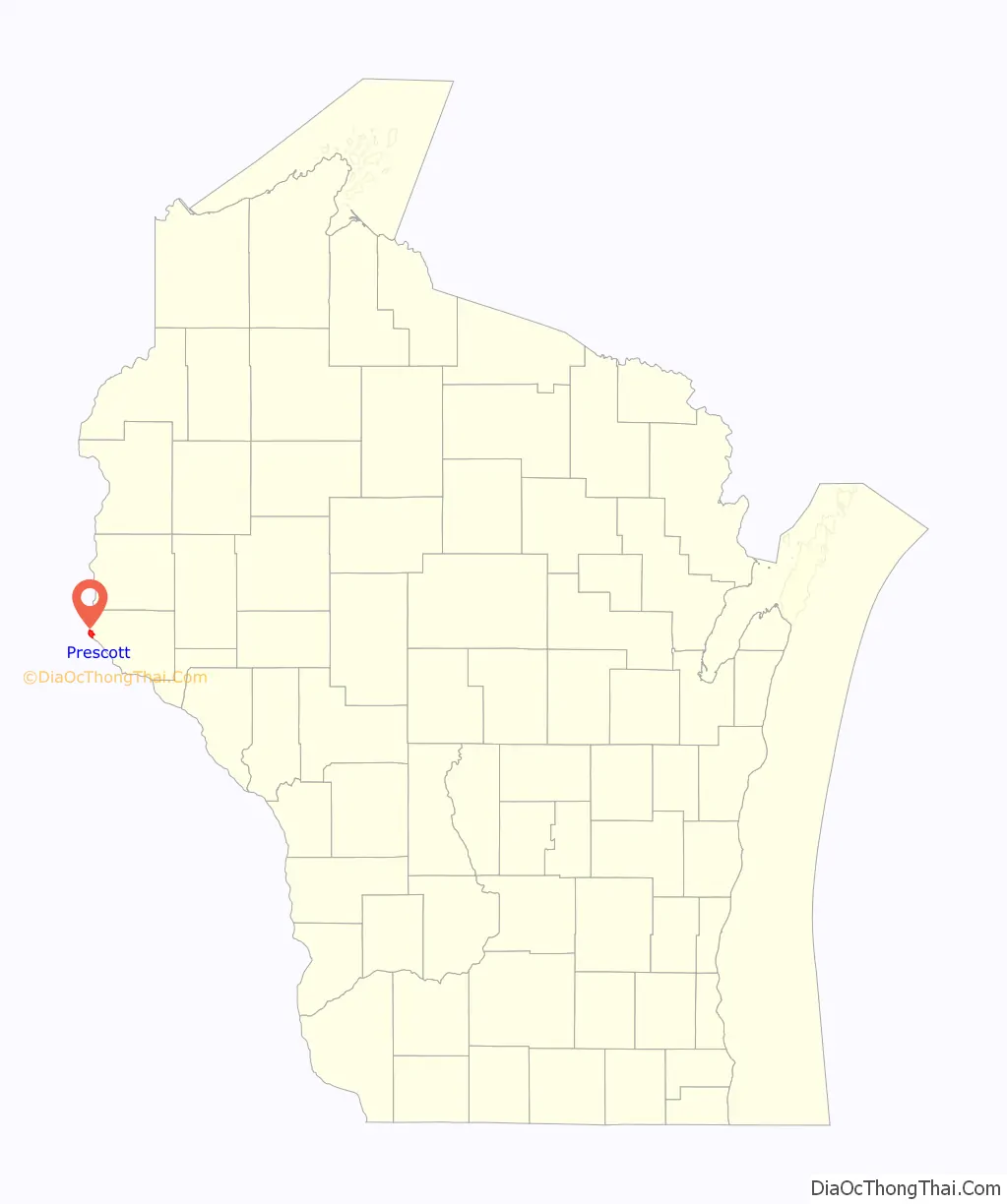
Prescott is a city in Pierce County, Wisconsin at the confluence of the St. Croix River and Mississippi River. The population was 4,258 at the 2010 census, making it the second-largest city in the county after River Falls, and the largest entirely within Pierce County.
Prescott was home to the mother house of the Franciscan Servants of Jesus. The town was first settled by (and named for) Philander Prescott, who opened a trading post there in 1839.
| Name: | Prescott city |
|---|---|
| LSAD Code: | 25 |
| LSAD Description: | city (suffix) |
| State: | Wisconsin |
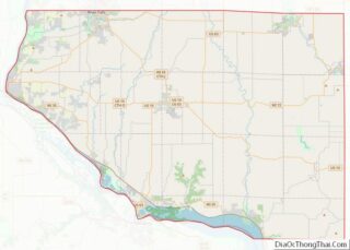
| County: | Pierce County |
| Elevation: | 712 ft (217 m) |
| Total Area: | 2.97 sq mi (7.70 km²) |
| Land Area: | 2.60 sq mi (6.73 km²) |
| Water Area: | 0.37 sq mi (0.97 km²) |
| Total Population: | 4,258 |
| Population Density: | 1,652.56/sq mi (638.14/km²) |
| Area code: | 715 & 534 |
| FIPS code: | 5565375 |
| GNISfeature ID: | 1571918 |
| Website: | prescottwi.org |
Online Interactive Map
Click on ![]() to view map in "full screen" mode.
to view map in "full screen" mode.
Prescott location map. Where is Prescott city?
Prescott Road Map

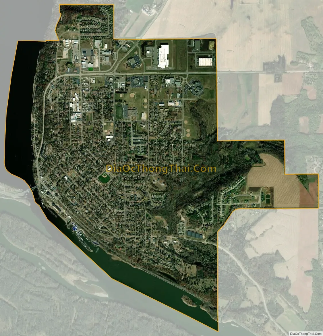
Prescott city Satellite Map
Geography
Prescott is located at 44°45′6″N 92°47′35″W / 44.75167°N 92.79306°W / 44.75167; -92.79306 (44.751567, -92.793141). It is the westernmost incorporated community in Wisconsin, although rural portions of Burnett and Polk counties are further west. Prescott, along with the rest of Pierce County, is officially a part of the Minneapolis-St Paul-Bloomington MN-WI Metropolitan Statistical Area, with many residents of Prescott commuting to Minneapolis or Saint Paul for employment or education.
According to the United States Census Bureau, the city has a total area of 2.96 square miles (7.67 km), of which, 2.59 square miles (6.71 km) is land and 0.37 square miles (0.96 km) is water.
See also
Map of Wisconsin State and its subdivision:- Adams
- Ashland
- Barron
- Bayfield
- Brown
- Buffalo
- Burnett
- Calumet
- Chippewa
- Clark
- Columbia
- Crawford
- Dane
- Dodge
- Door
- Douglas
- Dunn
- Eau Claire
- Florence
- Fond du Lac
- Forest
- Grant
- Green
- Green Lake
- Iowa
- Iron
- Jackson
- Jefferson
- Juneau
- Kenosha
- Kewaunee
- La Crosse
- Lafayette
- Lake Michigan
- Lake Superior
- Langlade
- Lincoln
- Manitowoc
- Marathon
- Marinette
- Marquette
- Menominee
- Milwaukee
- Monroe
- Oconto
- Oneida
- Outagamie
- Ozaukee
- Pepin
- Pierce
- Polk
- Portage
- Price
- Racine
- Richland
- Rock
- Rusk
- Saint Croix
- Sauk
- Sawyer
- Shawano
- Sheboygan
- Taylor
- Trempealeau
- Vernon
- Vilas
- Walworth
- Washburn
- Washington
- Waukesha
- Waupaca
- Waushara
- Winnebago
- Wood
- Alabama
- Alaska
- Arizona
- Arkansas
- California
- Colorado
- Connecticut
- Delaware
- District of Columbia
- Florida
- Georgia
- Hawaii
- Idaho
- Illinois
- Indiana
- Iowa
- Kansas
- Kentucky
- Louisiana
- Maine
- Maryland
- Massachusetts
- Michigan
- Minnesota
- Mississippi
- Missouri
- Montana
- Nebraska
- Nevada
- New Hampshire
- New Jersey
- New Mexico
- New York
- North Carolina
- North Dakota
- Ohio
- Oklahoma
- Oregon
- Pennsylvania
- Rhode Island
- South Carolina
- South Dakota
- Tennessee
- Texas
- Utah
- Vermont
- Virginia
- Washington
- West Virginia
- Wisconsin
- Wyoming