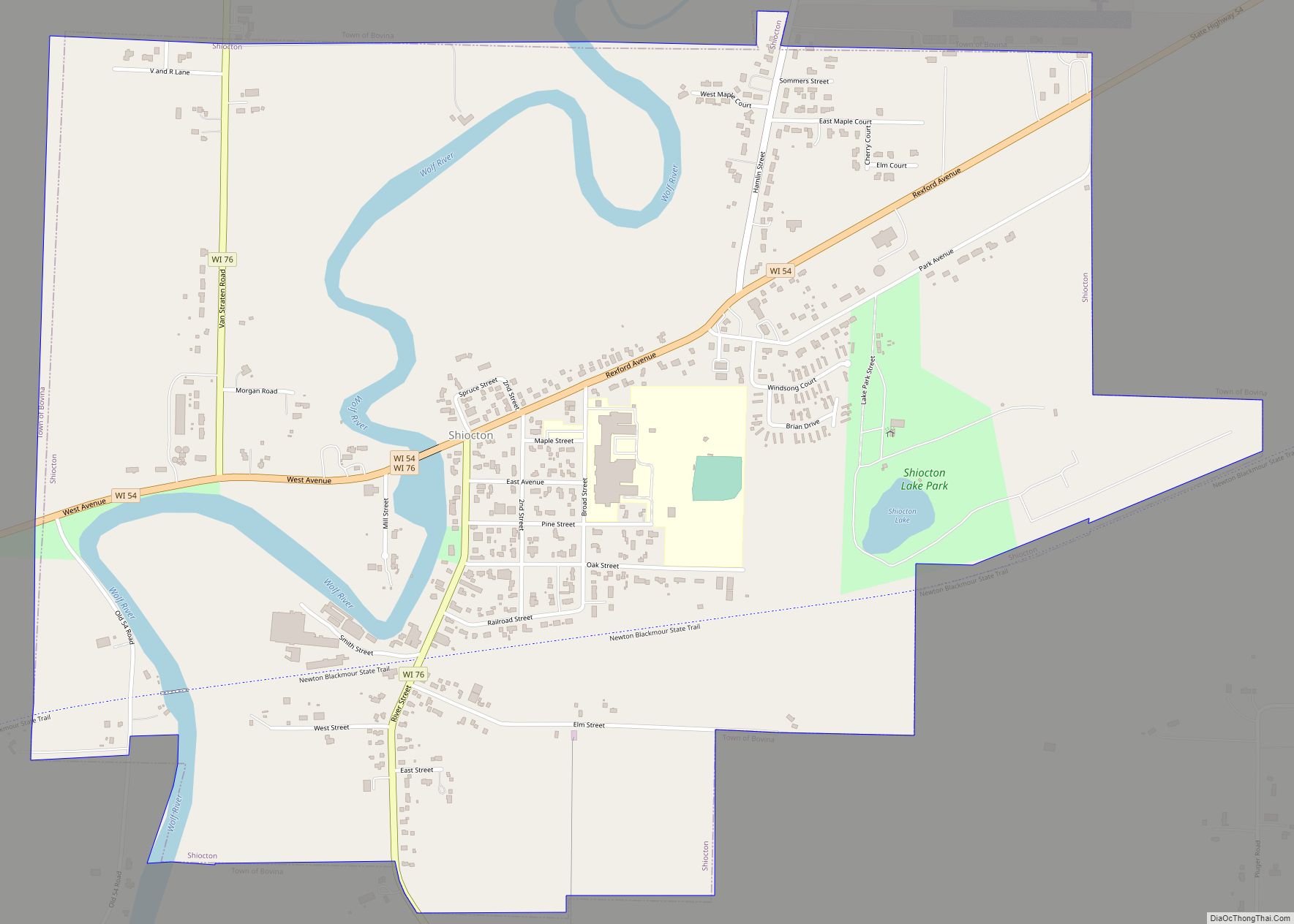
Map of Siren village
Siren is a town in Burnett County in the U.S. state of Wisconsin. The population was 936 at the 2010 census. The village of Siren is located within the town. Siren village overview: Name: Siren village LSAD Code: 47 LSAD Description: village (suffix) State: Wisconsin County: Burnett County FIPS code: 5574175 Online Interactive Map Siren ... Read more
Map of Siren village
Map of Springbrook CDP, Wisconsin
Springbrook is an unincorporated community and census-designated place located in the town of Springbrook, Washburn County, Wisconsin, United States. Springbrook is located on U.S. Route 63 13 miles (21 km) northeast of Spooner. Springbrook has a post office with ZIP code 54875. Its population was 76 in 2017. Springbrook CDP overview: Name: Springbrook CDP LSAD Code: ... Read more
Map of Springbrook CDP, Wisconsin
Map of Spooner city
Spooner is a city in Washburn County, Wisconsin, United States. The population was 2,573 at the 2020 census. The city is located mostly within the southwest corner of the Town of Spooner, with a small portion extending into the Town of Beaver Brook on the south, the Town of Bashaw on the southwest, and the ... Read more
Map of Spooner city
Map of Somers village, Wisconsin
Somers is a village in Kenosha County, Wisconsin, United States. The population was 8,402 at the 2020 census. Somers has a post office with ZIP code 53171. The former unincorporated communities of Berryville, Central Park, and Kellogg’s Corners are located in the village. The village of Somers was incorporated on April 24, 2015, following a ... Read more
Map of Somers village, Wisconsin
Map of Soldiers Grove village
Soldiers Grove is a village situated along the Kickapoo River in Crawford County, Wisconsin, in the United States. The population was 592 at the 2010 census. The town is notable for having relocated its central business district due to flooding on the nearby Kickapoo River during the 1970s, and has become a case study in ... Read more
Map of Soldiers Grove village
Map of Stone Lake CDP
Stone Lake is an unincorporated census-designated place in Sawyer and Washburn counties, Wisconsin, United States. Stone Lake is located on the eastern shore of Stone Lake and along Wisconsin Highway 70, 12 miles (19 km) west-northwest of Couderay. The Sawyer County portion of the community is located in the town of Sand Lake, while the Washburn ... Read more
Map of Stone Lake CDP
Map of Stoddard village
Stoddard is a village in Vernon County, Wisconsin, United States. The population was 840 at the 2020 census. Stoddard village overview: Name: Stoddard village LSAD Code: 47 LSAD Description: village (suffix) State: Wisconsin County: Vernon County Elevation: 659 ft (201 m) Total Area: 0.71 sq mi (1.84 km²) Land Area: 0.64 sq mi (1.65 km²) Water Area: 0.07 sq mi (0.19 km²) Total Population: 840 Population ... Read more
Map of Stoddard village
Map of Stockholm village, Wisconsin
Stockholm is a village in Pepin County, Wisconsin, United States, founded in 1854 by immigrants from Karlskoga, Sweden, who named it after their country’s capital. The population was 78 at the 2020 census. The village is located within the Town of Stockholm. Stockholm village overview: Name: Stockholm village LSAD Code: 47 LSAD Description: village (suffix) ... Read more
Map of Stockholm village, Wisconsin
Map of Taylor village, Wisconsin
Taylor is a village in Jackson County, Wisconsin, United States, along the Trempealeau River. The population was 484 at the 2020 census. Taylor village overview: Name: Taylor village LSAD Code: 47 LSAD Description: village (suffix) State: Wisconsin County: Jackson County Elevation: 892 ft (272 m) Total Area: 0.73 sq mi (1.89 km²) Land Area: 0.73 sq mi (1.89 km²) Water Area: 0.00 sq mi (0.00 km²) ... Read more
Map of Taylor village, Wisconsin
Map of Tomah city
Tomah is a city in Monroe County, Wisconsin, United States. The population was 9,570 as of the 2020 census. The city is surrounded by the Town of Tomah and the Town of La Grange. Tomah city overview: Name: Tomah city LSAD Code: 25 LSAD Description: city (suffix) State: Wisconsin County: Monroe County Total Area: 8.26 sq mi ... Read more
Map of Tomah city
Map of Summit village, Wisconsin
Summit is a village in Waukesha County, Wisconsin, United States. The population was 4,784 at the 2020 census. The former unincorporated communities of Summit Center, Summit Corners, and Waterville are located in the village. Summit village overview: Name: Summit village LSAD Code: 47 LSAD Description: village (suffix) State: Wisconsin County: Waukesha County Elevation: 863 ft (263 m) ... Read more
Map of Summit village, Wisconsin
Map of Three Lakes CDP, Wisconsin
Three Lakes is an unincorporated census-designated place located in the town of Three Lakes, Oneida County, Wisconsin, United States. Three Lakes is located at the junction of U.S. Route 45 and Wisconsin Highway 32 9 miles (14 km) south-southeast of Eagle River. Three Lakes has a post office with ZIP code 54562. As of the 2010 ... Read more
Map of Three Lakes CDP, Wisconsin