Map of Bowden CDP
Bowden is a census-designated place (CDP) in Randolph County, West Virginia, United States. Bowden is located on U.S. Route 33, 7.5 miles (12.1 km) east of Elkins. Bowden has a post office with ZIP code 26254. According to the 2010 Census, there were nine people residing at this location. Bowden CDP overview: Name: Bowden CDP LSAD ... Read more
Map of Bowden CDP
Map of Boomer CDP
Boomer is a census-designated place (CDP) in Fayette County, West Virginia, United States. Boomer is located on the north bank of the Kanawha River, 2 miles (3.2 km) southeast of Smithers. Boomer has a post office with ZIP code 25031. As of the 2010 census, its population was 615. Boomer CDP overview: Name: Boomer CDP LSAD ... Read more
Map of Boomer CDP
Map of Bolt CDP
Bolt is a census-designated place (CDP) in Raleigh County, West Virginia, United States. Bolt is located on West Virginia Route 99, 12 miles (19 km) west of Beckley. Bolt has a post office with ZIP code 25817. As of the 2010 census, its population is 548. Bolt CDP overview: Name: Bolt CDP LSAD Code: 57 LSAD ... Read more
Map of Bolt CDP
Map of Bolivar town, West Virginia
Bolivar (/ˈbɒlɪvər/ BOH-liv-er) is a town in Jefferson County, West Virginia, United States. The population was 1,072 at the 2020 census. The town is named for South American revolutionary leader Simón Bolívar. Located in West Virginia’s Eastern Panhandle, it is part of the northwestern fringes of the Washington metropolitan area. The Appalachian Trail passes directly ... Read more
Map of Bolivar town, West Virginia
Map of Boaz CDP, West Virginia
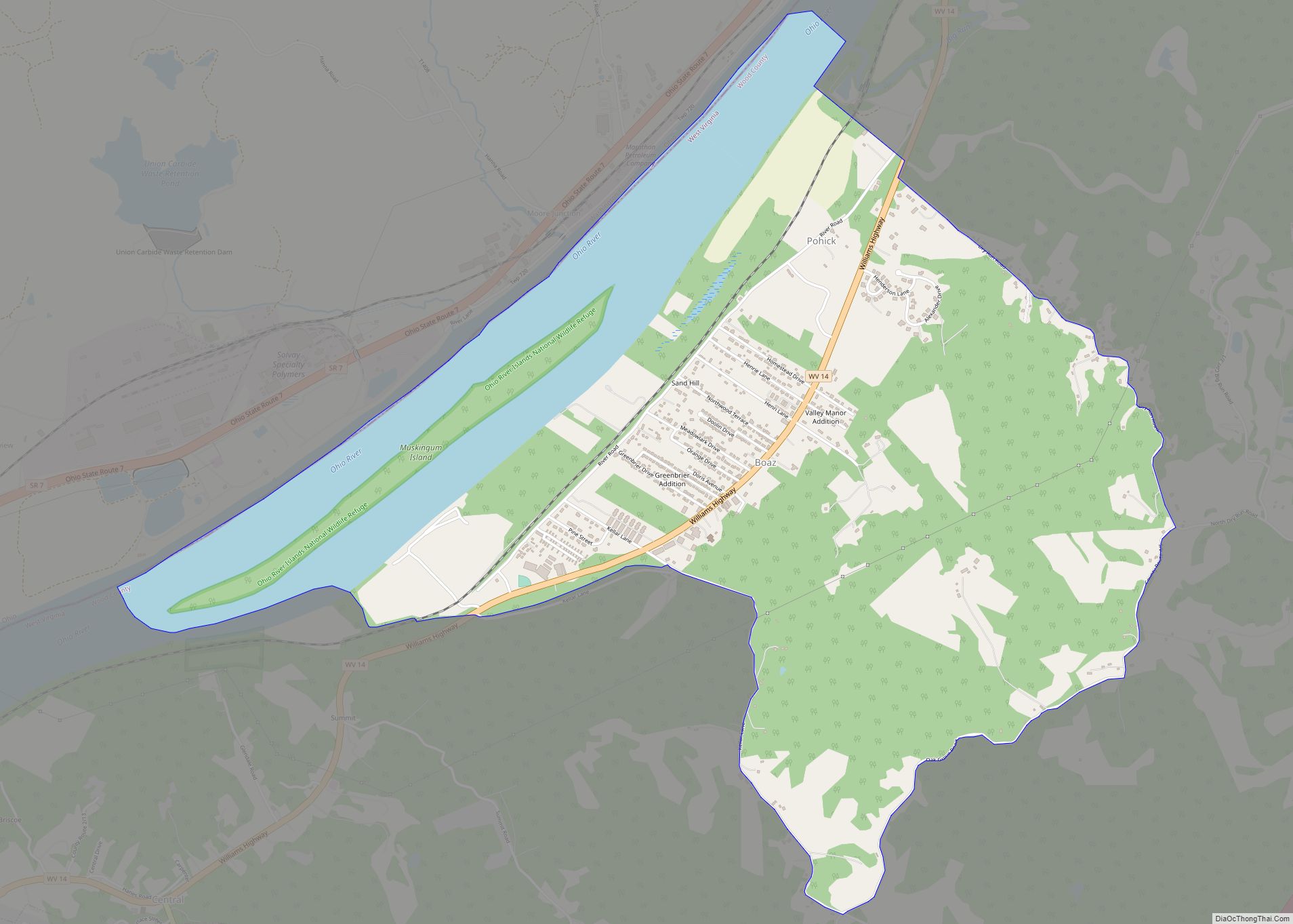
Boaz is a census-designated place (CDP) in Wood County, West Virginia, United States. It is part of the Parkersburg–Marietta–Vienna, WV-OH Metropolitan Statistical Area. As of the 2020 census, the CDP population was 1,321. The community was named in 1878 by the United States Post Office Department, which selected from three names suggested by a resident ... Read more
Map of Boaz CDP, West Virginia
Map of Bluewell CDP
Bluewell, West Virginia is an unincorporated census-designated place on U.S. Route 52 in Mercer County, West Virginia, United States. As of the 2010 census, its population is 2,184. It is the terminus of West Virginia Route 20. The community has no post office, its residences being a part of Bluefield for postal purposes. Its name ... Read more
Map of Bluewell CDP
Map of Bluefield city, West Virginia
Bluefield is a city in Mercer County, West Virginia, United States. The population was 9,658 at the 2020 census. It is the principal city of the Bluefield micropolitan area extending into Virginia, which had a population of 106,363 in 2020. Bluefield city overview: Name: Bluefield city LSAD Code: 25 LSAD Description: city (suffix) State: West ... Read more
Map of Bluefield city, West Virginia
Map of Blennerhassett CDP
Blennerhassett is a census-designated place (CDP) in Wood County, West Virginia, United States. It is part of the Parkersburg–Marietta–Vienna, WV-OH Metropolitan Statistical Area. The population was 3,089 at the 2010 census. Blennerhassett CDP overview: Name: Blennerhassett CDP LSAD Code: 57 LSAD Description: CDP (suffix) State: West Virginia County: Wood County Elevation: 781 ft (238 m) Total Area: ... Read more
Map of Blennerhassett CDP
Map of Bridgeport city, West Virginia
Bridgeport is a city in eastern Harrison County, West Virginia, United States. The population was 9,325 at the 2020 census. It is part of the Clarksburg micropolitan area in North Central West Virginia. Bridgeport had its beginning in pre-American Revolutionary War times. In 1764, John Simpson entered the area and gave his name to Simpson ... Read more
Map of Bridgeport city, West Virginia
Map of Carolina CDP, West Virginia
Carolina is a census-designated place (CDP) in Marion County, West Virginia, United States. Carolina is 2 miles (3.2 km) north-northwest of Worthington. Carolina has a post office with ZIP code 26563. As of the 2010 census, its population was 411. The community was named after Caroline Watson, a daughter of mining executive James Watson. Carolina CDP ... Read more
Map of Carolina CDP, West Virginia
Map of Capon Bridge town
Capon Bridge is a town in eastern Hampshire County, West Virginia, United States, along the Northwestern Turnpike (U.S. Route 50), approximately 20 miles (32 km) west of Winchester, Virginia. The population was 418 at the 2020 census. Originally known as “Glencoe”, Capon Bridge was incorporated in 1902 by the Hampshire County Circuit Court. It is named ... Read more
Map of Capon Bridge town
Map of Cairo town, West Virginia
Cairo (/ˈkɛəroʊ/ KAIR-oh) is a town in Ritchie County, West Virginia, United States, along West Virginia Route 31, the North Fork of the Hughes River, and the North Bend Rail Trail. The population was 174 at the 2020 census. Cairo town overview: Name: Cairo town LSAD Code: 43 LSAD Description: town (suffix) State: West Virginia ... Read more
Map of Cairo town, West Virginia