Bluefield is a city in Mercer County, West Virginia, United States. The population was 9,658 at the 2020 census. It is the principal city of the Bluefield micropolitan area extending into Virginia, which had a population of 106,363 in 2020.
| Name: | Bluefield city |
|---|---|
| LSAD Code: | 25 |
| LSAD Description: | city (suffix) |
| State: | West Virginia |
| County: | Mercer County |
| Elevation: | 2,612 ft (796 m) |
| Land Area: | 9.03 sq mi (23.39 km²) |
| Water Area: | 0.00 sq mi (0.00 km²) |
| Population Density: | 1,069/sq mi (412.9/km²) |
| ZIP code: | 24701 |
| FIPS code: | 5408524 |
| GNISfeature ID: | 1553939 |
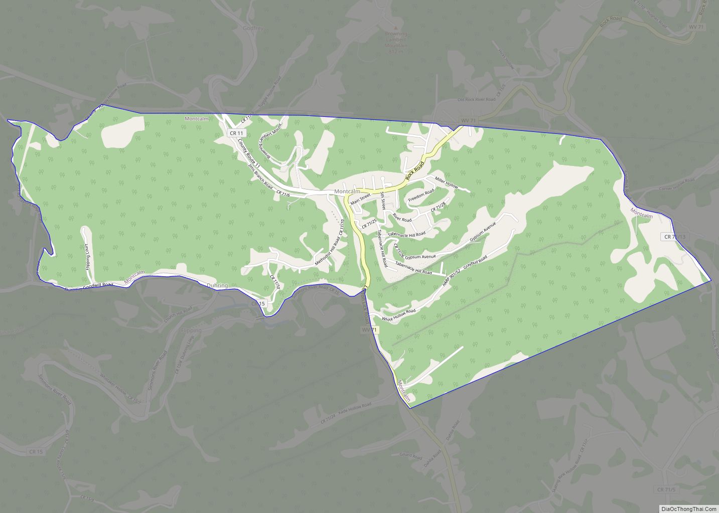
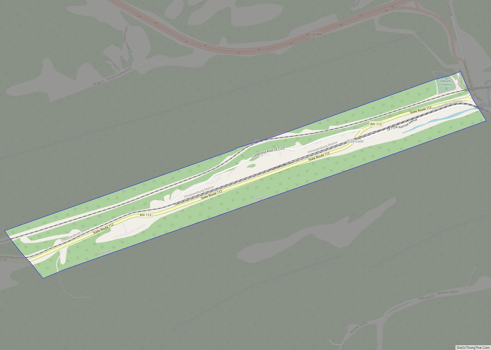
Online Interactive Map
Click on ![]() to view map in "full screen" mode.
to view map in "full screen" mode.
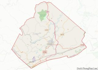
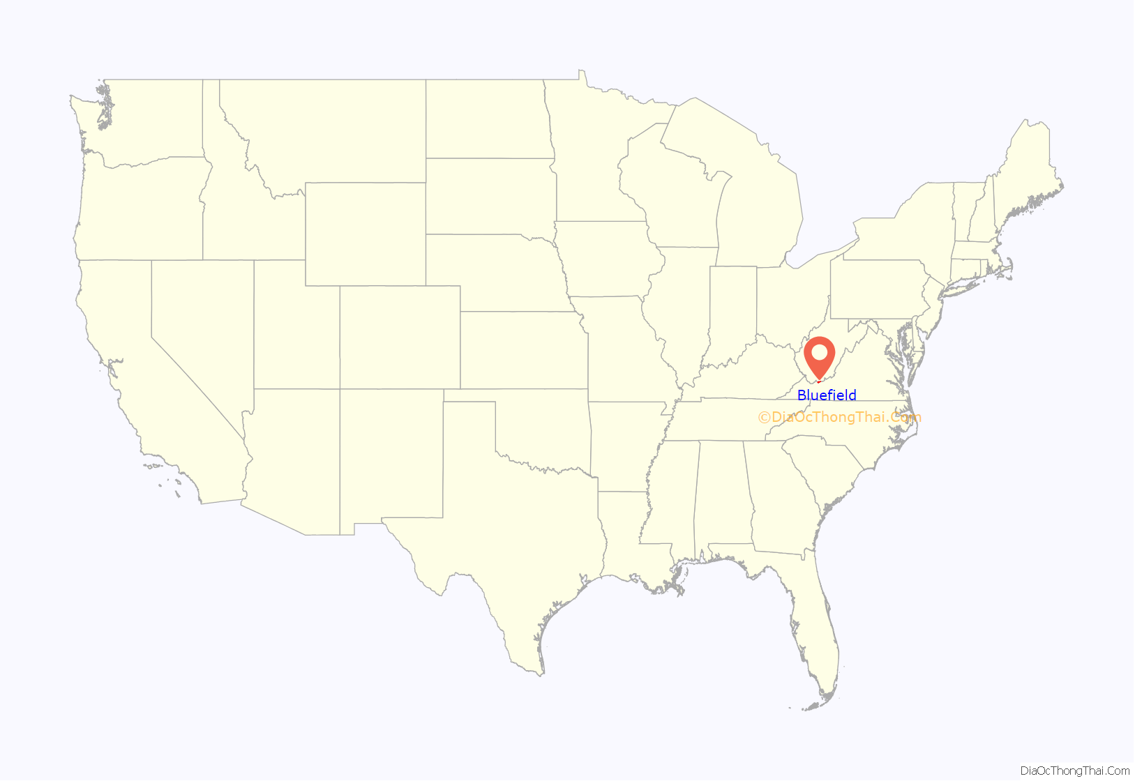
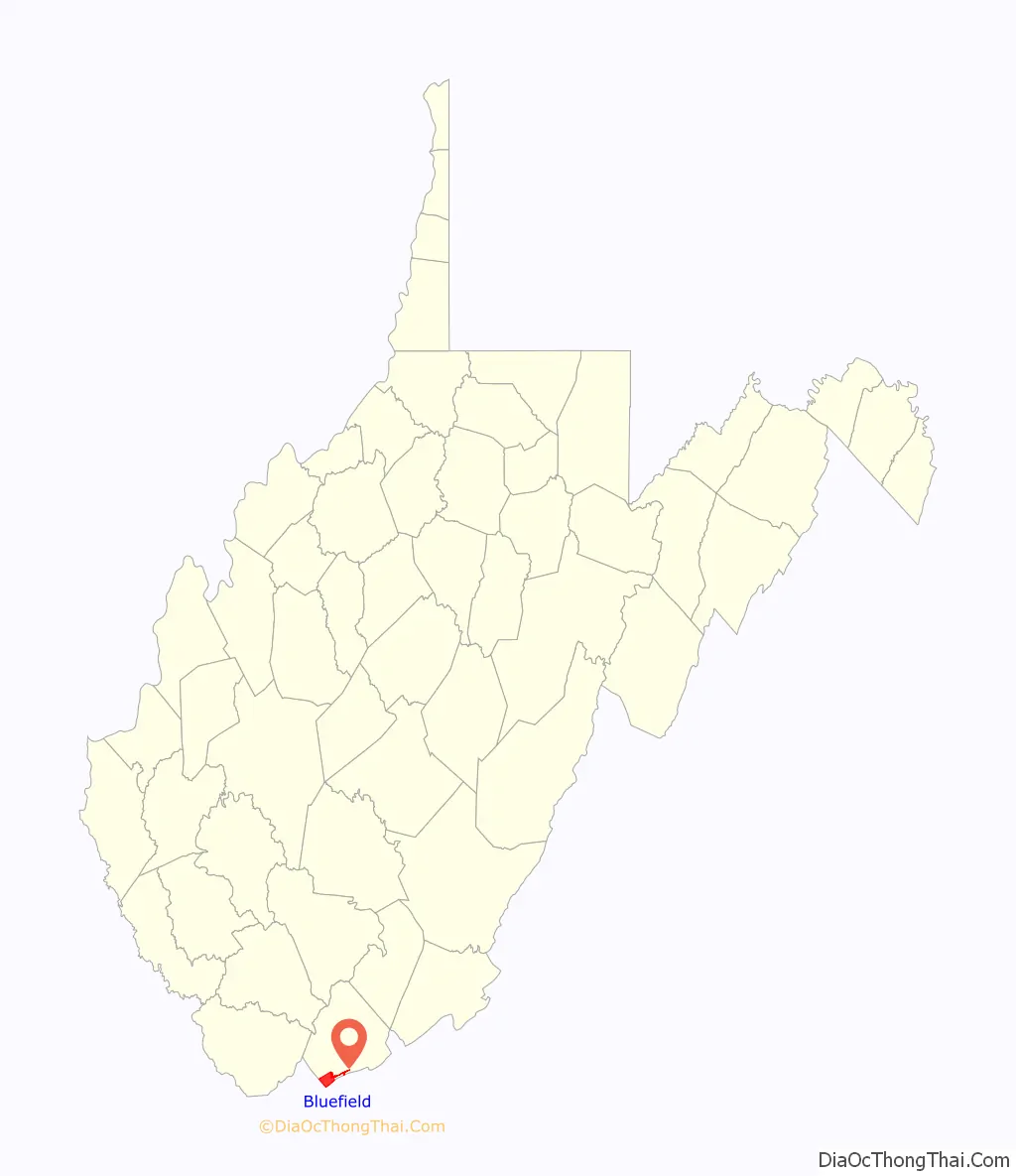
Bluefield location map. Where is Bluefield city?
History
The European-American history of Bluefield began in the 18th century, when the Davidson and Bailey families settled in a rugged and remote part of what is now southern West Virginia. Others joined them and they built a small village with a mill, a church, a one-room schoolhouse, and a fort for defending the settlement against invasions by the Shawnee tribe, which had a village on the banks of the Bluestone River.
In 1882, the descendants of the Davidson and Bailey family sold a portion of their land, when Captain John Fields of the Norfolk and Western Railway pioneered the area and began building a new railroad through the hills of Bluefield. The city is traditionally thought to be named after the chicory flowers in the area, which give the fields a purplish blue hue during the summer. Research has shown that this settlement, also known as Higginbotham’s Summit in the 1880s, was probably named for the coal fields that were developed in the area of the Bluestone River.
Coal rush
Beneath the land of the Davidsons and Baileys lay the largest and richest deposit of bituminous coal in the world. The first seam was discovered in nearby Pocahontas, Virginia in the backyard of Jordan Nelson. President Frederick Kimball of the Norfolk and Western Railway described this as the “most spectacular find on the continent and indeed perhaps of the entire planet.” The coal seam had been mentioned much earlier in Thomas Jefferson’s Notes on the State of Virginia, but it was not mined until 1882. Around that time, coal mines were developed in the area around Harman, Bluefield, War, and Pocahontas, which together were known as the Pocahontas Coal Fields. They helped support the Industrial Revolution in the United States. The development of the coal industry in this area created a boom in the local and national economy and attracted immigrant European workers and migrant African Americans from the Deep South to the mountains in search of industrial work.
In the late 19th century, the Norfolk and Western Railway Company selected Bluefield as the site for a repair center and a major division point, which greatly stimulated the town’s growth. In the one-year period from 1887 to 1888, passenger travel along the railroad increased 317%. As with the extremely accelerated growth of San Francisco during the gold rush, Bluefield became a city that seemed to spring up “overnight.” Growth far outpaced the existing infrastructure. Urban sprawl and blight were common complaints in the early days, as workers crowded into aging housing.
The growth and decay of the city depended almost entirely upon Norfolk and Western Railroad. When coal tonnage was good and the market for coal was booming, Bluefield was essentially a “Little New York,” as it was called in the day. A bustling metropolis, it had a nightlife and a personality that was “a little bit Chicago, a little bit New York, and a whole lot of Pittsburgh”—rugged and with steel and coal embedded in its soul.
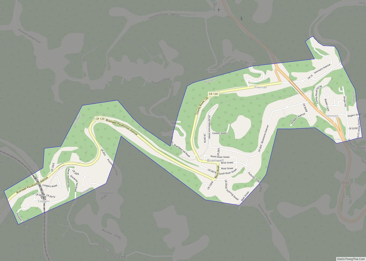
The coal boom generated a flood of money in the area. Nearby Bramwell, incorporated in 1888, boasted that it was the “Millionaires’ Town” because more millionaires per capita lived there than anywhere in the nation. The city also had more automobiles per capita than any other city in the country. In 1889, the city of Bluefield was officially incorporated.
With a strong Black community, Bluefield was the site of the 1895 founding of the Bluefield Colored Institute, an historically black college. It developed as today’s Bluefield State University. It is known as “The Whitest Historically Black College in America”.
20th century
During the 1920s, the twelve-story West Virginian Hotel was built. It has been adapted and in the 21st century is operated as the West Virginia Manor and Retirement Home. In 1924, nearby Graham, Virginia decided to rename itself as Bluefield to try to unite the two towns, which had been feuding since the civil war. Nobel Prize-winning economist and mathematician John Forbes Nash was born in Bluefield in 1928. George Marshall Palmer, the well-renowned Purdue University Professor of aeronautics and director of the AerospaceSciences Laboratory at Purdue, lead of the invention of the Boeing wind tunnel and a pioneer in the aerodynamic and structural testing of skyscrapers was born in Bluefield in 1921.
The Great Depression was particularly damaging to Bluefield. With the government nearly bankrupt, after a series of devastating structural fires swept through the downtown area, the city was nearly destroyed. It was not until the outbreak of World War II that coal production revived. The strategic importance of the city was so great that Adolf Hitler put Bluefield on his reputed list of German air raid targets in the United States. Air raid practice drills were common in the city during this time.
The Interstate Highway System was constructed through East River Mountain on December 20, 1974; for the first time automobile traffic could reach the city without crossing the top of the mountain. The dependence on the railroads waned and restructuring changed the industry. Bluefield lost jobs and population as a result. Its Amtrak station closed in the 1980s. Mercer Mall, the area’s major shopping mall, opened in 1980.
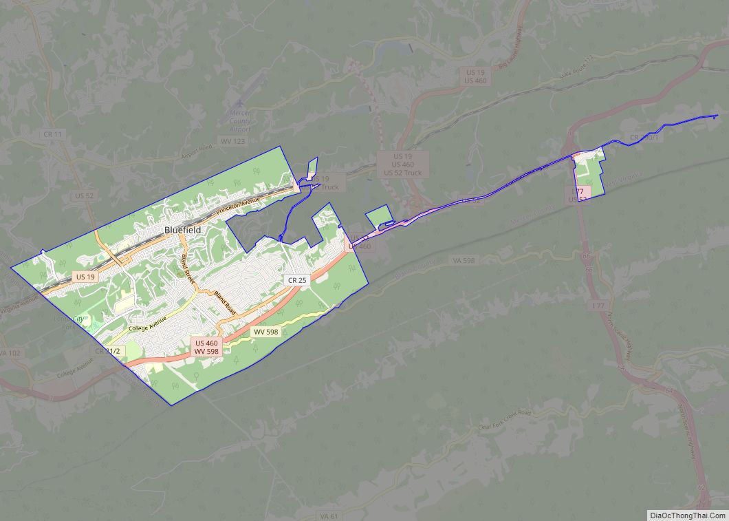
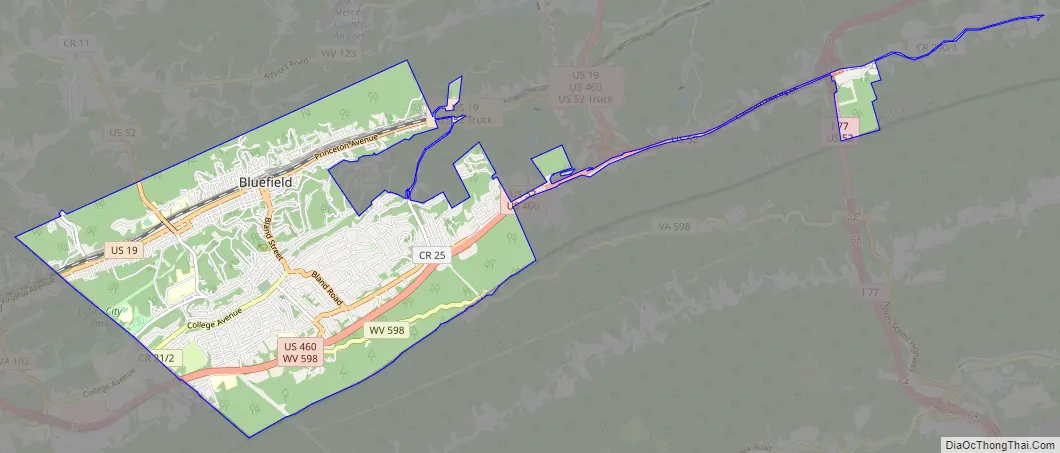
Bluefield Road Map
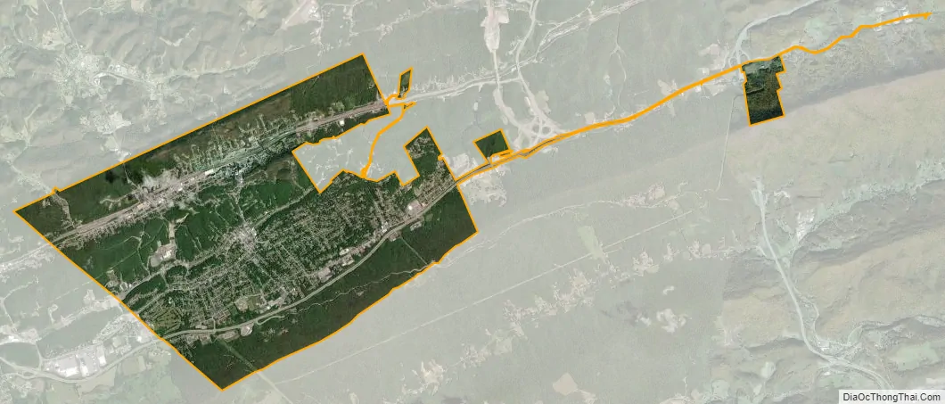
Bluefield city Satellite Map
Geography
Bluefield is located at 37°15′44″N 81°13′7″W / 37.26222°N 81.21861°W / 37.26222; -81.21861 (37.262219, -81.218674) in the Appalachian Mountains of West Virginia across the state border from Bluefield, Virginia.
According to the United States Census Bureau, the town has a total area of 8.86 square miles (22.95 km), all land.
Climate
Bluefield is a mountain city with a warm-summer humid continental climate (Dfb) bordering on subtropical highland climate or temperate oceanic climate (Cfb), due to its elevation. It is characterized by moderately cold, snowy winters and pleasantly warm to hot summers. The normal monthly mean daily temperature ranges from 31.9 °F (−0.1 °C) in January to 70.3 °F (21.3 °C) in July; on average, there are only 2.5 days with a maximum of at least 90 °F (32 °C) or greater maxima, 1.3 days of minima at or below 0 °F (−18 °C), and 23 days where the maximum does not rise above freezing. The hottest temperature ever recorded in the city was 99 °F (37 °C), set on July 28, 1952, and August 9, 1957, with the coldest temperature at −25 °F (−32 °C), set on December 30, 1917.
See also
Map of West Virginia State and its subdivision:- Barbour
- Berkeley
- Boone
- Braxton
- Brooke
- Cabell
- Calhoun
- Clay
- Doddridge
- Fayette
- Gilmer
- Grant
- Greenbrier
- Hampshire
- Hancock
- Hardy
- Harrison
- Jackson
- Jefferson
- Kanawha
- Lewis
- Lincoln
- Logan
- Marion
- Marshall
- Mason
- McDowell
- Mercer
- Mineral
- Mingo
- Monongalia
- Monroe
- Morgan
- Nicholas
- Ohio
- Pendleton
- Pleasants
- Pocahontas
- Preston
- Putnam
- Raleigh
- Randolph
- Ritchie
- Roane
- Summers
- Taylor
- Tucker
- Tyler
- Upshur
- Wayne
- Webster
- Wetzel
- Wirt
- Wood
- Wyoming
- Alabama
- Alaska
- Arizona
- Arkansas
- California
- Colorado
- Connecticut
- Delaware
- District of Columbia
- Florida
- Georgia
- Hawaii
- Idaho
- Illinois
- Indiana
- Iowa
- Kansas
- Kentucky
- Louisiana
- Maine
- Maryland
- Massachusetts
- Michigan
- Minnesota
- Mississippi
- Missouri
- Montana
- Nebraska
- Nevada
- New Hampshire
- New Jersey
- New Mexico
- New York
- North Carolina
- North Dakota
- Ohio
- Oklahoma
- Oregon
- Pennsylvania
- Rhode Island
- South Carolina
- South Dakota
- Tennessee
- Texas
- Utah
- Vermont
- Virginia
- Washington
- West Virginia
- Wisconsin
- Wyoming