Map of Fort Ashby CDP
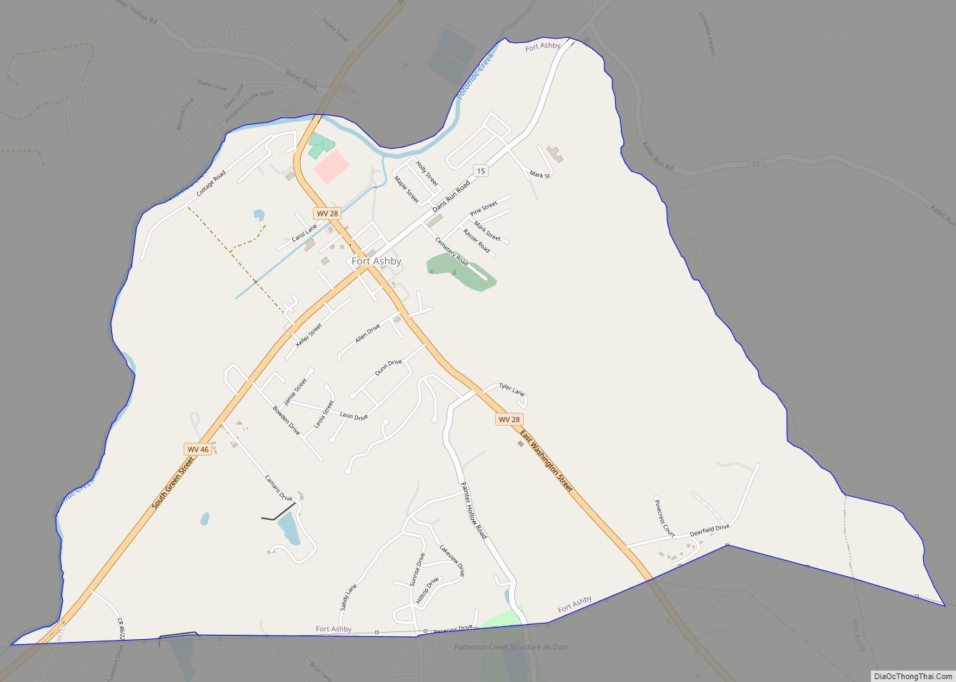
Fort Ashby is a census-designated place (CDP) in Mineral County, West Virginia, United States, along Patterson Creek. It is part of the Cumberland, MD–WV Metropolitan Statistical Area. The population was 1,380 at the 2010 census. The community was originally chartered as Frankfort and then known as Alaska before it took the name of its well-known ... Read more
Map of Fort Ashby CDP
Map of Elkins city, West Virginia
Elkins is a city in and the county seat of Randolph County, West Virginia, United States, along the Tygart Valley River. The community was incorporated in 1890 and named in honor of Stephen Benton Elkins, a U.S. Senator from West Virginia. The population was 6,950 at the 2020 census and estimated at 6,895 in 2021. ... Read more
Map of Elkins city, West Virginia
Map of Elk Garden town
Elk Garden is a town in Mineral County, West Virginia, United States. It is part of the ‘Cumberland, MD–WV Metropolitan Statistical Area’. The population was 211 at the 2020 census. Elk Garden High School was consolidated into Keyser High School in 1997. However the Primary School is still in session, offering classes from Pre-Kindergarten through ... Read more
Map of Elk Garden town
Map of Fenwick CDP, West Virginia
Fenwick is a census-designated place (CDP) in eastern Nicholas County, West Virginia, United States, adjacent to and immediately west of Richwood. As of the 2010 census, its population was 116. The town is situated at the bottomland surrounding the mouth of the Big Laurel Creek at its confluence with the Cherry River and has an ... Read more
Map of Fenwick CDP, West Virginia
Map of Gilbert Creek CDP
Gilbert Creek is a census-designated place (CDP) in Mingo County, West Virginia, United States. The population was 1,090 at the 2010 census. The community takes its name from nearby Gilbert Creek. Gilbert Creek CDP overview: Name: Gilbert Creek CDP LSAD Code: 57 LSAD Description: CDP (suffix) State: West Virginia County: Mingo County Elevation: 1,106 ft (337 m) ... Read more
Map of Gilbert Creek CDP
Map of Ghent CDP, West Virginia
Ghent /ˈdʒɛnt/ is a census-designated place in Raleigh County in the U.S. state of West Virginia. As of the 2010 census, its population was 457. Ghent CDP overview: Name: Ghent CDP LSAD Code: 57 LSAD Description: CDP (suffix) State: West Virginia County: Raleigh County Elevation: 2,986 ft (910 m) Total Area: 1.612 sq mi (4.18 km²) Land Area: 1.281 sq mi (3.32 km²) ... Read more
Map of Ghent CDP, West Virginia
Map of Gauley Bridge town
Gauley Bridge is a town in Fayette County, West Virginia, United States. The population was 614 at the 2010 census. The Kanawha River is formed at Gauley Bridge by the confluence of the New and Gauley Rivers. Two miles to the southeast of Gauley Bridge, in Glen Ferris, is Kanawha Falls, a popular stopping point ... Read more
Map of Gauley Bridge town
Map of Gary city, West Virginia
Gary is a city located along the Tug Fork River in McDowell County, West Virginia, United States. According to the 2020 census, the city had a population of 762. It was named for Elbert Henry Gary, one of the founders of U.S. Steel. The former coal towns of Elbert, Filbert, Thorpe, and Wilcoe became part ... Read more
Map of Gary city, West Virginia
Map of Glenville town, West Virginia
Glenville is a town in and the county seat of Gilmer County, West Virginia, United States, along the Little Kanawha River. The population was 1,128 at the 2020 census. It is the home of Glenville State University. Glenville town overview: Name: Glenville town LSAD Code: 43 LSAD Description: town (suffix) State: West Virginia County: Gilmer ... Read more
Map of Glenville town, West Virginia
Map of Frank CDP
Frank is a census-designated place (CDP) in Pocahontas County, West Virginia, United States. The population was 90 at the 2010 census. It was named to honor Frank Hoffman in 1926. Hoffman was the proprietor of a local tannery. The unemployment rate in Frank is 6.2% (U.S. avg. is 3.9%). Compared to the rest of the ... Read more
Map of Frank CDP
Map of Glen Fork CDP
Glen Fork is a census-designated place (CDP) in Wyoming County, West Virginia, United States. As of the 2010 census, its population was 487. The confluence of the Laurel Fork and its tributary, the Glen Fork, is located in the community. Glen Fork CDP overview: Name: Glen Fork CDP LSAD Code: 57 LSAD Description: CDP (suffix) ... Read more
Map of Glen Fork CDP
Map of Glen Dale city
Glen Dale is a city in Marshall County, West Virginia, United States, along the Ohio River. It is part of the Wheeling, West Virginia Metropolitan Statistical Area. The population was 1,514 at the 2020 census. Glen Dale was incorporated in 1924. It is in the northwest part of the county, which is above the Mason–Dixon ... Read more
Map of Glen Dale city