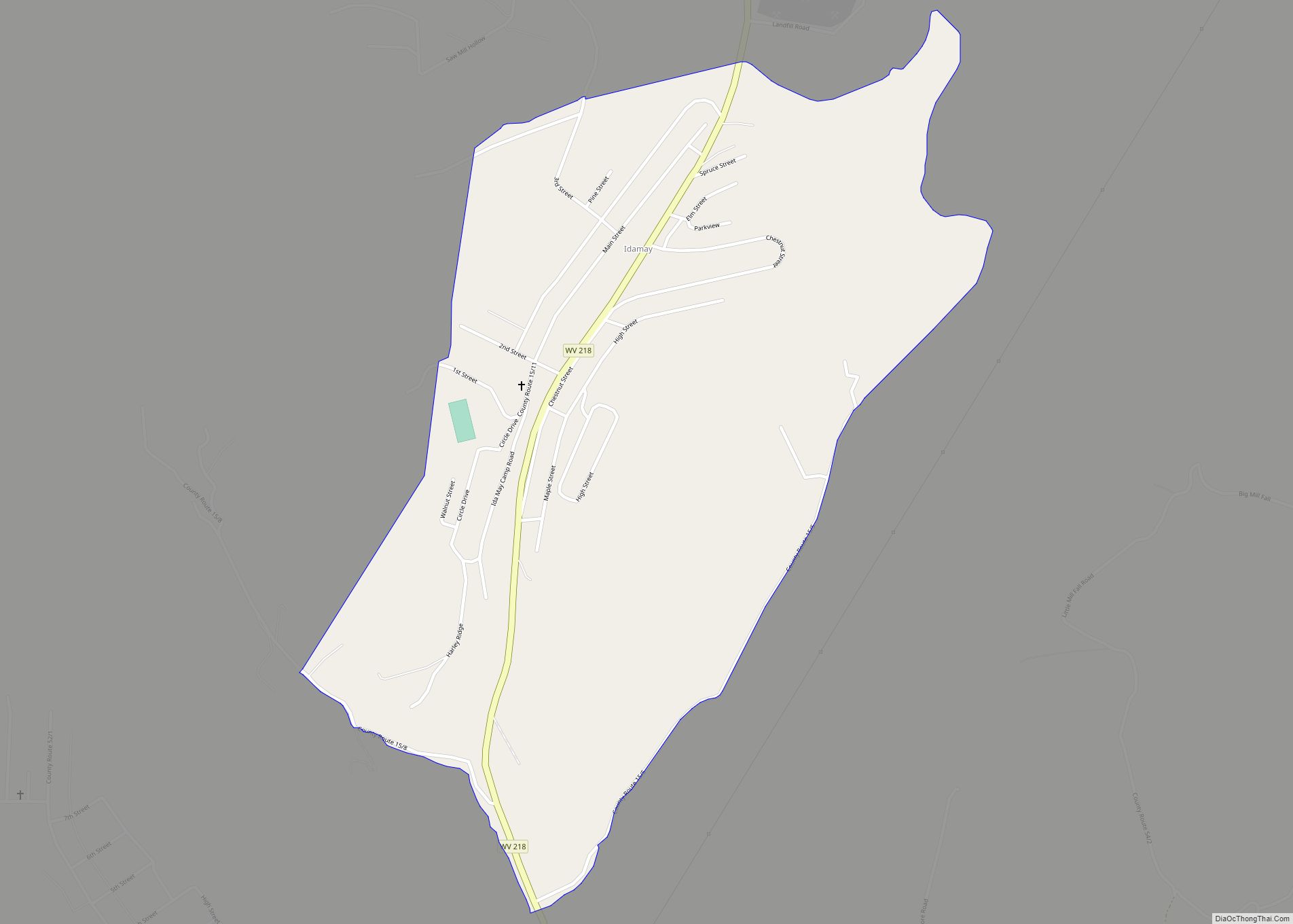
Map of North Rock Springs CDP

Map of North Rock Springs CDP

North Rock Springs is a census-designated place (CDP) in Sweetwater County, Wyoming, United States. The population was 2,207 at the 2010 census. North Rock Springs CDP overview: Name: North Rock Springs CDP LSAD Code: 57 LSAD Description: CDP (suffix) State: Wyoming County: Sweetwater County Elevation: 6,487 ft (1,977 m) Total Area: 14.78 sq mi (38.3 km²) Land Area: 14.75 sq mi (38.2 km²) … Read more

Map of Nordic CDP

Map of Nordic CDP

Nordic is a census-designated place (CDP) in Lincoln County, Wyoming, United States. The population was 602 at the 2010 census. Nordic CDP overview: Name: Nordic CDP LSAD Code: 57 LSAD Description: CDP (suffix) State: Wyoming County: Lincoln County Elevation: 6,120 ft (1,870 m) Total Area: 5.1 sq mi (13.1 km²) Land Area: 5.1 sq mi (13.1 km²) Water Area: 0.0 sq mi (0.0 km²) Total Population: … Read more

Map of Newcastle city, Wyoming

Map of Newcastle city, Wyoming

Newcastle is a city in and the county seat of Weston County, Wyoming, United States. The population was 3,374 at the 2020 census. Newcastle city overview: Name: Newcastle city LSAD Code: 25 LSAD Description: city (suffix) State: Wyoming County: Weston County Elevation: 4,327 ft (1,319 m) Total Area: 2.56 sq mi (6.63 km²) Land Area: 2.56 sq mi (6.63 km²) Water Area: 0.00 sq mi … Read more

Map of Mountain View CDP, Wyoming

Map of Mountain View CDP, Wyoming

Mountain View is a census-designated place in Natrona County, Wyoming, United States. It is part of the Casper, Wyoming Metropolitan Statistical Area. The population was 96 at the 2010 census. Mountain View CDP overview: Name: Mountain View CDP LSAD Code: 57 LSAD Description: CDP (suffix) State: Wyoming County: Natrona County Elevation: 5,200 ft (1,600 m) Total Area: … Read more

Map of Moose Wilson Road CDP

Map of Moose Wilson Road CDP

Moose Wilson Road is a census-designated place (CDP) in Teton County, Wyoming, United States. The population was 1,821 at the 2010 census. It is part of the Jackson, WY–ID Micropolitan Statistical Area. Moose Wilson Road CDP overview: Name: Moose Wilson Road CDP LSAD Code: 57 LSAD Description: CDP (suffix) State: Wyoming County: Teton County Elevation: … Read more

Map of Moorcroft town

Map of Moorcroft town

Moorcroft is a town in Crook County, Wyoming, United States. The population was 946 at the 2020 census. Moorcroft town overview: Name: Moorcroft town LSAD Code: 43 LSAD Description: town (suffix) State: Wyoming County: Crook County Elevation: 4,226 ft (1,288 m) Total Area: 1.26 sq mi (3.27 km²) Land Area: 1.26 sq mi (3.27 km²) Water Area: 0.00 sq mi (0.00 km²) Total Population: 946 Population … Read more

Map of Mills town

Map of Mills town

Mills is a town in Natrona County, Wyoming, United States. It is part of the Casper, Wyoming Metropolitan Statistical Area. The population was 3,461 at the 2010 census. Mills town overview: Name: Mills town LSAD Code: 43 LSAD Description: town (suffix) State: Wyoming County: Natrona County Elevation: 5,125 ft (1,562 m) Total Area: 2.99 sq mi (7.74 km²) Land Area: … Read more

Map of Midwest town

Map of Midwest town

Midwest is a town in Natrona County, Wyoming, United States. It is part of the Casper, Wyoming Metropolitan Statistical Area. The population was 404 at the 2010 census. Midwest town overview: Name: Midwest town LSAD Code: 43 LSAD Description: town (suffix) State: Wyoming County: Natrona County Elevation: 4,849 ft (1,478 m) Total Area: 0.49 sq mi (1.27 km²) Land Area: … Read more

Map of Meeteetse town

Map of Meeteetse town

Meeteetse is a town in Park County, Wyoming, United States. The population was 327 at the 2010 census. Meeteetse town overview: Name: Meeteetse town LSAD Code: 43 LSAD Description: town (suffix) State: Wyoming County: Park County Elevation: 5,751 ft (1,753 m) Total Area: 0.87 sq mi (2.26 km²) Land Area: 0.87 sq mi (2.26 km²) Water Area: 0.00 sq mi (0.00 km²) Total Population: 327 Population … Read more

Map of Medicine Bow town

Map of Medicine Bow town

Medicine Bow is a town in Carbon County, Wyoming, United States. Its population was 284 at the 2010 census. Medicine Bow town overview: Name: Medicine Bow town LSAD Code: 43 LSAD Description: town (suffix) State: Wyoming County: Carbon County Elevation: 6,565 ft (2,001 m) Total Area: 3.46 sq mi (8.96 km²) Land Area: 3.46 sq mi (8.96 km²) Water Area: 0.00 sq mi (0.00 km²) Total … Read more

Map of Meadow Acres CDP

Map of Meadow Acres CDP

Meadow Acres is a census-designated place (CDP) in Natrona County, Wyoming, United States. It is part of the Casper, Wyoming Metropolitan Statistical Area. The population was 198 at the 2010 census. Meadow Acres CDP overview: Name: Meadow Acres CDP LSAD Code: 57 LSAD Description: CDP (suffix) State: Wyoming County: Natrona County Elevation: 5,046 ft (1,538 m) Total … Read more

Map of Osmond CDP, Wyoming

Map of Osmond CDP, Wyoming

Osmond is a census-designated place (CDP) in Lincoln County, Wyoming, United States. The population was 397 at the 2010 census. Osmond CDP overview: Name: Osmond CDP LSAD Code: 57 LSAD Description: CDP (suffix) State: Wyoming County: Lincoln County Elevation: 6,329 ft (1,929 m) Total Area: 3.2 sq mi (8.4 km²) Land Area: 3.2 sq mi (8.4 km²) Water Area: 0.0 sq mi (0.0 km²) Total Population: … Read more