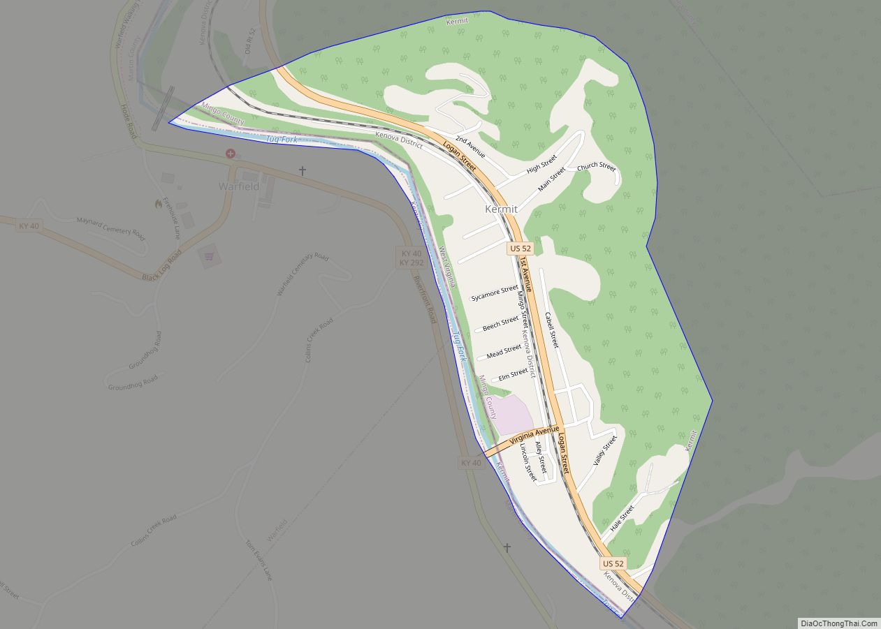
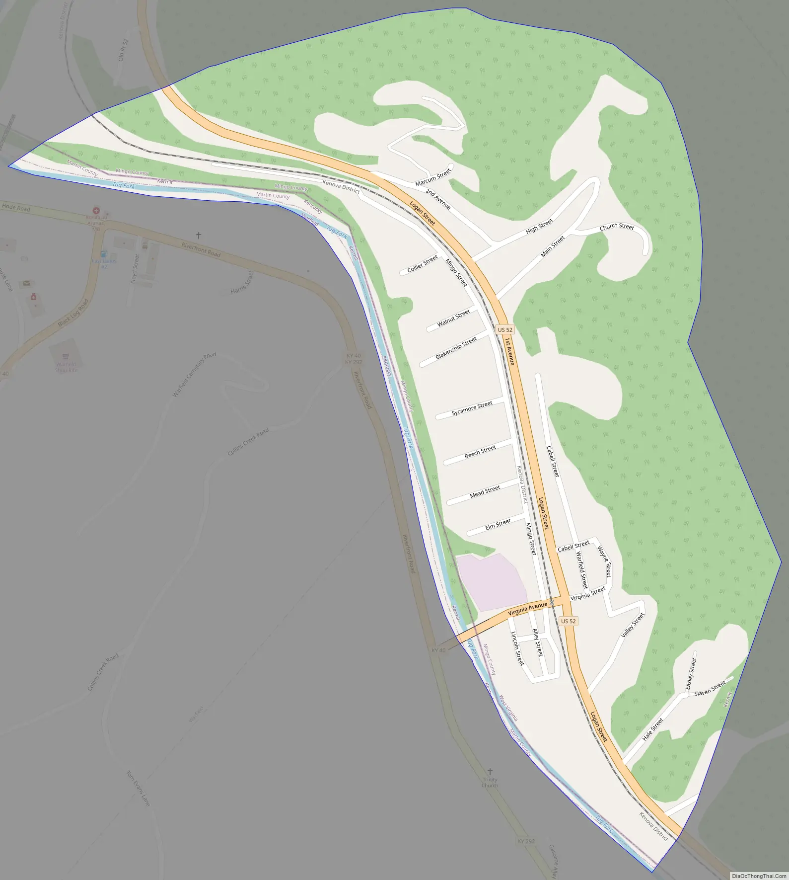
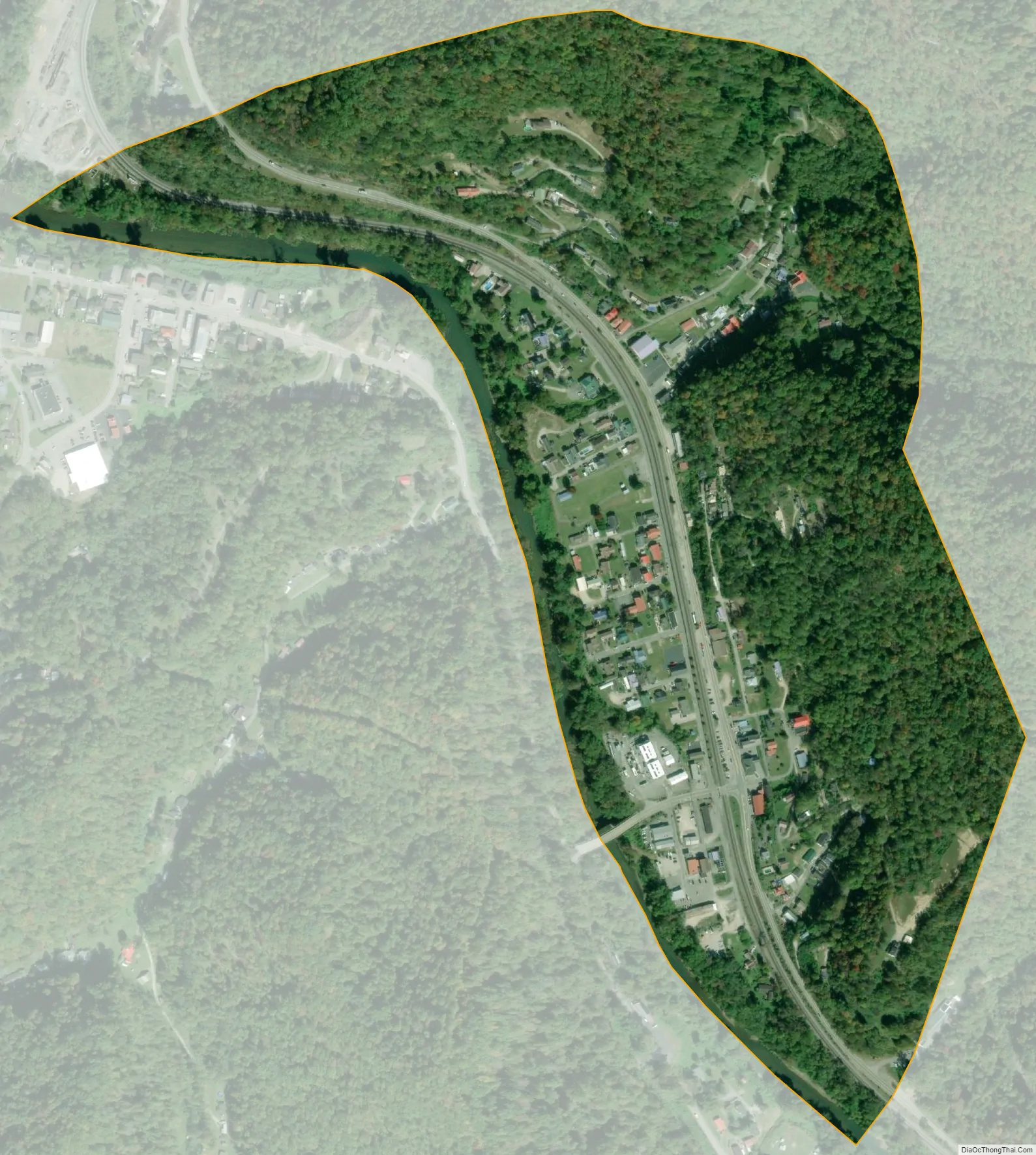
Kermit is a town in Mingo County, West Virginia, United States. The population was 406 at the 2010 census. Kermit is located along the Tug Fork, opposite Warfield, Kentucky. The Norfolk Southern Railway’s Kenova District runs through town.
The community was earlier known by the names “Lower Burning Creek”, “East Warfield,” and “Warfield.” The name was changed to “Kermit” when a post office was established in 1906. Kermit was named for Kermit Roosevelt, son of President Theodore Roosevelt, and incorporated in 1909.
| Name: | Kermit town |
|---|---|
| LSAD Code: | 43 |
| LSAD Description: | town (suffix) |
| State: | West Virginia |
| County: | Mingo County |
| Elevation: | 633 ft (193 m) |
| Total Area: | 0.39 sq mi (1.02 km²) |
| Land Area: | 0.39 sq mi (1.02 km²) |
| Water Area: | 0.00 sq mi (0.00 km²) |
| Total Population: | 406 |
| Population Density: | 890.31/sq mi (343.71/km²) |
| ZIP code: | 25674 |
| Area code: | 304 |
| FIPS code: | 5443300 |
| GNISfeature ID: | 1541162 |
Online Interactive Map
Click on ![]() to view map in "full screen" mode.
to view map in "full screen" mode.
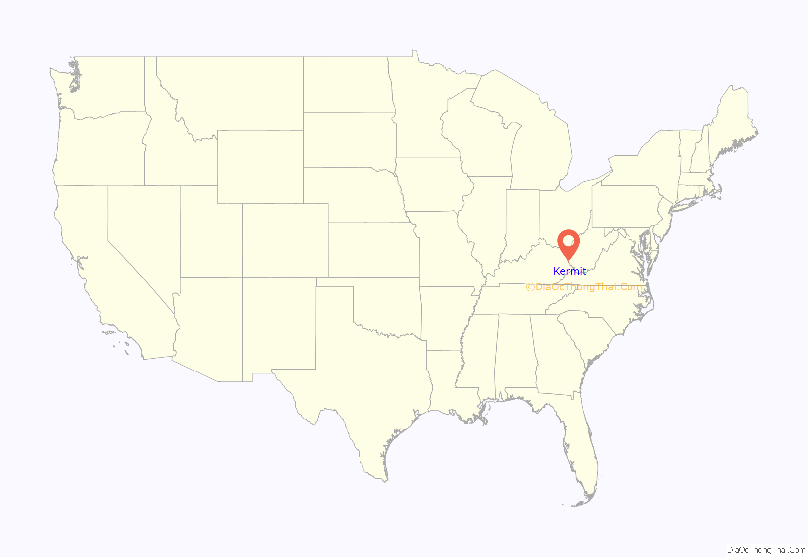
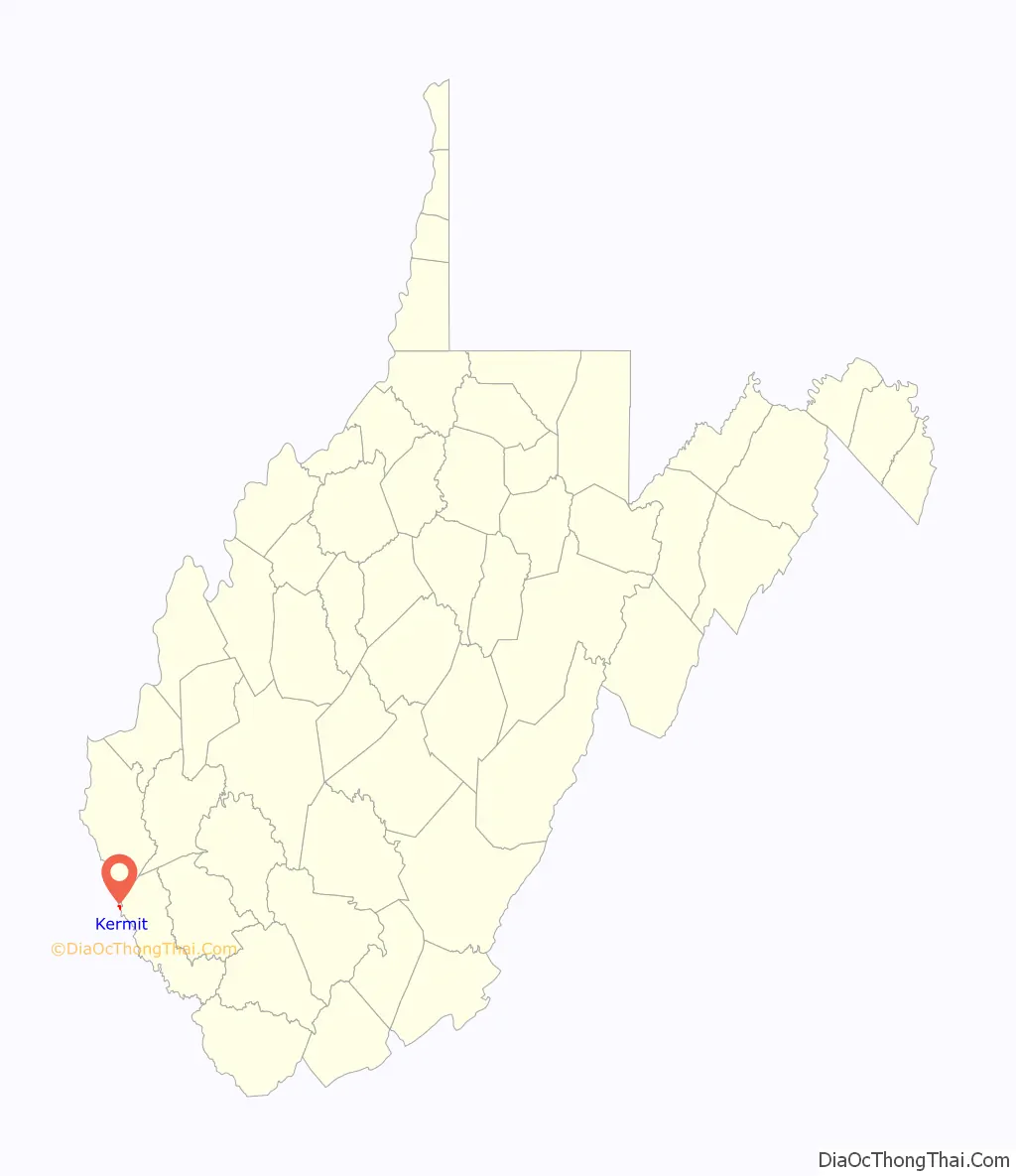
Kermit location map. Where is Kermit town?
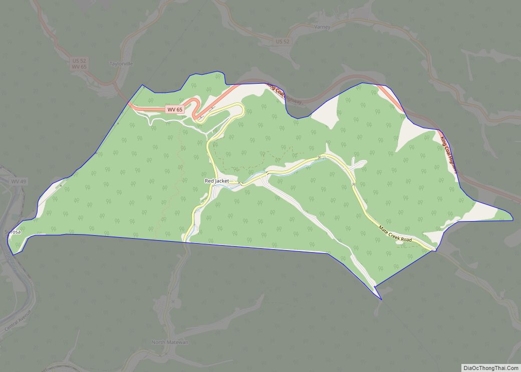
Kermit Road Map
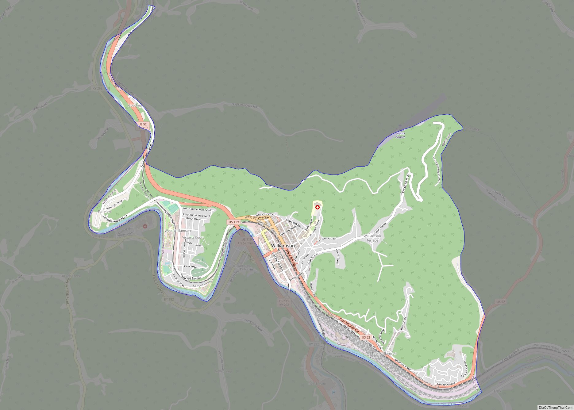
Kermit city Satellite Map
Geography
Kermit is located in the northwestern corner of Mingo County at 37°50′27″N 82°24′34″W / 37.84083°N 82.40944°W / 37.84083; -82.40944 (37.840783, -82.409465). It primarily occupies bottomland along the eastern bank of the Tug Fork, opposite Warfield, Kentucky. Many of the town’s primary municipal buildings and other public buildings lie in a hollow in the northeastern part of town along Main Street and High Street.
U.S. Route 52 (Logan Avenue) traverses Kermit, connecting the town with Williamson to the south and Kenova to the north. A vehicular and pedestrian bridge connects Kermit with Kentucky Route 292 across the Tug Fork in Warfield. The Norfolk Southern railroad tracks run roughly parallel to US-52.
According to the United States Census Bureau, the town has a total area of 0.39 square miles (1.01 km), all land.
Climate
The climate in this area is characterized by hot, humid summers and generally mild to cool winters. According to the Köppen Climate Classification system, Kermit has a humid subtropical climate, abbreviated “Cfa” on climate maps.
See also
Map of West Virginia State and its subdivision:- Barbour
- Berkeley
- Boone
- Braxton
- Brooke
- Cabell
- Calhoun
- Clay
- Doddridge
- Fayette
- Gilmer
- Grant
- Greenbrier
- Hampshire
- Hancock
- Hardy
- Harrison
- Jackson
- Jefferson
- Kanawha
- Lewis
- Lincoln
- Logan
- Marion
- Marshall
- Mason
- McDowell
- Mercer
- Mineral
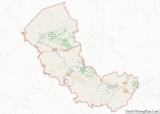
- Mingo
- Monongalia
- Monroe
- Morgan
- Nicholas
- Ohio
- Pendleton
- Pleasants
- Pocahontas
- Preston
- Putnam
- Raleigh
- Randolph
- Ritchie
- Roane
- Summers
- Taylor
- Tucker
- Tyler
- Upshur
- Wayne
- Webster
- Wetzel
- Wirt
- Wood
- Wyoming
- Alabama
- Alaska
- Arizona
- Arkansas
- California
- Colorado
- Connecticut
- Delaware
- District of Columbia
- Florida
- Georgia
- Hawaii
- Idaho
- Illinois
- Indiana
- Iowa
- Kansas
- Kentucky
- Louisiana
- Maine
- Maryland
- Massachusetts
- Michigan
- Minnesota
- Mississippi
- Missouri
- Montana
- Nebraska
- Nevada
- New Hampshire
- New Jersey
- New Mexico
- New York
- North Carolina
- North Dakota
- Ohio
- Oklahoma
- Oregon
- Pennsylvania
- Rhode Island
- South Carolina
- South Dakota
- Tennessee
- Texas
- Utah
- Vermont
- Virginia
- Washington
- West Virginia
- Wisconsin
- Wyoming