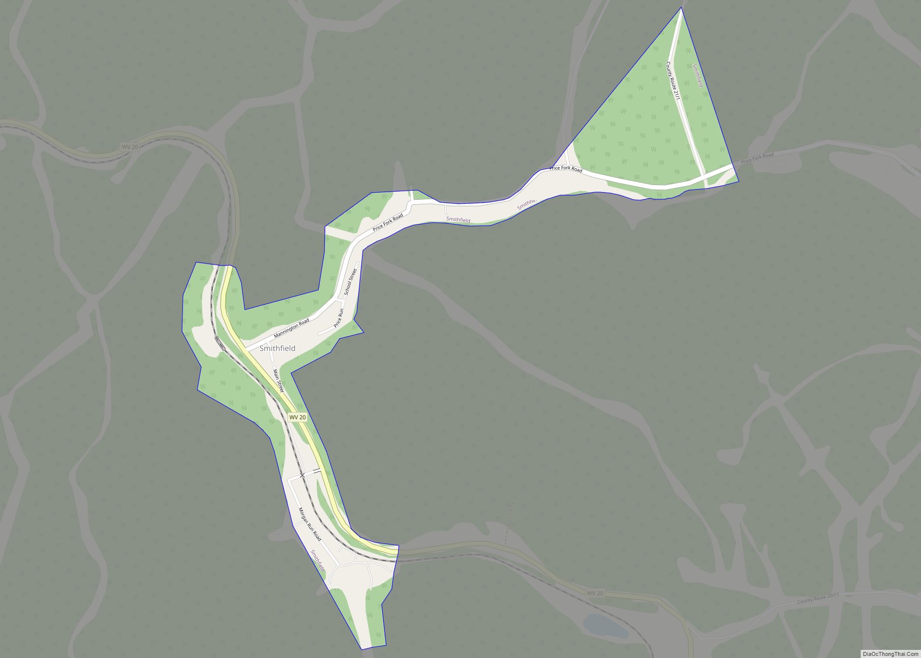
Map of Valley Grove village
Valley Grove is a village in Ohio County, West Virginia, United States. It is part of the Wheeling, West Virginia Metropolitan Statistical Area. The population was 378 at the 2010 census. The village was named from a nearby recreational area at a grove in a valley. Valley Grove village overview: Name: Valley Grove village LSAD ... Read more
Map of Valley Grove village
Map of Washington CDP, West Virginia
Washington is a census-designated place (CDP) in Wood County, West Virginia, United States, situated along the Ohio River. It is part of the Parkersburg–Marietta–Vienna, WV-OH Metropolitan Statistical Area. The population was 1,175 at the 2010 census. The community was named after George Washington. The CDP is home to the Washington Works, one of the largest ... Read more
Map of Washington CDP, West Virginia
Map of Vienna city, West Virginia
Vienna (/viˈɛnə/) is a city in Wood County, West Virginia, United States, situated along the Ohio River. The population was 10,676 at the 2020 census. It is the second-largest city in the Parkersburg–Vienna metropolitan area. Vienna city overview: Name: Vienna city LSAD Code: 25 LSAD Description: city (suffix) State: West Virginia County: Wood County Elevation: ... Read more
Map of Vienna city, West Virginia
Map of Waverly CDP, West Virginia
Waverly (also known as Bull Creek and Union School District) is a census-designated place (CDP) in northeastern Wood County, West Virginia, United States. As of the 2010 census, its population was 395. It lies along the Ohio River on West Virginia Route 2, northeast of the city of Parkersburg, the county seat of Wood County. ... Read more
Map of Waverly CDP, West Virginia
Map of Antelope Hills CDP
Antelope Hills is a census-designated place in Natrona County, Wyoming, United States. It is part of the Casper, Wyoming Metropolitan Statistical Area. The population was 97 at the 2010 census. Antelope Hills CDP overview: Name: Antelope Hills CDP LSAD Code: 57 LSAD Description: CDP (suffix) State: Wyoming County: Natrona County Elevation: 5,722 ft (1,744 m) Total Area: ... Read more
Map of Antelope Hills CDP
Map of Alta CDP, Wyoming
Alta is a census-designated place (CDP) in Teton County, Wyoming, United States. The population was 394 at the 2010 census. It is part of the Jackson, WY–ID Micropolitan Statistical Area, and it is located between Driggs, Idaho and the Grand Targhee ski resort. Alta CDP overview: Name: Alta CDP LSAD Code: 57 LSAD Description: CDP ... Read more
Map of Alta CDP, Wyoming
Map of Alpine town, Wyoming
Alpine is a town in Lincoln County, Wyoming, United States. The population was 828 at the 2010 census. Alpine town overview: Name: Alpine town LSAD Code: 43 LSAD Description: town (suffix) State: Wyoming County: Lincoln County Elevation: 5,633 ft (1,717 m) Total Area: 1.00 sq mi (2.58 km²) Land Area: 0.99 sq mi (2.57 km²) Water Area: 0.00 sq mi (0.01 km²) Total Population: 828 Population ... Read more
Map of Alpine town, Wyoming
Map of Alpine Northwest CDP
Alpine Northwest is a census-designated place (CDP) in Lincoln County, Wyoming, United States. The population was 244 at the 2010 census. Alpine Northwest CDP overview: Name: Alpine Northwest CDP LSAD Code: 57 LSAD Description: CDP (suffix) State: Wyoming County: Lincoln County Total Area: 1.4 sq mi (3.7 km²) Land Area: 1.4 sq mi (3.7 km²) Water Area: 0.0 sq mi (0.0 km²) Total Population: ... Read more
Map of Alpine Northwest CDP
Map of Alpine Northeast CDP
Alpine Northeast is a census-designated place in Lincoln County, Wyoming, United States. The population was 196 at the 2010 census. Alpine Northeast CDP overview: Name: Alpine Northeast CDP LSAD Code: 57 LSAD Description: CDP (suffix) State: Wyoming County: Lincoln County Total Area: 5.0 sq mi (13.1 km²) Land Area: 5.0 sq mi (13.1 km²) Water Area: 0.0 sq mi (0.0 km²) Total Population: 196 ... Read more
Map of Alpine Northeast CDP
Map of Alcova CDP
Alcova is a census-designated place (CDP) in Natrona County, Wyoming, United States. It is part of the Casper, Wyoming Metropolitan Statistical Area. The population was 34 at the 2020 census. Wyoming’s center of population is located in the small Town of Alcova. Alcova and the nearby reservoir, Alcova Lake, are popular vacation spots with many ... Read more
Map of Alcova CDP
Map of Albany CDP, Wyoming
Albany is a census-designated place (CDP) in Albany County, Wyoming, United States. The population was 55 at the 2010 census. Albany CDP overview: Name: Albany CDP LSAD Code: 57 LSAD Description: CDP (suffix) State: Wyoming County: Albany County Elevation: 8,327 ft (2,538 m) Total Area: 11.0 sq mi (28 km²) Land Area: 11.0 sq mi (28 km²) Water Area: 0 sq mi (0 km²) Total Population: ... Read more
Map of Albany CDP, Wyoming
Map of Basin town, Wyoming
Basin is a town in, and the county seat of, Big Horn County, Wyoming, United States. The population was 1,225 at the 2020 census. The community is located near the center of the Bighorn Basin with the Big Horn River east of the town. Basin’s post office, built in 1919, is listed on the National ... Read more
Map of Basin town, Wyoming