Map of Anvik city

Map of Anvik city

Anvik (Deg Xinag: Gitr’ingith Chagg) is a city, home to the Deg Hit’an people, in the Yukon-Koyukuk Census Area, Alaska, United States. The name Anvik, meaning “exit” in the Central Alaskan Yup’ik language, became the common usage despite multiple names at the time, and may have come from early Russian explorers. The native name in … Read more

Map of Aniak city

Map of Aniak city

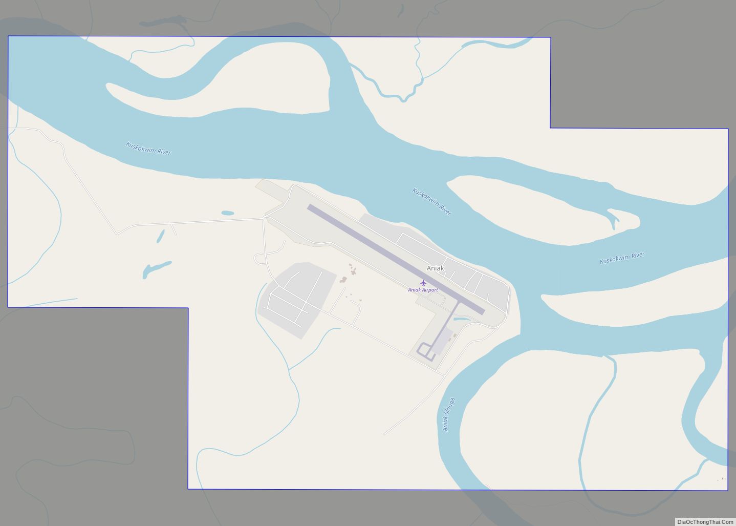
Aniak (Central Yupik: Anyaraq) is a city in the Bethel Census Area in the U.S. state of Alaska. At the 2010 census the population was 501, down from 572 in 2000. Aniak city overview: Name: Aniak city LSAD Code: 25 LSAD Description: city (suffix) State: Alaska County: Bethel Census Area Incorporated: May 10, 1972 Elevation: … Read more

Map of Atqasuk city

Map of Atqasuk city

Atqasuk (Inupiaq pronunciation: [ɐtqɐsuk]) is a city in North Slope Borough, Alaska, United States. The population was 276 at the 2020 census and 233 as of the 2010 census. Atqasuk city overview: Name: Atqasuk city LSAD Code: 25 LSAD Description: city (suffix) State: Alaska County: North Slope Borough Incorporated: October 10, 1982 Elevation: 56 ft (17 m) Total … Read more

Map of Atmautluak CDP

Map of Atmautluak CDP

Atmautluak (Central Yupik: Atmaulluaq) is a census-designated place (CDP) in Bethel Census Area, Alaska, United States. The population was 277 at the 2010 census, down from 294 in 2000. Atmautluak CDP overview: Name: Atmautluak CDP LSAD Code: 57 LSAD Description: CDP (suffix) State: Alaska County: Bethel Census Area Total Area: 3.37 sq mi (8.74 km²) Land Area: 0.60 sq mi … Read more

Map of Atka city

Map of Atka city

Atka (Aleut: Atx̂ax̂, Russian: Атка) is a small city located on the east side of Atka Island, in Aleutians West Census Area, Alaska, United States. The population was 53 at the 2020 census, down from 61 in 2010. The population of Atka is nearly entirely Aleut (Unangan). The major industry is fishing. Atka city overview: … Read more

Map of Bear Creek CDP

Map of Bear Creek CDP, Alaska

Bear Creek is a census-designated place (CDP) in Kenai Peninsula Borough, Alaska, United States. At the 2020 census the population was 2,129 up from 1,956 in 2010. Bear Creek is a few miles north of Seward near the stream of the same name and its source, Bear Lake. Bear Creek CDP overview: Name: Bear Creek … Read more

Map of Badger CDP

Map of Badger CDP, Alaska

Badger is a census-designated place (CDP) in the Fairbanks North Star Borough of Alaska. It was one of the CDPs created in 2010 out of small suburbs and outskirts of Fairbanks. It has an area of 66.71 sq. mi, 65.63 of land and 1.08 of water. The population of the CDP was 19,031 as of … Read more

Map of Attu Station CDP

Map of Attu Station CDP

Attu Station is a census-designated place (CDP) located on Attu Island in the Aleutians West Census Area in the U.S. state of Alaska. The population was 21 at the 2010 census, consisting entirely of coast guard personnel who resided and worked at Casco Cove Coast Guard Station, but left the island when the station was … Read more

Map of Bethel city

Map of Bethel city, Alaska

Bethel (Central Yupik: Mamterilleq) is a city in Bethel Census Area, Alaska, United States. It is the largest community on the Kuskokwim River, located approximately 50 mi (80 km) upriver from where the river flows into Kuskokwim Bay. It is also the largest city in western Alaska and in the Unorganized Borough, as well as the eighth-largest … Read more

Map of Beluga CDP

Map of Beluga CDP

Beluga is a census-designated place (CDP) in Kenai Peninsula Borough, Alaska, United States. The population was 20 at the 2010 census, down from 32 in 2000. Beluga CDP overview: Name: Beluga CDP LSAD Code: 57 LSAD Description: CDP (suffix) State: Alaska County: Kenai Peninsula Borough Elevation: 112 ft (34 m) Total Area: 99.84 sq mi (258.58 km²) Land Area: 99.13 sq mi … Read more

Map of Beaver CDP

Map of Beaver CDP, Alaska

Beaver (Ts’aahudaaneekk’onh Denh in Koyukon) is a census-designated place (CDP) in Yukon-Koyukuk Census Area, Alaska, United States. At the 2010 census the population was 84, unchanged from 2000. Beaver CDP overview: Name: Beaver CDP LSAD Code: 57 LSAD Description: CDP (suffix) State: Alaska County: Yukon-Koyukuk Census Area Total Area: 21.04 sq mi (54.51 km²) Land Area: 20.52 sq mi (53.14 km²) … Read more

Map of Big Lake CDP

Map of Big Lake CDP, Alaska

Big Lake (Dena’ina: K’enaka Bena)is a census-designated place (CDP) in Matanuska-Susitna Borough, Alaska, United States. It is part of the Anchorage, Alaska Metropolitan Statistical Area. The population was 3,833 at the 2020 census, up from 3,350 in 2010. Big Lake CDP overview: Name: Big Lake CDP LSAD Code: 57 LSAD Description: CDP (suffix) State: Alaska … Read more