Map of Frytown CDP
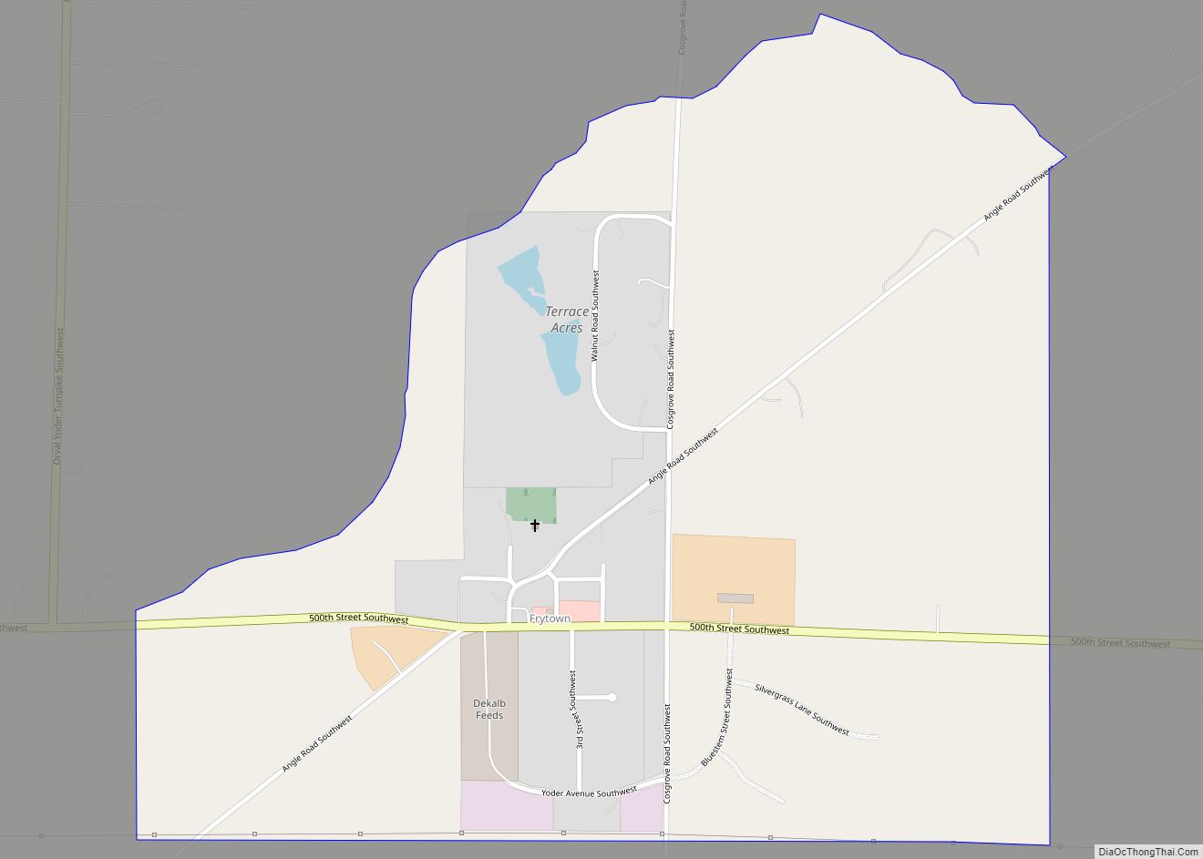
Frytown is an unincorporated community and census-designated place in Johnson County, Iowa, United States, approximately 10 miles southwest of Iowa City. The town has been known as Frytown since the 19th century, and is listed as such on state maps; the USGS once called it Williamstown, though it has since changed the name. Frytown Conservation ... Read more
Map of Frytown CDP
Map of Fruitland city, Iowa
Fruitland is a city in Muscatine County, Iowa, United States. The population was 963 at the time of the 2020 census. It is part of the Muscatine Micropolitan Statistical Area. Fruitland city overview: Name: Fruitland city LSAD Code: 25 LSAD Description: city (suffix) State: Iowa County: Muscatine County Elevation: 541 ft (165 m) Total Area: 1.80 sq mi (4.65 km²) ... Read more
Map of Fruitland city, Iowa
Map of Garden City CDP, Iowa
Garden City is an unincorporated community and census-designated place in Hardin County, Iowa, United States. As of the 2010 Census, the population was 89. Garden City CDP overview: Name: Garden City CDP LSAD Code: 57 LSAD Description: CDP (suffix) State: Iowa County: Hardin County Total Area: 1.00 sq mi (2.58 km²) Land Area: 1.00 sq mi (2.58 km²) Water Area: 0.00 sq mi ... Read more
Map of Garden City CDP, Iowa
Map of Garber city, Iowa
Garber is a city in Clayton County, Iowa, United States. The population was 76 at the time of the 2020 census, down from 103 in 2000. Garber city overview: Name: Garber city LSAD Code: 25 LSAD Description: city (suffix) State: Iowa County: Clayton County Elevation: 663 ft (202 m) Total Area: 0.23 sq mi (0.58 km²) Land Area: 0.23 sq mi (0.58 km²) ... Read more
Map of Garber city, Iowa
Map of Galva city, Iowa
Galva is a city in Ida County, Iowa, United States. The population was 435 at the time of the 2020 census. Galva city overview: Name: Galva city LSAD Code: 25 LSAD Description: city (suffix) State: Iowa County: Ida County Elevation: 1,299 ft (396 m) Total Area: 0.75 sq mi (1.95 km²) Land Area: 0.75 sq mi (1.95 km²) Water Area: 0.00 sq mi (0.00 km²) Total ... Read more
Map of Galva city, Iowa
Map of Garner city, Iowa
Garner is a city in and the county seat of Hancock County, Iowa, United States. The population was 3,065 in the 2020 census, an increase from 2,922 in 2000. Garner city overview: Name: Garner city LSAD Code: 25 LSAD Description: city (suffix) State: Iowa County: Hancock County Incorporated: November 19, 1881 Elevation: 1,211 ft (369 m) Total ... Read more
Map of Garner city, Iowa
Map of Garnavillo city
Garnavillo is a city in Clayton County, Iowa, United States. The population was 763 at the time of the 2020 census, up from 754 in 2000. Garnavillo city overview: Name: Garnavillo city LSAD Code: 25 LSAD Description: city (suffix) State: Iowa County: Clayton County Elevation: 1,063 ft (324 m) Total Area: 0.94 sq mi (2.44 km²) Land Area: 0.94 sq mi (2.44 km²) ... Read more
Map of Garnavillo city
Map of Garden Grove city, Iowa
Garden Grove is a small town in Decatur County, Iowa, United States. The population was 174 at the time of the 2020 census. Garden Grove city overview: Name: Garden Grove city LSAD Code: 25 LSAD Description: city (suffix) State: Iowa County: Decatur County Elevation: 1,112 ft (339 m) Total Area: 0.68 sq mi (1.75 km²) Land Area: 0.68 sq mi (1.75 km²) Water ... Read more
Map of Garden Grove city, Iowa
Map of Geneva city, Iowa
Geneva is a city in Franklin County, Iowa, United States. The population was 136 at the time of the 2020 census. Geneva city overview: Name: Geneva city LSAD Code: 25 LSAD Description: city (suffix) State: Iowa County: Franklin County Elevation: 1,102 ft (336 m) Total Area: 0.41 sq mi (1.06 km²) Land Area: 0.41 sq mi (1.06 km²) Water Area: 0.00 sq mi (0.00 km²) Total ... Read more
Map of Geneva city, Iowa
Map of Garwin city
Garwin is a city in Tama County, Iowa, United States. The population was 481 at the time of the 2020 census. Garwin city overview: Name: Garwin city LSAD Code: 25 LSAD Description: city (suffix) State: Iowa County: Tama County Elevation: 922 ft (281 m) Total Area: 1.01 sq mi (2.61 km²) Land Area: 1.01 sq mi (2.61 km²) Water Area: 0.00 sq mi (0.00 km²) Total ... Read more
Map of Garwin city
Map of Garrison city, Iowa
Garrison is a city in Benton County, Iowa, United States. The population was 344 at the time of the 2020 census. It is part of the Cedar Rapids Metropolitan Statistical Area. It was named for the farmer, Nelson Garrison, who had the post office in his home west of town. He owned the property.(1872). Garrison ... Read more
Map of Garrison city, Iowa
Map of Gibson city, Iowa
Gibson is a city in Keokuk County, Iowa, United States. The population was 63 at the time of the 2020 census. Gibson city overview: Name: Gibson city LSAD Code: 25 LSAD Description: city (suffix) State: Iowa County: Keokuk County Elevation: 896 ft (273 m) Total Area: 0.06 sq mi (0.16 km²) Land Area: 0.06 sq mi (0.16 km²) Water Area: 0.00 sq mi (0.00 km²) Total ... Read more
Map of Gibson city, Iowa