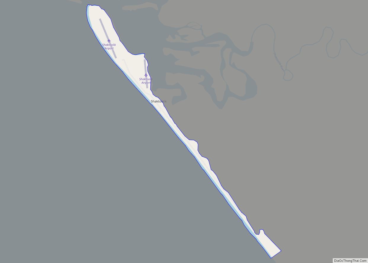
Map of Shageluk city

Map of Shageluk city

Shageluk (Deg Xinag: Łeggi Jitno’) is a city in Yukon-Koyukuk Census Area, Alaska, United States. At the 2010 census the population was 83, down from 129 in 2000. Shageluk city overview: Name: Shageluk city LSAD Code: 25 LSAD Description: city (suffix) State: Alaska County: Yukon-Koyukuk Census Area Incorporated: July 9, 1970 Elevation: 62 ft (19 m) Total … Read more

Map of Seward city

Map of Seward city, Alaska

Seward (Alutiiq: Qutalleq; Dena’ina: Tl’ubugh) is an incorporated home rule city in Alaska, United States. Located on Resurrection Bay, a fjord of the Gulf of Alaska on the Kenai Peninsula, Seward is situated on Alaska’s southern coast, approximately 120 miles (190 km) by road from Alaska’s largest city, Anchorage. With a population of 2,717 people as of … Read more

Map of Silver Springs CDP

Map of Silver Springs CDP, Alaska

Silver Springs is a census-designated place (CDP) in Copper River Census Area, Alaska, United States. At the 2020 census the population was 111, down from 114 in 2010. Silver Springs CDP overview: Name: Silver Springs CDP LSAD Code: 57 LSAD Description: CDP (suffix) State: Alaska County: Valdez-Cordova Census Area Total Area: 2.56 sq mi (6.64 km²) Land Area: … Read more

Map of Shungnak city

Map of Shungnak city

Shungnak (Inupiaq: Isiŋnaq or Nuurviuraq) is a city in Northwest Arctic Borough, Alaska, United States. At the 2010 census the population was 262, up from 256 in 2000. Shungnak city overview: Name: Shungnak city LSAD Code: 25 LSAD Description: city (suffix) State: Alaska County: Northwest Arctic Borough Incorporated: May 4, 1967 Elevation: 144 ft (44 m) Total … Read more

Map of Shishmaref city

Map of Shishmaref city

Shishmaref (/ˈʃɪʃmərɛf/ SHISH-mə-ref; Inupiaq: Qigiqtaq, IPA: [qixiqtaq]; Russian: Шишмарёв, IPA: [ʂɨʂmɐˈrʲɵf]) is a city in the Nome Census Area, Alaska, United States. It is located on Sarichef Island in the Chukchi Sea, just north of the Bering Strait and five miles from the mainland. Shishmaref lies within the Bering Land Bridge National Preserve. The population was 563 … Read more

Map of Skwentna CDP

Map of Skwentna CDP

Skwentna is a census-designated place (CDP) on Iditarod Trail in Matanuska-Susitna Borough, Alaska, United States. Located 61 miles northwest of Wasilla along the Skwentna River, it is part of the Anchorage, Alaska Metropolitan Statistical Area. At the 2020 census the population was 62, up from 37 in 2010. Skwentna CDP overview: Name: Skwentna CDP LSAD … Read more

Map of Skagway CDP

Map of Skagway CDP

The Municipality and Borough of Skagway is a first-class borough in Alaska on the Alaska Panhandle. As of the 2020 census, the population was 1,240, up from 968 in 2010. The population doubles in the summer tourist season in order to deal with more than 1,000,000 visitors each year. Incorporated as a borough on June … Read more

Map of Slana CDP

Map of Slana CDP

Slana /ˈslænə/ (Ahtena: Stl’ana’) is a census-designated place (CDP) in the Copper River Census Area in the Unorganized Borough of the U.S. state of Alaska. As of the 2020 census, the population of the CDP was 116, down from 147 in 2010. Slana CDP overview: Name: Slana CDP LSAD Code: 57 LSAD Description: CDP (suffix) … Read more

Map of South Naknek CDP

Map of South Naknek CDP

South Naknek (Central Yupik: Qinuyang) is a census-designated place (CDP) in Bristol Bay Borough, Alaska, United States. At the 2020 census the population was 67, down from 79 in 2010. South Naknek CDP overview: Name: South Naknek CDP LSAD Code: 57 LSAD Description: CDP (suffix) State: Alaska County: Bristol Bay Borough Total Area: 89.88 sq mi (232.80 km²) … Read more

Map of Soldotna city

Map of Soldotna city

Soldotna is a city in the Kenai Peninsula Borough in the U.S. state of Alaska. At the 2020 census, the population was 4,342, up from 4,163 in 2010. It is the seat of the Kenai Peninsula Borough. Soldotna is located in the Southcentral portion of Alaska on the central-western portion of the Kenai Peninsula. The … Read more

Map of Sleetmute CDP

Map of Sleetmute CDP

Sleetmute (Central Yupik: Cellitemiut; Deg Xinag: Tovisq’oł) is a census-designated place (CDP) in Bethel Census Area, Alaska, United States. At the 2010 census the population was 86, down from 100 in 2000. Sleetmute CDP overview: Name: Sleetmute CDP LSAD Code: 57 LSAD Description: CDP (suffix) State: Alaska County: Bethel Census Area Total Area: 104.72 sq mi (271.23 km²) Land … Read more

Map of St. Mary's city

Map of St. Mary’s city, Alaska

St. Mary’s (Central Yupik: Negeqliq) is a city in Kusilvak Census Area, Alaska, United States. The adjacent village of Andreafsky (historically known as Clear River) joined with St. Mary’s in 1980. At the 2010 census the population was 507, up from 500 in 2000. By 2018, the population was estimated to be 567. Within Saint … Read more