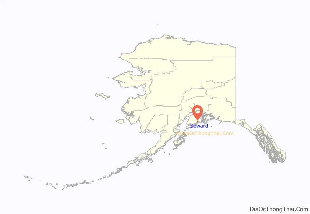
Seward (Alutiiq: Qutalleq; Dena’ina: Tl’ubugh) is an incorporated home rule city in Alaska, United States. Located on Resurrection Bay, a fjord of the Gulf of Alaska on the Kenai Peninsula, Seward is situated on Alaska’s southern coast, approximately 120 miles (190 km) by road from Alaska’s largest city, Anchorage.
With a population of 2,717 people as of the 2020 census, Seward is the fourth-largest city in the Kenai Peninsula Borough, behind Kenai, Homer, and the borough seat of Soldotna. The city is named for former United States Secretary of State William H. Seward, who orchestrated the United States’ purchase of Alaska from the Russian Empire in 1867 while serving in this position as part of President Andrew Johnson’s administration.
Seward is the southern terminus of the Alaska Railroad and the historic starting point of the original Iditarod Trail to Interior Alaska, with Mile 0 of the trail marked on the shoreline at the southern end of town.
| Name: | Seward city |
|---|---|
| LSAD Code: | 25 |
| LSAD Description: | city (suffix) |
| State: | Alaska |
| County: | Kenai Peninsula Borough |
| Incorporated: | June 1, 1912 |
| Elevation: | 0 ft (0 m) |
| Total Area: | 21.89 sq mi (56.69 km²) |
| Land Area: | 13.96 sq mi (36.16 km²) |
| Water Area: | 7.93 sq mi (20.54 km²) |
| Total Population: | 2,717 |
| Population Density: | 194.63/sq mi (75.15/km²) |
| ZIP code: | 99664 |
| Area code: | 907 |
| FIPS code: | 0268560 |
| GNISfeature ID: | 1414598 |
| Website: | www.cityofseward.us |
Online Interactive Map
Click on ![]() to view map in "full screen" mode.
to view map in "full screen" mode.
Seward location map. Where is Seward city?
History
In 1793, Alexander Baranov of the Shelikhov-Golikov company (precursor of the Russian-American Company) established a fur trade post on Resurrection Bay where Seward is today and had a three-masted vessel, the Phoenix, built at the post by James Shields, an English shipwright in Russian service.
The 1939 Slattery Report on Alaskan development identified the region as one of the areas where new settlements would be established through Jewish immigration. This plan was never implemented.
Seward was an important port for the military buildup in Alaska during World War II. Fort Raymond was established in Seward along the Resurrection River to protect the community. An Army airfield built in Seward during the war later became Walseth Air Force Base. Both of the military facilities were closed shortly after the end of the war.
A large portion of Seward was damaged by shaking and a local tsunami during the 1964 Alaska earthquake.
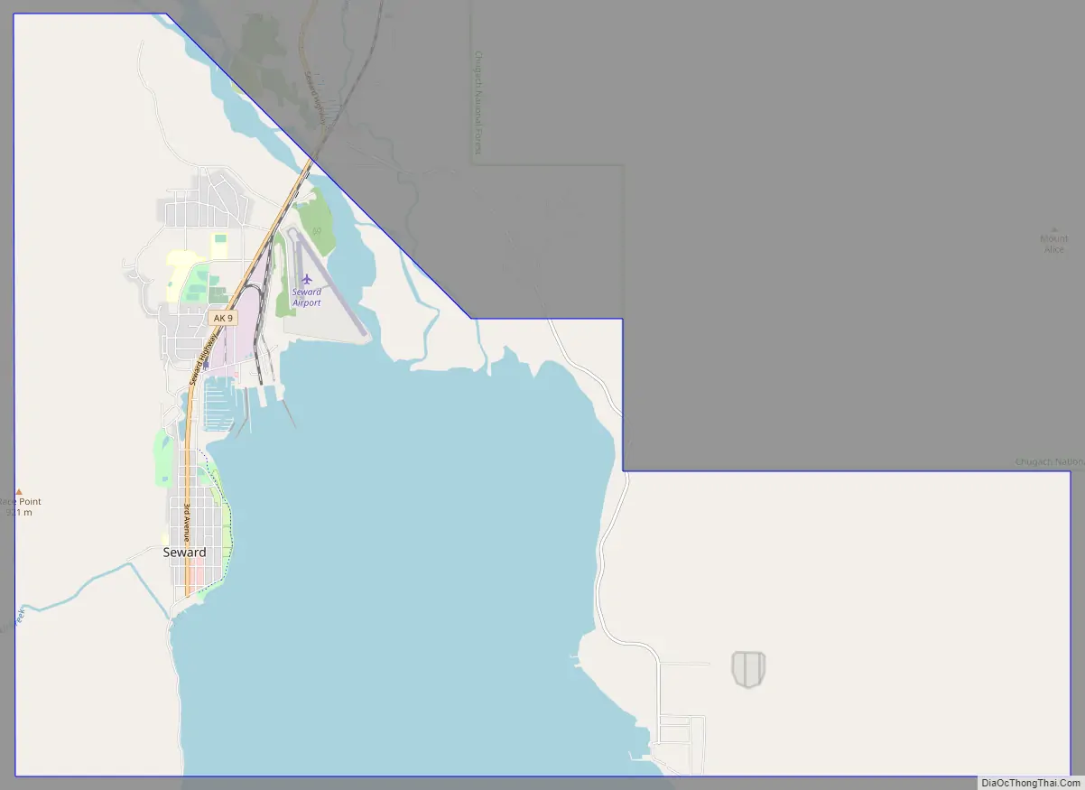
Seward Road Map
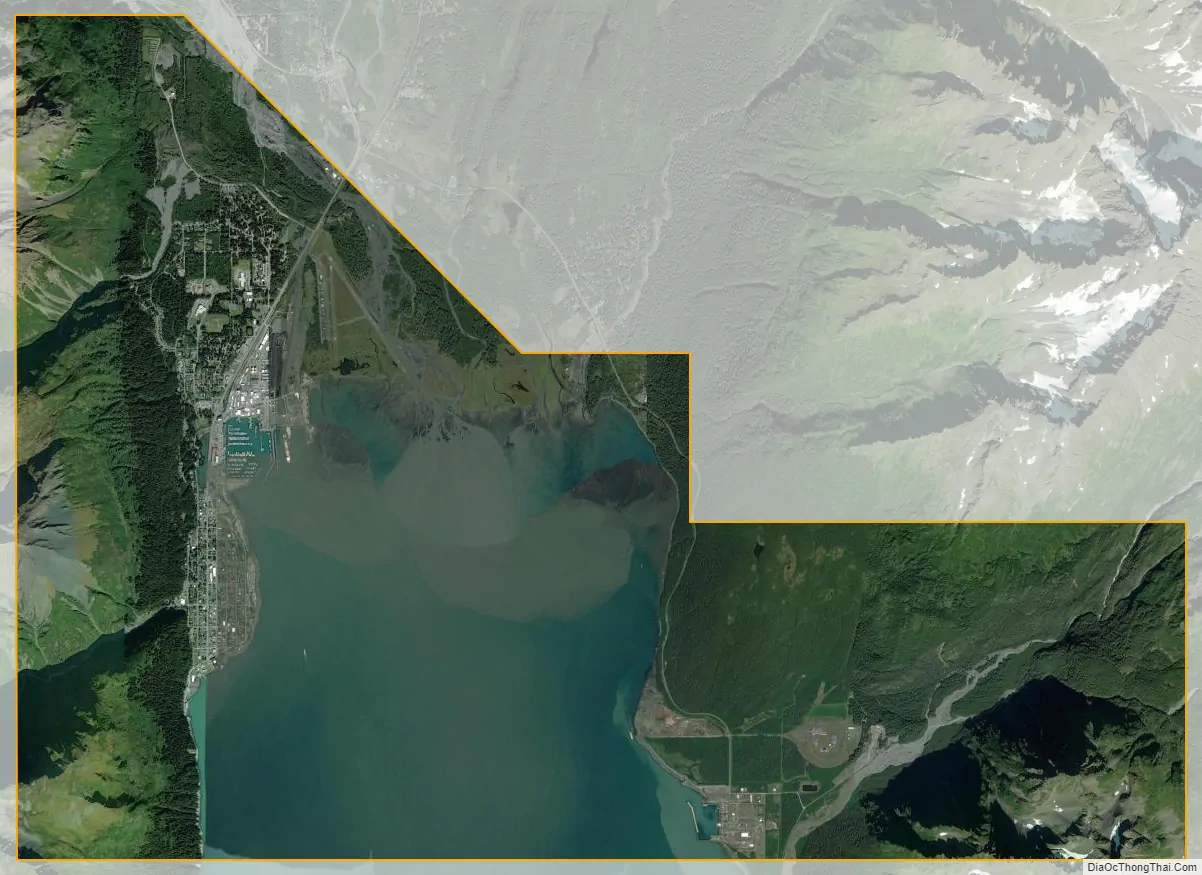
Seward city Satellite Map
Geography
According to the United States Census Bureau, the city has a total area of 21.5 square miles (56 km), of which 14.4 square miles (37 km) is land and 7.1 square miles (18 km) (32.93%) is water.
The northern city limits are demarcated by the lower reaches of the Resurrection River, but extend east past the river’s mouth at the northern end of Resurrection Bay to include parts of the bay’s extreme northeastern shore, including the beach at the mouth of Fourth of July Creek and the grounds of Spring Creek Correctional Center just inland. To the south, the city limits extend to the unincorporated community of Lowell Point, while the east and west sides of the city are constrained by Resurrection Bay and the steep slopes of Mount Marathon.
Nearby settlements include the aforementioned Lowell Point to the south, as well as the census-designated places of Bear Creek and Moose Pass further north. The nearest incorporated city is Soldotna, about 90 miles (by road) to the northwest.
Climate
Depending on the isotherm, Seward has a subpolar oceanic climate (Köppen Cfc) or a subarctic climate (Köppen Dfc), but it experiences relatively moderate temperatures compared to the rest of the state throughout the year due to the influence of the nearby Gulf of Alaska. Only one month, January, sees an average daily high temperature below freezing, and temperatures below zero degrees Fahrenheit are rare. The oceanic influence also imparts a high level of precipitation, with the heaviest amounts occurring during the fall and winter months.
See also
Map of Alaska State and its subdivision:- Aleutians East
- Aleutians West
- Anchorage
- Bethel
- Bristol Bay
- Denali
- Dillingham
- Fairbanks North Star
- Haines
- Juneau
- Kenai Peninsula
- Ketchikan Gateway
- Kodiak Island
- Lake and Peninsula
- Matanuska-Susitna
- Nome
- North Slope
- Northwest Arctic
- Prince of Wales-Outer Ketchi
- Sitka
- Skagway-Yakutat-Angoon
- Southeast Fairbanks
- Valdez-Cordova
- Wade Hampton
- Wrangell-Petersburg
- Yukon-Koyukuk
- Alabama
- Alaska
- Arizona
- Arkansas
- California
- Colorado
- Connecticut
- Delaware
- District of Columbia
- Florida
- Georgia
- Hawaii
- Idaho
- Illinois
- Indiana
- Iowa
- Kansas
- Kentucky
- Louisiana
- Maine
- Maryland
- Massachusetts
- Michigan
- Minnesota
- Mississippi
- Missouri
- Montana
- Nebraska
- Nevada
- New Hampshire
- New Jersey
- New Mexico
- New York
- North Carolina
- North Dakota
- Ohio
- Oklahoma
- Oregon
- Pennsylvania
- Rhode Island
- South Carolina
- South Dakota
- Tennessee
- Texas
- Utah
- Vermont
- Virginia
- Washington
- West Virginia
- Wisconsin
- Wyoming


