Soldotna is a city in the Kenai Peninsula Borough in the U.S. state of Alaska. At the 2020 census, the population was 4,342, up from 4,163 in 2010. It is the seat of the Kenai Peninsula Borough.
Soldotna is located in the Southcentral portion of Alaska on the central-western portion of the Kenai Peninsula. The city limits span 7 square miles along the Kenai River, which empties into the Cook Inlet in the nearby city of Kenai. Soldotna is located on the western edge of the vast Kenai National Wildlife Refuge, a protected area spanning nearly 2 million acres and home to bears, moose, caribou, sheep, and many fish and bird species.
The city is located at the junction of the Sterling Highway and the Kenai Spur Highway, which has enabled Soldotna to develop as a service and retail hub for the Central Peninsula as well as for travelers between Anchorage and Homer. The Central Peninsula Hospital serves the medical needs of the region’s residents and tourists. The Kenai Peninsula College, a branch of the University of Alaska Anchorage, operates the Kenai River Campus in Soldotna. Additionally, the headquarters of the Kenai National Wildlife Refuge, the Kenai Peninsula Borough, and the Kenai Peninsula Borough School District are located in the city.
| Name: | Soldotna city |
|---|---|
| LSAD Code: | 25 |
| LSAD Description: | city (suffix) |
| State: | Alaska |
| County: | Kenai Peninsula Borough |
| Incorporated: | July 1967 |
| Elevation: | 105 ft (32 m) |
| Total Area: | 7.41 sq mi (19.19 km²) |
| Land Area: | 6.96 sq mi (18.01 km²) |
| Water Area: | 0.45 sq mi (1.18 km²) |
| Total Population: | 4,342 |
| Population Density: | 624.30/sq mi (241.05/km²) |
| ZIP code: | 99669 |
| Area code: | 907 (local exchange prefix: 260, 262) |
| FIPS code: | 0271640 |
| GNISfeature ID: | 1414025 |
| Website: | www.soldotna.org |
Online Interactive Map
Click on ![]() to view map in "full screen" mode.
to view map in "full screen" mode.
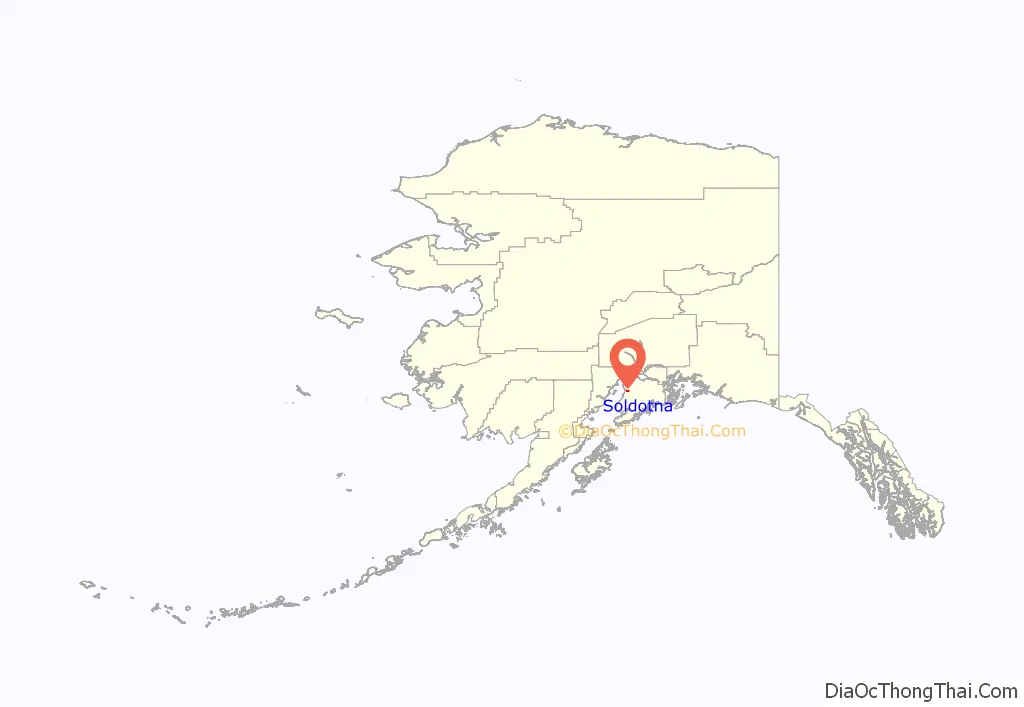
Soldotna location map. Where is Soldotna city?
History
In 1947, after World War II, the United States government withdrew a number of townships along Cook Inlet and the lower Kenai River from the Kenai National Moose Range, opening up the area to settlement under the Homestead Act. Veterans of the United States armed services were given a 90-day preference over non-veterans in selecting land and filing for property. Also in that year, the Sterling Highway right-of-way was cleared of trees from Cooper Landing to Kenai. The location of present-day Soldotna was selected as the site for the highway’s bridge crossing the Kenai River.
The construction of the Sterling Highway provided a link from the Soldotna area to the outside world. More homesteads were taken and visitors came to fish in the area. The Soldotna Post Office opened in 1949 and other businesses opened in the next few years.
Oil was discovered in the Swanson River region in 1957, bringing new economic development to the area. In 1960, Soldotna was incorporated as a fourth class city with a population of 332 and an area of 7.4 square miles (4,723.4 acres). Then seven years later, in 1967, Soldotna was recognized as a first class city.
In 1964, the Kenai Peninsula College, the Kenai Peninsula Borough government, and the Kenai Peninsula Borough School District were formed.
The city experienced rapid population growth in the 1960s through the 1990s as a result of its location at the intersection of two major highways and due to development of the oil industry on the Kenai Peninsula. As the city and the oil industry have matured, population growth has somewhat slowed, although the city experienced more growth from 2000-2010 than during the previous decade. In 2016, it was granted home rule.
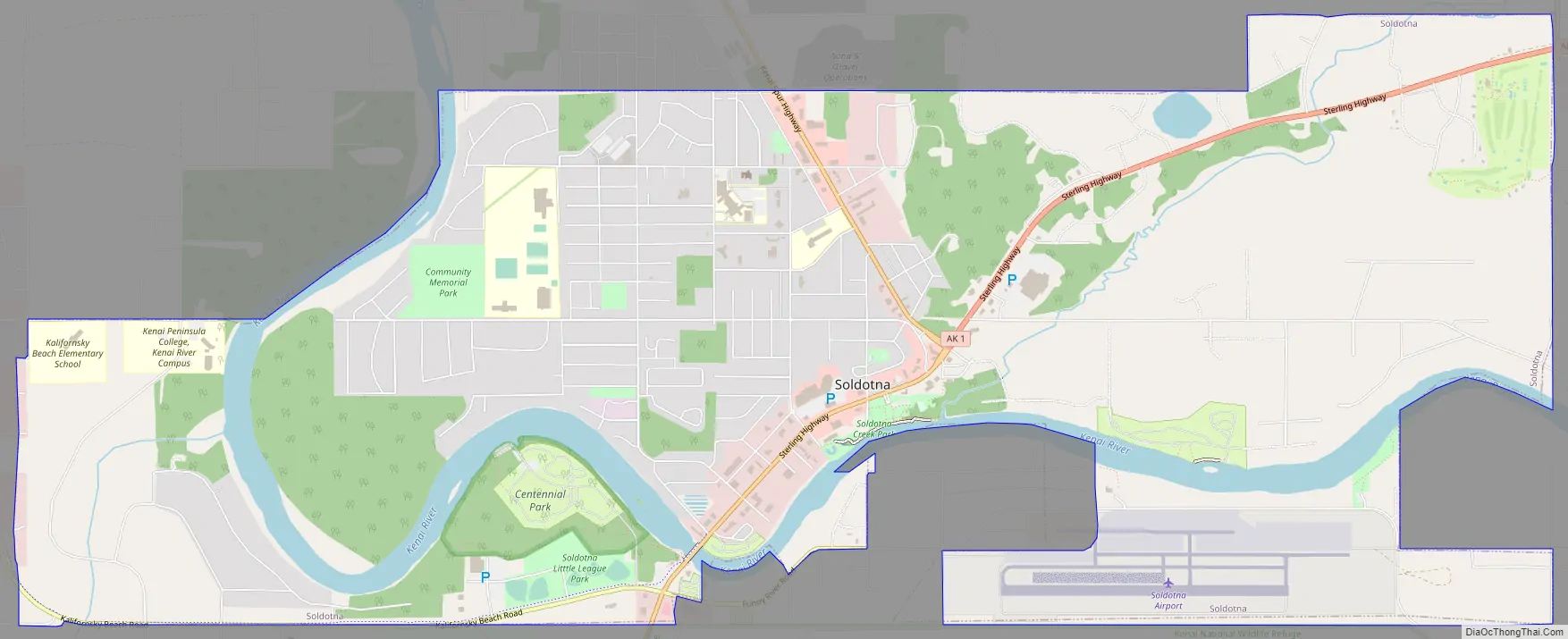
Soldotna Road Map
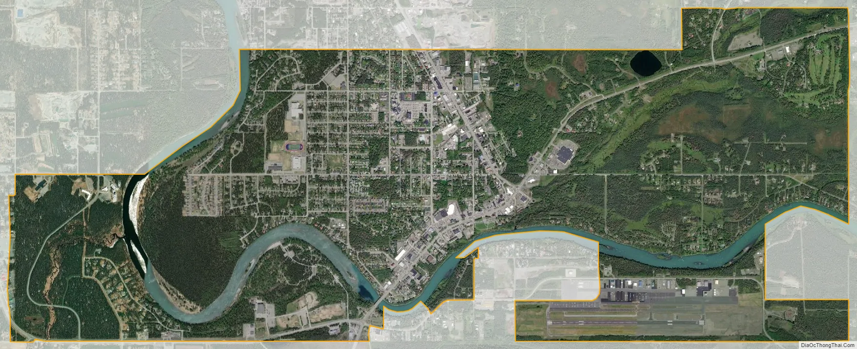
Soldotna city Satellite Map
Geography
Soldotna is located at 60°29′12″N 151°4′31″W / 60.48667°N 151.07528°W / 60.48667; -151.07528 (60.486617, −151.075373), on the banks of the Kenai River on the Kenai Peninsula of Alaska. It is named after nearby Soldotna Creek. There are multiple theories explaining the origin of the word “Soldotna”; these include the variant “Soldatna”, which was the prevalent spelling of the community’s name during the 1950s and 1960s.
According to the United States Census Bureau, the city has a total area of 7.4 square miles (19 km), of which 6.9 square miles (18 km) of it is land and 0.5 square miles (1.3 km) of it (6.34%) is water.
Climate
As with much of Southcentral Alaska, Soldotna has a moderate dry-summer subarctic climate (Köppen climate classification: Dsc) due to the cool summers, though the diurnal temperature variation is larger than most locations in the region. Winters are snowy, long but not particularly cold, especially considering the latitude, with January featuring a daily average temperature of 13.4 °F (−10.3 °C). There are 46 nights of sub-0 °F (−18 °C) lows annually, and the area lies in USDA Plant Hardiness Zone 4, indicating an average annual minimum in the −20 to −30 °F (−29 to −34 °C) range. Summers are cool due to the marine influence, with 12 days of 70 °F (21 °C)+ highs annually.
See also
Map of Alaska State and its subdivision:- Aleutians East
- Aleutians West
- Anchorage
- Bethel
- Bristol Bay
- Denali
- Dillingham
- Fairbanks North Star
- Haines
- Juneau
- Kenai Peninsula
- Ketchikan Gateway
- Kodiak Island
- Lake and Peninsula
- Matanuska-Susitna
- Nome
- North Slope
- Northwest Arctic
- Prince of Wales-Outer Ketchi
- Sitka
- Skagway-Yakutat-Angoon
- Southeast Fairbanks
- Valdez-Cordova
- Wade Hampton
- Wrangell-Petersburg
- Yukon-Koyukuk
- Alabama
- Alaska
- Arizona
- Arkansas
- California
- Colorado
- Connecticut
- Delaware
- District of Columbia
- Florida
- Georgia
- Hawaii
- Idaho
- Illinois
- Indiana
- Iowa
- Kansas
- Kentucky
- Louisiana
- Maine
- Maryland
- Massachusetts
- Michigan
- Minnesota
- Mississippi
- Missouri
- Montana
- Nebraska
- Nevada
- New Hampshire
- New Jersey
- New Mexico
- New York
- North Carolina
- North Dakota
- Ohio
- Oklahoma
- Oregon
- Pennsylvania
- Rhode Island
- South Carolina
- South Dakota
- Tennessee
- Texas
- Utah
- Vermont
- Virginia
- Washington
- West Virginia
- Wisconsin
- Wyoming


