Map of Hester CDP
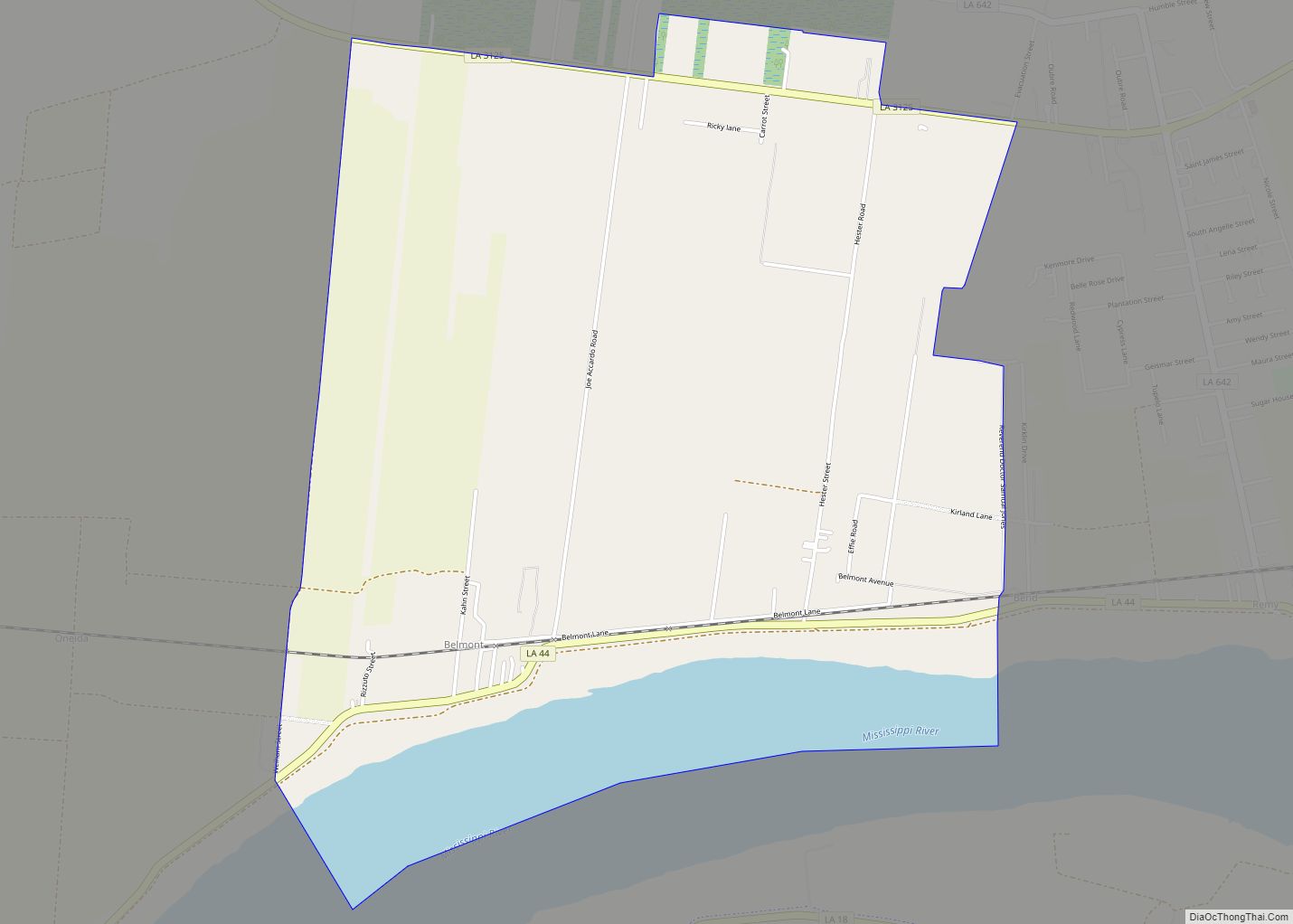
Hester is an unincorporated community and census-designated place in St. James Parish, Louisiana, United States. Its population was 498 as of the 2010 census. The community is located along Louisiana Highway 44 on the east bank of the Mississippi River. Hester CDP overview: Name: Hester CDP LSAD Code: 57 LSAD Description: CDP (suffix) State: Louisiana ... Read more
Map of Hester CDP
Map of Hessmer village
Hessmer is a village in Avoyelles Parish, Louisiana, United States. The population was 802 at the 2010 census. Hessmer village overview: Name: Hessmer village LSAD Code: 47 LSAD Description: village (suffix) State: Louisiana County: Avoyelles Parish Incorporated: 1955 Elevation: 79 ft (24 m) Total Area: 0.83 sq mi (2.14 km²) Land Area: 0.83 sq mi (2.14 km²) Water Area: 0.00 sq mi (0.00 km²) Total Population: ... Read more
Map of Hessmer village
Map of Henderson town, Louisiana
Henderson is a town in St. Martin Parish, Louisiana, United States. Part of the Lafayette metropolitan area, its population was 1,617 at the 2020 U.S. census. Home to Cajun Palms RV Resort, it was rated in 2017 as the best campsite in Louisiana in a 50-state survey conducted by Msn.com. Henderson town overview: Name: Henderson ... Read more
Map of Henderson town, Louisiana
Map of Hornbeck town
Hornbeck is a town in Vernon Parish, Louisiana, United States. The population was 480 at the 2010 census, up from 435 in 2000. It is part of the Fort Polk South Micropolitan Statistical Area. Hornbeck town overview: Name: Hornbeck town LSAD Code: 43 LSAD Description: town (suffix) State: Louisiana County: Vernon Parish Founded: October 21, ... Read more
Map of Hornbeck town
Map of Homer town, Louisiana
Homer is a town in and the parish seat of Claiborne Parish in northern Louisiana, United States. Named for the Greek poet Homer, the town was laid out around the Courthouse Square in 1850 by Frank Vaughn. The present-day brick courthouse, built in the Greek Revival style of architecture, is one of only four pre-Civil ... Read more
Map of Homer town, Louisiana
Map of Hodge village
Hodge is a village in Jackson Parish, Louisiana, United States. The population was 470 at the 2010 census. It is part of the Ruston Micropolitan Statistical Area. Hodge village overview: Name: Hodge village LSAD Code: 47 LSAD Description: village (suffix) State: Louisiana County: Jackson Parish Elevation: 190 ft (60 m) Total Area: 1.37 sq mi (3.55 km²) Land Area: 0.97 sq mi ... Read more
Map of Hodge village
Map of Ida village
Ida is a village in Caddo Parish, Louisiana, United States. The population was 221 at the 2010 census. It is part of the Shreveport–Bossier City Metropolitan Statistical Area. Ida and nearby Rodessa are the most northwesterly communities in Louisiana. Ida village overview: Name: Ida village LSAD Code: 47 LSAD Description: village (suffix) State: Louisiana County: ... Read more
Map of Ida village
Map of Houma city
Houma (/ˈhoʊmə/ HOH-mə) is the largest city in, and the parish seat of, Terrebonne Parish in the U.S. state of Louisiana. It is also the largest principal city of the Houma–Bayou Cane–Thibodaux metropolitan statistical area. The city’s government was absorbed by the parish in 1984, which currently operates as the Terrebonne Parish Consolidated Government. The ... Read more
Map of Houma city
Map of Hosston village
Hosston is a village in Caddo Parish, Louisiana, United States. The population was 318 at the 2010 census. It is part of the Shreveport–Bossier City Metropolitan Statistical Area. Hosston village overview: Name: Hosston village LSAD Code: 47 LSAD Description: village (suffix) State: Louisiana County: Caddo Parish Elevation: 220 ft (70 m) Total Area: 2.76 sq mi (7.14 km²) Land Area: ... Read more
Map of Hosston village
Map of Iota town
Iota is a town in Acadia Parish, Louisiana. The population was 1,304 in 2020. Iota is part of the Crowley Micropolitan Statistical Area. Iota town overview: Name: Iota town LSAD Code: 43 LSAD Description: town (suffix) State: Louisiana County: Acadia Parish Elevation: 30 ft (9 m) Total Area: 1.27 sq mi (3.29 km²) Land Area: 1.27 sq mi (3.29 km²) Water Area: 0.00 sq mi ... Read more
Map of Iota town
Map of Inniswold CDP
Inniswold is an unincorporated area and census-designated place (CDP) in East Baton Rouge Parish, Louisiana, United States. The population was 6,180 at the 2010 census, up from 4,944 in 2000. In 2020, its population was 5,987. It is part of the Baton Rouge metropolitan statistical area. It is in the proposed City of St. George. ... Read more
Map of Inniswold CDP
Map of Independence town, Louisiana
Independence, originally known as Uncle Sam, is a town in Tangipahoa Parish, Louisiana, United States. The population was 1,665 at the 2010 census. It is part of the Hammond Micropolitan Statistical Area. Independence town overview: Name: Independence town LSAD Code: 43 LSAD Description: town (suffix) State: Louisiana County: Tangipahoa Parish Elevation: 82 ft (25 m) Total Area: ... Read more
Map of Independence town, Louisiana