Houma (/ˈhoʊmə/ HOH-mə) is the largest city in, and the parish seat of, Terrebonne Parish in the U.S. state of Louisiana. It is also the largest principal city of the Houma–Bayou Cane–Thibodaux metropolitan statistical area. The city’s government was absorbed by the parish in 1984, which currently operates as the Terrebonne Parish Consolidated Government.
The population was 33,727 at the 2010 census, an increase of 1,334 over the 2000 census tabulation of 32,393. In 2020, the population estimates program determined 32,467 people lived in the city. At the 2020 census, its population rebounded to 33,406. Many unincorporated areas are adjacent to the city of Houma. The largest, Bayou Cane, is an urbanized area commonly referred to by locals as being part of Houma, but it is not included in the city’s census counts, and is a separate census-designated place. If the populations of the urbanized census-designated places were included with that of the city of Houma, the total would exceed 60,000 residents.
Houma was rated as an “affordable” city by Demographia’s 2013 International Housing Survey.
| Name: | Houma city |
|---|---|
| LSAD Code: | 25 |
| LSAD Description: | city (suffix) |
| State: | Louisiana |
| County: | Terrebonne Parish |
| Founded: | 1834; 189 years ago (1834) |
| Incorporated: | 1848; 175 years ago (1848) |
| Land Area: | 14.47 sq mi (37.47 km²) |
| Water Area: | 0.13 sq mi (0.33 km²) |
| Population Density: | 2,309.12/sq mi (891.55/km²) |
| ZIP code: | 70360, 70363-64 |
| Area code: | 985 |
| FIPS code: | 2236255 |
| Website: | www.tpcg.org |
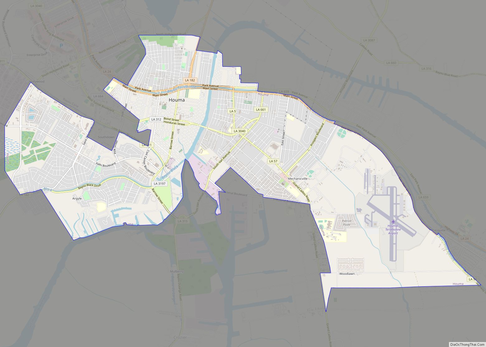
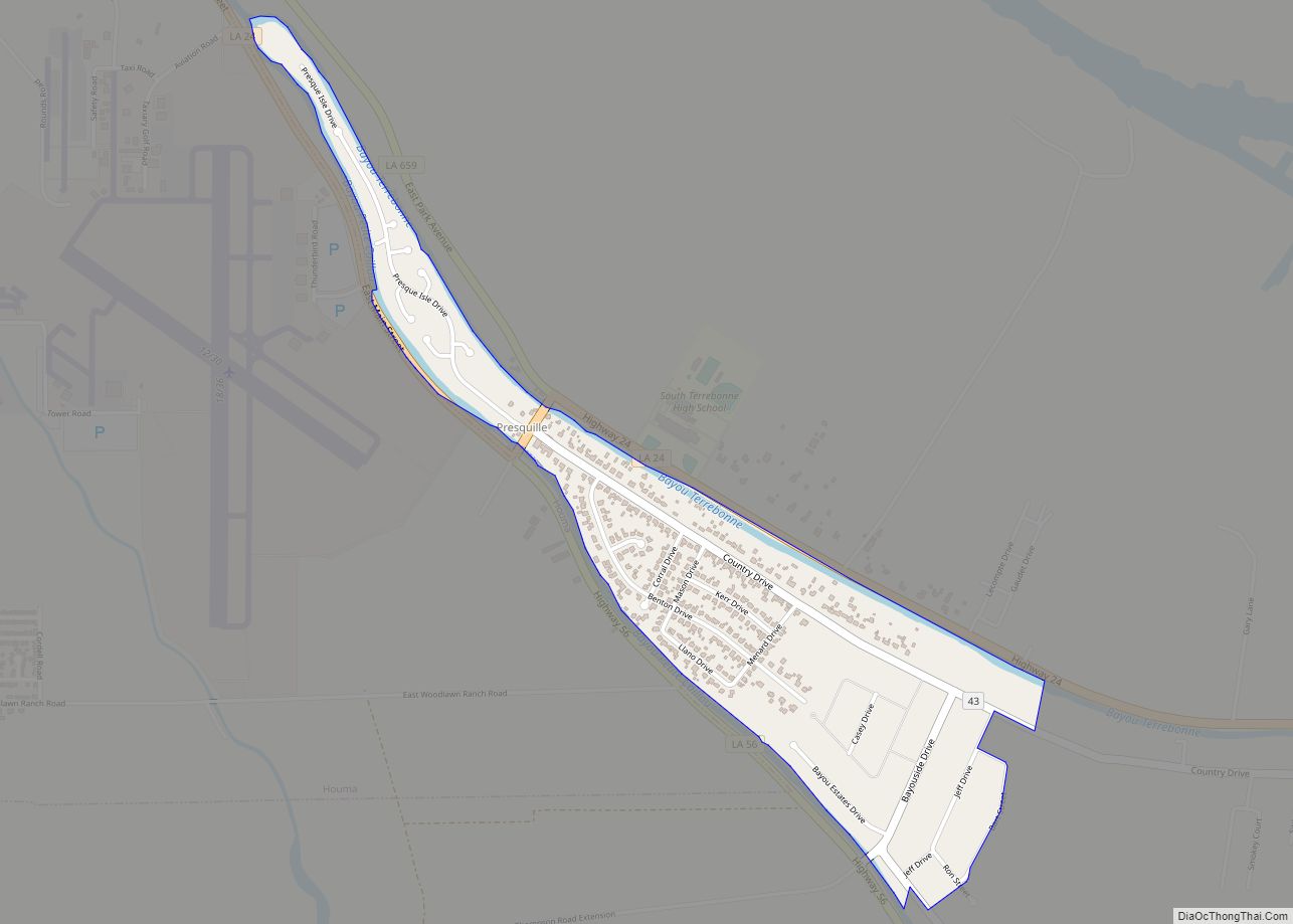
Online Interactive Map
Click on ![]() to view map in "full screen" mode.
to view map in "full screen" mode.
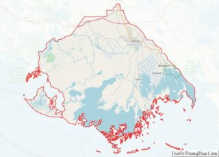
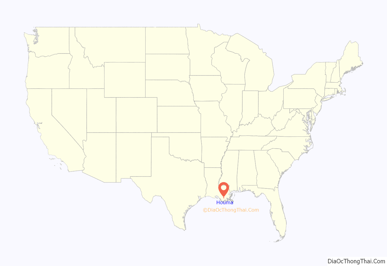
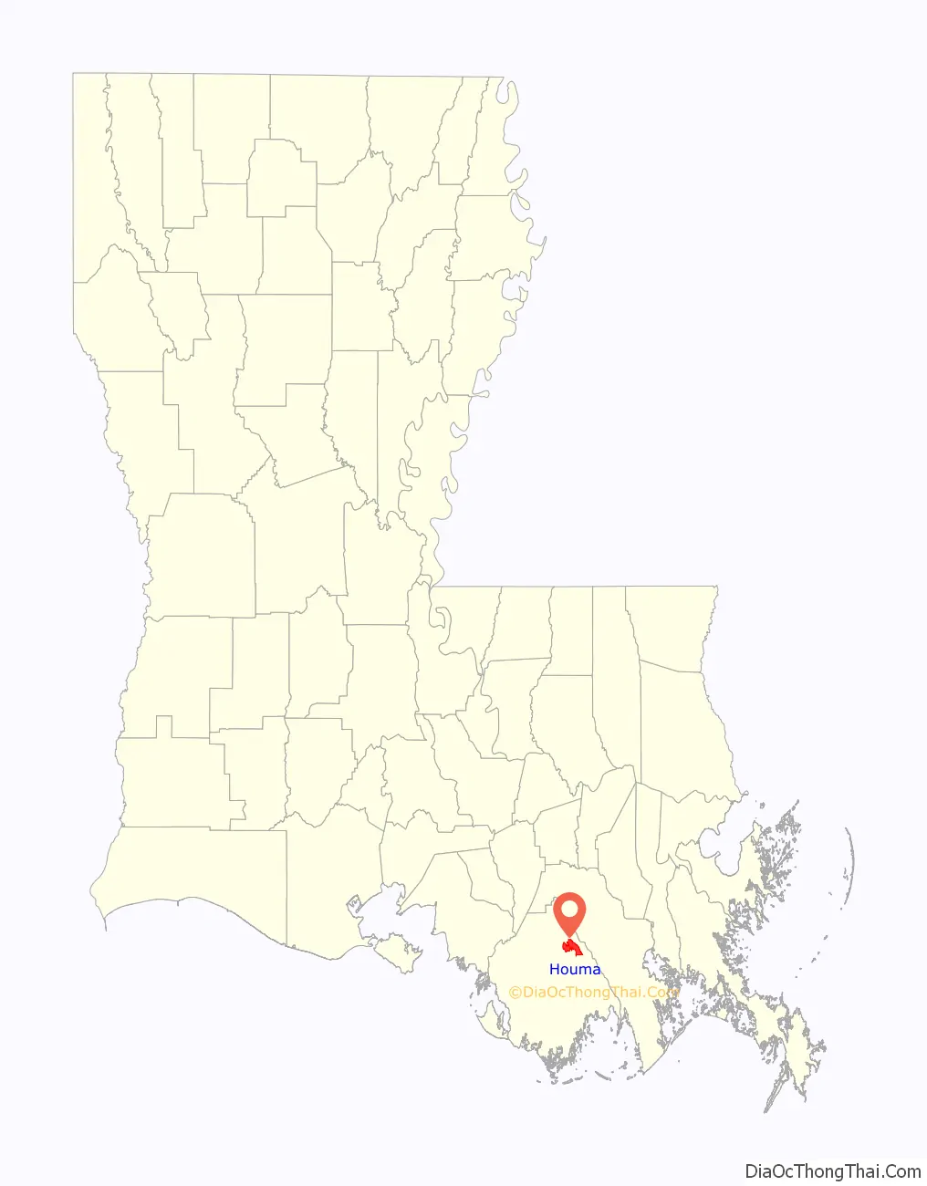
Houma location map. Where is Houma city?
History
Settled by the Chitimacha and then the Houma Indians prior to European colonization, Houma was soon named for the Houma Indians who were at Ouiski Point. Land claimed for the Houma Indians by the Spanish was not recognized by the United States after the Louisiana Purchase.
Present-day Houma was formed in 1832; the city was incorporated in 1848. The area was developed for sugar cane plantations in the antebellum years. Plantations were sited along the rivers and bayous in order to have access to water transportation.
Reconstruction to present
Sugar cane continued to be important after the war and into the 20th century.
On January 24, 1970, an accidental gas explosion killed three people and caused extensive damage downtown. Latour’s Jewelry Store was destroyed.
In 1984, the city and parish consolidated their governments. In 2008 Bill Ellzey, a columnist at Houma Today, wrote that area residents were often unaware of the Houma city boundaries as the city and parish governments had consolidated.
In late August 2021 Houma was struck by the intense eye-wall of category 4 Hurricane Ida causing widespread damage.
Houma Road Map
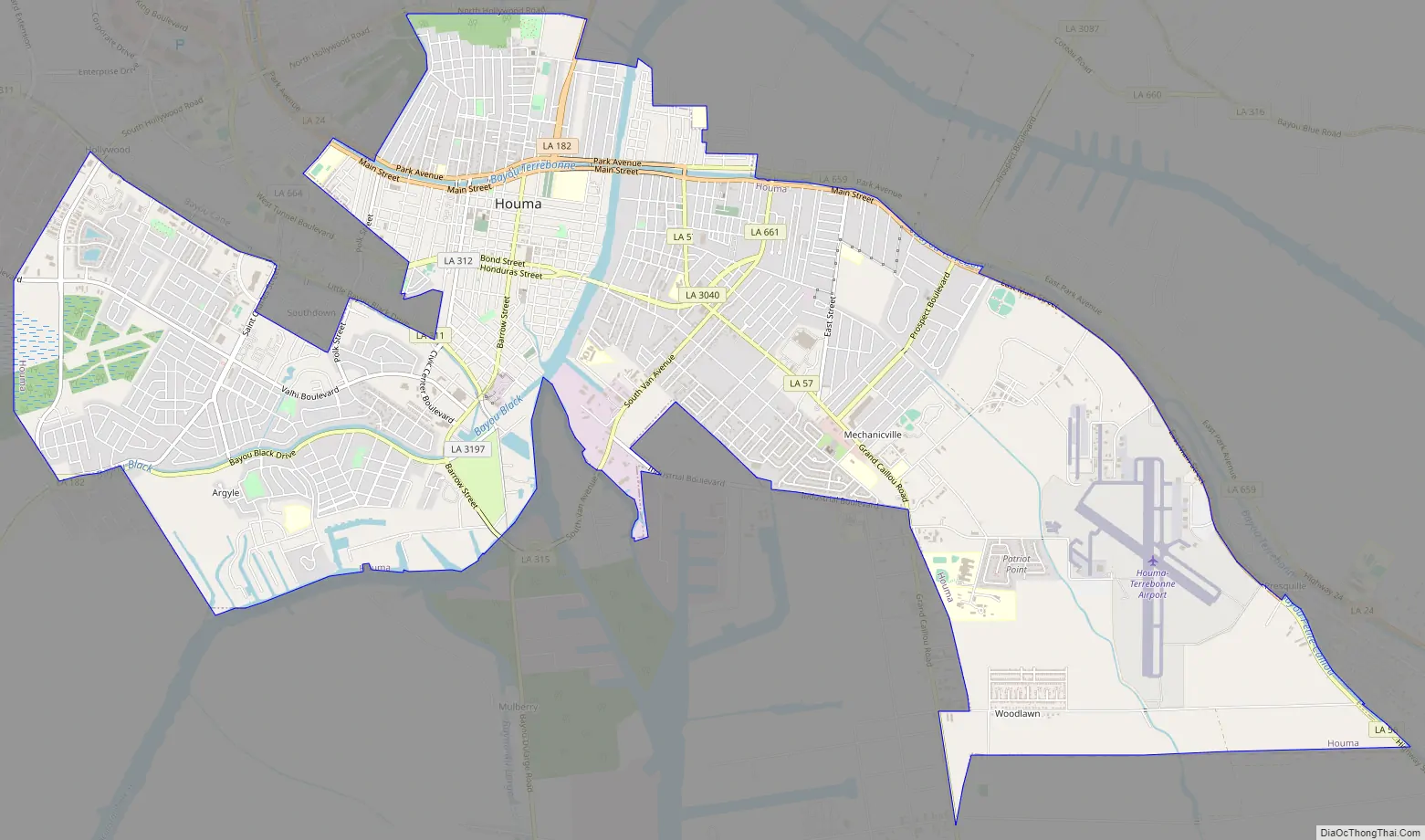
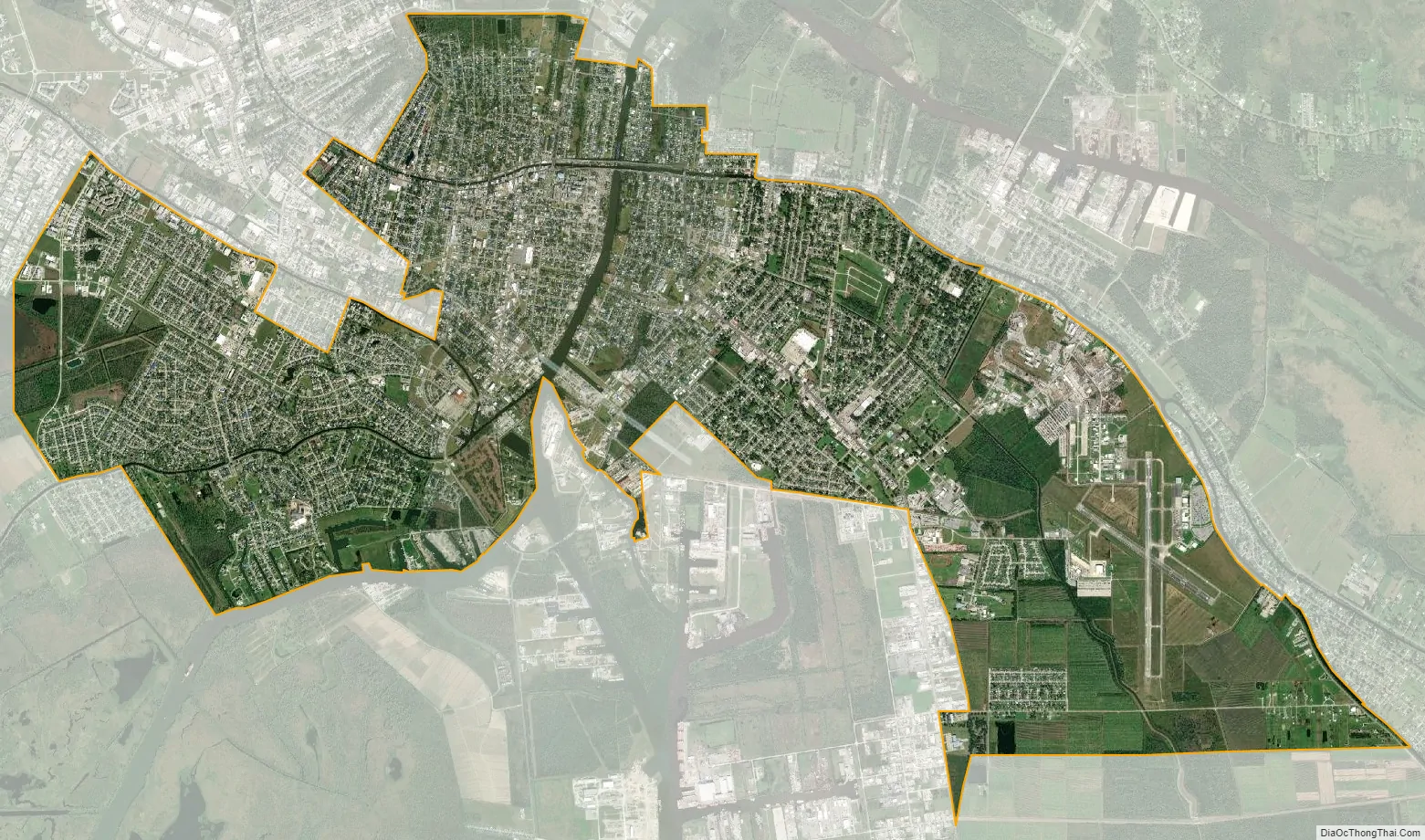
Houma city Satellite Map
Geography
Houma is located at 29°35′15″N 90°42′58″W / 29.58750°N 90.71611°W / 29.58750; -90.71611 (29.587614, -90.716108) and has an elevation of 10 feet (3.0 m) above sea level. According to the United States Census Bureau, the city has a total area of 14.2 square miles (37 km), of which 14.0 square miles (36 km) is land and 0.2 square miles (0.52 km) (0.92%) is water.
Climate
The climate in this area is characterized by hot, humid summers and generally mild, sometimes warm winters. According to the Köppen Climate Classification system, Houma has a humid subtropical climate, abbreviated “Cfa” on climate maps.
See also
Map of Louisiana State and its subdivision:- Acadia
- Allen
- Ascension
- Assumption
- Avoyelles
- Beauregard
- Bienville
- Bossier
- Caddo
- Calcasieu
- Caldwell
- Cameron
- Catahoula
- Claiborne
- Concordia
- De Soto
- East Baton Rouge
- East Carroll
- East Feliciana
- Evangeline
- Franklin
- Grant
- Iberia
- Iberville
- Jackson
- Jefferson
- Jefferson Davis
- La Salle
- Lafayette
- Lafourche
- Lincoln
- Livingston
- Madison
- Morehouse
- Natchitoches
- Orleans
- Ouachita
- Plaquemines
- Pointe Coupee
- Rapides
- Red River
- Richland
- Sabine
- Saint Bernard
- Saint Charles
- Saint Helena
- Saint James
- Saint John the Baptist
- Saint Landry
- Saint Martin
- Saint Mary
- Saint Tammany
- Tangipahoa
- Tensas
- Terrebonne
- Union
- Vermilion
- Vernon
- Washington
- Webster
- West Baton Rouge
- West Carroll
- West Feliciana
- Winn
- Alabama
- Alaska
- Arizona
- Arkansas
- California
- Colorado
- Connecticut
- Delaware
- District of Columbia
- Florida
- Georgia
- Hawaii
- Idaho
- Illinois
- Indiana
- Iowa
- Kansas
- Kentucky
- Louisiana
- Maine
- Maryland
- Massachusetts
- Michigan
- Minnesota
- Mississippi
- Missouri
- Montana
- Nebraska
- Nevada
- New Hampshire
- New Jersey
- New Mexico
- New York
- North Carolina
- North Dakota
- Ohio
- Oklahoma
- Oregon
- Pennsylvania
- Rhode Island
- South Carolina
- South Dakota
- Tennessee
- Texas
- Utah
- Vermont
- Virginia
- Washington
- West Virginia
- Wisconsin
- Wyoming