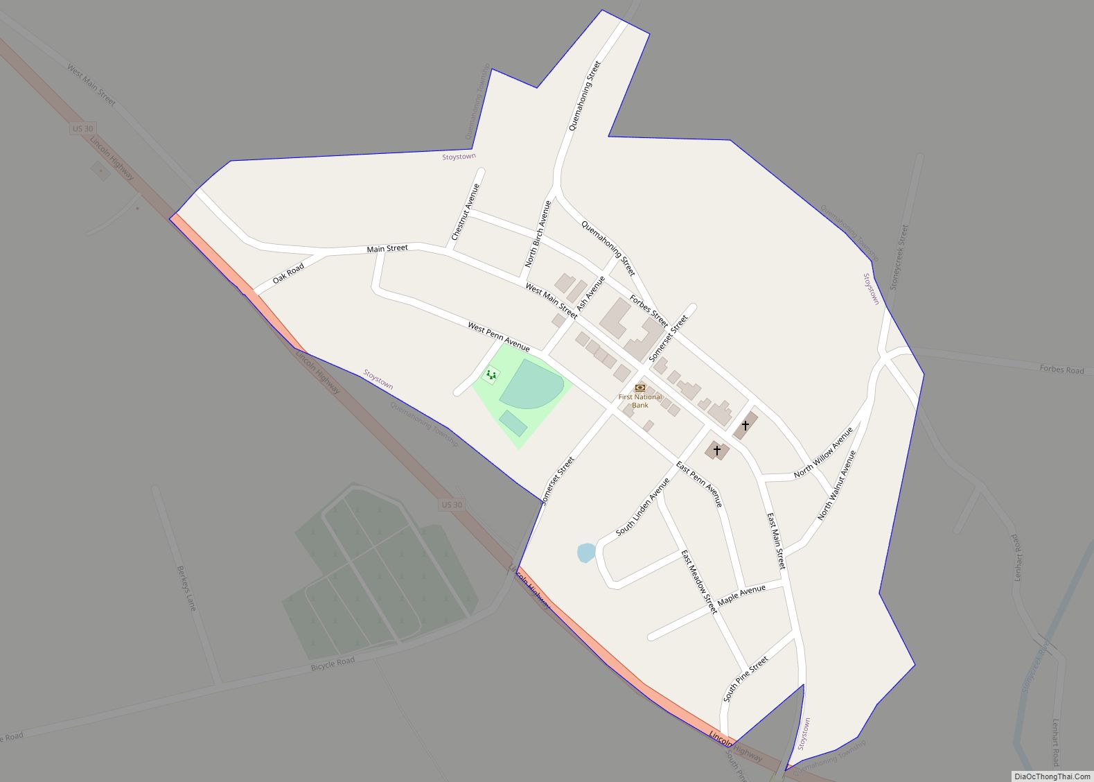
Map of Stowe CDP, Pennsylvania
Stowe is a census-designated place (CDP) in West Pottsgrove Township, Montgomery County, Pennsylvania, United States. The population was 3,695 at the 2010 census. It uses the Pottstown ZIP code of 19464. Stowe CDP overview: Name: Stowe CDP LSAD Code: 57 LSAD Description: CDP (suffix) State: Pennsylvania County: Montgomery County Elevation: 197 ft (60 m) Total Area: 1.5 sq mi ... Read more
Map of Stowe CDP, Pennsylvania
Map of Stouchsburg CDP
Stouchsburg is an unincorporated community, and a census-designated place, located in extreme western Berks County, Pennsylvania, United States. As of the 2010 census, it had a population of 600. It is just off U.S. Route 422 along Main St. in Marion Township, and is served by the Conrad Weiser Area School District. The community is ... Read more
Map of Stouchsburg CDP
Map of Stormstown CDP
Stormstown is a census-designated place (CDP) in Centre County, Pennsylvania, United States. It is part of the State College, Pennsylvania Metropolitan Statistical Area. The population was 2,366 at the 2010 census. Its population grew nearly 48% between 2000 and 2010, due largely to the development of several new neighborhoods in the area. Stormstown CDP overview: ... Read more
Map of Stormstown CDP
Map of Stonybrook CDP
Stonybrook is a census-designated place (CDP) in York County, Pennsylvania, United States. The population was 2,384 at the 2010 census. The area was delineated as the Stonybrook-Wilshire CDP for the 2000 census. Stonybrook CDP overview: Name: Stonybrook CDP LSAD Code: 57 LSAD Description: CDP (suffix) State: Pennsylvania County: York County Total Area: 1.6 sq mi (4.2 km²) Land ... Read more
Map of Stonybrook CDP
Map of Stony Creek Mills CDP
Stony Creek Mills is a census-designated place in Lower Alsace and Exeter Townships in Berks County, Pennsylvania. It is located approximately five miles east of the city of Reading. As of the 2010 census, the population was 1,045 residents. Stony Creek Mills CDP overview: Name: Stony Creek Mills CDP LSAD Code: 57 LSAD Description: CDP ... Read more
Map of Stony Creek Mills CDP
Map of Stonerstown CDP
Stonerstown is a census-designated place in Liberty Township, Bedford County, Pennsylvania, United States. The population was 376 as of the 2010 census. It is located just to the west of the borough of Saxton along Pennsylvania Route 913. Stonerstown CDP overview: Name: Stonerstown CDP LSAD Code: 57 LSAD Description: CDP (suffix) State: Pennsylvania County: Bedford ... Read more
Map of Stonerstown CDP
Map of Stoneboro borough
Stoneboro is a borough in eastern Mercer County, Pennsylvania, United States. The population was 946 at the 2020 census. It is part of the Youngstown–Warren metropolitan area. Stoneboro borough overview: Name: Stoneboro borough LSAD Code: 21 LSAD Description: borough (suffix) State: Pennsylvania County: Mercer County Total Area: 2.94 sq mi (7.61 km²) Land Area: 2.83 sq mi (7.34 km²) Water Area: ... Read more
Map of Stoneboro borough
Map of Strattanville borough
Strattanville is a borough in Clarion County, Pennsylvania, United States. The population was 537 at the 2020 census. Strattanville borough overview: Name: Strattanville borough LSAD Code: 21 LSAD Description: borough (suffix) State: Pennsylvania County: Clarion County Incorporated: 1850 Elevation: 1,531 ft (467 m) Total Area: 0.50 sq mi (1.30 km²) Land Area: 0.50 sq mi (1.30 km²) Water Area: 0.00 sq mi (0.00 km²) Total Population: ... Read more
Map of Strattanville borough
Map of Summerville borough, Pennsylvania
Summerville is a borough in Jefferson County, Pennsylvania, United States. The population was 528 at the 2010 census. Summerville borough overview: Name: Summerville borough LSAD Code: 21 LSAD Description: borough (suffix) State: Pennsylvania County: Jefferson County Incorporated: March 15, 1887 Elevation: 1,152 ft (351 m) Total Area: 0.62 sq mi (1.61 km²) Land Area: 0.59 sq mi (1.54 km²) Water Area: 0.03 sq mi (0.06 km²) ... Read more
Map of Summerville borough, Pennsylvania
Map of Summerhill borough
Summerhill is a borough in Cambria County, Pennsylvania, United States. The population was 490 at the 2010 census. Summerhill borough overview: Name: Summerhill borough LSAD Code: 21 LSAD Description: borough (suffix) State: Pennsylvania County: Cambria County Incorporated: 1892 Elevation: 1,588 ft (484 m) Total Area: 0.33 sq mi (0.86 km²) Land Area: 0.33 sq mi (0.85 km²) Water Area: 0.01 sq mi (0.01 km²) Total Population: ... Read more
Map of Summerhill borough
Map of Sugarcreek borough, Pennsylvania
Sugarcreek is a borough in Venango County, Pennsylvania, United States. The population was 4,824 at the 2020 census. It is the largest borough by total area in all Venango County. Sugarcreek borough overview: Name: Sugarcreek borough LSAD Code: 21 LSAD Description: borough (suffix) State: Pennsylvania County: Venango County Total Area: 38.65 sq mi (100.10 km²) Land Area: 37.51 sq mi ... Read more
Map of Sugarcreek borough, Pennsylvania
Map of Sugar Notch borough
Sugar Notch is a borough in Luzerne County, Pennsylvania, United States. The population was nine hundred and ninety-six at the time of the 2020 census. Sugar Notch borough overview: Name: Sugar Notch borough LSAD Code: 21 LSAD Description: borough (suffix) State: Pennsylvania County: Luzerne County Incorporated: 1867 Total Area: 0.99 sq mi (2.58 km²) Land Area: 0.99 sq mi (2.58 km²) ... Read more
Map of Sugar Notch borough