Map of Sugar Grove borough, Pennsylvania
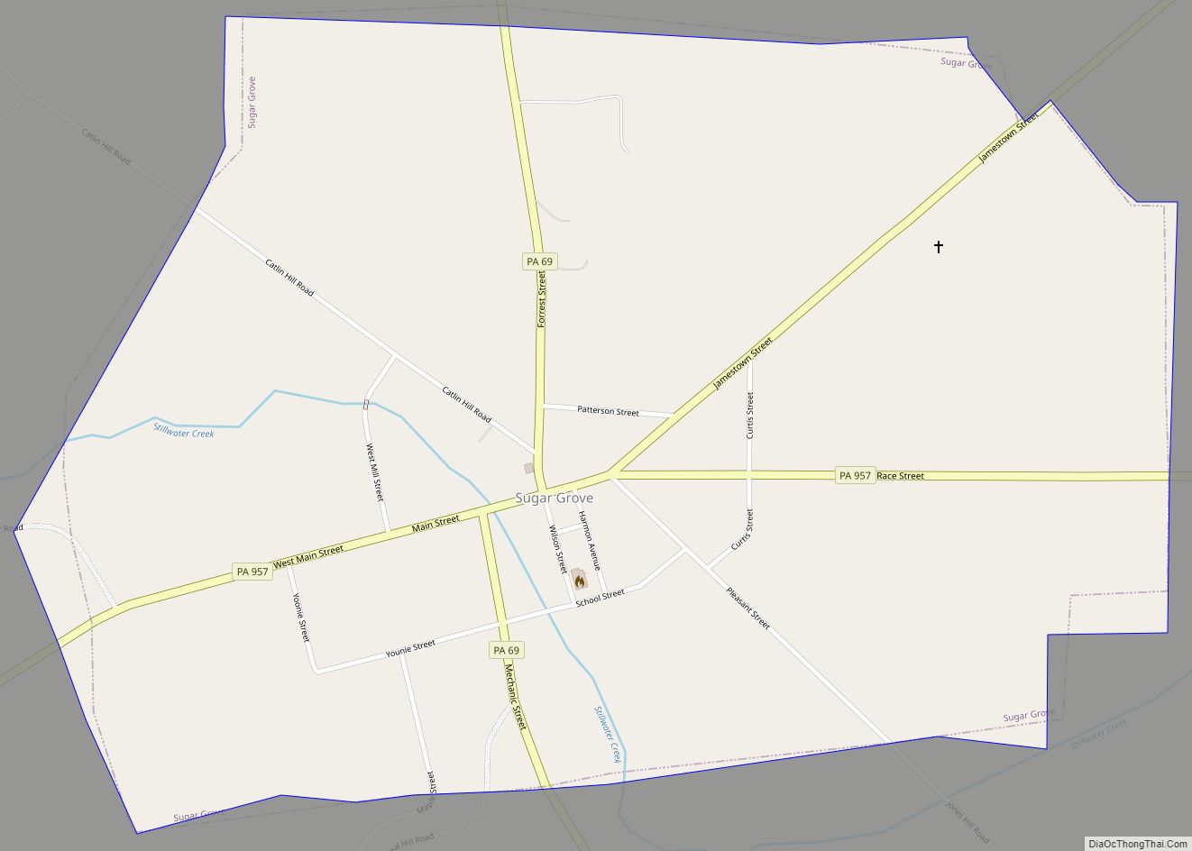
Sugar Grove is a borough in Warren County, Pennsylvania, United States. The population was 614 at the 2010 census. Sugar Grove borough overview: Name: Sugar Grove borough LSAD Code: 21 LSAD Description: borough (suffix) State: Pennsylvania County: Warren County Founded: 1797 Total Area: 1.12 sq mi (2.90 km²) Land Area: 1.12 sq mi (2.90 km²) Water Area: 0.00 sq mi (0.00 km²) Total Population: ... Read more
Map of Sugar Grove borough, Pennsylvania
Map of Sturgeon CDP, Pennsylvania
Sturgeon is a census-designated place (CDP) in Allegheny County, Pennsylvania, United States. The community was part of the Sturgeon-Noblestown CDP for the 2000 census, but was split into two separate CDP’s for the 2010 census. The population of Sturgeon was 1,611 at the 2020 census. Sturgeon CDP overview: Name: Sturgeon CDP LSAD Code: 57 LSAD ... Read more
Map of Sturgeon CDP, Pennsylvania
Map of Stroudsburg borough
Stroudsburg is a borough in Monroe County, Pennsylvania, United States. It lies within the Poconos region approximately five miles (8 km) from the Delaware Water Gap at the confluence of Brodhead Creek, McMichaels, and Pocono Creeks in Northeastern Pennsylvania. It is also the county seat of Monroe County. Stroudsburg is part of the East Stroudsburg, PA ... Read more
Map of Stroudsburg borough
Map of Strong CDP, Pennsylvania
Strong is a census-designated place in southeastern Northumberland County, Pennsylvania, United States. It is located in Mt. Carmel Township at the junction of Routes 54 and 61. The North Branch Shamokin Creek flows southwestward through Strong into the Shamokin Creek, a tributary of the Susquehanna River. It is served by the Mount Carmel post office, ... Read more
Map of Strong CDP, Pennsylvania
Map of Strodes Mills CDP
Strodes Mills is a census-designated place located in Oliver and Granville Townships in Mifflin County in the state of Pennsylvania, United States. It is located along U.S. Route 522 in central Mifflin County, between the community of McVeytown and the borough of Lewistown. As of the 2010 census the population was 757 residents. Strodes Mills ... Read more
Map of Strodes Mills CDP
Map of Strausstown CDP
Strausstown CDP overview: Name: Strausstown CDP LSAD Code: 57 LSAD Description: CDP (suffix) State: Pennsylvania County: Berks County FIPS code: 4274744 Online Interactive Map Strausstown online map. Source: Basemap layers from Google Map, Open Street Map (OSM), Arcgisonline, Wmflabs. Boundary Data from Database of Global Administrative Areas. Strausstown location map. Where is Strausstown CDP? Strausstown ... Read more
Map of Strausstown CDP
Map of Sunrise Lake CDP
Sunrise Lake is a census-designated place and private lake community located in Dingman Township, Pike County in the state of Pennsylvania. The community is located along Pennsylvania Route 739 in eastern Pike County, about eight miles west of the New Jersey state line at the Delaware River. Sunrise Lake is between, and shares borders with, ... Read more
Map of Sunrise Lake CDP
Map of Sunbury city, Pennsylvania
Sunbury (/ˈsʌnbɛri/ SUN-berr-ee) is a city and county seat of Northumberland County, Pennsylvania, United States. The principal city in the Sunbury, PA Micropolitan Statistical Area, it is also one of three principal cities in the Bloomsburg-Berwick-Sunbury, PA Combined Statistical Area. Located in Central Pennsylvania’s Susquehanna Valley on the east bank of the Susquehanna River, just ... Read more
Map of Sunbury city, Pennsylvania
Map of Sun Valley CDP, Pennsylvania
Sun Valley is a census-designated place in NW Chestnuthill Township, Monroe County, Pennsylvania on the west side of Route 115 and the south flank of Pohopoco Mountain. The Pohopoco Creek starts in Sun Valley and flows south to Gilbert then west to Beltzville Lake and the Lehigh River. New Jersey Camp Jaycee for people with ... Read more
Map of Sun Valley CDP, Pennsylvania
Map of Summit Station CDP
Summit Station is a census-designated place (CDP) in Schuylkill County, Pennsylvania, United States. The population is 174 as of the 2010 census. Summit Station CDP overview: Name: Summit Station CDP LSAD Code: 57 LSAD Description: CDP (suffix) State: Pennsylvania County: Schuylkill County Total Area: 1.1 sq mi (2.8 km²) Land Area: 1.1 sq mi (2.8 km²) Total Population: 208 Population Density: ... Read more
Map of Summit Station CDP
Map of Summit Hill borough
Summit Hill is a borough in Carbon County, Pennsylvania, United States. It is part of Northeastern Pennsylvania. The population was 3,034 at the 2010 census. Summit Hill was the western terminus of the United States’ second operational railway, the Mauch Chunk Switchback Railway. It was the site of some of the earliest coal mines developed ... Read more
Map of Summit Hill borough
Map of Swartzville CDP
Swartzville is an unincorporated community and census-designated place (CDP) in East Cocalico Township, Lancaster County, Pennsylvania, United States. As of the 2010 census, the population was 2,283. Swartzville CDP overview: Name: Swartzville CDP LSAD Code: 57 LSAD Description: CDP (suffix) State: Pennsylvania County: Lancaster County Elevation: 562 ft (171 m) Total Area: 1.46 sq mi (3.79 km²) Land Area: 1.46 sq mi ... Read more
Map of Swartzville CDP