Map of Bressler CDP
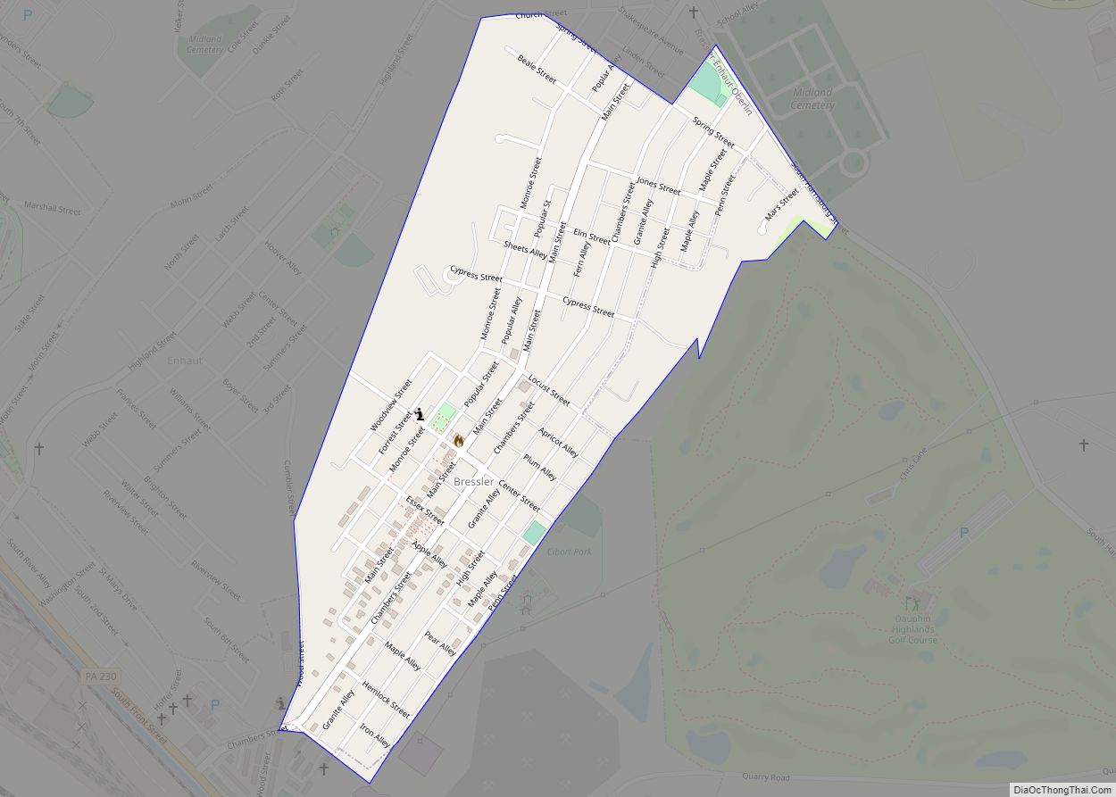
Bressler is an unincorporated community and census-designated place (CDP) located in Swatara Township, Dauphin County, in the U.S. state of Pennsylvania. The community was formerly part of the census-designated place of Bressler-Enhaut-Oberlin, before splitting into three separate CDPs for the 2010 census. As of the 2010 census the population of Bressler was 1,437. Bressler Bible ... Read more
Map of Bressler CDP
Map of Brentwood borough, Pennsylvania
Brentwood is a borough in Allegheny County, Pennsylvania, United States, and is part of the Pittsburgh Metro Area. The population was 10,082 at the 2020 census. Brentwood borough overview: Name: Brentwood borough LSAD Code: 21 LSAD Description: borough (suffix) State: Pennsylvania County: Allegheny County Incorporated: May 15, 1916 Elevation: 1,225 ft (373 m) Total Area: 1.45 sq mi (3.75 km²) ... Read more
Map of Brentwood borough, Pennsylvania
Map of Brockway borough
Brockway is a borough in Jefferson County, Pennsylvania, United States. The population was 2,072 at the 2010 census. Brockway borough overview: Name: Brockway borough LSAD Code: 21 LSAD Description: borough (suffix) State: Pennsylvania County: Jefferson County Incorporated: 1883 Elevation: 1,499 ft (457 m) Total Area: 1.22 sq mi (3.15 km²) Land Area: 1.19 sq mi (3.07 km²) Water Area: 0.03 sq mi (0.08 km²) Total Population: ... Read more
Map of Brockway borough
Map of Broad Top City borough
Broad Top City is a borough in Huntingdon County, Pennsylvania, United States. The population was 371 at the 2020 census, a decline from the figure of 452 tabulated in 2010. Broad Top City borough overview: Name: Broad Top City borough LSAD Code: 21 LSAD Description: borough (suffix) State: Pennsylvania County: Huntingdon County Elevation: 1,975 ft (602 m) ... Read more
Map of Broad Top City borough
Map of Bruin borough
Bruin is a borough in Butler County, Pennsylvania, United States. The population was 524 at the 2010 census. Bruin borough overview: Name: Bruin borough LSAD Code: 21 LSAD Description: borough (suffix) State: Pennsylvania County: Butler County Total Area: 1.82 sq mi (4.73 km²) Land Area: 1.82 sq mi (4.73 km²) Water Area: 0.00 sq mi (0.00 km²) Total Population: 423 Population Density: 231.78/sq mi (89.51/km²) ... Read more
Map of Bruin borough
Map of Browntown CDP, Pennsylvania
Browntown is a census-designated place (CDP) in Pittston Township, Luzerne County, Pennsylvania, United States, adjacent to Pittston City. The CDP population was 1,418 at the 2010 census. Browntown CDP overview: Name: Browntown CDP LSAD Code: 57 LSAD Description: CDP (suffix) State: Pennsylvania County: Luzerne County Total Area: 0.5 sq mi (1.2 km²) Land Area: 0.5 sq mi (1.2 km²) Water Area: ... Read more
Map of Browntown CDP, Pennsylvania
Map of Brownsville borough, Pennsylvania
Brownsville is a borough in Fayette County, Pennsylvania, United States, first settled in 1785 as the site of a trading post a few years after the defeat of the Iroquois enabled a resumption of westward migration after the Revolutionary War. The trading post soon became a tavern and inn and was receiving emigrants heading west, ... Read more
Map of Brownsville borough, Pennsylvania
Map of Brownstown CDP, Pennsylvania
Brownstown is an unincorporated community and census-designated place (CDP) in West Earl Township, Lancaster County, Pennsylvania, United States. As of the 2010 census, the population was 2,816. Brownstown CDP overview: Name: Brownstown CDP LSAD Code: 57 LSAD Description: CDP (suffix) State: Pennsylvania County: Lancaster County Elevation: 340 ft (100 m) Total Area: 2.54 sq mi (6.57 km²) Land Area: 2.49 sq mi ... Read more
Map of Brownstown CDP, Pennsylvania
Map of Broomall CDP
Broomall is a census-designated place (CDP) in Marple Township, Delaware County, Pennsylvania, United States. The population was 10,789 at the 2010 census. Broomall CDP overview: Name: Broomall CDP LSAD Code: 57 LSAD Description: CDP (suffix) State: Pennsylvania County: Delaware County Elevation: 351 ft (107 m) Total Area: 3.17 sq mi (8.21 km²) Land Area: 3.17 sq mi (8.21 km²) Water Area: 0.00 sq mi (0.00 km²) ... Read more
Map of Broomall CDP
Map of Brookville borough, Pennsylvania
Brookville is a borough in Jefferson County in the U.S. state of Pennsylvania, 80 miles (130 km) northeast of Pittsburgh. As of the 2010 census, the population was 3,933. Founded in 1830, it is the county seat of Jefferson County. Brookville borough overview: Name: Brookville borough LSAD Code: 21 LSAD Description: borough (suffix) State: Pennsylvania County: ... Read more
Map of Brookville borough, Pennsylvania
Map of Brookhaven borough, Pennsylvania
Brookhaven is a borough in Delaware County, Pennsylvania, United States. The population was 8,300 at the 2020 census. Brookhaven borough overview: Name: Brookhaven borough LSAD Code: 21 LSAD Description: borough (suffix) State: Pennsylvania County: Delaware County Elevation: 98 ft (30 m) Total Area: 1.71 sq mi (4.43 km²) Land Area: 1.71 sq mi (4.42 km²) Water Area: 0.00 sq mi (0.00 km²) Total Population: 8,300 Population ... Read more
Map of Brookhaven borough, Pennsylvania
Map of Brodheadsville CDP
Brodheadsville is a census-designated place (CDP) in Monroe County, Pennsylvania, United States. The population was 1,700 at the 2020 census. The community is served by Pleasant Valley School District. Brodheadsville CDP overview: Name: Brodheadsville CDP LSAD Code: 57 LSAD Description: CDP (suffix) State: Pennsylvania County: Monroe County Elevation: 745 ft (227 m) Total Area: 4.32 sq mi (11.18 km²) Land ... Read more
Map of Brodheadsville CDP