Brookville is a borough in Jefferson County in the U.S. state of Pennsylvania, 80 miles (130 km) northeast of Pittsburgh. As of the 2010 census, the population was 3,933. Founded in 1830, it is the county seat of Jefferson County.
| Name: | Brookville borough |
|---|---|
| LSAD Code: | 21 |
| LSAD Description: | borough (suffix) |
| State: | Pennsylvania |
| County: | Jefferson County |
| Incorporated: | 1830 |
| Elevation: | 1,273 ft (388 m) |
| Total Area: | 3.24 sq mi (8.38 km²) |
| Land Area: | 3.15 sq mi (8.15 km²) |
| Water Area: | 0.09 sq mi (0.23 km²) |
| Total Population: | 3,995 |
| Population Density: | 1,269.87/sq mi (490.37/km²) |
| ZIP code: | 15825 |
| Area code: | 814 |
| FIPS code: | 4209224 |
| Website: | borough.brookville.pa.us |
Online Interactive Map
Click on ![]() to view map in "full screen" mode.
to view map in "full screen" mode.
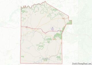
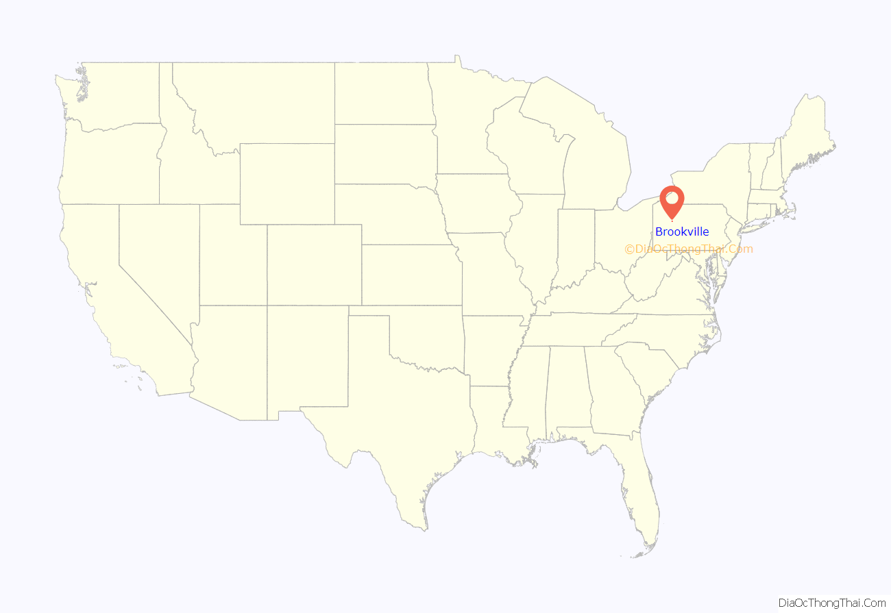
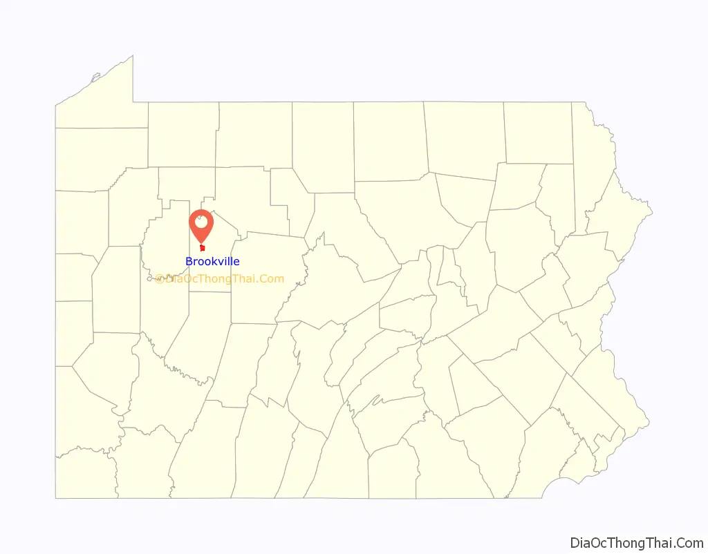
Brookville location map. Where is Brookville borough?
History
The area was initially settled in the late 1790s upon the arrival of brothers Joseph and Andrew Barnett, as well as their brother-in-law Samuel Scott, who together established the first settlement at the confluence of the Sandy Lick and Mill Creeks in the area now known as Port Barnett. The first non-Native American settler of the land within the eventual town limits was Moses Knapp, who built a log house at the confluence of North Fork Creek and Sandy Lick Creek (which form Redbank Creek) in 1801.
The 105th Pennsylvania Infantry Regiment, also known as the Wildcat Regiment, was a volunteer infantry regiment that served in the Union Army during the American Civil War and was raised by Amor A. McKnight of Brookville. The Regiment fought in several engagements, including Chancellorsville and Spotsylvania Court House.
Brookville’s main source of economic development throughout the 19th century was the lumber industry. Brookville’s many creeks and its connection to larger rivers (the Clarion to the north, which, like the Redbank, flows to the Allegheny) allowed for extensive construction of lumber mills along the watersheds and the floating of timber to markets in Pittsburgh. The town enjoyed great economic success during the late 19th and early 20th centuries, serving as home to several factories, breweries, an important railroad stop for local coal and timber, and briefly the Twyford Motor Car Company, which operated from 1905 to 1907 and produced the world’s first four-wheel drive automobile.
The Brookville Historic District, Brookville Presbyterian Church and Manse, Gray-Taylor House, Joseph E. Hall House, and Phillip Taylor House are listed on the National Register of Historic Places.
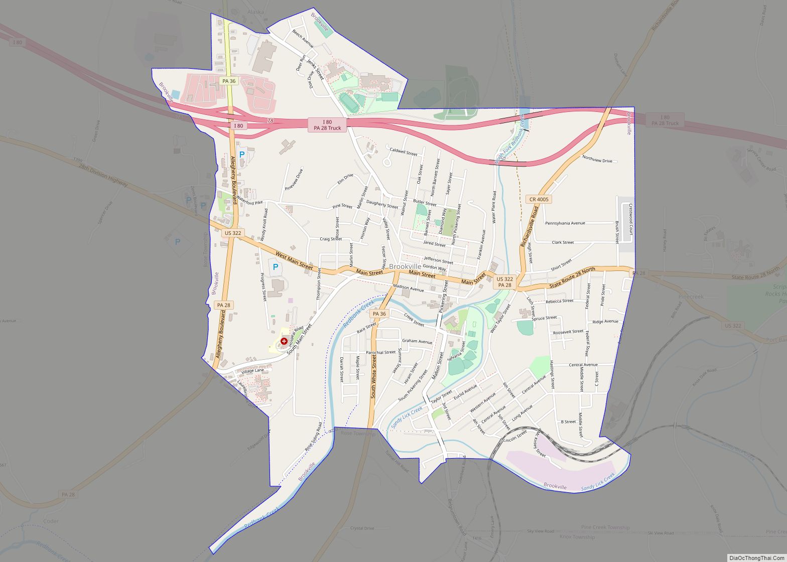
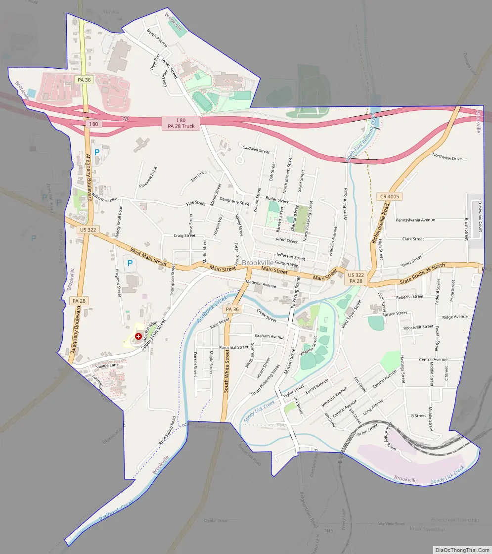
Brookville Road Map
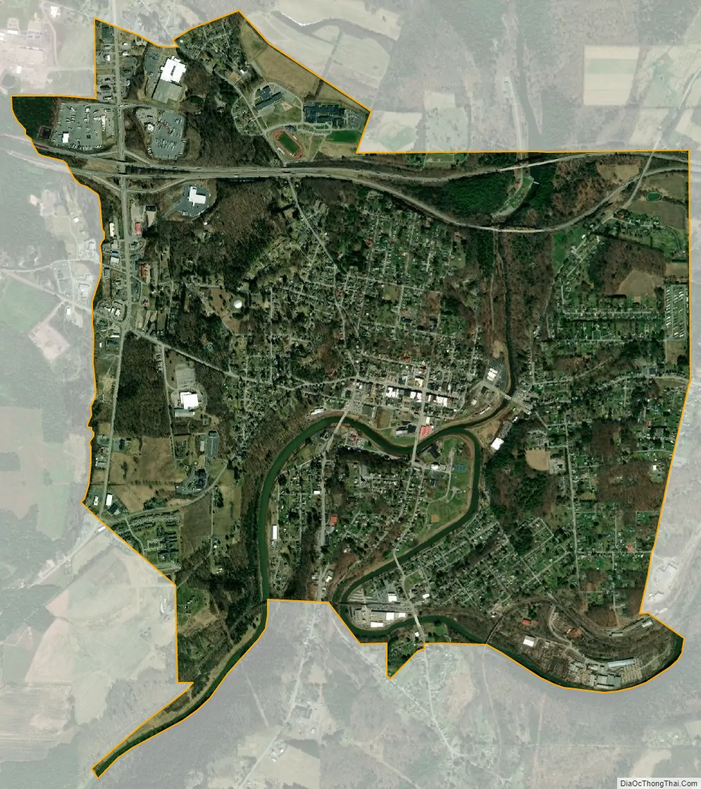
Brookville city Satellite Map
Geography
Brookville is located in west-central Jefferson County at 41°9′35″N 79°4′49″W / 41.15972°N 79.08028°W / 41.15972; -79.08028 (41.159654, -79.080276), at the confluence of the North Fork and Sandy Lick Creek, forming Redbank Creek, a westward-flowing tributary of the Allegheny River.
U.S. Route 322 (Main Street) passes through the center of town, leading southeast 12 miles (19 km) to Reynoldsville and west 16 miles (26 km) to Clarion. Interstate 80 passes through the northern side of the borough, with access from exits 78 and 81. I-80 leads east 20 miles (32 km) to DuBois and west 60 miles (97 km) to Interstate 79 near Mercer. Pennsylvania Route 28 joins US 322 as Main Street through Brookville, but leads northeast 17 miles (27 km) to Brockway and southwest 19 miles (31 km) to New Bethlehem. Pennsylvania Route 36 leads northwest from Brookville 23 miles (37 km) to Leeper and south 19 miles (31 km) to Punxsutawney.
Brookville is in the Eastern Standard Time zone. The center of town in the Redbank Creek valley is at an elevation of 1,273 feet (388 m), but hills lining the valley rise to summits ranging from 1,460 to 1,600 feet (450 to 490 m) within the borough limits. According to the U.S. Census Bureau, the borough has a total area of 3.2 square miles (8.3 km), of which 3.1 square miles (8.1 km) are land and 0.1 square miles (0.2 km), or 2.83%, are water.
See also
Map of Pennsylvania State and its subdivision:- Adams
- Allegheny
- Armstrong
- Beaver
- Bedford
- Berks
- Blair
- Bradford
- Bucks
- Butler
- Cambria
- Cameron
- Carbon
- Centre
- Chester
- Clarion
- Clearfield
- Clinton
- Columbia
- Crawford
- Cumberland
- Dauphin
- Delaware
- Elk
- Erie
- Fayette
- Forest
- Franklin
- Fulton
- Greene
- Huntingdon
- Indiana
- Jefferson
- Juniata
- Lackawanna
- Lancaster
- Lawrence
- Lebanon
- Lehigh
- Luzerne
- Lycoming
- Mc Kean
- Mercer
- Mifflin
- Monroe
- Montgomery
- Montour
- Northampton
- Northumberland
- Perry
- Philadelphia
- Pike
- Potter
- Schuylkill
- Snyder
- Somerset
- Sullivan
- Susquehanna
- Tioga
- Union
- Venango
- Warren
- Washington
- Wayne
- Westmoreland
- Wyoming
- York
- Alabama
- Alaska
- Arizona
- Arkansas
- California
- Colorado
- Connecticut
- Delaware
- District of Columbia
- Florida
- Georgia
- Hawaii
- Idaho
- Illinois
- Indiana
- Iowa
- Kansas
- Kentucky
- Louisiana
- Maine
- Maryland
- Massachusetts
- Michigan
- Minnesota
- Mississippi
- Missouri
- Montana
- Nebraska
- Nevada
- New Hampshire
- New Jersey
- New Mexico
- New York
- North Carolina
- North Dakota
- Ohio
- Oklahoma
- Oregon
- Pennsylvania
- Rhode Island
- South Carolina
- South Dakota
- Tennessee
- Texas
- Utah
- Vermont
- Virginia
- Washington
- West Virginia
- Wisconsin
- Wyoming