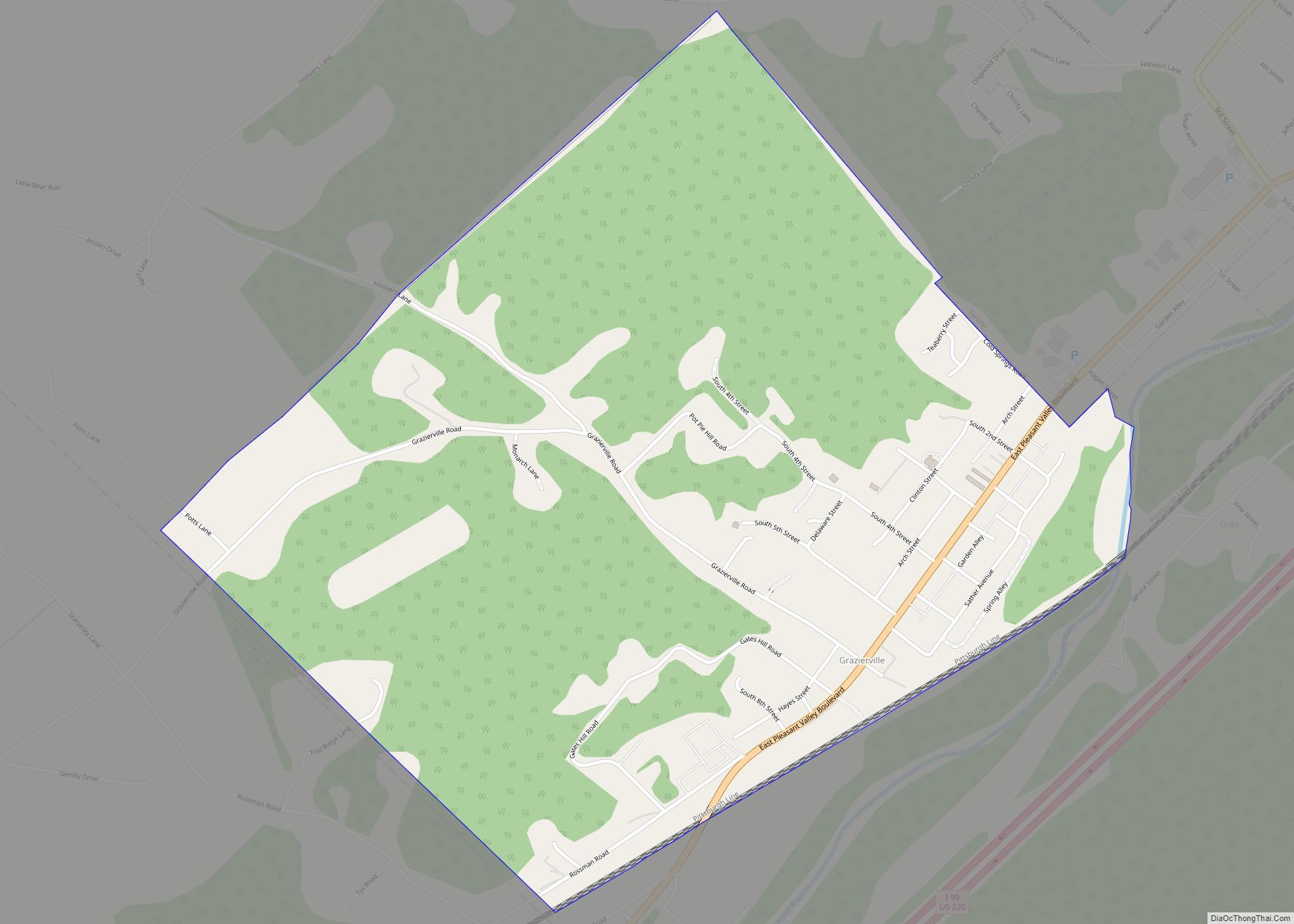
Map of Grassflat CDP
Grassflat is a census-designated place located in Cooper Township, Clearfield County, in the state of Pennsylvania. As of the 2020 census, the population was 479. Pennsylvania Route 53 passes just west of the community, leading 3 miles (5 km) southwest to Interstate 80, Exit 133 at Kylertown and 12 miles (19 km) east to Snow Shoe. Grassflat ... Read more
Map of Grassflat CDP
Map of Grapeville CDP
Grapeville is a census-designated place (CDP) in Hempfield Township, Westmoreland County, Pennsylvania, United States. The population was 676 at the time of the 2000 census. Grapeville CDP overview: Name: Grapeville CDP LSAD Code: 57 LSAD Description: CDP (suffix) State: Pennsylvania County: Westmoreland County Total Area: 0.13 sq mi (0.33 km²) Land Area: 0.13 sq mi (0.33 km²) Water Area: 0.00 sq mi (0.00 km²) ... Read more
Map of Grapeville CDP
Map of Greenwood CDP, Pennsylvania
Greenwood is a census-designated place in Logan Township, Blair County, Pennsylvania, United States. It is located near I-99 and is adjacent in the northeast to the city of Altoona. As of the 2010 census, the population was 2,458 residents. It is often considered a district of Altoona, as the addresses are listed as Altoona addresses ... Read more
Map of Greenwood CDP, Pennsylvania
Map of Greenville borough, Pennsylvania
Greenville is a borough with home rule status in northwestern Mercer County, Pennsylvania, United States. Located along the Shenango River, it lies roughly 80 miles from both Pittsburgh and Cleveland. It is 1.89 square miles in area, and had a population of 5,541 as of the 2020 census. Incorporated as the Borough of West Greenville ... Read more
Map of Greenville borough, Pennsylvania
Map of Greensburg city, Pennsylvania
Greensburg is a city in and the county seat of Westmoreland County, Pennsylvania, United States. The population was 14,976 at the 2020 census. The city lies within the Laurel Highlands and the ecoregion of the Western Allegheny Plateau and is a part of the Pittsburgh metropolitan area. The city is named after Nathanael Greene, a ... Read more
Map of Greensburg city, Pennsylvania
Map of Greensboro borough, Pennsylvania
Greensboro is a borough in Greene County, Pennsylvania, United States. The population was 267 at the 2020 census, up from 260 at the 2010 census. Greensboro borough overview: Name: Greensboro borough LSAD Code: 21 LSAD Description: borough (suffix) State: Pennsylvania County: Greene County Elevation: 800 ft (200 m) Total Area: 0.15 sq mi (0.38 km²) Land Area: 0.11 sq mi (0.28 km²) Water ... Read more
Map of Greensboro borough, Pennsylvania
Map of Greens Landing CDP
Greens Landing is a census-designated place in Athens Township, Bradford County, Pennsylvania, United States. It is part of Northeastern Pennsylvania and is located along US Route 220 approximately five miles south of the borough of Athens. As of the 2010 census, the population of Greens Landing was 894 residents. Greens Landing CDP overview: Name: Greens ... Read more
Map of Greens Landing CDP
Map of Greenock CDP
Greenock is a census-designated place (CDP) in Elizabeth Township, Allegheny County, Pennsylvania, United States. As of the 2020 US Census the population was 1,989. The community was named after Greenock, Scotland. Greenock CDP overview: Name: Greenock CDP LSAD Code: 57 LSAD Description: CDP (suffix) State: Pennsylvania County: Allegheny County Total Area: 1.15 sq mi (2.98 km²) Land Area: ... Read more
Map of Greenock CDP
Map of Greenfields CDP
Greenfields is a census-designated place in Bern Township, Berks County, Pennsylvania, United States. It is located approximately one mile to the west of the city of Reading at the confluence of the Tulpehocken Creek and Schuylkill River. As of the 2010 census, the population was 1,170 residents. Greenfields CDP overview: Name: Greenfields CDP LSAD Code: ... Read more
Map of Greenfields CDP
Map of Greencastle borough, Pennsylvania
Greencastle is a borough in Franklin County in south-central Pennsylvania, United States. The population was 4,251 at the 2020 census. Greencastle lies within the Cumberland Valley of Pennsylvania. Greencastle borough overview: Name: Greencastle borough LSAD Code: 21 LSAD Description: borough (suffix) State: Pennsylvania County: Franklin County Elevation: 587 ft (179 m) Total Area: 1.59 sq mi (4.11 km²) Land Area: ... Read more
Map of Greencastle borough, Pennsylvania
Map of Green Tree borough
Green Tree is a borough in Allegheny County, Pennsylvania, United States, and a suburb of Pittsburgh. The population was 4,941 at the 2020 census. The town is the hometown of U.S. Congressman and 2012 Republican presidential candidate Ron Paul and Star Trek/Heroes star Zachary Quinto, both of whom were born in nearby Pittsburgh. Green Tree ... Read more
Map of Green Tree borough
Map of Grier City CDP
Grier City is a census-designated place located in Rush Township, Schuylkill County in the state of Pennsylvania, United States. Grier City was part of the Grier City-Park Crest CDP for the 2000 census, before splitting into two separate CDPs for the 2010 census, the other being Park Crest. The community is located off Interstate 81. ... Read more
Map of Grier City CDP