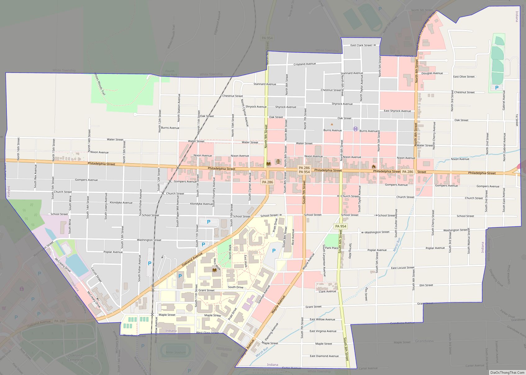
Map of Indian Lake borough, Pennsylvania
Indian Lake (Private Lake only to land owners within the borough) is a borough in Somerset County, Pennsylvania, United States. It is part of the Johnstown, Pennsylvania Metropolitan Statistical Area. The population was 391 at the 2020 census, down from 394 in 2010. Indian Lake is home to Indian Lake Golf Club, which opened in ... Read more
Map of Indian Lake borough, Pennsylvania
Map of Imperial CDP, Pennsylvania
Imperial is a census-designated place (CDP) in Allegheny County, Pennsylvania, United States and part of the Pittsburgh metropolitan area. The population was 2,722 at the 2020 census. The CDP is located in North Fayette and Findlay Townships, and geographically close to Pittsburgh International Airport. Imperial CDP overview: Name: Imperial CDP LSAD Code: 57 LSAD Description: ... Read more
Map of Imperial CDP, Pennsylvania
Map of Irvona borough
Irvona is a borough in Clearfield County, Pennsylvania, United States. The population was 549 at the 2020 census. Irvona borough overview: Name: Irvona borough LSAD Code: 21 LSAD Description: borough (suffix) State: Pennsylvania County: Clearfield County Incorporated: 1890 Elevation: 1,379 ft (420 m) Total Area: 0.95 sq mi (2.46 km²) Land Area: 0.93 sq mi (2.41 km²) Water Area: 0.02 sq mi (0.05 km²) Total Population: ... Read more
Map of Irvona borough
Map of Iola CDP, Pennsylvania
Iola is a census-designated place in Columbia County, Pennsylvania, United States. It is part of Northeastern Pennsylvania. The population was 144 at the 2010 census. It is part of the Bloomsburg-Berwick micropolitan area. Iola CDP overview: Name: Iola CDP LSAD Code: 57 LSAD Description: CDP (suffix) State: Pennsylvania County: Columbia County Elevation: 653 ft (199 m) Total ... Read more
Map of Iola CDP, Pennsylvania
Map of Jeannette city
Jeannette is a city in Westmoreland County, Pennsylvania, United States. Jeannette was founded in 1888. The city got its name from one of the original city fathers, who wished to honor his wife, Jeannette McLaughlin, by giving the new town her first name: Jeannette. The city celebrated its 125th anniversary in July 2013. The population ... Read more
Map of Jeannette city
Map of Jamison City CDP
Jamison City is a census-designated place in Sugarloaf Township, Columbia County, Pennsylvania, United States. It is part of Northeastern Pennsylvania. The population was 134 at the 2010 census. It is part of the Bloomsburg-Berwick micropolitan area. Jamison City CDP overview: Name: Jamison City CDP LSAD Code: 57 LSAD Description: CDP (suffix) State: Pennsylvania County: Columbia ... Read more
Map of Jamison City CDP
Map of Jamestown borough, Pennsylvania
Jamestown is a borough in northwestern Mercer County, Pennsylvania, United States, along the Shenango River. The population was reported as 580 on the 2020 census. It is part of the Youngstown–Warren metropolitan area. Jamestown borough overview: Name: Jamestown borough LSAD Code: 21 LSAD Description: borough (suffix) State: Pennsylvania County: Mercer County Founded: 1798 Total Area: ... Read more
Map of Jamestown borough, Pennsylvania
Map of James City CDP, Pennsylvania
James City, formerly Durant City, is an unincorporated community and census-designated place in Elk County, Pennsylvania, United States. It lies approximately 4 miles (6 km) south of Kane, about 1 mile (1.6 km) away from Pennsylvania Route 66. It is in the northern part of Highland Township, and its northern border is the McKean County line. As ... Read more
Map of James City CDP, Pennsylvania
Map of Jacobus borough
Jacobus (/dʒɑːkoʊbʌs/) is a borough which is located in York County, Pennsylvania, United States. A suburb of York, the population was 1,829 at the time of the 2020 census. Jacobus borough overview: Name: Jacobus borough LSAD Code: 21 LSAD Description: borough (suffix) State: Pennsylvania County: York County Incorporated: 1929 Elevation: 623 ft (190 m) Total Area: 0.93 sq mi ... Read more
Map of Jacobus borough
Map of Jacksonwald CDP
Jacksonwald is a census-designated place in Exeter Township, Berks County, Pennsylvania, United States. It is located less than a mile from the borough of St. Lawrence. As of the 2010 census, the population was 3,393 residents. The Village of Jacksonwald was established in 1870, when John Jackson built the Jacksonwald Hotel on the corner of ... Read more
Map of Jacksonwald CDP
Map of Jacksonville CDP, Pennsylvania
Jacksonville (also known as Kent) is a census-designated place (CDP) in Indiana County, Pennsylvania, United States. The population was 637 at the 2010 census. It was formerly an independent borough, until January 1, 1993 when it was returned to Black Lick Township, Pennsylvania. Jacksonville CDP overview: Name: Jacksonville CDP LSAD Code: 57 LSAD Description: CDP ... Read more
Map of Jacksonville CDP, Pennsylvania
Map of Jackson Center borough, Pennsylvania
Jackson Center is a borough in eastern Mercer County, Pennsylvania, United States. The population was 192 at the 2020 census. It is part of the Youngstown–Warren metropolitan area. Jackson Center borough overview: Name: Jackson Center borough LSAD Code: 21 LSAD Description: borough (suffix) State: Pennsylvania County: Mercer County Total Area: 1.14 sq mi (2.95 km²) Land Area: 1.14 sq mi ... Read more
Map of Jackson Center borough, Pennsylvania