Map of Pikes Creek CDP
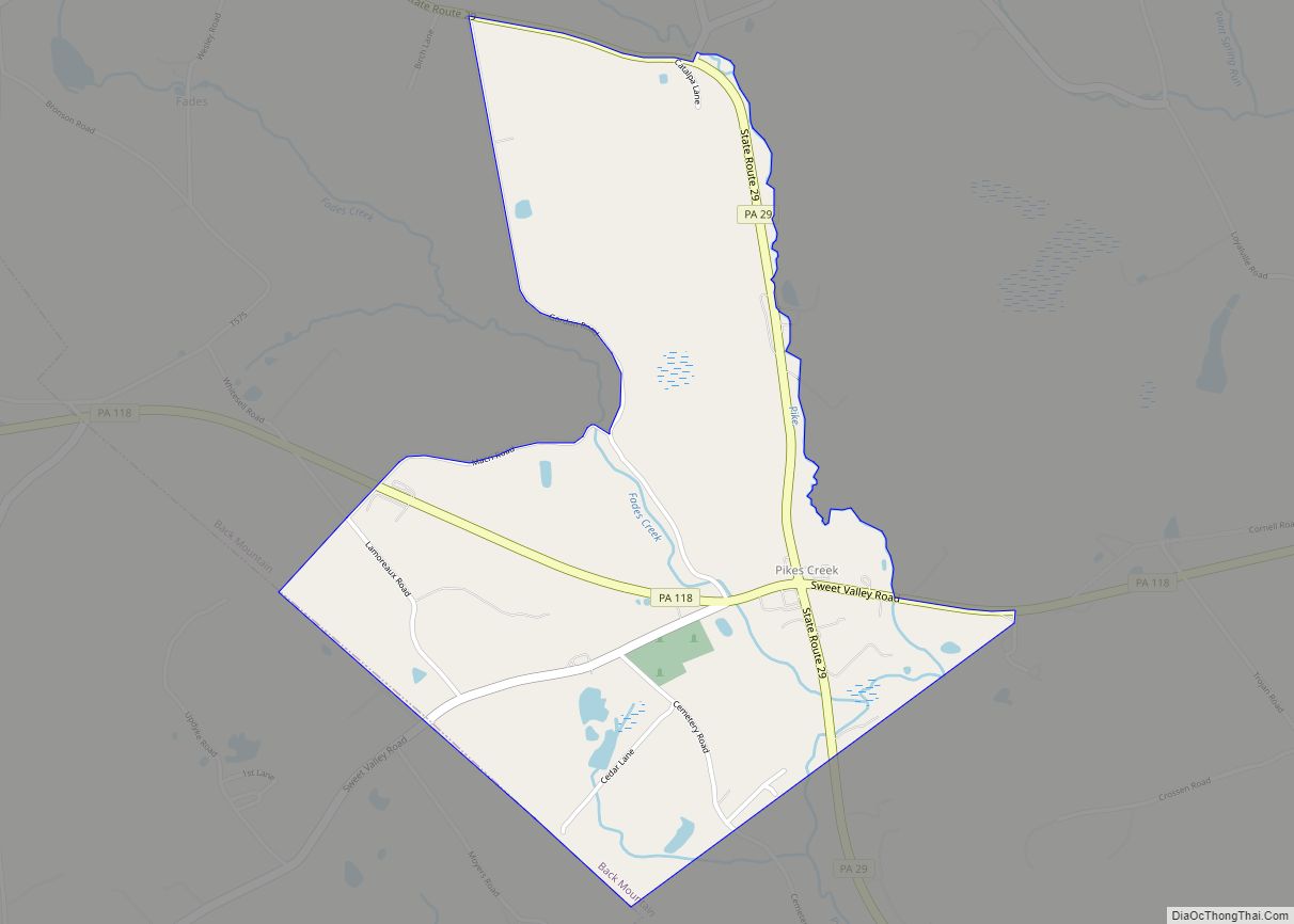
Pikes Creek is a census-designated place (CDP) in Lake Township, Luzerne County, Pennsylvania, United States. The population was 269 at the 2010 census. Pikes Creek CDP overview: Name: Pikes Creek CDP LSAD Code: 57 LSAD Description: CDP (suffix) State: Pennsylvania County: Luzerne County Total Area: 1.27 sq mi (3.30 km²) Land Area: 1.27 sq mi (3.30 km²) Water Area: 0.00 sq mi (0.00 km²) ... Read more
Map of Pikes Creek CDP
Map of Picture Rocks borough, Pennsylvania
Picture Rocks is a borough in Lycoming County, Pennsylvania, United States. The 2020 census measured the population at 640. It is part of the Williamsport, Pennsylvania Metropolitan Statistical Area. Picture Rocks borough overview: Name: Picture Rocks borough LSAD Code: 21 LSAD Description: borough (suffix) State: Pennsylvania County: Lycoming County Incorporated: 1857 Elevation: 646 ft (197 m) Total ... Read more
Map of Picture Rocks borough, Pennsylvania
Map of Phoenixville borough
Phoenixville is a borough in Chester County, Pennsylvania, United States. It is located 28 miles (45 km) northwest of Philadelphia at the junction of French Creek and the Schuylkill River. It is in the Philadelphia metropolitan area. According to a 2021 estimate, the population was 19,029. As noted by Forbes, Phoenixville is a former beaten-down mill ... Read more
Map of Phoenixville borough
Map of Philipsburg borough, Pennsylvania
Philipsburg is a borough in Centre County, Pennsylvania. It is located at 40°53′42″N 78°13′09″W / 40.89500°N 78.21917°W / 40.89500; -78.21917Coordinates: 40°53′42″N 78°13′09″W / 40.89500°N 78.21917°W / 40.89500; -78.21917 (40.895, -78.2193). It is part of the State College, Pennsylvania metropolitan statistical area. The borough’s population was 2,770 at the 2010 census. Philipsburg borough overview: Name: Philipsburg ... Read more
Map of Philipsburg borough, Pennsylvania
Map of Petrolia borough, Pennsylvania
Petrolia is a borough in Butler County, Pennsylvania, United States. The population was 212 at the 2010 census. Petrolia borough overview: Name: Petrolia borough LSAD Code: 21 LSAD Description: borough (suffix) State: Pennsylvania County: Butler County Incorporated: 1873 Elevation: 1,178 ft (359 m) Total Area: 0.40 sq mi (1.02 km²) Land Area: 0.40 sq mi (1.02 km²) Water Area: 0.00 sq mi (0.00 km²) Total Population: ... Read more
Map of Petrolia borough, Pennsylvania
Map of Petersburg borough, Pennsylvania
Petersburg is a borough in Huntingdon County, Pennsylvania, United States. It was a stop on the former Pennsylvania Railroad Main Line between Tyrone and Huntingdon and the junction point for the Petersburg Branch. The population was 480 at the 2010 census. Petersburg borough overview: Name: Petersburg borough LSAD Code: 21 LSAD Description: borough (suffix) State: ... Read more
Map of Petersburg borough, Pennsylvania
Map of Platea borough
Platea is a borough in Erie County, Pennsylvania, United States. The population was 443 at the 2020 census. Platea borough overview: Name: Platea borough LSAD Code: 21 LSAD Description: borough (suffix) State: Pennsylvania County: Erie County Total Area: 3.34 sq mi (8.66 km²) Land Area: 3.34 sq mi (8.66 km²) Water Area: 0.00 sq mi (0.00 km²) Total Population: 442 Population Density: 132.22/sq mi (51.05/km²) ... Read more
Map of Platea borough
Map of Plains CDP, Pennsylvania
Plains is a census-designated place (CDP) in Plains Township, Luzerne County, Pennsylvania, United States. The population of the CDP was 4,335 at the 2010 census, out of 9,961 in the entire township. Plains CDP overview: Name: Plains CDP LSAD Code: 57 LSAD Description: CDP (suffix) State: Pennsylvania County: Luzerne County Total Area: 1.28 sq mi (3.31 km²) Land ... Read more
Map of Plains CDP, Pennsylvania
Map of Plainfield CDP, Pennsylvania
Plainfield is a census-designated place (CDP) in Cumberland County, Pennsylvania, United States. The population was 399 at the 2010 census. It is part of the Harrisburg–Carlisle metropolitan statistical area. Plainfield CDP overview: Name: Plainfield CDP LSAD Code: 57 LSAD Description: CDP (suffix) State: Pennsylvania County: Cumberland County Elevation: 509 ft (155 m) Total Area: 0.65 sq mi (1.67 km²) Land ... Read more
Map of Plainfield CDP, Pennsylvania
Map of Pittston city
Pittston is a city in Luzerne County, Pennsylvania, United States. It is situated between Scranton and Wilkes-Barre in Northeastern Pennsylvania. The city gained prominence in the late 19th and early 20th centuries as an active anthracite coal mining city, drawing a large portion of its labor force from European immigrants. The population was 7,739 as ... Read more
Map of Pittston city
Map of Pitcairn borough
Pitcairn /ˈpɪtkɛərn/ is a borough in Allegheny County, Pennsylvania, United States, located 12 miles (19 km) east of Pittsburgh‘s central business district, named for Robert Pitcairn, an official of the Pennsylvania Railroad. Early in the 20th century, Pitcairn was the site of large railroad yards and shops that employed nearly ten thousand men. The population increased ... Read more
Map of Pitcairn borough
Map of Pine Ridge CDP, Pennsylvania
Pine Ridge is a census-designated place located in Lehman Township, Pike County in the state of Pennsylvania. The community is located near U.S. Route 209 close to the New Jersey line. Pine Ridge is just to the south and shares a northern border with another CDP, Pocono Mountain Lake Estates. As of the 2010 census, ... Read more
Map of Pine Ridge CDP, Pennsylvania