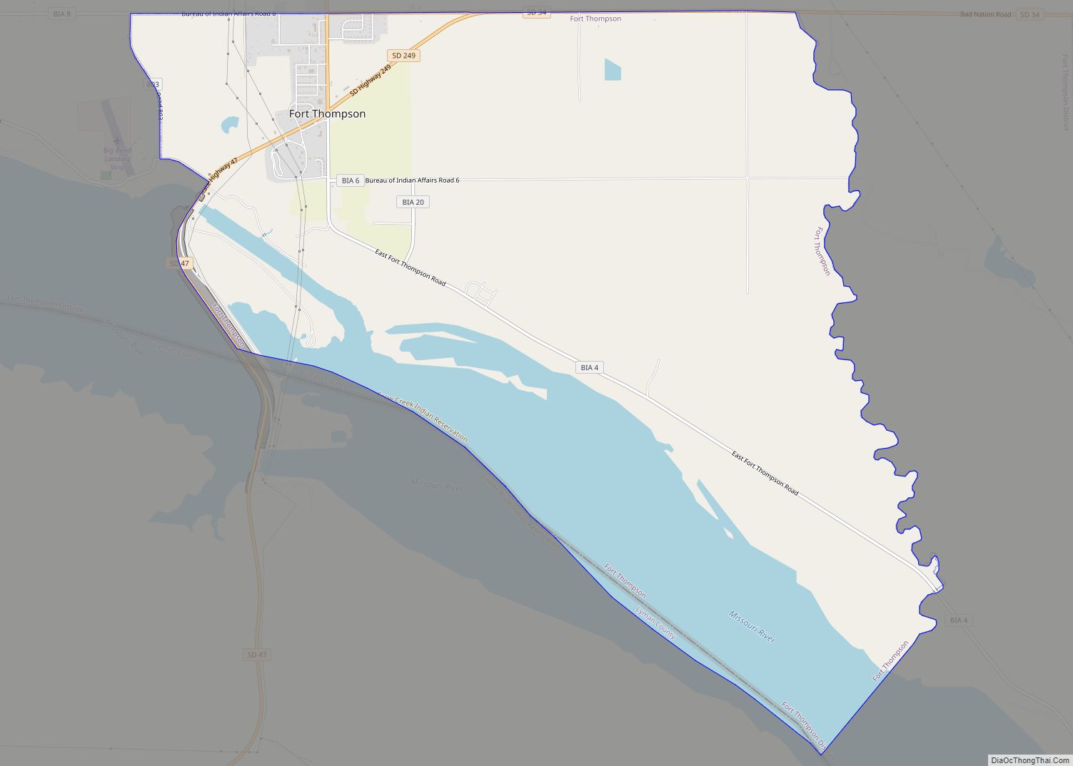
Map of Florence town, South Dakota

Map of Florence town, South Dakota

Florence is a town in northwestern Codington County, South Dakota, United States. It is part of the Watertown, South Dakota Micropolitan Statistical Area. The population was 337 at the 2020 census. Florence was named for a lady acquaintance of a railroad employee. Florence town overview: Name: Florence town LSAD Code: 43 LSAD Description: town (suffix) … Read more

Map of Flandreau city

Map of Flandreau city

Flandreau /ˈflændruː/ FLAN-droo is a city in and county seat of Moody County, South Dakota, United States. The population was 2,372 at the 2020 census. It was named in honor of Charles Eugene Flandrau, a judge in the territory and state of Minnesota. He is credited with saving the community of New Ulm, Minnesota, from … Read more

Map of Ferney CDP

Map of Ferney CDP

Ferney is an unincorporated community and census-designated place in Brown County, South Dakota, United States. As of the 2020 census it had a population of 42. Ferney has been assigned the ZIP code of 57439. Ferney CDP overview: Name: Ferney CDP LSAD Code: 57 LSAD Description: CDP (suffix) State: South Dakota County: Brown County Elevation: … Read more

Map of Gayville town

Map of Gayville town

Gayville is a town in Yankton County, South Dakota, United States. The population was 382 at the 2020 census. Gayville town overview: Name: Gayville town LSAD Code: 43 LSAD Description: town (suffix) State: South Dakota County: Yankton County Incorporated: 1892 Elevation: 1,161 ft (354 m) Total Area: 0.20 sq mi (0.53 km²) Land Area: 0.20 sq mi (0.53 km²) Water Area: 0.00 sq mi (0.00 km²) … Read more

Map of Gary city, South Dakota

Map of Gary city, South Dakota

Gary is a city in Deuel County, South Dakota, United States. The population was 240 at the 2020 census. South Dakota Highway 101 serves as the main route of the community. Gary city overview: Name: Gary city LSAD Code: 25 LSAD Description: city (suffix) State: South Dakota County: Deuel County Incorporated: 1917 Elevation: 1,467 ft (447 m) … Read more

Map of Garretson city

Map of Garretson city

Garretson is a city in Minnehaha County, South Dakota, United States. The city had a population of 1,228 at the 2020 census. Garretson city overview: Name: Garretson city LSAD Code: 25 LSAD Description: city (suffix) State: South Dakota County: Minnehaha County Incorporated: 1891 Elevation: 1,503 ft (458 m) Total Area: 1.50 sq mi (3.89 km²) Land Area: 1.46 sq mi (3.77 km²) Water … Read more

Map of Garden City town, South Dakota

Map of Garden City town, South Dakota

Garden City is a town in Clark County, South Dakota, United States. The population was 33 at the 2020 census. Garden City town overview: Name: Garden City town LSAD Code: 43 LSAD Description: town (suffix) State: South Dakota County: Clark County Elevation: 1,850 ft (564 m) Total Area: 0.40 sq mi (1.02 km²) Land Area: 0.40 sq mi (1.02 km²) Water Area: 0.00 sq mi … Read more

Map of Gann Valley CDP

Map of Gann Valley CDP

Gann Valley CDP overview: Name: Gann Valley CDP LSAD Code: 57 LSAD Description: CDP (suffix) State: South Dakota County: Buffalo County FIPS code: 4623421 Online Interactive Map Gann Valley online map. Source: Basemap layers from Google Map, Open Street Map (OSM), Arcgisonline, Wmflabs. Boundary Data from Database of Global Administrative Areas. Gann Valley location map. … Read more

Map of Fulton town, South Dakota

Map of Fulton town, South Dakota

Fulton is a town in Hanson County, South Dakota, United States. It is part of the Mitchell, South Dakota Micropolitan Statistical Area. The population was 87 at the 2020 census. Fulton town overview: Name: Fulton town LSAD Code: 43 LSAD Description: town (suffix) State: South Dakota County: Hanson County Elevation: 1,325 ft (404 m) Total Area: 0.85 sq mi … Read more

Map of Fruitdale town, South Dakota

Map of Fruitdale town, South Dakota

Fruitdale is a town in Butte County, South Dakota, United States. The population was 73 at the 2020 census. Fruitdale was laid out in 1911, and named for a fruit orchard near the original town site. Fruitdale town overview: Name: Fruitdale town LSAD Code: 43 LSAD Description: town (suffix) State: South Dakota County: Butte County … Read more

Map of Freeman city, South Dakota

Map of Freeman city, South Dakota

Freeman is a city in Hutchinson County, South Dakota, United States. The population was 1,329 at the 2020 census. Freeman was laid out in 1879. Freeman city overview: Name: Freeman city LSAD Code: 25 LSAD Description: city (suffix) State: South Dakota County: Hutchinson County Incorporated: 1893 Elevation: 1,512 ft (461 m) Total Area: 1.49 sq mi (3.86 km²) Land Area: … Read more

Map of Frederick town, South Dakota

Map of Frederick town, South Dakota

Frederick is a town in northwestern Brown County, South Dakota, United States. The population was 215 at the 2020 census. Home to the annual Frederick Finn Fest, the town is part of the Aberdeen Micropolitan Statistical Area. Frederick town overview: Name: Frederick town LSAD Code: 43 LSAD Description: town (suffix) State: South Dakota County: Brown … Read more