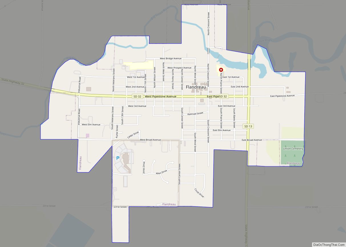
Flandreau /ˈflændruː/ FLAN-droo is a city in and county seat of Moody County, South Dakota, United States. The population was 2,372 at the 2020 census. It was named in honor of Charles Eugene Flandrau, a judge in the territory and state of Minnesota. He is credited with saving the community of New Ulm, Minnesota, from destruction during conflict with the Sioux tribe in 1862.
In 2015, the nearby federally recognized Flandreau Indian Reservation of Santee Sioux had planned to open the nation’s first recreational marijuana lounge in a former bowling alley, close to its existing Royal River Casino and Hotel. Any tourists or non-tribal members using marijuana on tribal land risked state prosecution, so they abandoned the plan.
| Name: | Flandreau city |
|---|---|
| LSAD Code: | 25 |
| LSAD Description: | city (suffix) |
| State: | South Dakota |
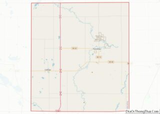
| County: | Moody County |
| Incorporated: | 1902 |
| Elevation: | 1,565 ft (477 m) |
| Total Area: | 1.93 sq mi (4.99 km²) |
| Land Area: | 1.86 sq mi (4.81 km²) |
| Water Area: | 0.07 sq mi (0.17 km²) |
| Total Population: | 2,372 |
| Population Density: | 1,275.95/sq mi (492.72/km²) |
| ZIP code: | 57028 |
| Area code: | 605 |
| FIPS code: | 4621540 |
| GNISfeature ID: | 1255073 |
| Website: | www.cityofflandreau.com |
Online Interactive Map
Click on ![]() to view map in "full screen" mode.
to view map in "full screen" mode.
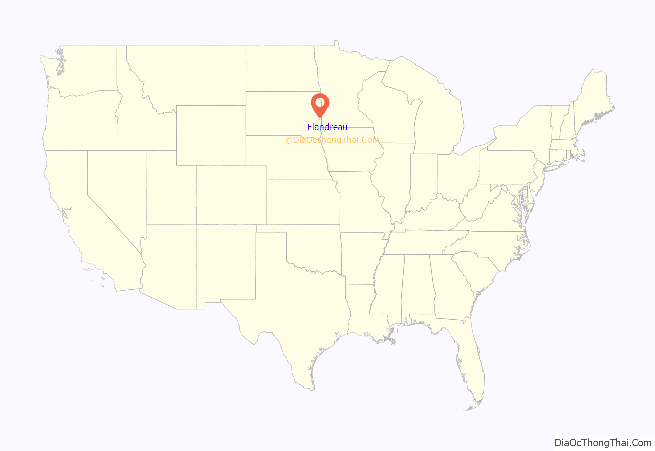
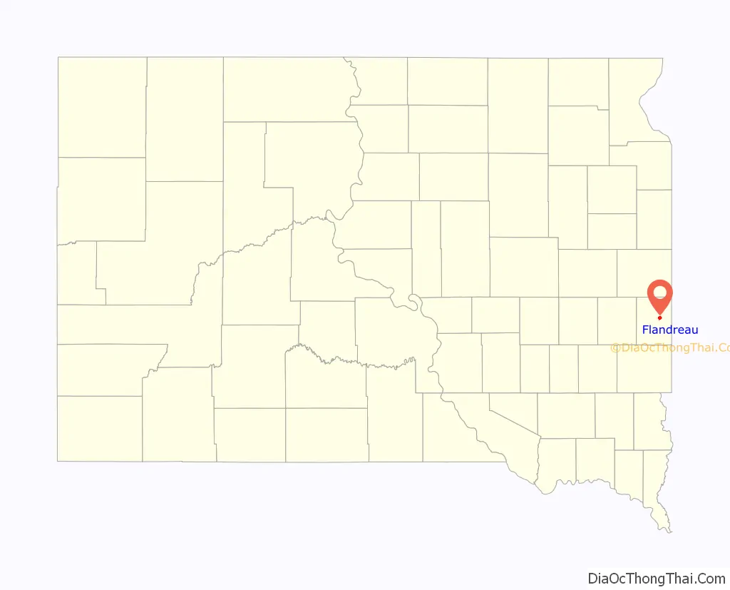
Flandreau location map. Where is Flandreau city?
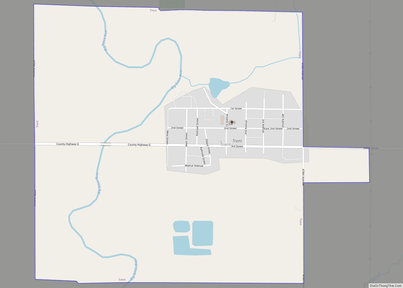
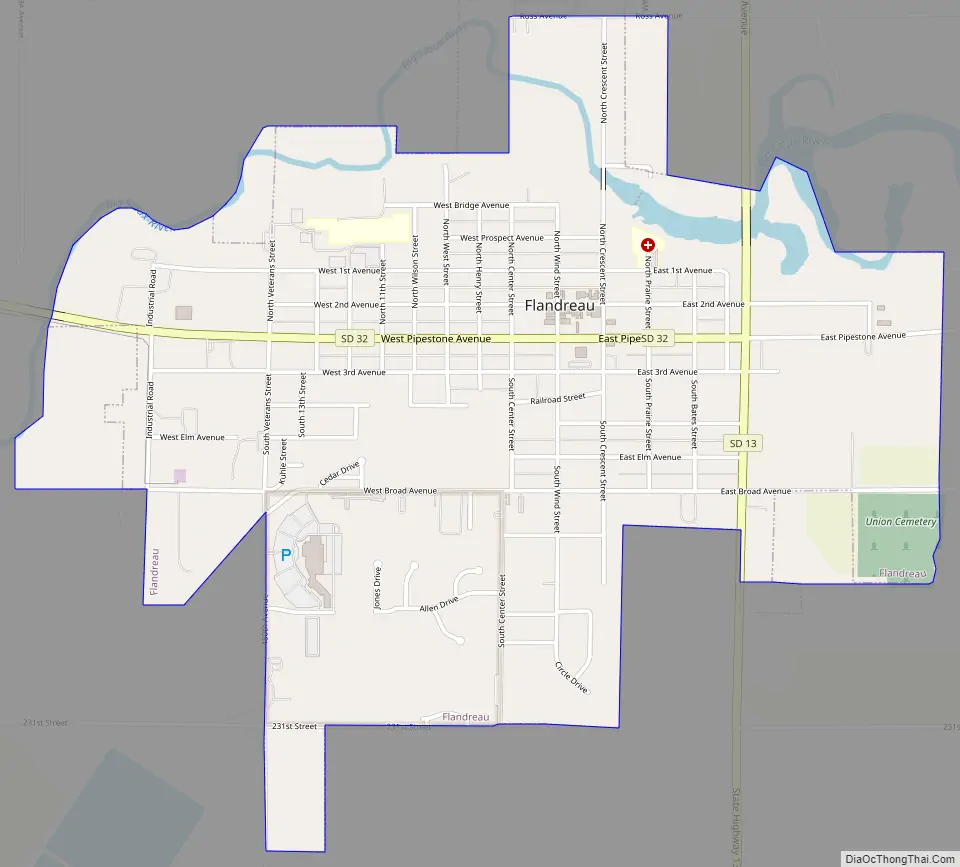
Flandreau Road Map
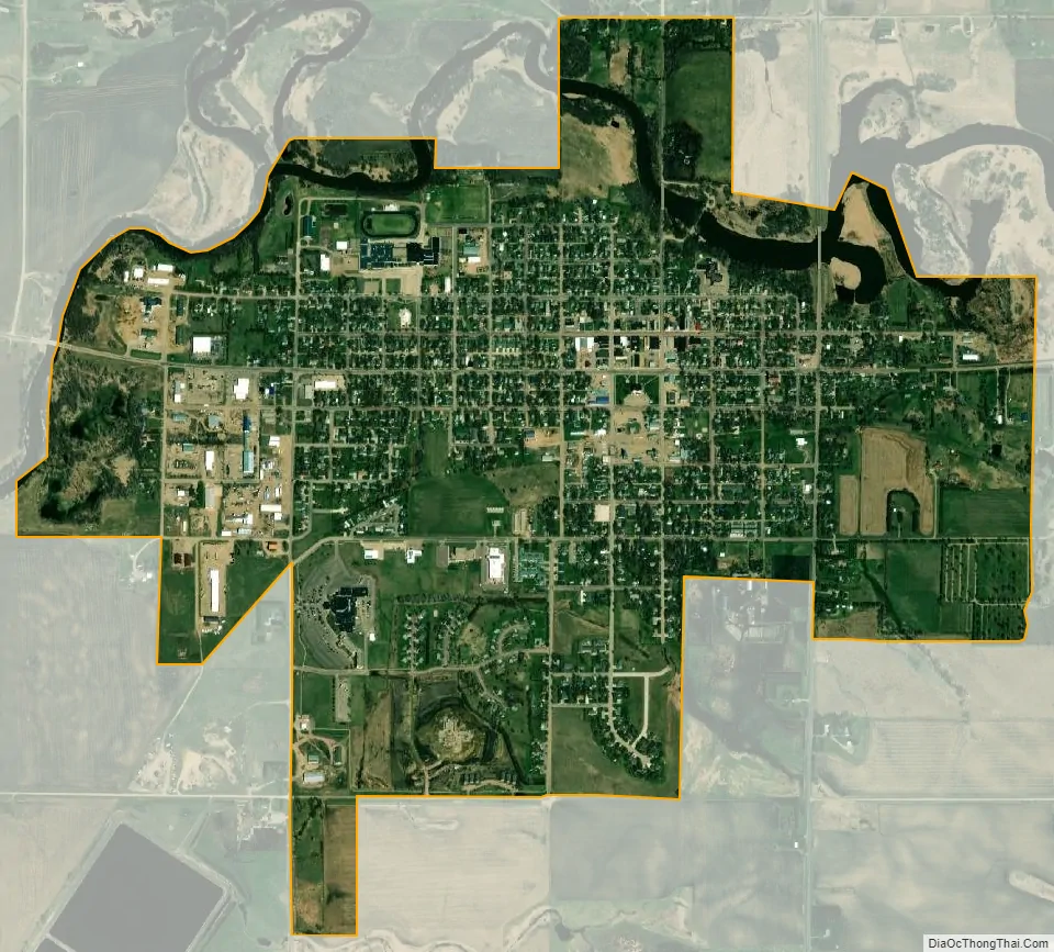
Flandreau city Satellite Map
Geography
Flandreau is located at 44°2′52″N 96°35′47″W / 44.04778°N 96.59639°W / 44.04778; -96.59639 (44.047855, −96.596417), along the Big Sioux River.
According to the United States Census Bureau, the city has a total area of 1.93 square miles (5.00 km), of which 1.86 square miles (4.82 km) is land and 0.07 square miles (0.18 km) is water.
Flandreau has been assigned the ZIP code 57028 and the FIPS place code 21540.
Climate
See also
Map of South Dakota State and its subdivision:- Aurora
- Beadle
- Bennett
- Bon Homme
- Brookings
- Brown
- Brule
- Buffalo
- Butte
- Campbell
- Charles Mix
- Clark
- Clay
- Codington
- Corson
- Custer
- Davison
- Day
- Deuel
- Dewey
- Douglas
- Edmunds
- Fall River
- Faulk
- Grant
- Gregory
- Haakon
- Hamlin
- Hand
- Hanson
- Harding
- Hughes
- Hutchinson
- Hyde
- Jackson
- Jerauld
- Jones
- Kingsbury
- Lake
- Lawrence
- Lincoln
- Lyman
- Marshall
- McCook
- McPherson
- Meade
- Mellette
- Miner
- Minnehaha
- Moody
- Pennington
- Perkins
- Potter
- Roberts
- Sanborn
- Shannon
- Spink
- Stanley
- Sully
- Todd
- Tripp
- Turner
- Union
- Walworth
- Yankton
- Ziebach
- Alabama
- Alaska
- Arizona
- Arkansas
- California
- Colorado
- Connecticut
- Delaware
- District of Columbia
- Florida
- Georgia
- Hawaii
- Idaho
- Illinois
- Indiana
- Iowa
- Kansas
- Kentucky
- Louisiana
- Maine
- Maryland
- Massachusetts
- Michigan
- Minnesota
- Mississippi
- Missouri
- Montana
- Nebraska
- Nevada
- New Hampshire
- New Jersey
- New Mexico
- New York
- North Carolina
- North Dakota
- Ohio
- Oklahoma
- Oregon
- Pennsylvania
- Rhode Island
- South Carolina
- South Dakota
- Tennessee
- Texas
- Utah
- Vermont
- Virginia
- Washington
- West Virginia
- Wisconsin
- Wyoming