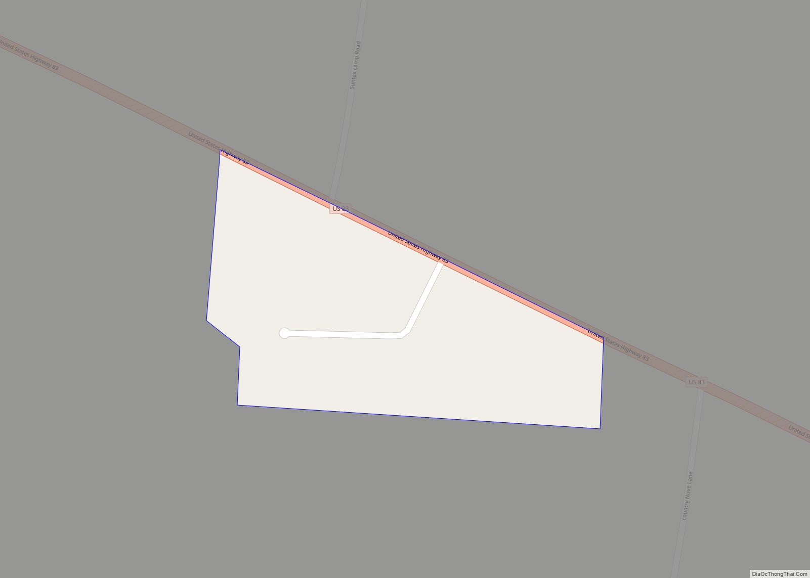
Map of Schulenburg city

Map of Schulenburg city

Schulenburg is a city in Fayette County, Texas, United States. The population was 2,633 at the 2020 census. Known for its German culture, Schulenburg is home of the Texas Polka Music Museum. It is in a rural, agricultural area settled by German and Czech emigrants in the 1800s. Schulenburg city overview: Name: Schulenburg city LSAD … Read more

Map of Schertz city

Map of Schertz city

Schertz (/ʃɜːrts/ shurts) is a city in Guadalupe, Bexar, and Comal counties in the U.S. state of Texas, within the San Antonio–New Braunfels metropolitan area. The population was 42,002 at the 2020 census, up from 31,465 at the 2010 census. Schertz was settled by Alsatian emigrants in the 1800s. Schertz city overview: Name: Schertz city … Read more

Map of Seguin city

Map of Seguin city

Seguin (/sɪˈɡiːn/ sih-GEEN) is a city in and the county seat of Guadalupe County, Texas, United States; as of the 2020 census, its population was 29,433. Its economy is primarily supported by a regional hospital, as well as the Schertz-Seguin Local Government Corporation water-utility, that supplies the surrounding Greater San Antonio areas from nearby aquifers … Read more

Map of Seco Mines CDP

Map of Seco Mines CDP

Seco Mines is an unincorporated community and census-designated place in Maverick County, Texas, United States. Its population was 560 as of the 2010 census. U.S. Route 277 passes through the community. Seco Mines CDP overview: Name: Seco Mines CDP LSAD Code: 57 LSAD Description: CDP (suffix) State: Texas County: Maverick County Elevation: 735 ft (224 m) Total … Read more

Map of Sebastian CDP, Texas

Map of Sebastian CDP, Texas

Sebastian is a census-designated place (CDP) in Willacy County, Texas, United States. The population was 1,917 at the 2010 census. Sebastian CDP overview: Name: Sebastian CDP LSAD Code: 57 LSAD Description: CDP (suffix) State: Texas County: Willacy County Elevation: 39 ft (12 m) Total Area: 1.7 sq mi (4.3 km²) Land Area: 1.7 sq mi (4.3 km²) Water Area: 0.0 sq mi (0.0 km²) Total Population: … Read more

Map of Sealy city

Map of Sealy city

Sealy is a city in Austin County in southeastern Texas, United States. The population was 6,839 at the 2020 census. Sealy is located 49 miles (79 km) west of the downtown Houston area, on the most eastern part of the Texas-German belt region, an area settled by German emigrants. Sealy city overview: Name: Sealy city LSAD … Read more

Map of Seagraves city

Map of Seagraves city

Seagraves is a city in Gaines County, Texas, United States. Its population was 2,417 at the 2010 census. Seagraves city overview: Name: Seagraves city LSAD Code: 25 LSAD Description: city (suffix) State: Texas County: Gaines County Elevation: 3,353 ft (1,022 m) Total Area: 1.45 sq mi (3.76 km²) Land Area: 1.45 sq mi (3.76 km²) Water Area: 0.00 sq mi (0.00 km²) Total Population: 2,417 Population … Read more

Map of Seagoville city

Map of Seagoville city

Seagoville (/ˈsiːɡoʊvɪl/ SEE-goh-vil) is a city in Dallas County, Texas, United States, and a suburb of Dallas. A small portion of Seagoville extends into Kaufman County. The population was 18,446 at the 2020 census. The city is located along U.S. Highway 175, 10 miles (16 km) from downtown Mesquite. Seagoville city overview: Name: Seagoville city LSAD … Read more

Map of Seadrift city

Map of Seadrift city

Seadrift is a city in Calhoun County, Texas, United States. The population was 1,364 at the 2010 census. It is a part of the Victoria, Texas Metropolitan Statistical Area. Seadrift city overview: Name: Seadrift city LSAD Code: 25 LSAD Description: city (suffix) State: Texas County: Calhoun County Elevation: 10 ft (3 m) Total Area: 1.53 sq mi (3.95 km²) Land … Read more

Map of Seabrook city, Texas

Map of Seabrook city, Texas

Seabrook is a city in Harris County in the U.S. state of Texas, with some water surface area located within Chambers County. The population was 11,952 at the 2010 U.S. census, and 14,149 in 2019. Several fish markets line the city’s waterfront, while antique shops and bed and breakfast establishments are found in the city’s … Read more

Map of Scurry town

Map of Scurry town

Scurry is a town in Kaufman County, Texas, United States. It was incorporated in 2003. As of the 2010 census, it had a population of 681. Scurry is named after Scurry Dean. The arrival of the Texas and Pacific Railway in the 1870s established the settlement as a shipment point for area farmers. When local … Read more

Map of Scottsville city, Texas

Map of Scottsville city, Texas

Scottsville is a city in Harrison County, Texas, United States. The population was 376 at the 2010 census, up from 263 at the 2000 census. Scottsville’s population in 2020 decreased to 334. Scottsville city overview: Name: Scottsville city LSAD Code: 25 LSAD Description: city (suffix) State: Texas County: Harrison County Elevation: 410 ft (125 m) Total Area: … Read more