Map of Shenandoah city, Texas
Shenandoah is a city in Montgomery County, Texas, United States. Its population was 3,499 at the 2020 census. It is the hometown of David Vetter, the famous “boy in the plastic bubble”. In 1986, the Shenandoah city council renamed Tamina School Road to David Memorial Drive in honor of Vetter. Shenandoah city overview: Name: Shenandoah ... Read more
Map of Shenandoah city, Texas
Map of Sheldon CDP, Texas
Sheldon is an unincorporated community and a census-designated place (CDP) in northeastern Harris County, Texas, United States located completely inside the extraterritorial jurisdiction of the City of Houston. The Sheldon area is located along Beltway 8 and US Highway 90 approximately twelve miles (19 km) northeast of Downtown Houston. Since the 1950s, the population growth of ... Read more
Map of Sheldon CDP, Texas
Map of Shavano Park city
Shavano Park is a city located in Bexar County, Texas, United States. As of the 2020 census, the population was 3,524, up from 3,035 at the 2010 census. It is an enclave of San Antonio and is part of the San Antonio Metropolitan Statistical Area. Shavano Park city overview: Name: Shavano Park city LSAD Code: ... Read more
Map of Shavano Park city
Map of Shamrock city, Texas
Shamrock is a city in Wheeler County, Texas, United States. As of the 2010 census, the city had a total population of 1,910. The city is located in the eastern portion of the Texas Panhandle centered along the crossroads of Interstate 40 (formerly U.S. Route 66) and U.S. Route 83. It is 110 miles (180 km) ... Read more
Map of Shamrock city, Texas
Map of Shallowater city
Shallowater is a city in Lubbock County, Texas, United States. Shallowater is on U.S. Route 84 and the Burlington Northern Santa Fe line, 12 miles (19 km) northwest of Lubbock. Its population was 2,484 at the 2010 census. It is part of the Lubbock metropolitan statistical area. Shallowater city overview: Name: Shallowater city LSAD Code: 25 ... Read more
Map of Shallowater city
Map of Shoreacres city
Shoreacres is a city located in Harris County in the U.S. state of Texas alongside State Highway 146. Established with a mayor-alderman form of city government, it was incorporated in 1949. The population was 1,566 at the 2020 census. Shoreacres city overview: Name: Shoreacres city LSAD Code: 25 LSAD Description: city (suffix) State: Texas County: ... Read more
Map of Shoreacres city
Map of Shiner city
Shiner is a city in Lavaca County, Texas, United States. The town was named after Henry B. Shiner, who donated 250 acres (1.0 km) for a railroad right-of-way. As of the 2020 census, the city had a population of 2,127. Shiner was founded by German and Czech emigrants. Shiner city overview: Name: Shiner city LSAD Code: ... Read more
Map of Shiner city
Map of Sherwood Shores CDP
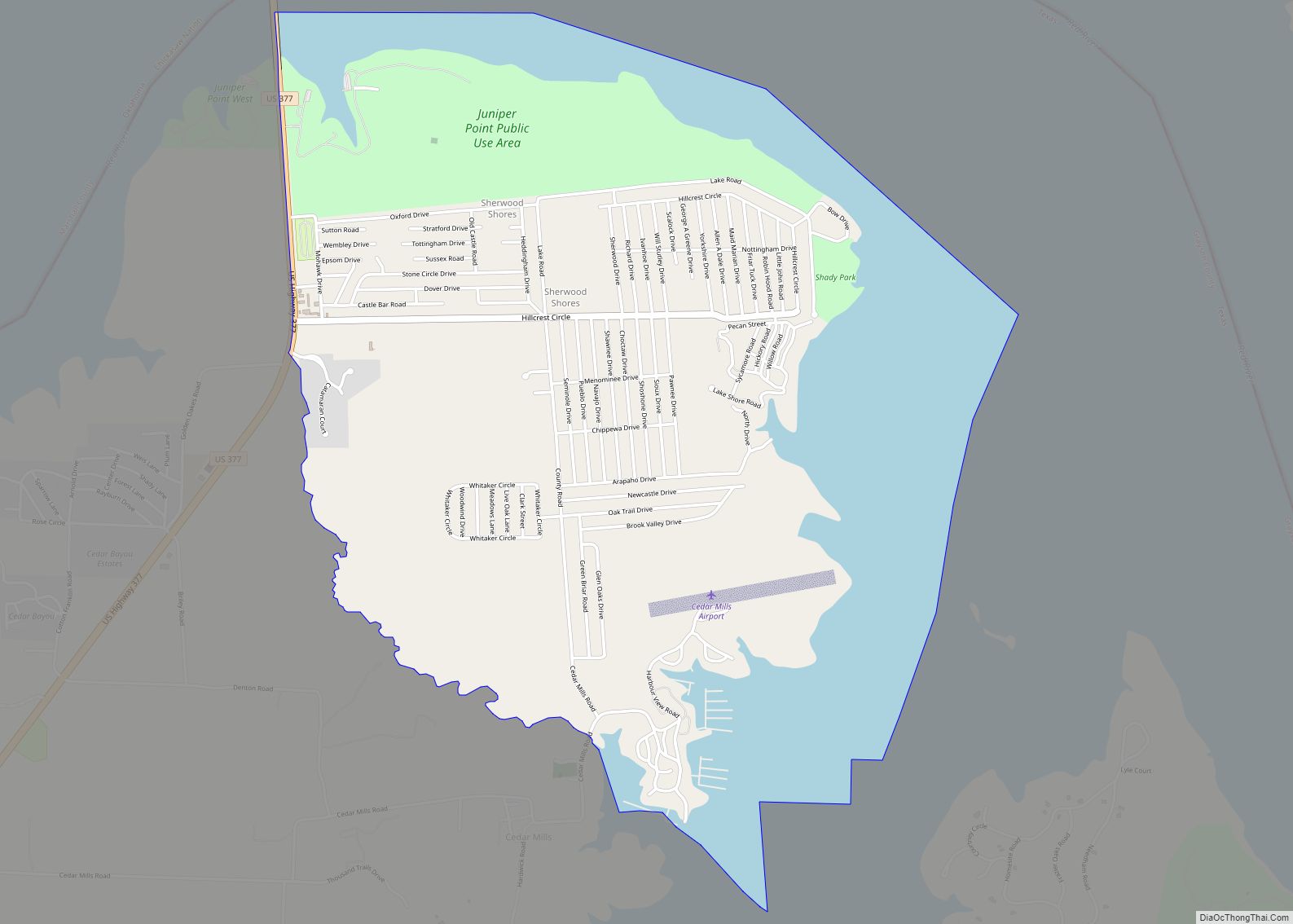
Sherwood Shores is an unincorporated community and census-designated place in Grayson County, Texas, United States. Its population was 1,190 as of the 2010 census. The community is located on the Red River, which forms the state line with Oklahoma. Sherwood Shores CDP overview: Name: Sherwood Shores CDP LSAD Code: 57 LSAD Description: CDP (suffix) State: ... Read more
Map of Sherwood Shores CDP
Map of Skidmore CDP, Texas
Skidmore is a census-designated place (CDP) in Bee County, Texas, United States. The population was 925 at the 2010 census. Skidmore CDP overview: Name: Skidmore CDP LSAD Code: 57 LSAD Description: CDP (suffix) State: Texas County: Bee County Elevation: 154 ft (47 m) Total Area: 10.5 sq mi (27.3 km²) Land Area: 10.5 sq mi (27.3 km²) Water Area: 0.0 sq mi (0.0 km²) Total Population: ... Read more
Map of Skidmore CDP, Texas
Map of Skellytown town
Skellytown is a town in Carson County, Texas, United States. Its population was 473 at the 2010 census, down from 610 at the 2000 census. Located in the Texas Panhandle, it is part of the Amarillo metropolitan area. In 1926, Skelly Oil Company purchased a 320-acre (130 ha) lease from Henry Schafer, a local rancher on ... Read more
Map of Skellytown town
Map of Sinton city
Sinton is a city in and the county seat of San Patricio County, Texas, United States. The population was 5,665 at the 2010 census. It was founded in 1886 and was named in honor of David Sinton, a influential business owner and rancher. Sinton city overview: Name: Sinton city LSAD Code: 25 LSAD Description: city ... Read more
Map of Sinton city
Map of Simonton city
Simonton is a city in Fort Bend County, Texas, United States, within the Houston–Sugar Land–Baytown metropolitan area. Simonton is located at the intersection of Farm roads 1093 and 1489, approximately fourteen miles northwest of Richmond, Texas and five miles west of Fulshear, Texas. As of the 2020 U.S. Census, the city population was 647, down ... Read more
Map of Simonton city