Sierra Blanca is an unincorporated area in Hudspeth County, Texas, United States. It is also the county seat of the county and the namesake of a census-designated place (CDP) in which it is located. The town is part of the Trans-Pecos region of far West Texas, is located northeast of the Mexican border and is within the Mountain Time Zone. As of the 2010 census, its population was 553.
The town was founded in 1881 at the completion point of a long-sought southern transcontinental railway. Sierra Blanca has served as the junction of the Southern Pacific and Missouri Pacific railroads. Hudspeth County was formed in 1917 from El Paso County. Sierra Blanca was named the county seat, and has the only adobe courthouse in Texas.
The town continues to accommodate travelers between Van Horn and El Paso along Interstate 10, which is the main route that connects Texas from west to southeast. The town was named for the nearby Sierra Blanca Mountain, which was in turn named for the white poppies that grew there (sierra blanca is Spanish for “white mountain”).
The letters “SB” can be seen on a nearby mountain from Interstate 10.
| Name: | Sierra Blanca CDP |
|---|---|
| LSAD Code: | 57 |
| LSAD Description: | CDP (suffix) |
| State: | Texas |
| County: | Hudspeth County |
| Elevation: | 4,528 ft (1,380 m) |
| Total Area: | 4.8 sq mi (12.4 km²) |
| Land Area: | 4.7 sq mi (12.3 km²) |
| Water Area: | 0.04 sq mi (0.1 km²) |
| Total Population: | 553 |
| Population Density: | 116/sq mi (44.9/km²) |
| ZIP code: | 79851 |
| Area code: | 915 |
| FIPS code: | 4867772 |
| GNISfeature ID: | 1368253 |
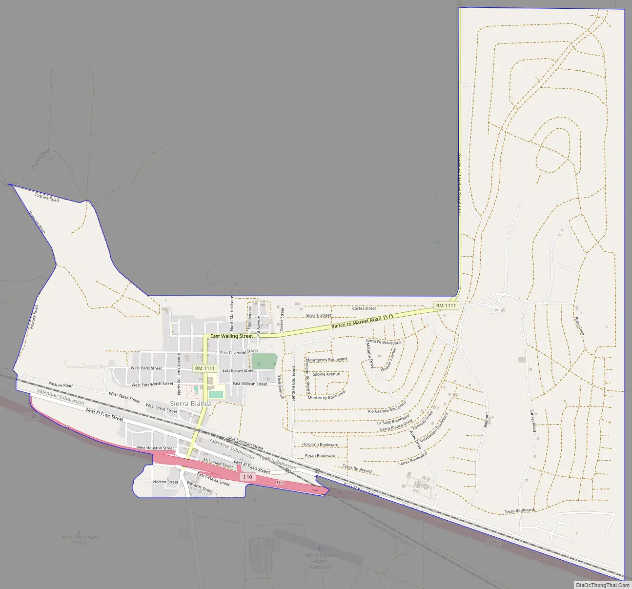
Online Interactive Map
Click on ![]() to view map in "full screen" mode.
to view map in "full screen" mode.
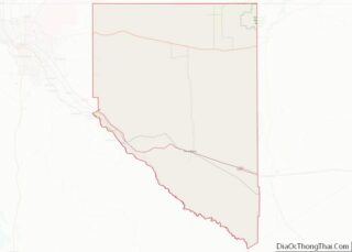
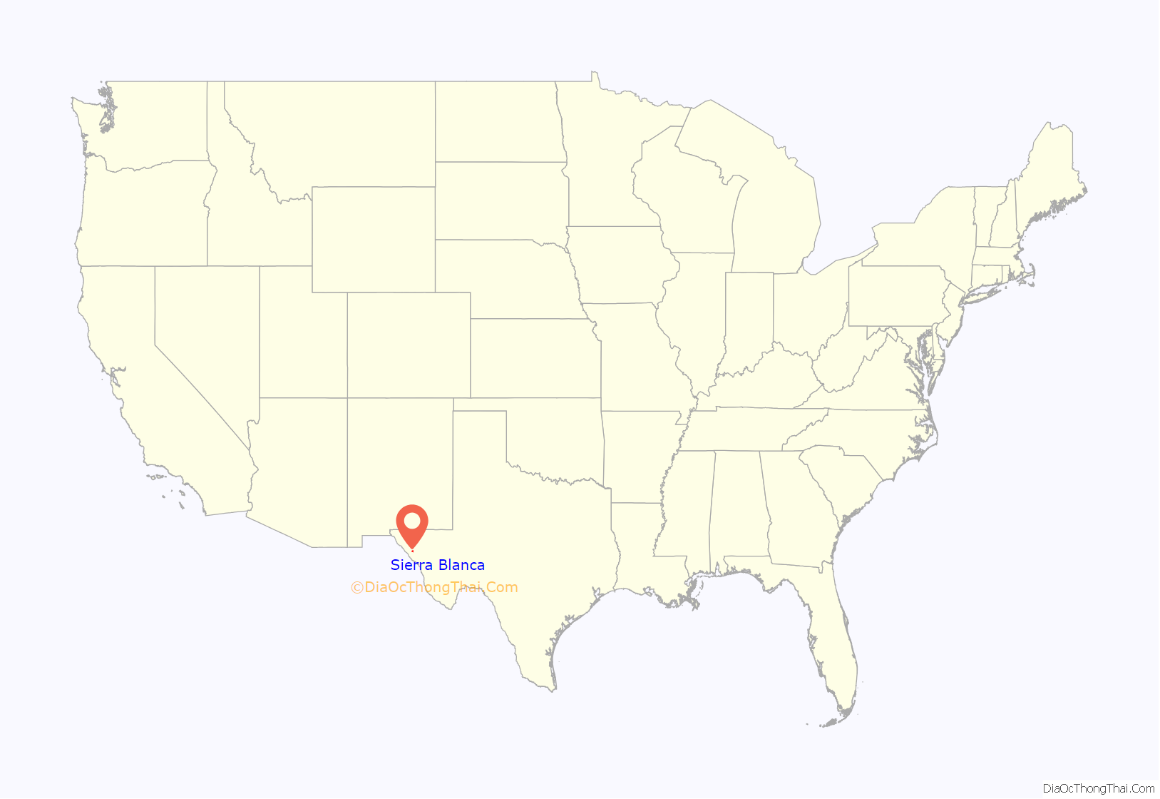
Sierra Blanca location map. Where is Sierra Blanca CDP?
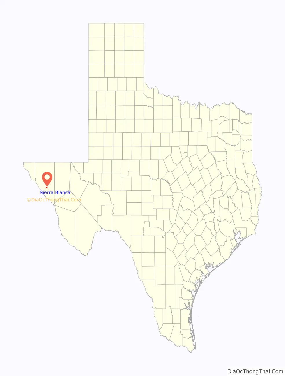
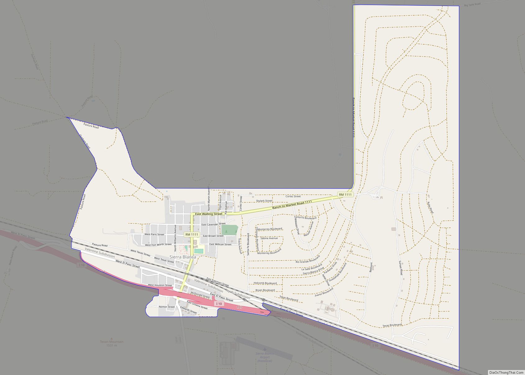
Sierra Blanca Road Map
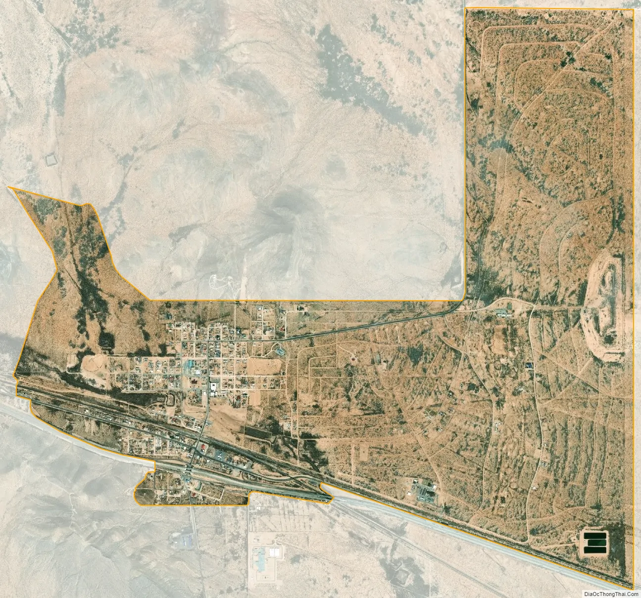
Sierra Blanca city Satellite Map
Geography
Sierra Blanca is found in Far West Texas, a subdivision of West Texas, and is located at 31°10′55″N 105°20′27″W / 31.18194°N 105.34083°W / 31.18194; -105.34083 (31.182009, -105.340843) 4,520 feet (1,380 m) above sea level. The town is part of the Trans-Pecos region within the most mountainous and arid portion of Texas. The town is located in Hudspeth County, which is large and sparsely populated. Sierra Blanca (White Mountain), at an elevation over 7,000 feet (2,100 m) above sea level, towers over the town to the northwest and is the most prominent mountain peak of the surrounding mountainous terrain.
According to the United States Census Bureau, the CDP has a total area of 4.8 square miles (12.4 km), of which 4.7 square miles (12.3 km) are land and 0.04 square miles (0.1 km), or 0.52%, is covered by water. Soil in the surrounding area is mostly nonarable due to lack of water, so cannot sustain large-scale farming. Due to the high altitude of the town, it has a cooler climate than other areas of the Chihuahuan Desert.
Climate
Summers are hot with mild nights. The town occasionally experiences high winds and dust storms. July is normally the warmest month, with the highest recorded temperature in town being 109 °F (43 °C) in 1994. During the winter, the jet stream periodically dips far south and brings extremely low temperatures. December is usually the coolest month and the lowest temperature recorded was −10 °F (−23 °C) in 1985.
Normally, the town receives less than 1 inch (25 mm) of snow annually. During the hurricane season, tropical storms can sometimes bring large amounts of precipitation to the arid mountainous region and can cause flash flooding. Precipitation is low; the town and vicinity receive an average of 11.24 inches (285 mm) of precipitation annually, with 45 days having rain.
See also
Map of Texas State and its subdivision:- Anderson
- Andrews
- Angelina
- Aransas
- Archer
- Armstrong
- Atascosa
- Austin
- Bailey
- Bandera
- Bastrop
- Baylor
- Bee
- Bell
- Bexar
- Blanco
- Borden
- Bosque
- Bowie
- Brazoria
- Brazos
- Brewster
- Briscoe
- Brooks
- Brown
- Burleson
- Burnet
- Caldwell
- Calhoun
- Callahan
- Cameron
- Camp
- Carson
- Cass
- Castro
- Chambers
- Cherokee
- Childress
- Clay
- Cochran
- Coke
- Coleman
- Collin
- Collingsworth
- Colorado
- Comal
- Comanche
- Concho
- Cooke
- Coryell
- Cottle
- Crane
- Crockett
- Crosby
- Culberson
- Dallam
- Dallas
- Dawson
- Deaf Smith
- Delta
- Denton
- Dewitt
- Dickens
- Dimmit
- Donley
- Duval
- Eastland
- Ector
- Edwards
- El Paso
- Ellis
- Erath
- Falls
- Fannin
- Fayette
- Fisher
- Floyd
- Foard
- Fort Bend
- Franklin
- Freestone
- Frio
- Gaines
- Galveston
- Garza
- Gillespie
- Glasscock
- Goliad
- Gonzales
- Gray
- Grayson
- Gregg
- Grimes
- Guadalupe
- Hale
- Hall
- Hamilton
- Hansford
- Hardeman
- Hardin
- Harris
- Harrison
- Hartley
- Haskell
- Hays
- Hemphill
- Henderson
- Hidalgo
- Hill
- Hockley
- Hood
- Hopkins
- Houston
- Howard
- Hudspeth
- Hunt
- Hutchinson
- Irion
- Jack
- Jackson
- Jasper
- Jeff Davis
- Jefferson
- Jim Hogg
- Jim Wells
- Johnson
- Jones
- Karnes
- Kaufman
- Kendall
- Kenedy
- Kent
- Kerr
- Kimble
- King
- Kinney
- Kleberg
- Knox
- La Salle
- Lamar
- Lamb
- Lampasas
- Lavaca
- Lee
- Leon
- Liberty
- Limestone
- Lipscomb
- Live Oak
- Llano
- Loving
- Lubbock
- Lynn
- Madison
- Marion
- Martin
- Mason
- Matagorda
- Maverick
- McCulloch
- McLennan
- McMullen
- Medina
- Menard
- Midland
- Milam
- Mills
- Mitchell
- Montague
- Montgomery
- Moore
- Morris
- Motley
- Nacogdoches
- Navarro
- Newton
- Nolan
- Nueces
- Ochiltree
- Oldham
- Orange
- Palo Pinto
- Panola
- Parker
- Parmer
- Pecos
- Polk
- Potter
- Presidio
- Rains
- Randall
- Reagan
- Real
- Red River
- Reeves
- Refugio
- Roberts
- Robertson
- Rockwall
- Runnels
- Rusk
- Sabine
- San Augustine
- San Jacinto
- San Patricio
- San Saba
- Schleicher
- Scurry
- Shackelford
- Shelby
- Sherman
- Smith
- Somervell
- Starr
- Stephens
- Sterling
- Stonewall
- Sutton
- Swisher
- Tarrant
- Taylor
- Terrell
- Terry
- Throckmorton
- Titus
- Tom Green
- Travis
- Trinity
- Tyler
- Upshur
- Upton
- Uvalde
- Val Verde
- Van Zandt
- Victoria
- Walker
- Waller
- Ward
- Washington
- Webb
- Wharton
- Wheeler
- Wichita
- Wilbarger
- Willacy
- Williamson
- Wilson
- Winkler
- Wise
- Wood
- Yoakum
- Young
- Zapata
- Zavala
- Alabama
- Alaska
- Arizona
- Arkansas
- California
- Colorado
- Connecticut
- Delaware
- District of Columbia
- Florida
- Georgia
- Hawaii
- Idaho
- Illinois
- Indiana
- Iowa
- Kansas
- Kentucky
- Louisiana
- Maine
- Maryland
- Massachusetts
- Michigan
- Minnesota
- Mississippi
- Missouri
- Montana
- Nebraska
- Nevada
- New Hampshire
- New Jersey
- New Mexico
- New York
- North Carolina
- North Dakota
- Ohio
- Oklahoma
- Oregon
- Pennsylvania
- Rhode Island
- South Carolina
- South Dakota
- Tennessee
- Texas
- Utah
- Vermont
- Virginia
- Washington
- West Virginia
- Wisconsin
- Wyoming