Map of Crosby CDP, Texas

Map of Crosby CDP, Texas

Crosby is a census-designated place in Harris County, Texas, United States. The population was 3,417 at the 2020 census. Crosby CDP overview: Name: Crosby CDP LSAD Code: 57 LSAD Description: CDP (suffix) State: Texas County: Harris County Elevation: 46 ft (14 m) Total Area: 2.3 sq mi (5.9 km²) Land Area: 2.3 sq mi (5.9 km²) Water Area: 0.0 sq mi (0.0 km²) Total Population: 3,417 … Read more

Map of Crockett city, Texas

Map of Crockett city, Texas

Crockett is a city and the county seat of Houston County, Texas, United States. As of the 2020 census, the city population was 6,332. Houston County is the oldest county and Crockett the fifth-oldest city in Texas. Crockett city overview: Name: Crockett city LSAD Code: 25 LSAD Description: city (suffix) State: Texas County: Houston County … Read more

Map of Cresson city, Texas

Map of Cresson city, Texas

Cresson is a city located at the corners of Hood, Johnson, and Parker counties in the U.S. state of Texas. It is located at the intersection of U.S. Highway 377 and State Highway 171, 25 miles (40 km) southwest of Fort Worth. Incorporated in 2001, Cresson had a population of 741 at the 2010 census. Cresson … Read more

Map of Creedmoor city, Texas

Map of Creedmoor city, Texas

Creedmoor is a city in , Texas, United States. The population was 202 at the 2010 census. Creedmoor city overview: Name: Creedmoor city LSAD Code: 25 LSAD Description: city (suffix) State: Texas County: Travis County Elevation: 633 ft (193 m) Total Area: 2.28 sq mi (5.91 km²) Land Area: 2.28 sq mi (5.91 km²) Water Area: 0.00 sq mi (0.00 km²) Total Population: 202 Population Density: … Read more

Map of Crawford town, Texas

Map of Crawford town, Texas

Crawford is a town located in western McLennan County, Texas, United States. Crawford is part of the Waco Metropolitan Statistical Area. As of the 2020 census, the town had a total population of 887. The town was incorporated on August 12, 1897. It is best known as the home of former President of the United … Read more

Map of Cranfills Gap city

Map of Cranfills Gap city

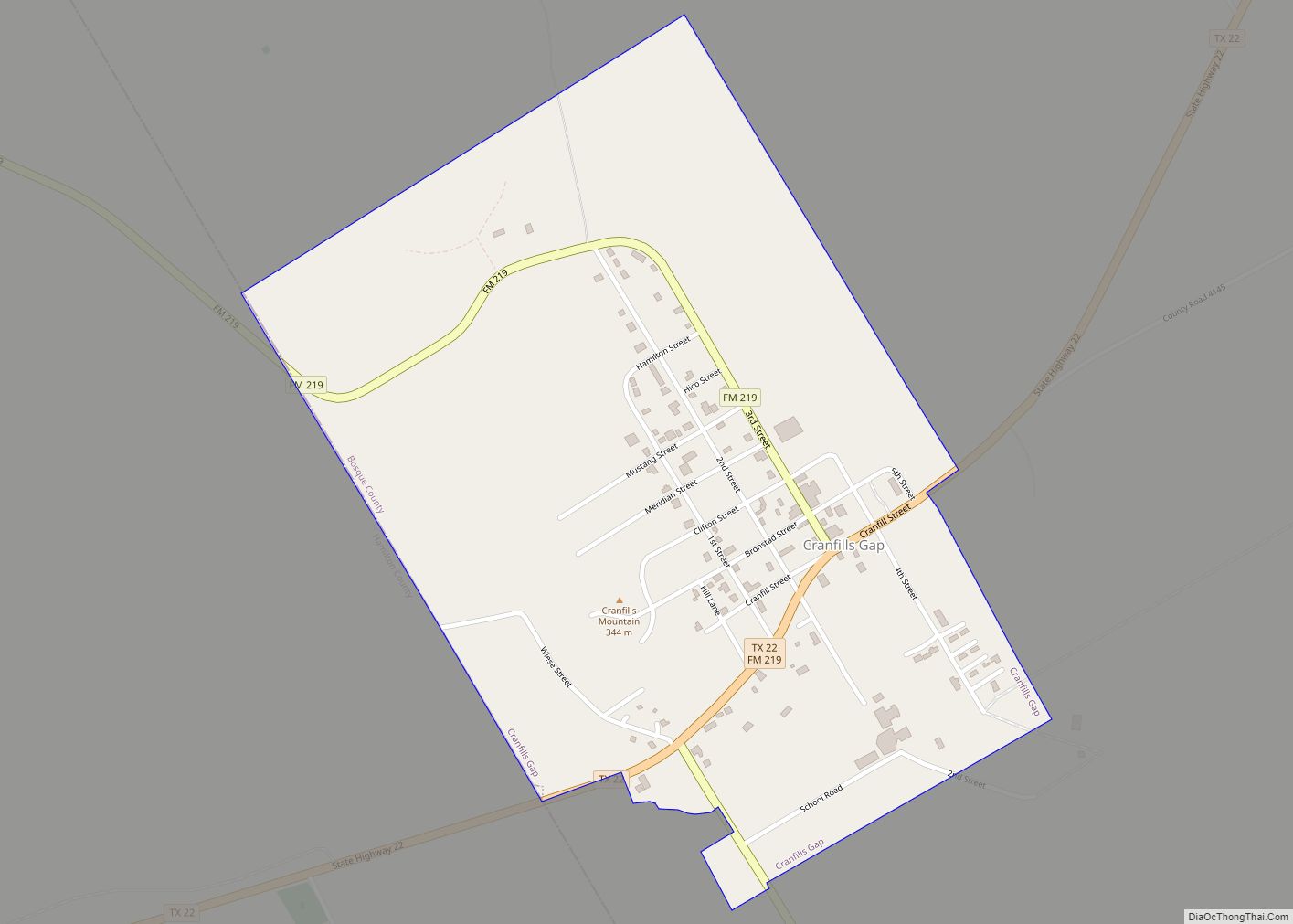
Cranfills Gap is a city located in Bosque County in central Texas, United States. It was founded by Norwegian Emigrants and to this day most residents can trace their lineage to those Norwegian Founders. The population was 281 at the 2010 census. Cranfills Gap city overview: Name: Cranfills Gap city LSAD Code: 25 LSAD Description: … Read more

Map of Crane city, Texas

Map of Crane city, Texas

Crane is a city in and the county seat of Crane County, Texas, United States. Its population is about 3,680 as of 2018. An oil boomtown since the 1920s, Crane is still in the center of a prominent oil-producing region. It is the only significant town in sparsely populated Crane County, and contains the only … Read more

Map of Crandall city, Texas

Map of Crandall city, Texas

Crandall is a city in Kaufman County, Texas, United States. Its population was 3,860 in 2020. It is part of the Dallas-Fort Worth metroplex. Crandall is named after Cornelius F. Crandall, who had previously founded Crandall, Indiana Crandall city overview: Name: Crandall city LSAD Code: 25 LSAD Description: city (suffix) State: Texas County: Kaufman County … Read more

Map of Cross Timber town

Map of Cross Timber town

Cross Timber is a town in Johnson County, Texas, in the United States. As of the 2010 census the population was 268. Cross Timber town overview: Name: Cross Timber town LSAD Code: 43 LSAD Description: town (suffix) State: Texas County: Johnson County Elevation: 709 ft (216 m) Total Area: 1.41 sq mi (3.65 km²) Land Area: 1.41 sq mi (3.65 km²) Water Area: … Read more

Map of Cross Roads town, Texas

Map of Cross Roads town, Texas

Cross Roads is a town in Denton County, Texas, United States. The population was 1,744 in 2020. Cross Roads town overview: Name: Cross Roads town LSAD Code: 43 LSAD Description: town (suffix) State: Texas County: Denton County Elevation: 633 ft (193 m) Total Area: 6.80 sq mi (17.61 km²) Land Area: 6.72 sq mi (17.41 km²) Water Area: 0.08 sq mi (0.20 km²) Total Population: 1,744 … Read more

Map of Cross Plains town, Texas

Map of Cross Plains town, Texas

Cross Plains is a town in Callahan County, Texas, United States. The population was 982 at the 2010 census. It is part of the Abilene, Texas Metropolitan Statistical Area. Cross Plains town overview: Name: Cross Plains town LSAD Code: 43 LSAD Description: town (suffix) State: Texas County: Callahan County Elevation: 1,736 ft (529 m) Total Area: 1.20 sq mi … Read more

Map of Cumings CDP

Map of Cumings CDP

Cumings is an unincorporated community and census-designated place (CDP) in Fort Bend County, Texas, United States. The population was 981 at the 2010 census. Cumings CDP overview: Name: Cumings CDP LSAD Code: 57 LSAD Description: CDP (suffix) State: Texas County: Fort Bend County Elevation: 85 ft (26 m) Total Area: 2.92 sq mi (7.57 km²) Land Area: 2.80 sq mi (7.24 km²) Water … Read more