Crockett is a city and the county seat of Houston County, Texas, United States. As of the 2020 census, the city population was 6,332. Houston County is the oldest county and Crockett the fifth-oldest city in Texas.
| Name: | Crockett city |
|---|---|
| LSAD Code: | 25 |
| LSAD Description: | city (suffix) |
| State: | Texas |
| County: | Houston County |
| Elevation: | 364 ft (111 m) |
| Total Area: | 8.85 sq mi (22.93 km²) |
| Land Area: | 8.85 sq mi (22.92 km²) |
| Water Area: | 0.00 sq mi (0.00 km²) |
| Total Population: | 6,332 |
| Population Density: | 721.39/sq mi (278.53/km²) |
| ZIP code: | 75835 |
| Area code: | 936 |
| FIPS code: | 4817744 |
| GNISfeature ID: | 1355365 |
| Website: | www.crocketttexas.org |
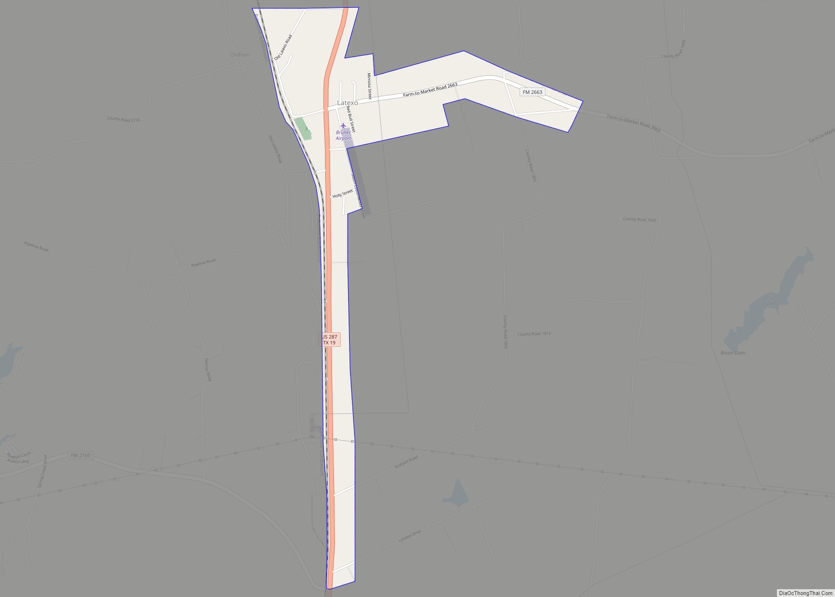
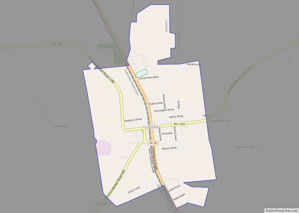
Online Interactive Map
Click on ![]() to view map in "full screen" mode.
to view map in "full screen" mode.
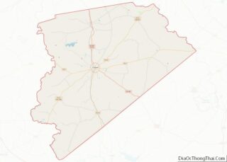
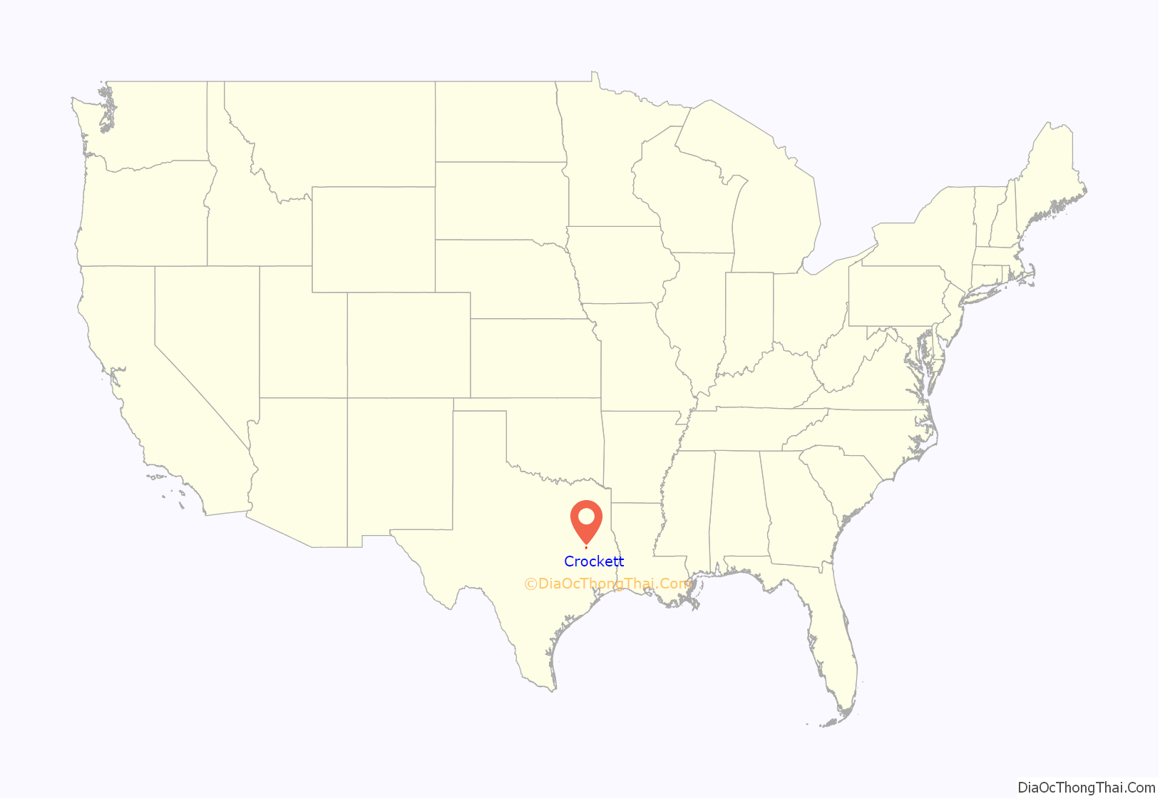
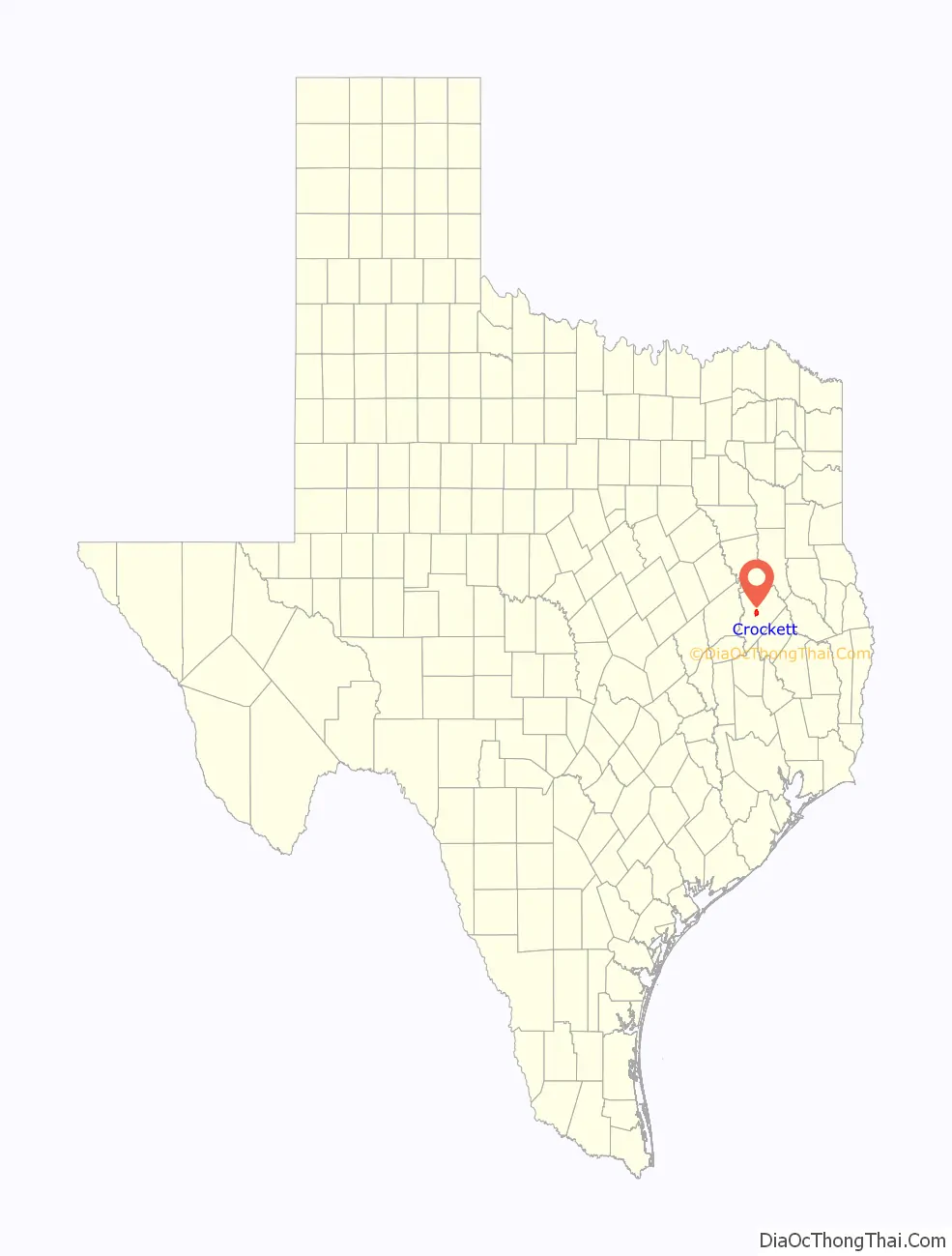
Crockett location map. Where is Crockett city?
History
The town was named after Davy Crockett, who had camped nearby on his way to the Alamo; the site was very near the Old San Antonio Road. Andrew Edwards Gossett, a Texas Revolution soldier from Maury, Tennessee, along with his father and brother, donated the land for the town in 1836, and named it after Crockett, whom they had previously known. The town was incorporated in 1837, and a post office was granted the following year. Crockett was connected to Nacogdoches by stage service. In 1839 raids by the Alabama-Coushatta and Cherokee Indians forced the town’s residents to take shelter in the fortified log courthouse. Crockett was a training center for Confederate conscripts during the Civil War.
The railroad came through in 1872, enabling Crockett to exploit the county’s timber resources. By 1885 the town was thriving with a population of 1,200, and the following year a school was opened for black girls. It evolved into Mary Allen Junior College, which operated into the 1970s. In 1904 lignite mining started, peaking about 1910. The stands of timber were seriously depleted by the 1920s. The population was over 3,000 in the mid-1920s, and by 1936 it was nearly 4,500. The population of Crockett increased while most of East Texas declined after World War II. It had reached 5,000 by the 1960 census.
During this time, one of the first loop roads in the nation (Loop 304) was built around the city. This traffic reliever was procured through the works of heavyweight politicians who called Crockett home. Blues singer Lightnin’ Hopkins was once arrested in Crockett. In recent years, the economy of Crockett has expanded with the construction of new retail space on Loop 304. Several historic buildings in downtown have been renovated to accommodate new office and service space. Renewed interest in reserves of natural gas in the surrounding area has led to construction of energy infrastructure and receipt of royalty revenues for land.
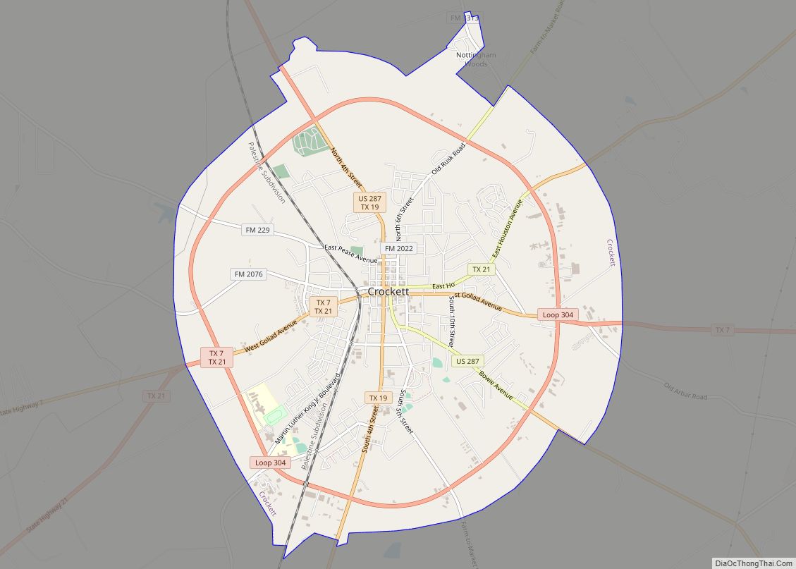
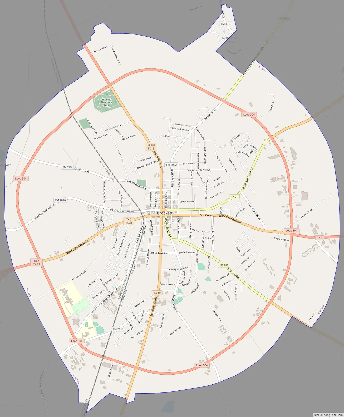
Crockett Road Map
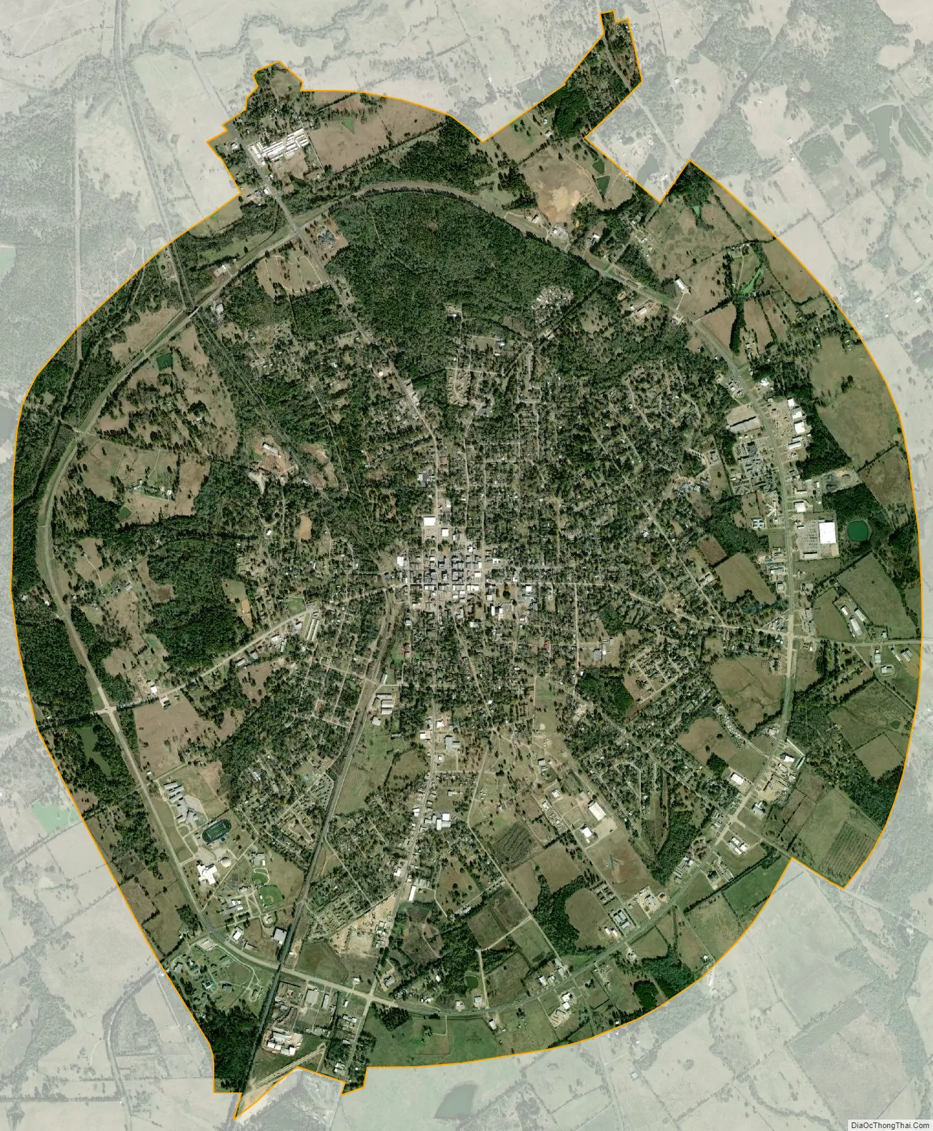
Crockett city Satellite Map
Geography
Crockett is located near the center of Houston County at 31°19′1″N 95°27′30″W / 31.31694°N 95.45833°W / 31.31694; -95.45833 (31.317010, –95.458397). Several highways converge on the city. U.S. Route 287 leads north 35 miles (56 km) to Palestine and southeast 46 miles (74 km) to Corrigan. Texas State Highway 21 leads northeast 33 miles (53 km) to Alto and southwest 38 miles (61 km) to Madisonville at Interstate 45. State Highway 7 leads east 54 miles (87 km) to Nacogdoches and west 33 miles (53 km) to Centerville along I-45. State Highway 19 leads south from Crockett 48 miles (77 km) to Huntsville.
According to the United States Census Bureau, Crockett has a total area of 8.8 square miles (22.9 km), all land. The city is within the Trinity River watershed, with the north side of the city draining toward Hurricane Bayou, which joins the Trinity River west of Crockett, and the south side draining toward Gail Creek, a tributary of White Rock Creek, which joins the Trinity at Lake Livingston.
The terrain of the town is hilly, and (as with many East Texas towns) contains significant forest, mostly loblolly pine and pecan trees.
See also
Map of Texas State and its subdivision:- Anderson
- Andrews
- Angelina
- Aransas
- Archer
- Armstrong
- Atascosa
- Austin
- Bailey
- Bandera
- Bastrop
- Baylor
- Bee
- Bell
- Bexar
- Blanco
- Borden
- Bosque
- Bowie
- Brazoria
- Brazos
- Brewster
- Briscoe
- Brooks
- Brown
- Burleson
- Burnet
- Caldwell
- Calhoun
- Callahan
- Cameron
- Camp
- Carson
- Cass
- Castro
- Chambers
- Cherokee
- Childress
- Clay
- Cochran
- Coke
- Coleman
- Collin
- Collingsworth
- Colorado
- Comal
- Comanche
- Concho
- Cooke
- Coryell
- Cottle
- Crane
- Crockett
- Crosby
- Culberson
- Dallam
- Dallas
- Dawson
- Deaf Smith
- Delta
- Denton
- Dewitt
- Dickens
- Dimmit
- Donley
- Duval
- Eastland
- Ector
- Edwards
- El Paso
- Ellis
- Erath
- Falls
- Fannin
- Fayette
- Fisher
- Floyd
- Foard
- Fort Bend
- Franklin
- Freestone
- Frio
- Gaines
- Galveston
- Garza
- Gillespie
- Glasscock
- Goliad
- Gonzales
- Gray
- Grayson
- Gregg
- Grimes
- Guadalupe
- Hale
- Hall
- Hamilton
- Hansford
- Hardeman
- Hardin
- Harris
- Harrison
- Hartley
- Haskell
- Hays
- Hemphill
- Henderson
- Hidalgo
- Hill
- Hockley
- Hood
- Hopkins
- Houston
- Howard
- Hudspeth
- Hunt
- Hutchinson
- Irion
- Jack
- Jackson
- Jasper
- Jeff Davis
- Jefferson
- Jim Hogg
- Jim Wells
- Johnson
- Jones
- Karnes
- Kaufman
- Kendall
- Kenedy
- Kent
- Kerr
- Kimble
- King
- Kinney
- Kleberg
- Knox
- La Salle
- Lamar
- Lamb
- Lampasas
- Lavaca
- Lee
- Leon
- Liberty
- Limestone
- Lipscomb
- Live Oak
- Llano
- Loving
- Lubbock
- Lynn
- Madison
- Marion
- Martin
- Mason
- Matagorda
- Maverick
- McCulloch
- McLennan
- McMullen
- Medina
- Menard
- Midland
- Milam
- Mills
- Mitchell
- Montague
- Montgomery
- Moore
- Morris
- Motley
- Nacogdoches
- Navarro
- Newton
- Nolan
- Nueces
- Ochiltree
- Oldham
- Orange
- Palo Pinto
- Panola
- Parker
- Parmer
- Pecos
- Polk
- Potter
- Presidio
- Rains
- Randall
- Reagan
- Real
- Red River
- Reeves
- Refugio
- Roberts
- Robertson
- Rockwall
- Runnels
- Rusk
- Sabine
- San Augustine
- San Jacinto
- San Patricio
- San Saba
- Schleicher
- Scurry
- Shackelford
- Shelby
- Sherman
- Smith
- Somervell
- Starr
- Stephens
- Sterling
- Stonewall
- Sutton
- Swisher
- Tarrant
- Taylor
- Terrell
- Terry
- Throckmorton
- Titus
- Tom Green
- Travis
- Trinity
- Tyler
- Upshur
- Upton
- Uvalde
- Val Verde
- Van Zandt
- Victoria
- Walker
- Waller
- Ward
- Washington
- Webb
- Wharton
- Wheeler
- Wichita
- Wilbarger
- Willacy
- Williamson
- Wilson
- Winkler
- Wise
- Wood
- Yoakum
- Young
- Zapata
- Zavala
- Alabama
- Alaska
- Arizona
- Arkansas
- California
- Colorado
- Connecticut
- Delaware
- District of Columbia
- Florida
- Georgia
- Hawaii
- Idaho
- Illinois
- Indiana
- Iowa
- Kansas
- Kentucky
- Louisiana
- Maine
- Maryland
- Massachusetts
- Michigan
- Minnesota
- Mississippi
- Missouri
- Montana
- Nebraska
- Nevada
- New Hampshire
- New Jersey
- New Mexico
- New York
- North Carolina
- North Dakota
- Ohio
- Oklahoma
- Oregon
- Pennsylvania
- Rhode Island
- South Carolina
- South Dakota
- Tennessee
- Texas
- Utah
- Vermont
- Virginia
- Washington
- West Virginia
- Wisconsin
- Wyoming