Cuero (/ˈkwɛroʊ/ KWAIR-oh) is a city in and the county seat of DeWitt County, Texas, United States. Its population was 8,128 at the 2020 census.
| Name: | Cuero city |
|---|---|
| LSAD Code: | 25 |
| LSAD Description: | city (suffix) |
| State: | Texas |
| County: | DeWitt County |
| Elevation: | 184 ft (56 m) |
| Total Area: | 6.58 sq mi (17.05 km²) |
| Land Area: | 6.56 sq mi (17.00 km²) |
| Water Area: | 0.02 sq mi (0.05 km²) |
| Total Population: | 8,128 |
| Population Density: | 1,254.72/sq mi (484.45/km²) |
| ZIP code: | 77954 |
| Area code: | 361 |
| FIPS code: | 4818092 |
| GNISfeature ID: | 1377543 |
| Website: | www.cityofcuero.com |
Online Interactive Map
Click on ![]() to view map in "full screen" mode.
to view map in "full screen" mode.
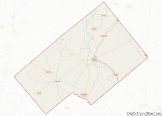
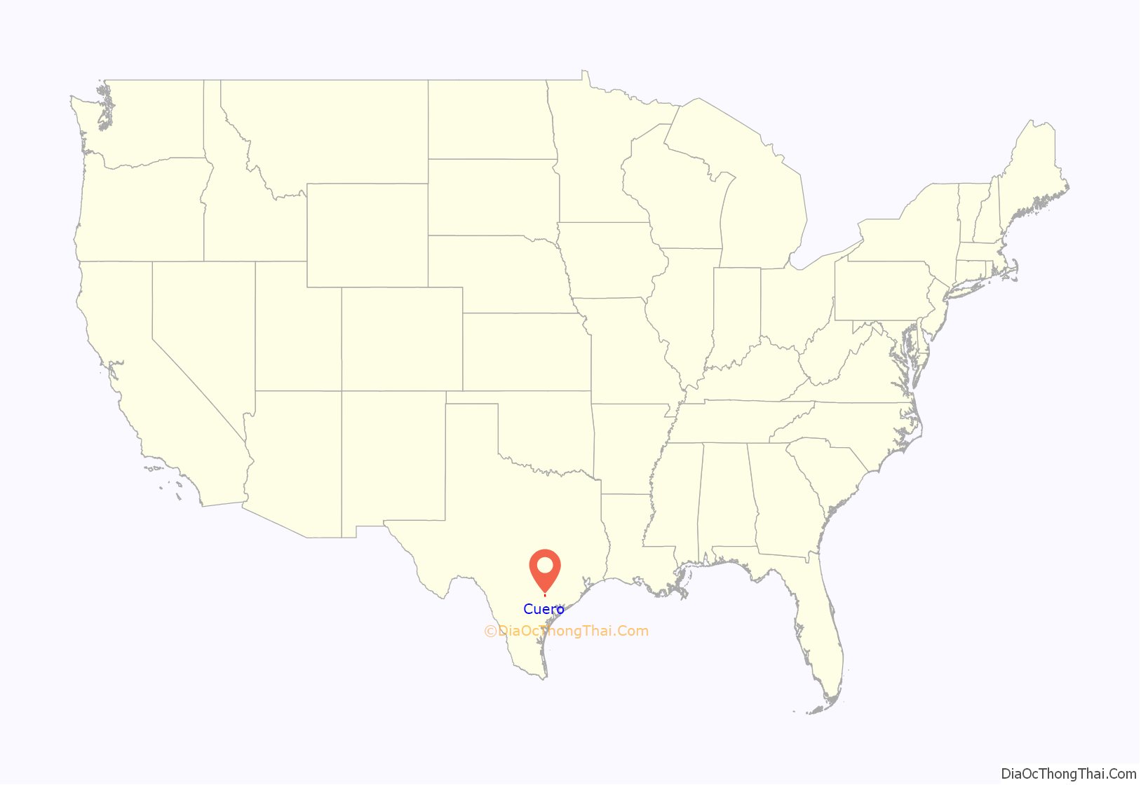
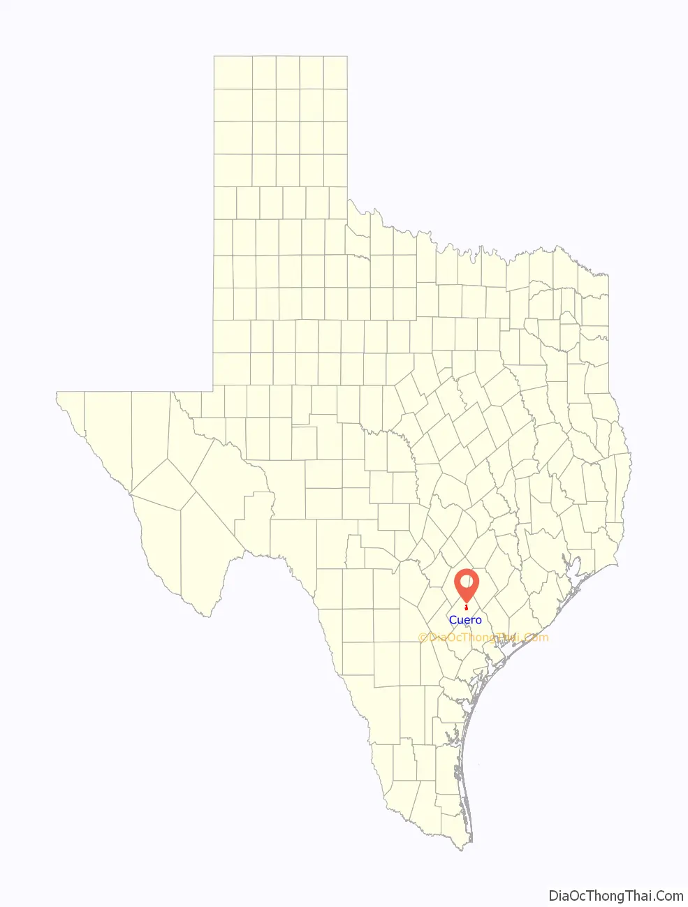
Cuero location map. Where is Cuero city?
History
The city of Cuero had its start in the mid-19th century as a stopping point on the Chisholm Trail cattle route to Kansas. It was not recognized as a town until 1873, though, when it was officially founded. The city was named for the Spanish word “hide”, referring to the leather made from animal hides. The industry was extremely short-lived, however, and gave way to various forms of ranching. The city had several Old West gunfights related to clan feuding following the Civil War.
Cuero’s population grew considerably in the 1870s and 1880s, as residents from the coastal town of Indianola, Texas, settled here after major hurricanes in this period destroyed sizeable portions of that city. Cuero thrived through much of the late 19th and early 20th centuries by the introduction and practice of turkey ranching in the area. Today, agriculture is still the primary industry in the region. Cuero is considered to be one of the top cattle producers and shippers in Texas.
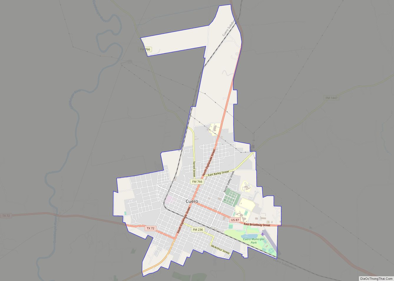
Cuero Road Map
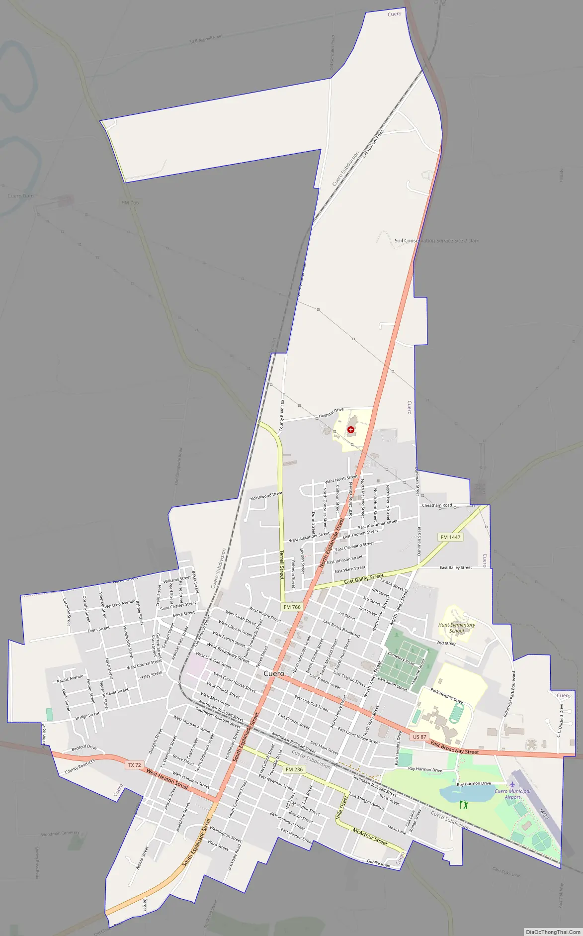
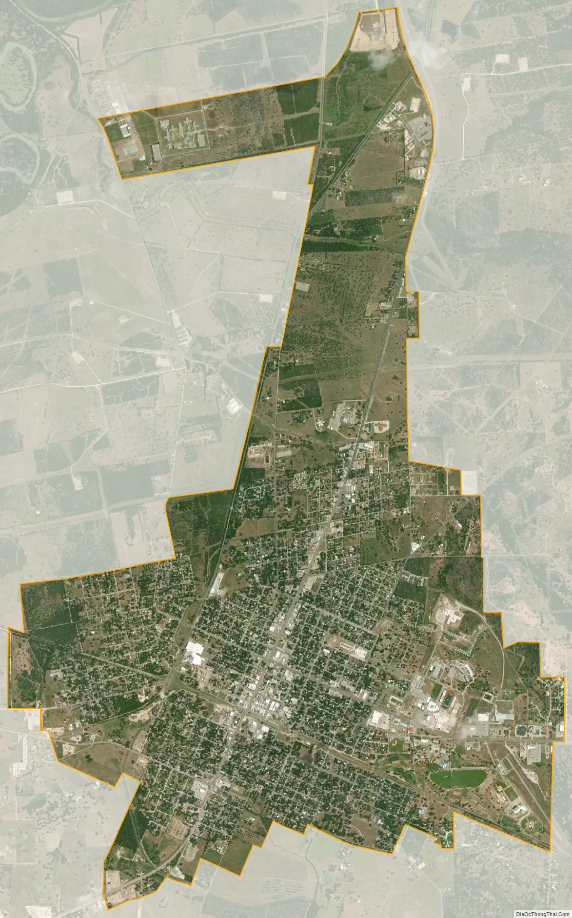
Cuero city Satellite Map
Geography
Cuero is located east of the center of DeWitt County near the mouth of Sandies Creek, where it empties into the Guadalupe River.
U.S. Routes 87, 77 Alternate, and 183 pass through the city. All three highways follow South Esplanade Street into the center of town; US 87 then leaves town via East Broadway Street, while US 77A and 183 continue north out of town on North Esplanade Street. US 87 leads southeast 28 miles (45 km) to Victoria and west 87 miles (140 km) to San Antonio. US 77 Alternate leads northeast 16 miles (26 km) to Yoakum, and US 183 leads north 32 miles (51 km) to Gonzales. Both 77 Alternate and 183 lead south 31 miles (50 km) to Goliad.
According to the United States Census Bureau, Cuero has a total area of 4.9 square miles (12.8 km), of which 0.02 square miles (0.05 km), or 0.36%, is covered by water.
Climate
The climate in this area is characterized by hot, humid summers and generally mild to cool winters. According to the Köppen climate classification, Cuero has a humid subtropical climate, Cfa on climate maps. Cuero has an annual average precipitation of 38.0 in (965.2 mm), all rain, as snow is negligible in the area.
See also
Map of Texas State and its subdivision:- Anderson
- Andrews
- Angelina
- Aransas
- Archer
- Armstrong
- Atascosa
- Austin
- Bailey
- Bandera
- Bastrop
- Baylor
- Bee
- Bell
- Bexar
- Blanco
- Borden
- Bosque
- Bowie
- Brazoria
- Brazos
- Brewster
- Briscoe
- Brooks
- Brown
- Burleson
- Burnet
- Caldwell
- Calhoun
- Callahan
- Cameron
- Camp
- Carson
- Cass
- Castro
- Chambers
- Cherokee
- Childress
- Clay
- Cochran
- Coke
- Coleman
- Collin
- Collingsworth
- Colorado
- Comal
- Comanche
- Concho
- Cooke
- Coryell
- Cottle
- Crane
- Crockett
- Crosby
- Culberson
- Dallam
- Dallas
- Dawson
- Deaf Smith
- Delta
- Denton
- Dewitt
- Dickens
- Dimmit
- Donley
- Duval
- Eastland
- Ector
- Edwards
- El Paso
- Ellis
- Erath
- Falls
- Fannin
- Fayette
- Fisher
- Floyd
- Foard
- Fort Bend
- Franklin
- Freestone
- Frio
- Gaines
- Galveston
- Garza
- Gillespie
- Glasscock
- Goliad
- Gonzales
- Gray
- Grayson
- Gregg
- Grimes
- Guadalupe
- Hale
- Hall
- Hamilton
- Hansford
- Hardeman
- Hardin
- Harris
- Harrison
- Hartley
- Haskell
- Hays
- Hemphill
- Henderson
- Hidalgo
- Hill
- Hockley
- Hood
- Hopkins
- Houston
- Howard
- Hudspeth
- Hunt
- Hutchinson
- Irion
- Jack
- Jackson
- Jasper
- Jeff Davis
- Jefferson
- Jim Hogg
- Jim Wells
- Johnson
- Jones
- Karnes
- Kaufman
- Kendall
- Kenedy
- Kent
- Kerr
- Kimble
- King
- Kinney
- Kleberg
- Knox
- La Salle
- Lamar
- Lamb
- Lampasas
- Lavaca
- Lee
- Leon
- Liberty
- Limestone
- Lipscomb
- Live Oak
- Llano
- Loving
- Lubbock
- Lynn
- Madison
- Marion
- Martin
- Mason
- Matagorda
- Maverick
- McCulloch
- McLennan
- McMullen
- Medina
- Menard
- Midland
- Milam
- Mills
- Mitchell
- Montague
- Montgomery
- Moore
- Morris
- Motley
- Nacogdoches
- Navarro
- Newton
- Nolan
- Nueces
- Ochiltree
- Oldham
- Orange
- Palo Pinto
- Panola
- Parker
- Parmer
- Pecos
- Polk
- Potter
- Presidio
- Rains
- Randall
- Reagan
- Real
- Red River
- Reeves
- Refugio
- Roberts
- Robertson
- Rockwall
- Runnels
- Rusk
- Sabine
- San Augustine
- San Jacinto
- San Patricio
- San Saba
- Schleicher
- Scurry
- Shackelford
- Shelby
- Sherman
- Smith
- Somervell
- Starr
- Stephens
- Sterling
- Stonewall
- Sutton
- Swisher
- Tarrant
- Taylor
- Terrell
- Terry
- Throckmorton
- Titus
- Tom Green
- Travis
- Trinity
- Tyler
- Upshur
- Upton
- Uvalde
- Val Verde
- Van Zandt
- Victoria
- Walker
- Waller
- Ward
- Washington
- Webb
- Wharton
- Wheeler
- Wichita
- Wilbarger
- Willacy
- Williamson
- Wilson
- Winkler
- Wise
- Wood
- Yoakum
- Young
- Zapata
- Zavala
- Alabama
- Alaska
- Arizona
- Arkansas
- California
- Colorado
- Connecticut
- Delaware
- District of Columbia
- Florida
- Georgia
- Hawaii
- Idaho
- Illinois
- Indiana
- Iowa
- Kansas
- Kentucky
- Louisiana
- Maine
- Maryland
- Massachusetts
- Michigan
- Minnesota
- Mississippi
- Missouri
- Montana
- Nebraska
- Nevada
- New Hampshire
- New Jersey
- New Mexico
- New York
- North Carolina
- North Dakota
- Ohio
- Oklahoma
- Oregon
- Pennsylvania
- Rhode Island
- South Carolina
- South Dakota
- Tennessee
- Texas
- Utah
- Vermont
- Virginia
- Washington
- West Virginia
- Wisconsin
- Wyoming