Map of New Boston city, Texas

Map of New Boston city, Texas

New Boston is a city in Bowie County, Texas, United States. Boston was named for an early storekeeper in the settlement, W.J. Boston. The coming of the railroads led to the location of two more Bostons. A depot was built about four miles north of Boston and was named New Boston. The original Boston then … Read more

Map of New Berlin city, Texas

Map of New Berlin city, Texas

New Berlin (/ˈbɜːrlɪn/ BUR-lin) is a city in Guadalupe County, Texas, United States. The population was 511 at the 2010 census. New Berlin is a German-Texan town settled by German emigrants in the 1800s as a farming community. New Berlin is named after Berlin, Germany and boasts many residents being descendants of the original German … Read more

Map of Nevada city, Texas

Map of Nevada city, Texas

Nevada (/nəˈveɪdə/ nə-VAY-də, unlike the state of Nevada) is a city in Collin County, Texas, United States. The population was 822 at the 2010 census, and 1,314 in 2020. First settled in 1835 by John McMinn Stambaugh and named “McMinn Chapel”, the area was settled by Granville Stinebaugh, who named it after the Nevada Territory. … Read more

Map of Netos CDP

Map of Netos CDP

Netos is a census-designated place (CDP) in Starr County, Texas, United States. This was a new CDP for the 2010 census with a population of 31. Netos CDP overview: Name: Netos CDP LSAD Code: 57 LSAD Description: CDP (suffix) State: Texas County: Starr County Total Area: 31 FIPS code: 4850742 Online Interactive Map Netos online … Read more

Map of Nesbitt town

Map of Nesbitt town

Nesbitt town overview: Name: Nesbitt town LSAD Code: 43 LSAD Description: town (suffix) State: Texas County: Harrison County FIPS code: 4850724 Online Interactive Map Nesbitt online map. Source: Basemap layers from Google Map, Open Street Map (OSM), Arcgisonline, Wmflabs. Boundary Data from Database of Global Administrative Areas. Nesbitt location map. Where is Nesbitt town? Nesbitt … Read more

Map of Needville city

Map of Needville city

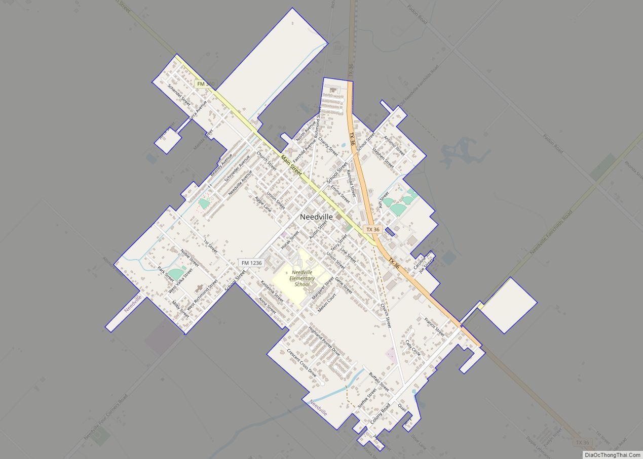
Needville is a city in Fort Bend County, Texas, United States. It is within the Houston–Sugar Land metropolitan area. The population was 3,089 at the 2020 census. Needville city overview: Name: Needville city LSAD Code: 25 LSAD Description: city (suffix) State: Texas County: Fort Bend County Elevation: 89 ft (27 m) Total Area: 2.01 sq mi (5.21 km²) Land Area: … Read more

Map of Nederland city, Texas

Map of Nederland city, Texas

Nederland (/ˈniːdərlənd/ NEE-dər-lənd) is a city in Jefferson County, Texas, United States. The population was 18,856 at the 2020 census. The city was settled in 1897 along what is now Boston Avenue and incorporated in 1940. It was settled by Dutch immigrants on land sold by the Kansas City Southern railroad. It is part of … Read more

Map of Nazareth city, Texas

Map of Nazareth city, Texas

Nazareth is a city in Castro County, Texas, United States. The population was 311 at the 2010 census, down from 356 at the 2000 census. Nazareth city overview: Name: Nazareth city LSAD Code: 25 LSAD Description: city (suffix) State: Texas County: Castro County Elevation: 3,760 ft (1,150 m) Total Area: 0.36 sq mi (0.94 km²) Land Area: 0.36 sq mi (0.94 km²) Water … Read more

Map of New Falcon CDP

Map of New Falcon CDP

New Falcon is a census-designated place (CDP) in Zapata County, Texas, United States. The population was 191 at the 2010 census. New Falcon CDP overview: Name: New Falcon CDP LSAD Code: 57 LSAD Description: CDP (suffix) State: Texas County: Zapata County Elevation: 420 ft (128 m) Total Area: 0.2 sq mi (0.5 km²) Land Area: 0.2 sq mi (0.5 km²) Water Area: 0.0 sq mi … Read more

Map of New Fairview city

Map of New Fairview city

New Fairview is a city in Wise County, Texas, United States. The population was 1,386 in 2020. Growing from a settlement called Illinois Community, the city was called Fairview until 1999, when it was changed to distinguish it from several other Fairviews in Texas. In order to maintain a quieter, more rural atmosphere, residential lots … Read more

Map of New Deal town, Texas

Map of New Deal town, Texas

New Deal is a U.S. town in Lubbock County, Texas. The population was 794 at the 2010 census. It is part of the Lubbock Metropolitan Statistical Area and the Llano Estacado region. New Deal town overview: Name: New Deal town LSAD Code: 43 LSAD Description: town (suffix) State: Texas County: Lubbock County Elevation: 3,300 ft (1,000 m) … Read more

Map of Newcastle city, Texas

Map of Newcastle city, Texas

Newcastle is a city in Young County, Texas, United States. Following the beginning of coal mining in 1908, the town was established and named after the English coal town, Newcastle upon Tyne. Coal mining had ended by 1942. Its population was 585 at the 2010 census. Newcastle city overview: Name: Newcastle city LSAD Code: 25 … Read more